Latimer, Kansas facts for kids
Quick facts for kids
Latimer, Kansas
|
|
|---|---|

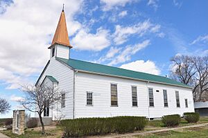
Zion Lutheran Church
|
|

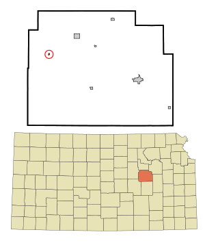
Location within Morris County and Kansas
|
|

|
|
| Country | United States |
| State | Kansas |
| County | Morris |
| Founded | 1883 |
| Incorporated | 1929 |
| Government | |
| • Type | Mayor–Council |
| Area | |
| • Total | 0.06 sq mi (0.15 km2) |
| • Land | 0.06 sq mi (0.15 km2) |
| • Water | 0.00 sq mi (0.00 km2) |
| Elevation | 1,414 ft (431 m) |
| Population
(2020)
|
|
| • Total | 31 |
| • Density | 520/sq mi (207/km2) |
| Time zone | UTC-6 (CST) |
| • Summer (DST) | UTC-5 (CDT) |
| Area code | 785 |
| FIPS code | 20-38800 |
| GNIS ID | 477001 |
Latimer is a small city located in Morris County, Kansas, in the United States. It is a quiet place with a rich history. As of the 2020 census, only 31 people lived in Latimer.
Contents
History of Latimer
Latimer was first settled around 1883. Back then, it had a different name: Far West. In 1888, the community was renamed Latimer. This new name honored one of the people who helped start the town.
Railroad History
In 1887, a railroad company called the Chicago, Kansas and Nebraska Railway built a main train line. This line connected Topeka to Herington, passing right through Latimer.
Over the years, this railroad changed hands many times. It became part of the Chicago, Rock Island and Pacific Railway in 1891. Even though it changed names, many local people still call it the "Rock Island" railroad.
Post Office Closure
The post office in Latimer served the community for many years. However, it was eventually closed down in 1961.
Geography of Latimer
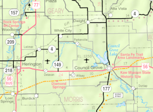
Latimer is located at coordinates 38°44′16″N 96°50′46″W / 38.73778°N 96.84611°W. This helps us find its exact spot on a map. According to the United States Census Bureau, the city covers a total area of about 0.09 square miles (0.15 square kilometers). All of this area is land, meaning there are no lakes or large rivers within the city limits.
Population and People
The word "demographics" helps us understand the people who live in a place. It looks at things like how many people there are, their ages, and how households are formed.
| Historical population | |||
|---|---|---|---|
| Census | Pop. | %± | |
| 1930 | 124 | — | |
| 1940 | 84 | −32.3% | |
| 1950 | 34 | −59.5% | |
| 1960 | 40 | 17.6% | |
| 1970 | 29 | −27.5% | |
| 1980 | 31 | 6.9% | |
| 1990 | 20 | −35.5% | |
| 2000 | 21 | 5.0% | |
| 2010 | 20 | −4.8% | |
| 2020 | 31 | 55.0% | |
| U.S. Decennial Census | |||
2020 Census Information
The 2020 United States census counted 31 people living in Latimer. There were 9 households, which are groups of people living together in one home. Most of the people living in Latimer were white.
About 55.6% of the households had children under 18 years old. Most households (77.8%) were married couples living together. The average household had 2 people.
2010 Census Information
In the census of 2010, there were 20 people living in Latimer. There were 9 households and 11 housing units. All the people living in the city were white.
About 33.3% of households had children under 18. The average household size was 2.22 people. The median age in the city was 46 years old. This means half the people were younger than 46 and half were older.
Education
The children in Latimer attend schools that are part of the Rural Vista USD 481 public school district.
See also
 In Spanish: Latimer (Kansas) para niños
 | Kyle Baker |
 | Joseph Yoakum |
 | Laura Wheeler Waring |
 | Henry Ossawa Tanner |

