Morris County, Kansas facts for kids
Quick facts for kids
Morris County
|
|
|---|---|
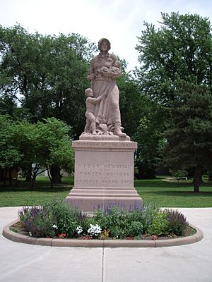
Madonna of the Trail monument in Council Grove
|
|
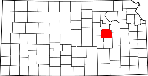
Location within the U.S. state of Kansas
|
|
 Kansas's location within the U.S. |
|
| Country | |
| State | |
| Founded | February 11, 1859 |
| Named for | Thomas Morris |
| Seat | Council Grove |
| Largest city | Council Grove |
| Area | |
| • Total | 703 sq mi (1,820 km2) |
| • Land | 695 sq mi (1,800 km2) |
| • Water | 7.6 sq mi (20 km2) 1.1%% |
| Population
(2020)
|
|
| • Total | 5,386 |
| • Density | 7.7/sq mi (3.0/km2) |
| Time zone | UTC−6 (Central) |
| • Summer (DST) | UTC−5 (CDT) |
| Congressional district | 2nd |
Morris County is a county in the state of Kansas, USA. Its main city and county seat is Council Grove. In 2020, about 5,386 people lived here. The county is named after Thomas Morris. He was a U.S. Senator from Ohio who spoke out against slavery.
Contents
History of Morris County
Early Days
For thousands of years, the Great Plains of North America were home to nomadic Native American tribes. In the 16th to 18th centuries, France claimed large parts of North America. Later, France secretly gave this land to Spain in 1762.
In 1803, the United States bought most of the land that is now Kansas from France. This was part of the huge Louisiana Purchase. In 1848, after the Mexican–American War, the U.S. gained more land, including parts of southwest Kansas. The Kansas Territory was set up in 1854. Then, in 1861, Kansas officially became the 34th U.S. state.
The 1800s: A Time of Change
Morris County was first home to the Kaw Native American tribe. As more settlers arrived, their relationship with the Kaw became difficult.
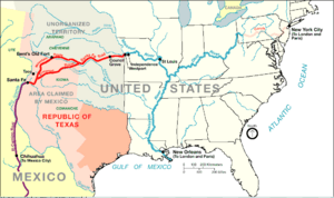
The town of Council Grove was started by European Americans in 1825. It became a very important stop for supplies on the Santa Fe Trail. The Santa Fe Trail was a busy trade route that crossed Morris County from 1821 to 1866.
The county was first called Wise County in 1855. It was named after Henry A. Wise, a governor from Virginia. However, in 1859, people who were against slavery renamed it Morris County. They chose to honor Thomas Morris, who was a strong opponent of slavery.
From 1846 to 1873, the Kaw Indian Reservation was located near Council Grove. In 1851, the Methodist Church also started an Indian Mission in Morris County.
Between 1877 and 1879, Benjamin "Pap" Singleton helped former enslaved people settle in Morris County. These settlers were called "Exodusters". Thousands of families moved from the southern U.S. to the Midwest. They hoped to find more opportunities and better lives.
In 1887, the Chicago, Kansas and Nebraska Railway built a main railroad line through the county. Another railroad, the Atchison, Topeka and Santa Fe Railway, also built a line in 1887. These railroads helped connect Morris County to other parts of the country.
The 1900s
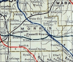
The National Old Trails Road was created in 1912. This important road, also known as the Ocean-to-Ocean Highway, passed through Herington, Delavan, and Council Grove in Morris County.
Geography
Morris County covers about 703 square miles. Most of this area, 695 square miles, is land. The remaining 7.6 square miles, or about 1.1%, is water.
Neighboring Counties
Morris County shares borders with these counties:
- Geary County (north)
- Wabaunsee County (northeast)
- Lyon County (southeast)
- Chase County (south)
- Marion County (southwest)
- Dickinson County (west)
Population Information

| Historical population | |||
|---|---|---|---|
| Census | Pop. | %± | |
| 1860 | 770 | — | |
| 1870 | 2,225 | 189.0% | |
| 1880 | 9,265 | 316.4% | |
| 1890 | 11,381 | 22.8% | |
| 1900 | 11,967 | 5.1% | |
| 1910 | 12,397 | 3.6% | |
| 1920 | 12,005 | −3.2% | |
| 1930 | 11,859 | −1.2% | |
| 1940 | 10,363 | −12.6% | |
| 1950 | 8,485 | −18.1% | |
| 1960 | 7,392 | −12.9% | |
| 1970 | 6,432 | −13.0% | |
| 1980 | 6,419 | −0.2% | |
| 1990 | 6,198 | −3.4% | |
| 2000 | 6,104 | −1.5% | |
| 2010 | 5,923 | −3.0% | |
| 2020 | 5,386 | −9.1% | |
| 2023 (est.) | 5,334 | −9.9% | |
| U.S. Decennial Census 1790-1960 1900-1990 1990-2000 2010-2020 |
|||
Education
Morris County has a few school districts that serve its students.
Local School Districts
- Morris County USD 417
- Rural Vista USD 481
Some students in Morris County might attend schools in districts that have offices in neighboring counties:
- Centre USD 397
- Chase County USD 284
Communities
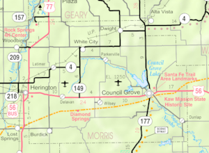
Morris County has several cities and smaller communities.
Cities in Morris County
- Council Grove (This is the county seat, where the main county government offices are.)
- Dunlap
- Dwight
- Herington (Part of this city is in another county.)
- Latimer
- Parkerville
- White City
- Wilsey
Smaller Communities
These are communities that are not officially incorporated as cities:
- Burdick (This is a Census-Designated Place, meaning the U.S. Census Bureau tracks its population.)
- Delavan
- Diamond Springs
- Skiddy
Former Communities
- Comiskey (This was once a community but is now considered a "ghost town." Part of it was in another county.)
See also
 In Spanish: Condado de Morris (Kansas) para niños
 | Tommie Smith |
 | Simone Manuel |
 | Shani Davis |
 | Simone Biles |
 | Alice Coachman |


