Laurieston, Glasgow facts for kids
Quick facts for kids Laurieston |
|
|---|---|
 |
|
| OS grid reference | NS587641 |
| Council area | |
| Lieutenancy area |
|
| Country | Scotland |
| Sovereign state | United Kingdom |
| Post town | GLASGOW |
| Postcode district | G5 |
| Dialling code | 0141 |
| Ambulance | Scottish |
| EU Parliament | Scotland |
| UK Parliament |
|
| Scottish Parliament |
|
Laurieston is a neighborhood in the Gorbals area of Glasgow, a big city in Scotland. You can find it just south of the River Clyde.
Laurieston got its name from James Laurie. He and his brother helped build a lot of this area in the early 1800s.
Contents
Laurieston's Story: A Look at Its Past
Laurieston is a key part of the Gorbals area. Many of its buildings from the 1800s are still standing. This is because they were not torn down during the big slum clearance projects of the 1960s and 70s. This was especially true for buildings closer to the river.
Changes in Housing: From Tenements to Towers and Beyond
Further south, many old apartment buildings called tenements were removed. In their place, four tall, black tower blocks were built. These towers were known as Norfolk Court and Stirlingfauld Place. They actually had two towers joined together, each with its own entrance.
These towers helped solve a housing problem for a while. Some people liked living there because they were close to Glasgow city center. However, they became expensive to take care of. Their quality and look also became less popular over time.
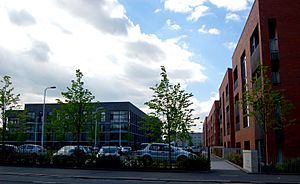
In the early 2000s, the people living in these towers moved out. The towers were then taken down. Now, new, smaller apartment buildings are being built in their place.
Important Places in Laurieston
Some well-known buildings are actually in Laurieston. These include the Glasgow Sheriff Court, which is a court building. The O2 Academy Glasgow is also here. This building used to be a movie theater called the New Bedford Cinema.
Getting Around Laurieston: Transport Links
Laurieston is easy to reach by public transport. The Bridge Street subway station is part of the Glasgow Subway system. Many local buses also stop nearby on Eglinton Street and Gorbals Street. From there, they go into Glasgow city center.
The West Coast Main Line railway tracks run along the west side of Laurieston. Other tracks are also close by, connecting to the City Union Bridge. However, Laurieston and the Gorbals have not had their own train station, like the old Cumberland Street railway station, for many decades.
 | Dorothy Vaughan |
 | Charles Henry Turner |
 | Hildrus Poindexter |
 | Henry Cecil McBay |


