Leasburg, Missouri facts for kids
Quick facts for kids
Leasburg, Missouri
|
|
|---|---|
|
Village
|
|

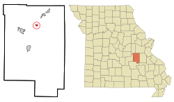
Location of Leasburg, Missouri
|
|
| Country | United States |
| State | Missouri |
| County | Crawford |
| Area | |
| • Total | 0.43 sq mi (1.12 km2) |
| • Land | 0.43 sq mi (1.12 km2) |
| • Water | 0.00 sq mi (0.00 km2) |
| Elevation | 1,037 ft (316 m) |
| Population
(2020)
|
|
| • Total | 326 |
| • Density | 754.63/sq mi (291.08/km2) |
| Time zone | UTC-6 (Central (CST)) |
| • Summer (DST) | UTC-5 (CDT) |
| ZIP code |
65535
|
| Area code(s) | 573 |
| FIPS code | 29-41114 |
| GNIS feature ID | 2398407 |
Leasburg is a small village located in Crawford County, Missouri, in the United States. In 2010, about 338 people lived there. By 2020, the population was 326.
Contents
A Look Back in Time
Leasburg was first planned and settled in 1859. It was named after Samuel Lea, who was one of the first people to settle in the area. For a short time, it was also known as Harrison Station. A post office has been open in Leasburg since 1860, helping people send and receive mail.
An important historical site nearby is the Scotia Iron Furnace Stack. This old furnace was added to the National Register of Historic Places in 1969. This means it's recognized as a special place worth protecting because of its history.
Where is Leasburg?
Leasburg is found on Missouri Route H. It is about two miles south of the big highway, I-44. If you travel west, you'll reach Cuba in about six miles. To the northeast, Bourbon is about five miles away. A cool place to visit, Onondaga Cave State Park, is only four miles southeast along Missouri Route H.
The United States Census Bureau says that Leasburg covers a total area of about 0.43 square miles (1.12 square kilometers). All of this area is land, with no large bodies of water.
Who Lives in Leasburg?
| Historical population | |||
|---|---|---|---|
| Census | Pop. | %± | |
| 1880 | 79 | — | |
| 1930 | 130 | — | |
| 1940 | 173 | 33.1% | |
| 1950 | 178 | 2.9% | |
| 1960 | 176 | −1.1% | |
| 1970 | 218 | 23.9% | |
| 1980 | 304 | 39.4% | |
| 1990 | 289 | −4.9% | |
| 2000 | 323 | 11.8% | |
| 2010 | 338 | 4.6% | |
| 2020 | 326 | −3.6% | |
| U.S. Decennial Census | |||
A Closer Look at the 2010 Census
In 2010, a census (a count of people) showed that 338 people lived in Leasburg. These people lived in 144 different homes, and 80 of these were families. The village had about 786 people per square mile. There were 155 housing units, which means places where people could live.
Most of the people in Leasburg (about 98.5%) were White. A small number were Native American or Pacific Islander, and some people identified with two or more races.
Out of the 144 homes, about 31.9% had children under 18 living there. About 40.3% of homes had married couples. Some homes had a female head of the household without a husband (11.1%), and a few had a male head of the household without a wife (4.2%). About 44.4% of homes were not families, meaning they might be individuals living alone or roommates.
Nearly 42% of all homes had just one person living there. About 19.4% of homes had someone aged 65 or older living by themselves. On average, there were 2.35 people in each home, and 3.26 people in each family.
The average age of people in Leasburg was 37.2 years old. About 27.5% of residents were under 18. About 7.9% were between 18 and 24 years old. People aged 25 to 44 made up 24.3% of the population. Those between 45 and 64 years old were 25.7%, and 14.5% were 65 years or older. The village had almost an even number of males (49.7%) and females (50.3%).
See also
 In Spanish: Leasburg (Misuri) para niños
 | Selma Burke |
 | Pauline Powell Burns |
 | Frederick J. Brown |
 | Robert Blackburn |

