Leavitt Falls facts for kids
Quick facts for kids Leavitt Falls |
|
|---|---|
 |
|
| Lua error in Module:Infobox_mapframe at line 185: attempt to index field 'wikibase' (a nil value). | |
| Location | Mono County, California |
| Coordinates | 38°19′09″N 119°33′47″W / 38.31917°N 119.56306°W |
| Type | Tiered |
| Elevation | 7,769 ft (2,368 m) |
| Total height | 200 ft (61 m) |
| Number of drops | 4 |
| Longest drop | 70 ft (21 m) |
| Watercourse | Leavitt Creek |
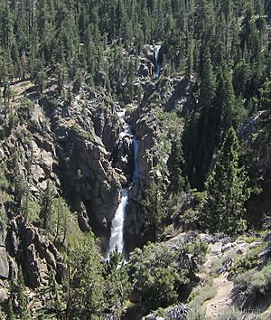
Leavitt Falls is a beautiful waterfall located in the Sierra Nevada mountains of California. It stands about 200 feet (61 meters) tall. This waterfall has several levels, like steps, making it a "multi-tiered" fall. You can find it in Mono County.
About Leavitt Falls
Leavitt Falls gets its water from Leavitt Creek. This creek is a smaller stream that flows into the West Walker River. The waterfall was formed where Leavitt Creek flows over the edge of a "hanging valley." Imagine a valley that suddenly ends high above another area. The water then tumbles down into Leavitt Meadow below.
Seeing the Falls
You can get a good view of Leavitt Falls from a special spot on Highway 108. This viewing spot is called a "turnout." From here, you can see both the waterfall and the pretty Leavitt Meadow.
It is not possible to walk right up to the waterfall itself. There isn't a path because the falls are in a very steep and narrow canyon. This kind of canyon is sometimes called a "box canyon" because its sides are very high and close together.
Who Was Leavitt?
The waterfall, Leavitt Creek, and Leavitt Meadow are all named after a person named Hiram Leavitt. He was one of the first people to settle and live in Mono County a long time ago.
 | Mary Eliza Mahoney |
 | Susie King Taylor |
 | Ida Gray |
 | Eliza Ann Grier |


