Lewiston, Wisconsin facts for kids
Quick facts for kids
Lewiston, Wisconsin
|
|
|---|---|

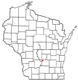
Location of Lewiston, Wisconsin
|
|
| Country | |
| State | |
| County | Columbia |
| Area | |
| • Total | 54.9 sq mi (142.2 km2) |
| • Land | 54 sq mi (139.8 km2) |
| • Water | 1 sq mi (2.5 km2) |
| Elevation | 804 ft (245 m) |
| Population
(2000)
|
|
| • Total | 1,187 |
| • Density | 22/sq mi (8.5/km2) |
| Time zone | UTC-6 (Central (CST)) |
| • Summer (DST) | UTC-5 (CDT) |
| FIPS code | 55-43775 |
| GNIS feature ID | 1583549 |
Lewiston is a town located in Columbia County, Wisconsin, in the United States. In the year 2000, about 1,187 people lived there.
Geography of Lewiston
Lewiston covers a total area of about 54.9 square miles (142.2 square kilometers). Most of this area, about 54 square miles (139.8 square kilometers), is land. The remaining 1 square mile (2.5 square kilometers) is water, like rivers or lakes.
People in Lewiston
In 2000, there were 1,187 people living in Lewiston. This means there were about 22 people for every square mile. There were 473 households, which are groups of people living together in one home. Most households were married couples living together.
The people living in Lewiston included a mix of ages. About 23% of the population was under 18 years old. Around 29% were between 45 and 64 years old. The average age of people in Lewiston was 41 years.
Historic Sites Nearby
A famous historic place called the Aldo Leopold Shack and Farm is located about 6 miles south of Lewiston. It is actually in the town of Fairfield, which is in Sauk County. This site is important for its connection to a famous conservationist.
See also

- In Spanish: Lewiston (Wisconsin) para niños
 | Frances Mary Albrier |
 | Whitney Young |
 | Muhammad Ali |

