Lignumvitae Key facts for kids

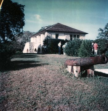
House on Lignumvitae Key, December 1977
|
|
| Geography | |
|---|---|
| Location | Florida Keys |
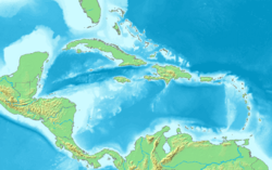
| Coordinates | 24°54′07″N 80°41′56″W / 24.902°N 80.699°W |
| Administration | |
| State | Florida |
| County | Monroe |
|
Lignumvitae Key Archaeological and Historical District
|
|
| Nearest city | Islamorada, Florida |
|---|---|
| NRHP reference No. | 98000652 |
| Added to NRHP | February 16, 1999 |
Lignumvitae Key is a special island in the upper Florida Keys. It's located just north of Lower Matecumbe Key.
This island is a National Natural Landmark and a historic site. It's also part of the Lignumvitae Key Botanical State Park, which helps protect its unique plants and animals.
Lignumvitae Key is the highest point in the Florida Keys! It rises about 19 feet (5.8 meters) above the water. That's even a bit higher than Key West's Solares Hill. The island is covered with rare tropical trees, like the Holywood Lignum-vitae (Guaiacum sanctum), which is where the island gets its name.
Contents
Exploring Ancient History on Lignumvitae Key
Lignumvitae Key has some interesting old sites that tell us about the people who lived there long ago. These sites are called "archaeological identifiers" by the State of Florida.
Ancient Burial Mound
One important site is a burial mound. It's about 30 meters (98 feet) wide and 1 meter (3.3 feet) high. People used to think it was built by the Spanish, but now experts believe it was made by the Glades culture. This culture lived in Florida from about 500 BCE until Europeans arrived.
Archaeologists think the Florida Keys were part of the Tequesta or Everglades region of the Glades culture.
What We Know About the Past
We don't have a lot of old records about Lignumvitae Key. The Spanish called the people living in this area in the 1500s and 1600s "Matecumbes."
In 1940, a researcher named John Goggin studied the burial mound. He said it was about 50 feet (15 meters) wide and 3.5 feet (1.1 meters) high. He noticed that a big storm in 1935 had washed over the mound, but it wasn't badly damaged. He found pieces of human bones on the surface but no other old objects.
Later Discoveries
Since Goggin's visit, other archaeologists have looked at the burial mound in 1962, 1967, and 1970. They found that the mound had been disturbed a lot since Goggin's time. This means people had dug into it without permission, which can damage important historical information.
A Look at Lignumvitae Key's Past
The island has had a few different names over the years.
Early Names and Crops
In 1760, a map called the island Cayo de la Leña, which means "Isle of Wood" in Spanish. When Britain took control of Florida in 1763, the island was renamed "Jenkinson."
In the 1830s, people from nearby Indian Key called the island "Lignurd Vitoz." They grew crops like sisal there. Later, between 1888 and 1919, a coconut grove was planted on the island.
Owners and Caretakers
Records of who owned Lignumvitae Key go back to 1843. From 1919 to 1953, the Matheson family from Miami owned the island.
In 1953, Dr. Edwin C. Lunsford, Sr. and two other investors bought the island. During this time, Charlotte and Russell Neidhauk lived on the island and took care of it. The house they lived in, made of coral rock, is still standing today!
On March 2, 1971, the state of Florida bought Lignumvitae Key and nearby Shell Key. They became part of the Lignumvitae Key State Botanical Park, helping to protect this special place for everyone to enjoy.


