Florida Keys facts for kids
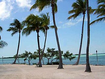
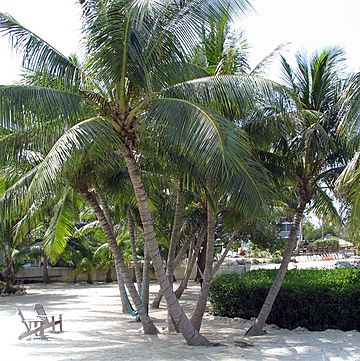
Coconut palms like these in Islamorada flourish in the tropical climate of the Florida Keys
|
|
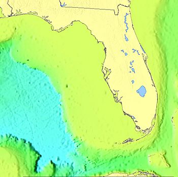
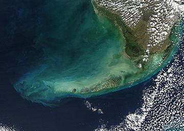
The Keys were formed near the edge of the Florida Platform
|
|
| Geography | |
|---|---|
| Location | Florida Straits |
| Coordinates | 24°40′01″N 81°32′39″W / 24.66694°N 81.54417°W |
| Area | 356 km2 (137 sq mi) |
| Administration | |
|
United States
|
|
| State | Florida |
| Demographics | |
| Population | 82,874 (2020) |
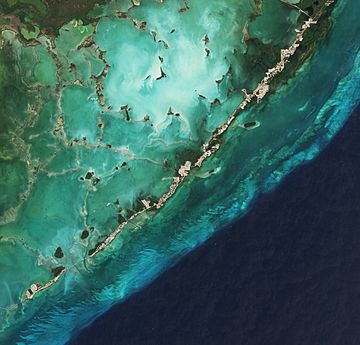
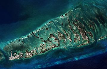
The Florida Keys are a chain of coral islands, called cays, located off the southern coast of Florida. They form the southernmost part of the continental United States. The Keys start about 15 miles (24 km) south of Miami. They stretch in a gentle curve southwest to Key West, the last inhabited island, and then to the uninhabited Dry Tortugas.
These islands are found along the Straits of Florida. This area separates the Atlantic Ocean to the east from the Gulf of Mexico to the northwest. It also marks one edge of Florida Bay. The southern tip of Key West is only 93 miles (150 km) from Cuba.
Most of the land area of the Keys is in Monroe County. A small part, like Totten Key, extends into Miami-Dade County. The total land area is about 137.3 square miles (356 km²). In 2020, about 82,874 people lived there. Many people live in Key West, which is the largest city and the county seat of Monroe County.
Contents
History of the Keys
The first people to live in the Keys were the Calusa and Tequesta tribes. In 1513, Juan Ponce de León explored the islands. He called them Los Martires, meaning "The Martyrs," because they looked like suffering men from a distance. The word "Key" comes from the Spanish word cayo, which means "small island."
For many years, Key West was the biggest town in Florida. It became rich from "wrecking," which meant salvaging goods from shipwrecks. Its location was great for trading with Cuba and the Bahamas. It was also on the main trade route from New Orleans. As navigation got better, fewer ships wrecked, and Key West's wealth declined in the late 1800s.
The Overseas Railway
For a long time, you could only reach the Keys by boat. This changed when Henry Flagler built the Overseas Railroad in the early 1900s. Flagler was a big developer on Florida's Atlantic coast. He extended his Florida East Coast Railway all the way to Key West. This was a huge project with many railroad bridges built over the ocean. Three hurricanes hit the project in 1906, 1909, and 1910, but the railway was completed.
The 1935 Labor Day Hurricane
The strongest hurricane to ever hit the U.S. struck the Upper Keys near Islamorada on September 2, 1935. Winds were estimated to be as high as 200 miles per hour (320 km/h). A huge storm surge, over 17.5 feet (5.3 m) high, washed over the islands. More than 400 people died in this terrible storm.
This hurricane was one of only four storms to hit the U.S. coast as a Category 5 hurricane since records began around 1850. The others were Hurricane Camille (1969), Hurricane Andrew (1992), and Hurricane Michael (2018).
In 1935, new bridges were being built to create a highway through the Keys. Hundreds of World War I veterans were working on this road as part of a government program. They lived in weak buildings in three camps in the Upper Keys. An evacuation train could not reach them before the storm hit. Sadly, over 200 veterans died. This led to anger and an investigation by Congress.
The storm also ended the 23-year run of the Overseas Railway. The damaged tracks were never rebuilt. The Overseas Highway (U.S. Highway 1) then replaced the railroad as the main way to travel from Miami to Key West.
The Seven Mile Bridge
The Seven Mile Bridge was one of the longest bridges when it was built. It connects Knight's Key (in Marathon) to Little Duck Key in the Lower Keys. This concrete bridge is about 6.79 miles (10.93 km) long. The current bridge goes around Pigeon Key, a small island that housed workers who built Henry Flagler's original railway.
A 2.2-mile (3.5 km) section of the old bridge is still there. It allows people to walk, bike, or jog to Pigeon Key. However, it was closed to cars in 2008 because it was deemed unsafe.
The Overseas Highway
After the 1935 Labor Day hurricane destroyed the Keys railway, the railroad bridges were turned into roads for cars. This new road, U.S. Highway 1, became the Overseas Highway. It runs from Key Largo south to Key West. Today, this highway lets you drive through the tropical Florida Keys. You can see unique plants and animals found nowhere else on the U.S. mainland. You can also see the largest coral reef chain in the United States.
The Conch Republic
In 1982, the United States Border Patrol set up a checkpoint on U.S. Highway 1. They stopped all cars heading north to the mainland at Florida City to search for people without proper documents. The Key West City Council complained many times. These roadblocks caused big delays for travelers and hurt the Keys' important tourism business.
After their complaints and legal attempts failed, the mayor of Key West, Dennis Wardlow, and the city council declared Key West independent on April 23, 1982. They called it the "Conch Republic." After just one minute of being "independent," the "Prime Minister" (Mayor Wardlow) surrendered to a U.S. Navy officer. He jokingly asked for $1 billion in "foreign aid."
This clever stunt brought a lot of attention to the Keys' problems. The inspection roadblock was removed. The idea of the Conch Republic has become a fun part of the Keys' culture. It helps bring in money from tourist souvenirs. The Conch Republic has even taken part in other protests since then.
Geology of the Keys
The northern and central parts of the Florida Keys are actually the exposed parts of an ancient coral reef. This reef is called the Key Largo Limestone. The northernmost island formed from this old reef is Elliott Key. North of Elliott Key are smaller islands made of sand built around tiny bits of the ancient reef. Further north, Key Biscayne and other places are barrier islands, made mostly of sand.
The islands in the southwestern part of the chain, from Big Pine Key to the Marquesas Keys, are exposed areas of Miami Limestone.
The Florida Keys look the way they do today because of big changes in sea level during past ice ages. About 130,000 years ago, the sea level was about 25 feet (7.6 m) higher than it is now. All of southern Florida was covered by a shallow sea. Lines of reefs formed along the edge of the submerged Florida Platform. These reefs formed the Key Largo Limestone. You can see this limestone on the surface of islands from Soldier Key to the southeast part of Big Pine Key.
Just off the coast of the Florida Keys is the Florida Reef. This reef system is about 270 km (168 miles) long. It is the third-largest barrier reef system in the world.
Environment and Wildlife
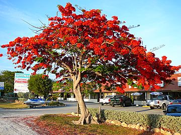
The climate and environment of the Florida Keys are more like the Caribbean than the rest of Florida. However, unlike the Caribbean's volcanic islands, the Keys were formed by plants and animals. The Upper Keys are made of sandy limestone grains from plants and sea creatures. The Lower Keys are what's left of large coral reefs that turned into fossils and became visible when the sea level dropped.
The natural areas of the Keys include forests, wetlands, and shorelines. The soil can be sand, marl, or rich leaf litter. In some spots, "caprock" (eroded coral) covers the ground. Rain falling through leaf debris becomes acidic. This dissolves holes in the limestone, where soil collects and trees can grow roots.
Unique Plants and Animals
The Florida Keys have special plants and animals. Some are found nowhere else in the United States. This is because the Keys are the northernmost place where these species can live. Many imported plants also grow well here. Some of these non-native plants now spread and threaten the natural areas.
The native plants of the Keys are very diverse. They include trees like red maple and oaks, which are at the southern end of their natural range. They also have tropical trees like mahogany, gumbo limbo, and Jamaican dogwood. Several types of palms are native to the Florida Keys, including the Florida thatch palm.
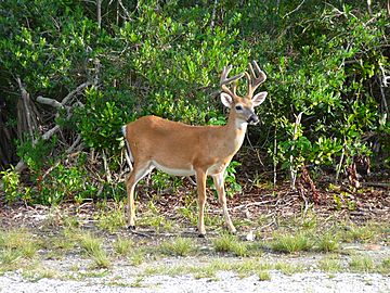
The Keys are also home to unique animals. These include the American crocodile, the Key deer (protected by the National Key Deer Refuge), and the Key Largo woodrat. The American crocodile lives in the Keys, which is the northernmost part of its range. The Key Largo Woodrat is found only on the northern part of Key Largo island. About 70 miles (110 km) west of Key West is Dry Tortugas National Park.
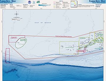
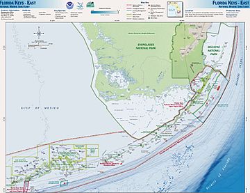
The waters around the Keys are a protected area called the Florida Keys National Marine Sanctuary.
Climate
The Florida Keys have a tropical savanna climate (Köppen climate classification: Aw). The Florida Keys are one of the only places in the continental United States that have never reported freezing temperatures since people started keeping records. The lowest temperature ever recorded in Key West was 41°F (5°C). Temperatures below 48°F (9°C) are very rare.
The Keys have two main "seasons." There's a hot and wet season from June to October. Then there's a dry season from November to April. This dry season has little rain, sunny skies, and warm, breezy weather. The warm, sunny winter climate, with average highs around 75°F (24°C), is when most tourists visit the Florida Keys. Key West is the driest city in Florida. Some plants in the Keys are small and scrubby because of the strong sun, sandy soil, and dry winter.
| Climate data for Key West Int'l, Florida (1981–2010 normals, extremes 1872−present) | |||||||||||||
|---|---|---|---|---|---|---|---|---|---|---|---|---|---|
| Month | Jan | Feb | Mar | Apr | May | Jun | Jul | Aug | Sep | Oct | Nov | Dec | Year |
| Record high °F (°C) | 90 (32) |
87 (31) |
89 (32) |
91 (33) |
93 (34) |
96 (36) |
97 (36) |
97 (36) |
95 (35) |
93 (34) |
91 (33) |
88 (31) |
97 (36) |
| Mean maximum °F (°C) | 82.0 (27.8) |
82.7 (28.2) |
84.2 (29.0) |
86.0 (30.0) |
88.6 (31.4) |
91.0 (32.8) |
92.0 (33.3) |
92.1 (33.4) |
91.1 (32.8) |
88.7 (31.5) |
85.6 (29.8) |
82.7 (28.2) |
92.6 (33.7) |
| Mean daily maximum °F (°C) | 74.3 (23.5) |
76.0 (24.4) |
78.2 (25.7) |
81.3 (27.4) |
85.0 (29.4) |
87.8 (31.0) |
89.3 (31.8) |
89.4 (31.9) |
87.9 (31.1) |
84.5 (29.2) |
79.9 (26.6) |
76.0 (24.4) |
82.5 (28.1) |
| Daily mean °F (°C) | 69.3 (20.7) |
71.0 (21.7) |
73.2 (22.9) |
76.4 (24.7) |
80.3 (26.8) |
83.3 (28.5) |
84.5 (29.2) |
84.5 (29.2) |
83.2 (28.4) |
80.2 (26.8) |
75.8 (24.3) |
71.4 (21.9) |
77.8 (25.4) |
| Mean daily minimum °F (°C) | 64.2 (17.9) |
66.0 (18.9) |
68.3 (20.2) |
71.6 (22.0) |
75.7 (24.3) |
78.8 (26.0) |
79.8 (26.6) |
79.6 (26.4) |
78.5 (25.8) |
76.0 (24.4) |
71.7 (22.1) |
66.9 (19.4) |
73.1 (22.8) |
| Mean minimum °F (°C) | 51.0 (10.6) |
53.7 (12.1) |
57.4 (14.1) |
61.9 (16.6) |
69.5 (20.8) |
73.4 (23.0) |
74.1 (23.4) |
73.8 (23.2) |
73.6 (23.1) |
69.1 (20.6) |
62.2 (16.8) |
54.5 (12.5) |
48.8 (9.3) |
| Record low °F (°C) | 41 (5) |
44 (7) |
47 (8) |
48 (9) |
63 (17) |
65 (18) |
68 (20) |
68 (20) |
64 (18) |
59 (15) |
49 (9) |
44 (7) |
41 (5) |
| Average rainfall inches (mm) | 2.04 (52) |
1.49 (38) |
2.05 (52) |
2.05 (52) |
3.00 (76) |
4.11 (104) |
3.55 (90) |
5.38 (137) |
6.71 (170) |
4.93 (125) |
2.30 (58) |
2.22 (56) |
39.83 (1,012) |
| Average rainy days (≥ 0.01 in) | 6.2 | 5.3 | 5.8 | 4.5 | 7.2 | 11.0 | 11.7 | 14.2 | 16.2 | 11.3 | 6.6 | 6.4 | 106.4 |
| Average relative humidity (%) | 76.0 | 74.3 | 73.0 | 70.1 | 71.8 | 74.0 | 72.2 | 73.4 | 75.3 | 75.1 | 76.0 | 76.2 | 74.0 |
| Mean monthly sunshine hours | 249.6 | 245.4 | 308.8 | 324.6 | 340.3 | 314.0 | 325.2 | 306.6 | 269.6 | 254.7 | 230.9 | 234.5 | 3,404.2 |
| Percent possible sunshine | 75 | 77 | 83 | 85 | 82 | 77 | 78 | 76 | 73 | 71 | 70 | 71 | 77 |
| Source: NOAA (relative humidity and sun 1961−1990) , The Weather Channel | |||||||||||||
Tropical Storms and Hurricanes
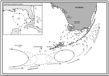
throughout the Florida Keys
(NOAA June 2010)
The Keys are sometimes threatened by tropical storms and hurricanes. When this happens, people are often asked to leave and go to the mainland. Hurricane Georges caused damage and flooding in the Lower Keys in 1998. In 2005, Hurricanes Katrina, Rita, and Wilma affected the Keys, causing damage and flooding. The worst hurricane to hit the area was the 1935 Labor Day hurricane, a Category 5 storm.
Tropical storms and hurricanes are very dangerous for the Keys. No part of the islands is more than 20 feet (6 m) above sea level. Many areas are only a few feet high. Since water surrounds the islands, almost every neighborhood can flood. Homes in the Keys are often built on concrete stilts. The first floor is usually not a legal living space and has walls designed to break away in a storm.
Because of the risk of storm surge, people are usually told to evacuate when a hurricane watch or warning is issued. Sometimes, they are even told to leave for a tropical storm warning. Evacuating the Keys relies on causeways and the two-lane highway to the mainland. It can take 12 to 24 hours to evacuate everyone from the Keys.
On September 10, 2017, Hurricane Irma hit Cudjoe Key. The storm destroyed about 25% of the houses in the Keys. Another 65% had major damage. Most people had left before the storm. The damage was worst in the Lower Keys. Some areas were not safe to live in for months.
Major Islands of the Keys
U.S. Highway 1, also known as the "Overseas Highway," runs across most of the inhabited islands. The islands are listed from southwest to north. Mile markers (MM) are shown for islands the highway crosses:
- Dry Tortugas
- Loggerhead Key
- Marquesas Keys
- Sunset Key
- Wisteria Island
- Key West (MM 0-4)
- Fleming Key
- Stock Island (MM 5)
- Boca Chica Key (MM 7-8)
- Rockland Key (MM 9)
- Big Coppitt Key (MM 10)
- Cudjoe Key (MM 21-23)
- Summerland Key (MM 24-25)
- Ramrod Key (MM 27)
- Little Torch Key (MM 28½)
- Big Pine Key (MM 30-32)
- No Name Key
- Scout Key (MM 34-35)
- Bahia Honda Key (MM 37-38)
- Ohio Key (MM 38¾)
- Little Duck Key (MM 39¾)
The Seven Mile Bridge (MM 40-46¾) separates the Lower Keys from the Middle Keys:
- Pigeon Key (near MM 45; access at MM 46¾)
- Knights Key (MM 47)
- Vaca Key (MM 48-53)
- Fat Deer Key (MM 53¼-55)
- Long Point Key (MM 56)
- Crawl Key (MM 56½)
- Grassy Key (MM 58-60)
The Long Key Bridge (MM 63¼-65¼) separates the Middle Keys from the Upper Keys:
- Long Key (MM 66-70)
- Fiesta Key (off to the north at MM 70)
- Craig Key (MM 72)
- Lower Matecumbe Key (MM 74-77)
- Indian Key
- Upper Matecumbe Key (MM 80-83)
- Windley Key (MM 85)
- Plantation Key (MM 86-90)
- Key Largo (MM 91-107)
- Tavernier Key
- Rodriguez Key
Islands north of Broad Creek are in Biscayne National Park and Miami-Dade County. These are "true" Florida Keys, made of exposed ancient coral reefs:
Some are "transitional keys," made of ancient reef surrounded by sand:
Transportation
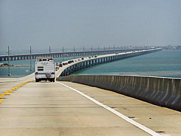
The main islands of the Keys can be reached by car on the Overseas Highway. This is a 127-mile (204 km) section of U.S. 1. It runs from Key West all the way to Fort Kent, Maine. The highway was built next to the original Overseas Railway route. The railway was not rebuilt after the 1935 hurricane.
Before the hurricane, parts of the road and highway bridges allowed cars to travel from Miami to Lower Matecumbe Key. From there, a car ferry connected to another road section through the Lower Keys. After the hurricane, some of the old railway bridges were changed to carry the highway. These bridges were used until the 1980s, when new highway bridges were built next to them. Many of the original railroad and highway bridges are still there today. They are used as fishing piers for people to walk on.
Public Transportation
The Florida Keys has public bus transportation available for residents and visitors.
Road Safety
Even with new bridges, U.S. 1 was not made much wider. Today, most of the road is still just two lanes. Because of its tropical climate, the Florida Keys attract hundreds of thousands of tourists every year. While some visitors fly into Key West International Airport or Florida Keys Marathon Airport, most tourists drive down from the mainland on U.S. 1.
This large amount of traffic, combined with the two-lane road and no other routes, means that Monroe County has a higher rate of serious car accidents per person than any other county in Florida.
Culture and Recreation
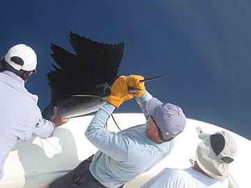
The main industries in the Keys are fishing and tourism. This includes ecotourism, where many visitors go scuba diving in the protected waters. A ferry takes people between Key West and Fort Myers, and also Marco Island.
Dark Skies Recreation
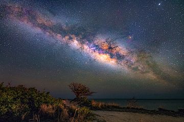
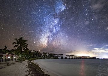
The Middle and Lower Florida Keys are some of the few places in South Florida where you can still see dark night skies from a car. This is because they are along the Atlantic Ocean. This means the southern skies are not blocked by light pollution from cities.
Scout Key hosts the Winter Star Party. This is a big annual event for amateur astronomers in the United States. It's considered one of the top 10 star parties in the world. Over 500 people gather each year to enjoy stargazing, astrophotography, and taking pictures of the Milky Way.
Bahia Honda State Park is another well-known spot for dark skies. Locals love it for its clear views of the southern night sky all year round. It also hosts gatherings for amateur astronomers.
See also
 In Spanish: Cayos de la Florida para niños
 | James Van Der Zee |
 | Alma Thomas |
 | Ellis Wilson |
 | Margaret Taylor-Burroughs |


