Ragged Keys facts for kids
| Geography | |
|---|---|
| Location | Atlantic Ocean |
| Coordinates | 25°32′07″N 80°10′14″W / 25.5352°N 80.1705°W |
| Administration | |
| State | Florida |
| County | Miami-Dade |
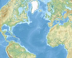
Ragged Keys are a group of small islands. They are found north of the upper Florida Keys.
These islands are located in Biscayne Bay. They are just north of Sands Key. The Ragged Keys are also part of Biscayne National Park.
In the past, these islands had many different names. Some of these names were "Knox Island", "Laurence Island", and "Soldiers Island". Other names included "Los Paradisos", "Mascaras", "Mucaras", "Mucasas", and "Pollock Island".
History of Ragged Keys
A person named Bernard Romans visited these islands in 1774. He was an explorer and mapmaker. He wrote that these were "Seven rocks called Mascaras".
He also noted that this name was "Ill copied on English charts as Mucares". This means the name was written incorrectly on some maps.
The island called Ragged Key #1 is the most northern one. People used to live on this island a long time ago.
Today, you can still see parts of what was once there. There are remains of an old wooden dock, but it is not safe. A broken concrete wall goes around most of the island.
You can also find old concrete pillars. There is also what looks like a broken concrete tank, which was likely a cistern. A cistern is a tank used to collect and store water.
 | Emma Amos |
 | Edward Mitchell Bannister |
 | Larry D. Alexander |
 | Ernie Barnes |


