Biscayne National Park facts for kids
Quick facts for kids Biscayne National Park |
|
|---|---|
|
IUCN Category V (Protected Landscape/Seascape)
|
|
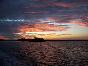
Sunset at Biscayne National Park
|
|
| Location | Miami-Dade County, Florida, United States |
| Nearest city | Homestead |
| Area | 172,971 acres (699.99 km2) |
| Established | June 28, 1980 |
| Visitors | 469,253 (in 2018) |
| Governing body | National Park Service |
| Website | Biscayne National Park |
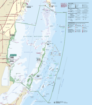
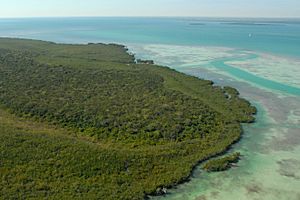
Biscayne National Park is an amazing national park in southern Florida, just south of Miami. It protects a special area called Biscayne Bay and its beautiful coral reefs. Most of the park, about 95%, is water! Along the bay's edge, you'll find a huge mangrove forest. The park covers about 173,000 acres (700 square kilometers). It includes Elliott Key, which is the biggest island in the park and the northernmost of the true Florida Keys. These islands were formed from ancient coral reefs.
Biscayne National Park is home to four main types of natural areas: the mangrove swamps along the shore, the shallow waters of Biscayne Bay, the coral limestone islands (called keys), and the offshore Florida Reef. The mangrove swamps act like a nursery for baby fish, crabs, and other sea creatures. The bay waters are full of fish, seagrass beds, sponges, and gentle manatees. The keys have tropical plants, including rare cacti and palms. Their beaches are important nesting spots for endangered sea turtles. The coral reefs and deeper waters offshore are home to over 200 kinds of fish, seabirds, and even whales. You might even spot 16 endangered species here, like the Schaus' swallowtail butterflies, smalltooth sawfish, manatees, and green and hawksbill sea turtles. The park also has a few American crocodiles and some American alligators.
People have lived in the Biscayne Bay area for a very long time, starting about 10,000 years ago. The Tequesta people lived on the islands and shore from about 4,000 years ago until the 1500s, when the Spanish arrived. Many ships, from Spanish times to the 1900s, have sunk on the reefs. Over 40 shipwrecks are found within the park's boundaries. Even though people tried farming on the islands in the 1800s and early 1900s, it was hard because of the rocky soil and frequent hurricanes.
In the early 1900s, the islands became secret getaways for rich people from Miami. They built fancy homes and clubs. Mark C. Honeywell had a guesthouse on Boca Chita Key with a fake lighthouse! The Cocolobo Cay Club was owned by famous people like Miami developer Carl G. Fisher and even visited by four United States presidents. A unique community called Stiltsville started in the 1930s. It was made of houses built on stilts in the shallow bay waters, far from land. After the Cuban Revolution in 1959, CIA and Cuban exile groups used Elliott Key for training.
Biscayne Bay was first considered to be part of Everglades National Park, but it was left out so the Everglades park could be created. The area stayed mostly undeveloped until the 1960s. Then, there were plans to build hotels like Miami Beach and a huge shipping port with factories. But many people fought against these plans. This led to the creation of Biscayne National Monument in 1968. The protected area grew even larger when it became Biscayne National Park in 1980. Today, many people visit the park by boat. The only land access is at the visitor center on the mainland.
Contents
What is Biscayne National Park Like?
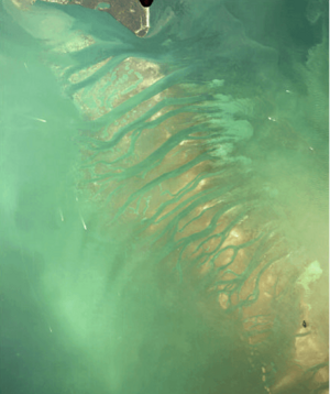
Biscayne National Park covers about 173,000 acres (700 square kilometers) in Miami-Dade County, Florida. It stretches from just south of Key Biscayne to just north of Key Largo. The park includes islands like Soldier Key, the Ragged Keys, Sands Key, Elliott Key, Totten Key, and Old Rhodes Key. These are the northernmost islands of the Florida Keys. A wide, shallow area called the "Safety Valve" lets storm water flow out of the bay after storms.
The park's eastern edge is in the Atlantic Ocean, reaching a depth of about 60 feet (18 meters) on the Florida Reef. The western edge is a small strip of land on the mainland. The only way to get to the park by land is at the Convoy Point Visitor Center. Only about 9,075 acres (3,672 hectares) of the park are land. The islands make up about 4,250 acres (1,720 hectares), and the mainland mangrove swamps are about 4,825 acres (1,953 hectares).
How Was the Park Formed?
Biscayne Bay is where the Atlantic barrier islands (like Key Biscayne) meet the Florida Keys (like Elliott Key). The keys are different because they have coral limestone right under a thin layer of soil. Barrier islands, however, are mostly made of sand. Biscayne Bay sits between two low ridges. One is made of Miami Limestone on the west, and the other is made of coral-based Key Largo Limestone under Elliott Key and the keys to the south. The Key Largo Limestone is a fossilized coral reef that formed about 75,000 to 125,000 years ago. Because the keys were once reefs, their beaches are often rocky. You'll only find significant sandy beaches at Sands Key.
How Does Water Flow in the Bay?
Biscayne Bay is a shallow, partly enclosed lagoon, usually about 10 feet (3 meters) deep. Both the mainland edges and the islands are covered in mangrove forests. The park also has areas of thin sediment called "hardbottom" and seagrass meadows.
Over the years, canals were built to control water in Florida and drain the Everglades. These canals changed how fresh water flows into Biscayne Bay. Now, water from farms in the Everglades flows into the bay, changing its saltiness and bringing in sediment and pollution. The Comprehensive Everglades Restoration Plan (CERP) was started in 2000 to fix these problems. It aims to bring back the natural water flow to the Everglades and also help Biscayne Bay.
A Look Back: Human History in the Park
Who Lived Here First?
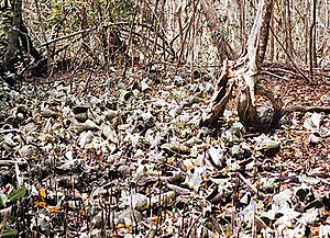
Native Americans lived in southern Florida 10,000 years ago, when the ocean levels were much lower. Any signs of these early people are now underwater. The oldest evidence of humans in Biscayne dates back about 2,500 years. These are piles of conch and whelk shells left by the Glades culture. Later, the Tequesta people lived along Biscayne Bay. They were a settled group who ate fish and other sea life, and they didn't do much farming. Archeologists have found pottery and tools on Sands Key from about 1000 AD to 1650.
European Explorers and Shipwrecks
Juan Ponce de León explored this area in 1513. He found the Florida Keys and met the Tequesta people. Later, in the 1500s, other Spanish explorers arrived, and Florida became Spanish territory. The Tequesta people were moved to the Florida Keys, and the mainland became empty. Ponce de León called the bay "Chequescha," which later became "Tequesta." The name "Biscayne" might come from a shipwrecked sailor from the Basque region, or it could be a general reference to the Bay of Biscay.
Spanish treasure fleets often sailed past the Florida Keys and were caught in hurricanes. There are 44 documented shipwrecks in the park from the 1500s to the 1900s. At least two Spanish ships from the 1700s sank here. The Spanish ship Nuestra Senora del Popolo is thought to have sunk in park waters in 1733. HMS Fowey sank in 1748. The discovery of this ship in 1975 was important because it was protected as an archaeological site, not just a place to find treasure. Many wrecks are now part of the National Register of Historic Places in the Offshore Reefs Archeological District. In the 1700s, Elliott Key was said to be the base for two pirates, both named Black Caesar.
Early Settlers and Famous Visitors
The first permanent European settlers came to the Miami area in the early 1800s. Small farms on Elliott Key grew crops like key limes and pineapples. John James Audubon visited Elliott Key in 1832. After the American Civil War in 1865, some Confederates passed through the area trying to escape to Cuba. John C. Breckinridge, a former U.S. vice president, even stopped on Elliott Key during his escape.
In 1897, Israel Lafayette Jones, an African-American property manager, bought Porgy Key for $300. The next year, he bought Old Rhodes Key and moved his family there to grow limes and pineapples. His farms became some of the largest lime producers in Florida.
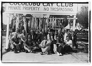
Carl G. Fisher, who helped develop Miami Beach, bought Adams Key in 1916 and built the Cocolobo Cay Club in 1922. This club had guest rooms and a dining room. Famous guests included President Warren G. Harding, Harvey Firestone, and Will Rogers. Israel Jones' sons, Lancelot and Arthur, became full-time fishing guides at the Cocolobo Club after lime farming became less profitable. They guided famous people like Herbert Hoover and future presidents John F. Kennedy, Lyndon B. Johnson, and Richard Nixon.
During the Cold War, the park area was used as a training ground for Cuban exiles preparing for missions in Fidel Castro's Cuba. Elliott Key was used by the CIA in the early 1960s before the Bay of Pigs Invasion.
Why the Park Was Created
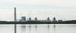
As Miami grew, developers wanted to build on the undeveloped keys south of Key Biscayne. They planned to build a highway connecting the keys and a deepwater port called SeaDade, which would include an oil refinery. Florida Power and Light (FP&L) also planned to build power plants at Turkey Point.
Many local people supported these plans because they would create jobs. But a group of early environmentalists, led by Lloyd Miller and reporter Juanita Greene, thought the plans would harm the environment too much. They fought against the development and suggested creating a national park to protect the reefs, islands, and bay. Their idea gained support from the Miami Herald, Congressman Dante Fascell, and Governor Claude R. Kirk, Jr..
In 1960, some landowners who wanted development created a town called Islandia on Elliott Key. They hoped this would encourage Dade County to improve access to the island. In 1968, when it looked like the area would become a national monument, Islandia supporters bulldozed a six-lane highway down the middle of Elliott Key, destroying the forest. They called it "Spite Highway," hoping the damage would stop the park from being created. But the forest eventually grew back, and now the main hiking trail on Elliott Key follows that path.
The Turkey Point power plants were finished in 1967–68. They caused problems by releasing hot water into Biscayne Bay, which killed marine plants. Later, two nuclear reactors were added. After many discussions, a special cooling system was built to protect the bay.
President Lyndon B. Johnson signed a law to create Biscayne National Monument on October 18, 1968. The monument was expanded in 1974 and then became Biscayne National Park on June 28, 1980. The park grew to include Boca Chita Key, the Ragged Keys, and the Safety Valve area.
Lancelot Jones, one of Israel Jones' sons, was the first landowner to sell his land to the National Park Service. He sold his land for $1,272,500 and was allowed to live on 3 acres (1.2 hectares) for the rest of his life. The Cocolobo Club burned down in 1975, and Lancelot's house burned down in 1982. He lived in a small shack until Hurricane Andrew in 1992 destroyed it. He passed away in 1997 at 99 years old.
The town of Islandia eventually disappeared. In 1990, it was found that all of its elections were invalid because only landowners could vote, not residents. The town was officially ended in 2012.
Hurricane Andrew in 1992 caused a lot of damage to the nearby Homestead Air Force Base. There were plans to turn the base into a commercial airport, but studies showed that flights over the bay would harm the park. So, major commercial development was stopped.
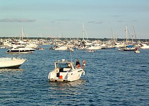
The park is very popular with boaters, which sometimes leads to accidents. The Columbus Day weekend is known as the "most dangerous weekend of the year" for boating here.
Fun Things to Do at Biscayne National Park
Biscayne National Park is open all year. Camping is best in winter when there are fewer mosquitoes on the keys. The Biscayne National Park Institute offers half-day and full-day tours that include snorkeling, hiking, paddling, and sailing. You can also take boat trips to Boca Chita Key and the lighthouses. Private companies offer guided fishing, snorkeling, sailing, and sightseeing tours.
Activities in the Park
You can only get to most of the park by private or tour boats. Activities include boating, fishing, kayaking, windsurfing, snorkeling, and scuba diving. Miami-Dade County has four marina parks near the park, like Homestead Bayfront Park right next to the park headquarters.
Fishing in Biscayne is controlled by the state of Florida. If you want to fish, you need a Florida saltwater fishing license. You can only catch certain sport fish, spiny lobster, stone crab, blue crab, and shrimp. You cannot collect tropical reef fish, sharks, conch, sea urchins, or other marine life. Corals and sponges are also protected. Lobstering is not allowed in the Biscayne Bay-Card Sound Lobster Sanctuary, which protects lobster breeding areas.
Island Facilities
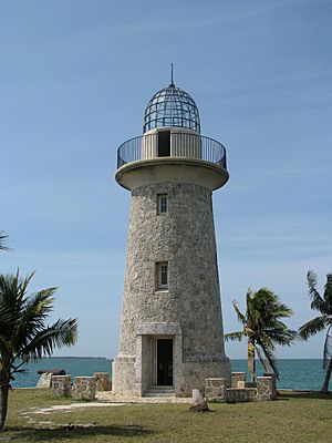
Most of the park's buildings are on the offshore islands. Elliott Key has a ranger station (open seasonally), a campground, and 36 boat slips. There's a hiking trail that follows the old "Spite Highway" down the length of the island. Adams Key is only for day use. Boca Chita Key is the most visited island, with a campground and picnic areas. The Boca Chita Lighthouse is sometimes open for visitors.
Snorkeling and Diving
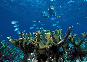
Snorkeling and scuba diving on the offshore reefs are very popular. The reefs have caused many shipwrecks over the years. Some of these wrecks are part of the Maritime Heritage Trail, which is an underwater archaeological trail. You can explore wrecks like the Arratoon Apcar (sank 1878), Erl King (1891), Alicia (1905), Lugano (1913), and Mandalay (1966). The Mandalay is in shallower water, making it great for snorkeling.
Historic Places in the Park
Even though most of Biscayne National Park is water, the islands have many historic buildings and areas. Shipwrecks are also protected.
Stiltsville
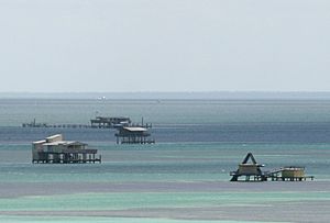
Stiltsville started in the 1930s as a small group of shacks built on stilts in the shallow waters of Biscayne Bay. At its peak in the 1960s, it had 27 structures. Many were lost to fires and hurricanes, and only seven remain today. Stiltsville became part of Biscayne National Park in 1985. The park service is working to preserve this unique community. It will be used for camping, education, and research.
Other Structures
Biscayne National Park has several important navigation lights. The Fowey Rocks Light is a metal structure built in 1878. The Pacific Reef Light is about three miles (5 km) offshore from Elliott Key.
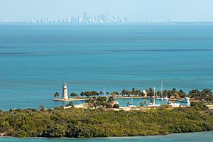
Industrialist Mark C. Honeywell bought Boca Chita Key in 1937. He built several structures, including a small, decorative lighthouse made of coral rock. He also built a chapel, a guesthouse, and seawalls on the island. These buildings show how the area was used as a retreat for wealthy people. Other historic sites include the abandoned farms of Israel Jones and his sons, and the Sweeting Homestead on Elliott Key.
Animals and Plants of Biscayne
South Florida is a special place where plants and animals from North America and the tropics meet. This means you can see many different species here, especially birds, that you might not find anywhere else in North America. The park has four different ecosystems, each with its own unique plants and animals: mangrove swamps, the bay, the islands (keys), and the offshore reefs.
Hundreds of types of fish live in the park's waters. There are also over 50 kinds of crustaceans, from tiny isopods to huge blue land crabs. About 200 bird species and 27 mammal species (both land and sea animals) call the park home. You'll also find many Molluscs like clams, snails, and even octopuses and squid.
The bay and islands are important resting spots for birds migrating between North America, the Caribbean, and South America. Many small birds like warblers stop on Elliott Key during their spring migration. You might also see hawks, eagles, and ospreys. Rare birds like white-tailed and red-tailed tropicbirds, and even flamingos, are sometimes seen here.
Mangrove Forests and Shoreline
The mainland shorelines are mostly covered by mangrove forests. These include red mangrove, black mangrove, and white mangrove trees. The tangled roots of these trees create a safe home for crabs, fish, and wading birds. The calm, brownish waters within the mangroves are like nurseries for baby fish and other sea creatures. Mangroves also provide food for many animals when their leaves fall into the water. The mangrove forest along Biscayne Bay is the longest on Florida's east coast.
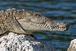
The park's edges are home to the threatened American crocodile. The warm waters of the cooling canals near the Turkey Point power plant have created a perfect place for crocodiles to nest. While both crocodiles and American alligators live in southern Florida, alligators are rare in Biscayne because they prefer fresh water, while crocodiles can live in the bay's saltier waters.
Life in the Bay Waters
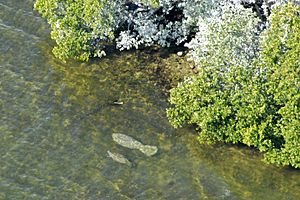
The open waters of the bay are filled with fish, molluscs, and crustaceans that live on seagrasses or hunt each other. The shallow bay is a good place for diving birds like anhingas, cormorants, and diving ducks. Manatees often visit the calm waters of the bay. You can also see double-crested cormorants all year round. In winter, birds like northern gannets and American white pelicans visit. The bay also has a group of common bottlenose dolphins.
Biscayne Bay is shallow, so its saltiness changes depending on how much fresh water flows in from canals on the west side and how much seawater enters from the ocean. The bottom of the bay has sponges and soft corals where seagrasses don't grow. Three main types of seagrass are found here: turtlegrass, shoal grass, and manatee grass. About 75% of the central bay floor is covered by these grasses. Boat propellers can damage seagrass beds, and it can take up to 15 years for them to grow back.
The Keys: Islands of Life
Elliott Key is the largest island in the park, about 8 miles (13 km) long and 0.6 miles (1 km) wide. Other large islands include Old Rhodes Key, Sands Key, and Totten Key. All the keys are surrounded by mangroves, with tropical plants and hardwood forests inside. These forests have trees like gumbo limbo, mahogany, and ironwood. Insects include the endangered Schaus' swallowtail butterfly. You might also see Marsh rabbits, raccoons, mice, and rats. Reptiles include rattlesnakes and lizards, and sometimes a crocodile.
The keys are a stopping point for many birds, including rare Caribbean species. Warblers and hawks are common in the island interiors. Coastal areas are home to shorebirds like ruddy turnstones and least sandpipers. Gulls, terns, and brown pelicans are also seen. Wilson's plovers nest on Boca Chita Key, so some areas are closed during nesting season.
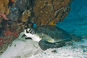
Sea turtles nest on the park's island beaches. Park staff help protect turtle nests by removing trash and putting mesh screens over them to keep raccoons away. Loggerhead turtles are the most common sea turtle species here.
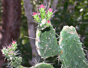
Rare and endangered plants on the islands include Sargent's cherry palm and the semaphore prickly-pear cactus (Consolea corallicola). This cactus is very rare, with only about 20 individuals found in one area. However, in 2001, a large group of 570 cacti was found on another island in Biscayne Bay, making it the biggest known population in the world!
Two very endangered butterflies, Schaus' swallowtail and the Miami blue, live in the park, mostly on Elliott Key. Scientists are working to breed these butterflies to help their populations grow.
The Amazing Coral Reefs
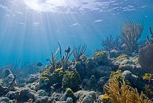
Beyond the keys in the Atlantic Ocean, the seafloor gently slopes down before rising into a continuous coral reef. This reef, made of living corals, is home to over 200 kinds of fish, as well as molluscs, crustaceans, and worms. Every coral species in the park is protected by law. Coral reefs cover about half of the park's area. There are hundreds of types of hard and soft corals, sea anemones, and sponges. The offshore reefs are mostly made of elkhorn coral and staghorn coral.
Unfortunately, the number and variety of fish species on the coral reefs in Biscayne National Park have decreased over the years. This might be linked to the decline in coral cover. Also, pollution and changes in the bay's saltiness might play a role.
The park's eastern boundary is just beyond the offshore reef. Areas farther out are protected within the Florida Keys National Marine Sanctuary. In these offshore waters, you might see brown pelicans, magnificent frigatebirds, and brown boobies. Whales are rare but can include right whales, humpback whales, and sperm whales, all of which are endangered. The smalltooth sawfish is also rare and endangered in park waters. Threatened coral species include elkhorn, staghorn, and pillar coral.
Invader Species
More than 50 types of non-native plants have been found in the park. About 20 of these are considered pests because they can push out native plants and change the natural balance. Green iguanas, cane toads, black rats, lionfish, fire ants, oscars, and brown basilisk lizards are common. Lionfish, which are from the Indian-Pacific Ocean, are known for eating a lot and quickly taking over new areas. They might have been introduced during Hurricane Andrew in 1992 when home aquariums were destroyed, or from other populations in the Florida Keys. Burmese pythons, also likely from human captivity, have been seen near the park's mainland boundary. Other invasive plants that threaten native species include Brazilian-pepper, torpedo grass, and guava.
Weather in Biscayne National Park
Biscayne has a tropical climate because of its location in extreme South Florida. It has a dry season from November to April and a wet season from May to October. In the dry season, temperatures average between 66 and 76°F (19-24°C), with about 2.1 inches (53 mm) of rain per month. In the wet season, temperatures average between 76 and 85°F (24-29°C), with about 5.4 inches (137 mm) of rain per month. The wet season also has frequent thunderstorms and is when hurricanes are most likely.
Like many places in southern Florida, Biscayne National Park is affected by hurricanes every few years. Most storms cause temporary closures and minor damage. But a direct hit from a powerful hurricane can have serious effects, especially on human-made structures. The park's natural environment is usually well-adapted to these storms. Major hurricanes that have hit Biscayne include storms in 1835, 1904, 1926, 1935, 1945, 1948, Hurricane King in 1950, Hurricane Donna in 1960, and Hurricane Andrew in 1992. Even distant storms, like Hurricane Sandy in 2012, can cause damage.
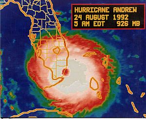
On August 24, 1992, Hurricane Andrew, a very strong Category 5 hurricane, passed directly over Biscayne National Park. Winds reached 141 mph (227 km/h) with gusts up to 169 mph (272 km/h). The storm surge was up to 17 feet (5.2 meters) above sea level. The storm damaged the mangrove forests and caused pollution from damaged boats. A plaque at the Dante Fascell Visitor Center remembers the storm's impact and the area's recovery.
Since all of the park's land is only a few feet above sea level, it is very vulnerable to rising sea levels. Studies predict that much of the park's land area could be lost in the next 200 years. Sea level in Biscayne Bay is expected to rise between 3 and 7 inches (8-18 cm) by 2030, and 9 to 24 inches (23-61 cm) by 2060. This will cause more saltwater to enter the underground water supply and change the ecology of the southern Everglades.
| Climate data for Elliott Key Ranger Station, elevation 0 ft (0 m), 1981-2010 normals, extremes 1981-2019 | |||||||||||||
|---|---|---|---|---|---|---|---|---|---|---|---|---|---|
| Month | Jan | Feb | Mar | Apr | May | Jun | Jul | Aug | Sep | Oct | Nov | Dec | Year |
| Record high °F (°C) | 83.7 (28.7) |
87.1 (30.6) |
88.0 (31.1) |
92.2 (33.4) |
91.2 (32.9) |
93.9 (34.4) |
95.0 (35.0) |
93.6 (34.2) |
92.3 (33.5) |
89.9 (32.2) |
88.7 (31.5) |
86.7 (30.4) |
95.0 (35.0) |
| Mean daily maximum °F (°C) | 74.1 (23.4) |
75.5 (24.2) |
76.8 (24.9) |
79.0 (26.1) |
82.1 (27.8) |
85.5 (29.7) |
87.2 (30.7) |
87.3 (30.7) |
86.4 (30.2) |
83.2 (28.4) |
79.2 (26.2) |
75.9 (24.4) |
81.0 (27.2) |
| Mean daily minimum °F (°C) | 61.8 (16.6) |
63.5 (17.5) |
66.0 (18.9) |
68.7 (20.4) |
73.6 (23.1) |
77.0 (25.0) |
78.6 (25.9) |
78.9 (26.1) |
78.3 (25.7) |
75.0 (23.9) |
69.8 (21.0) |
64.6 (18.1) |
71.4 (21.9) |
| Record low °F (°C) | 35.0 (1.7) |
38.6 (3.7) |
43.6 (6.4) |
51.7 (10.9) |
59.5 (15.3) |
65.9 (18.8) |
72.6 (22.6) |
72.0 (22.2) |
70.8 (21.6) |
55.9 (13.3) |
47.7 (8.7) |
32.8 (0.4) |
32.8 (0.4) |
| Average precipitation inches (mm) | 1.85 (47) |
1.91 (49) |
2.62 (67) |
2.55 (65) |
4.64 (118) |
7.83 (199) |
5.41 (137) |
7.09 (180) |
7.56 (192) |
5.18 (132) |
2.85 (72) |
1.79 (45) |
51.28 (1,303) |
| Average dew point °F (°C) | 59.9 (15.5) |
61.1 (16.2) |
62.2 (16.8) |
64.1 (17.8) |
69.0 (20.6) |
73.5 (23.1) |
74.3 (23.5) |
74.7 (23.7) |
74.5 (23.6) |
71.5 (21.9) |
66.4 (19.1) |
62.3 (16.8) |
67.8 (19.9) |
| Source: PRISM | |||||||||||||
See also
 In Spanish: Parque nacional Biscayne para niños
 | John T. Biggers |
 | Thomas Blackshear |
 | Mark Bradford |
 | Beverly Buchanan |


