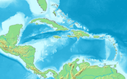
Key Vaca facts for kids
| Geography | |
|---|---|
| Location | Gulf of Mexico |
| Coordinates | 24°43′09″N 81°04′08″W / 24.71917°N 81.06889°W |
| Archipelago | Florida Keys |
| Adjacent bodies of water | Florida Straits |
| Highest elevation | 7 ft (2.1 m) |
| Administration | |
| State | Florida |
| County | Monroe |
Key Vaca is an island in the middle of the Florida Keys. It is completely inside the city of Marathon, Florida.
Island Geography
Key Vaca sits between two other islands: Fat Deer Key and Knight's Key. It used to be connected to Boot Key by a bridge. But the city of Marathon didn't take care of the bridge. So, it had to be removed. This made things harder for businesses on Boot Key. Key Vaca also forms most of the northern edge of Boot Key Harbor.
What's in a Name?
People have different ideas about how Key Vaca got its name. The most likely idea is that it was named after Álvar Núñez Cabeza de Vaca. He was an explorer who wrote a lot about Florida in the 1500s.
Other ideas are about the Spanish word vaca, which means "cattle." A book from 1957 called The Florida Keys says the island was named after wild cattle. These cattle were thought to have lived there. But no one has ever found proof of them. The name might also refer to manatees. These "sea cows" were very common in the area before the 1950s.
Because Key Vaca is fully inside Marathon, people sometimes incorrectly call it "Marathon Key."
Key Vaca's Climate
Key Vaca is in a subtropical area. But it has a full tropical climate. This is because the Gulf Stream is close by to the southeast. Also, the Gulf of Mexico to the west and north helps keep the weather mild. Key Vaca has a very pleasant, tropical-maritime climate. It is similar to the Caribbean islands.
Cold fronts from the north in winter are made warmer by the ocean. In January, the average low temperature is about 64.2 °F (17.9 °C). The average high is about 75.8 °F (24.3 °C).
In the summer, temperatures are a bit higher than in Key West. This is because Key Vaca is closer to the shallower waters of Florida Bay. These waters heat up more easily than the deeper waters south of Key West. Summers are hot and humid. There are often sudden, heavy thunderstorms.
Hurricanes are a common danger in the summer. They sometimes hit the island directly. This happened with the Labor Day Hurricane in 1935. It also happened with Hurricane Donna in 1960. Later, Hurricane Wilma hit in 2005. Most recently, Hurricane Irma hit in 2017. In August, the average low temperature is about 79.7 °F (26.5 °C). The average high is about 91.6 °F (33.1 °C). Temperatures can sometimes get close to 100 °F (38 °C).
Getting Around Key Vaca
U.S. 1, also called the Overseas Highway, crosses Key Vaca. It runs between mile markers 47.5 and 53.5.
Before the Labor Day Hurricane of 1935, Key Vaca was a big stop for trains. It was part of the Key West Extension of the Florida East Coast Railway. The island had a special track for turning trains around. It also had shops for fixing machines and trains. During the Great Depression, when the Overseas Highway was being built, Key Vaca was home to Camp No. 10. This camp housed many World War I veterans who worked on the project.
You can also reach Key Vaca by water. The main way is through Boot Key Harbor. This harbor is on the south side of the island. However, the water in the harbor is shallow. So, very large ships cannot unload there.
Between 1906 and 1912, Key Vaca was a temporary deep-water port. This was because of the Knight's Key Trestle. This trestle was built about 3 miles (4.8 km) west of the island. It helped bring supplies for the growing Overseas Railroad. Once the railroad was finished, the trestle was taken apart and burned.
During World War II, an airport was built on Key Vaca. It was first meant to be a training field for pilots. These pilots flew between Homestead and Miami. After the war, the airport was given to the county.
See also
 In Spanish: Cayo Vaca para niños
 | Shirley Ann Jackson |
 | Garett Morgan |
 | J. Ernest Wilkins Jr. |
 | Elijah McCoy |


