Islamorada, Florida facts for kids
Quick facts for kids
Islamorada, Florida
|
|
|---|---|
| Village of Islamorada | |

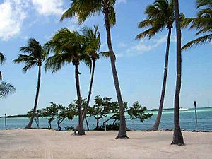
One of a few beaches on the Atlantic side of Islamorada
|
|
| Motto(s):
"Village of Islands"
|
|

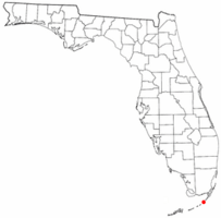
Location of Islamorada, Florida
|
|

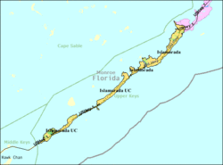
U.S. Census Bureau map showing village boundaries
|
|
| Country | |
| State | |
| County | Monroe |
| Incorporated | December 31, 1997 |
| Government | |
| • Type | Council–Manager |
| Area | |
| • Total | 6.70 sq mi (17.35 km2) |
| • Land | 6.45 sq mi (16.70 km2) |
| • Water | 0.25 sq mi (0.65 km2) |
| Population
(2020)
|
|
| • Total | 7,107 |
| • Density | 1,102.03/sq mi (425.48/km2) |
| Time zone | UTC-5 (Eastern (EST)) |
| • Summer (DST) | UTC-4 (EDT) |
| ZIP codes |
33036, 33070
|
| Area code(s) | 305 |
| FIPS code | 12-34132 |
Islamorada (sometimes called Isla Morada) is a special kind of town called a village in Monroe County, Florida, United States. It's located right between Miami and Key West. Islamorada is made up of five beautiful islands in the Florida Keys. These islands are Tea Table Key, Lower Matecumbe Key, Upper Matecumbe Key, Windley Key, and Plantation Key. In 2020, about 7,107 people lived there.
| Top - 0-9 A B C D E F G H I J K L M N O P Q R S T U V W X Y Z |
History of Islamorada
The Name "Purple Island"
The name Islamorada comes from early Spanish explorers. In Spanish, isla morada means "purple island." They might have called it this because of the beautiful purple sunsets or the purple flowers they saw.
The Overseas Railroad and a Big Storm
Islamorada was once a stop on the Overseas Railroad. This was a famous train line that connected the Florida Keys.
In 1935, a very powerful storm called the Labor Day Hurricane of 1935 hit Islamorada. It caused a lot of damage and sadness, and many lives were lost. Today, there is a special memorial at Overseas Highway mile marker 82 to remember those who passed away. It even holds the ashes of over 300 victims.
Famous Resident: Ted Williams
Hall of Fame baseball player Ted Williams started visiting Islamorada in 1943. For 45 years, he was one of the island's most famous residents. After he stopped playing baseball, he became well-known for his amazing fishing skills. He even hosted many famous people at his Islamorada home and took them fishing.
Becoming a Village
Islamorada officially became a village on December 31, 1997. Before this date, "Islamorada" mostly referred to the community on Upper Matecumbe Key.
Exploring Islamorada's Geography
Where is Islamorada?
Islamorada is located at 24°56′9″N 80°36′49″W / 24.93583°N 80.61361°W. The village covers about 6.7 square miles (17.35 square kilometers). Most of this area is land (6.4 square miles or 16.70 square kilometers), and a small part is water (0.3 square miles or 0.65 square kilometers).
The Overseas Highway
U.S. Route 1, also known as the Overseas Highway, runs through the entire village. This highway goes north about 74 miles (119 km) to Miami. It also goes southwest about 80 miles (129 km) to Key West.
Nearby Natural Wonders
Islamorada is about 19 nautical miles (35 km) southwest of John Pennekamp Coral Reef State Park. This park is famous for its beautiful coral reefs.
The Sportfishing Capital
Islamorada is located between the Atlantic Ocean and the Gulf of Mexico. This special location means many large fish species travel through the area. Because of this, Islamorada is often called the "Sportfishing Capital of the World." A popular route for boats, called Hawk Channel, is south or southeast of the village. Commercial fishing boats often use this channel to avoid strong currents.
Islamorada's Tropical Climate
Islamorada has a tropical savanna climate. This means it's usually warm all year round. It has a wet season and a dry season, similar to other parts of the Florida Keys.
| Climate data for Islamorada, Florida (1991–2020 normals, extremes 1999–2017) | |||||||||||||
|---|---|---|---|---|---|---|---|---|---|---|---|---|---|
| Month | Jan | Feb | Mar | Apr | May | Jun | Jul | Aug | Sep | Oct | Nov | Dec | Year |
| Record high °F (°C) | 83 (28) |
85 (29) |
86 (30) |
89 (32) |
90 (32) |
96 (36) |
97 (36) |
96 (36) |
95 (35) |
92 (33) |
90 (32) |
84 (29) |
97 (36) |
| Mean maximum °F (°C) | 81.0 (27.2) |
81.6 (27.6) |
83.3 (28.5) |
85.2 (29.6) |
87.7 (30.9) |
90.3 (32.4) |
91.0 (32.8) |
91.6 (33.1) |
90.2 (32.3) |
88.5 (31.4) |
84.1 (28.9) |
82.1 (27.8) |
91.9 (33.3) |
| Mean daily maximum °F (°C) | 75.2 (24.0) |
76.7 (24.8) |
78.1 (25.6) |
81.0 (27.2) |
83.7 (28.7) |
86.8 (30.4) |
88.7 (31.5) |
89.1 (31.7) |
88.3 (31.3) |
85.1 (29.5) |
80.2 (26.8) |
77.6 (25.3) |
82.5 (28.1) |
| Daily mean °F (°C) | 69.8 (21.0) |
71.7 (22.1) |
73.5 (23.1) |
76.7 (24.8) |
79.9 (26.6) |
82.4 (28.0) |
84.1 (28.9) |
84.1 (28.9) |
83.5 (28.6) |
80.7 (27.1) |
75.7 (24.3) |
72.7 (22.6) |
77.9 (25.5) |
| Mean daily minimum °F (°C) | 64.5 (18.1) |
66.7 (19.3) |
68.9 (20.5) |
72.4 (22.4) |
76.1 (24.5) |
78.1 (25.6) |
79.5 (26.4) |
79.1 (26.2) |
78.6 (25.9) |
76.2 (24.6) |
71.3 (21.8) |
67.9 (19.9) |
73.3 (22.9) |
| Mean minimum °F (°C) | 48.3 (9.1) |
52.6 (11.4) |
56.2 (13.4) |
62.8 (17.1) |
70.1 (21.2) |
71.7 (22.1) |
73.0 (22.8) |
72.7 (22.6) |
72.3 (22.4) |
68.1 (20.1) |
58.6 (14.8) |
55.3 (12.9) |
45.9 (7.7) |
| Record low °F (°C) | 37 (3) |
41 (5) |
47 (8) |
54 (12) |
64 (18) |
67 (19) |
70 (21) |
71 (22) |
70 (21) |
57 (14) |
54 (12) |
41 (5) |
37 (3) |
| Average precipitation inches (mm) | 0.97 (25) |
1.32 (34) |
1.32 (34) |
2.35 (60) |
2.76 (70) |
5.08 (129) |
3.85 (98) |
5.61 (142) |
8.09 (205) |
4.51 (115) |
1.59 (40) |
1.23 (31) |
38.68 (982) |
| Average precipitation days (≥ 0.01 in) | 4.8 | 4.4 | 4.4 | 3.8 | 6.4 | 9.5 | 9.6 | 9.9 | 12.0 | 9.2 | 5.6 | 7.3 | 86.9 |
| Source: NOAA (mean maxima/minima 2000–2016) | |||||||||||||
People and Population in Islamorada
| Historical population | |||
|---|---|---|---|
| Census | Pop. | %± | |
| 1970 | 1,251 | — | |
| 1980 | 1,441 | 15.2% | |
| 1990 | 1,220 | −15.3% | |
| 2000 | 6,846 | 461.1% | |
| 2010 | 6,119 | −10.6% | |
| 2020 | 7,107 | 16.1% | |
| source: | |||
The official name for Islamorada in the census is Islamorada, Village of Islands.
Population Changes (2010 and 2020)
Here's a look at the different groups of people living in Islamorada, based on the 2010 and 2020 census reports:
| Race | Pop 2010 | Pop 2020 | % 2010 | % 2020 |
|---|---|---|---|---|
| White (NH) | 5,371 | 5,763 | 87.78% | 81.09% |
| Black or African American (NH) | 42 | 39 | 0.69% | 0.55% |
| Native American or Alaska Native (NH) | 22 | 14 | 0.36% | 0.20% |
| Asian (NH) | 36 | 49 | 0.59% | 0.69% |
| Pacific Islander or Native Hawaiian (NH) | 6 | 0 | 0.10% | 0.00% |
| Some other race (NH) | 7 | 25 | 0.11% | 0.35% |
| Two or more races/Multiracial (NH) | 46 | 173 | 0.75% | 2.43% |
| Hispanic or Latino (any race) | 589 | 1,044 | 9.63% | 14.69% |
| Total | 6,119 | 7,107 |
In 2020, there were 7,107 people living in Islamorada. They lived in 2,997 homes, and 1,788 of these were families. Back in 2010, there were 6,119 people, 2,674 homes, and 1,705 families.
Neighborhoods in Islamorada
Islamorada has several official neighborhoods within its village limits:
- Lower Matecumbe Beach
- Matecumbe
- Moorings Village
- Plantation Key Colony
Education and Learning
Students living in Islamorada go to schools that are part of the Monroe County School District.
- Most students attend Plantation Key School in Plantation Key.
- Older students go to Coral Shores High School.
- There is also a charter school called Treasure Village Montessori Charter School.
Islamorada Public Library
The Islamorada Public Library, also known as the Helen Wadley Branch, is part of the Monroe County Public Library system. The very first public library in the Florida Keys opened in Key West way back in 1853. Today, there are five library locations across the Keys that serve many young people and adults.
The current Islamorada library building has a cool history. It was built in the late 1930s as the Matecumbe School. It was designed to be strong and safe, even during hurricanes! As more children came to the school, they moved to a bigger building. The old building then became home to other groups before opening as the Islamorada Branch of the Monroe County Library in 1966. It was a unique library, offering comfy couches and even tea and coffee!
The building is a bit bigger now than when it first opened in 1938, with additions made in 1983 and 1999. In 1983, the library was rededicated to honor Mrs. Helen Wadley, who was a great friend to the library. This branch also has six special sculptures called bas relief sculptures by Joan van Breeman.
Culture and Fun Things to Do
Museums and Attractions
The History of Diving Museum opened in 2005. It has cool exhibits about Diving With a Purpose, a group that explores underwater history. It also features the USS Spiegel Grove, which is now an artificial reef where divers can explore.
Another popular place is Robbie's Marina. It's famous because guests can feed live fish to large tarpon, which are big, shiny fish! You can also see Betsy the Lobster, a giant sculpture of a lobster in the city.
Famous People from Islamorada
Some well-known people have lived in or visited Islamorada:
- Gene Hackman, a famous actor
- Jimmy Johnson, a former college and NFL football coach
- Robert E. Rich, Jr., the chairman of Rich Products, a big food company
See also
 In Spanish: Islamorada para niños
 | William M. Jackson |
 | Juan E. Gilbert |
 | Neil deGrasse Tyson |

