List of Los Angeles bike paths facts for kids
Los Angeles County is a huge place, and it's full of amazing bike paths! These special trails are perfect for riding your bike, walking, or even running. They let you explore different parts of the county, from busy cities to quiet riversides and beautiful beaches. Whether you want to get some exercise, see new sights, or just have fun with friends, there's a bike path in LA County for you.
Contents
Awesome Bike Paths to Explore
Here's a list of some cool bike paths you can find in Los Angeles County:
- 98th Street Bike Path
- This short path runs for about half a mile along 98th Street in South Los Angeles.
- Arroyo Seco Bike Path
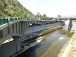
- This path follows the Arroyo Seco river channel. It goes from Montecito Heights all the way to South Pasadena, stretching for over 2 miles. It even connects to another path in Pasadena called the Kenneth Newell Bikeway.
- Balboa Boulevard East Bike Path
- You can find this path along Balboa Boulevard in Encino. It's about 1 mile long and runs between Victory Boulevard and Burbank Boulevard.
- Ballona Creek Bike Path
- This popular path follows Ballona Creek in West Los Angeles. It has two main parts. One section is near Baldwin Hills, and another longer part (almost 2.5 miles) goes from Lincoln Boulevard in Playa Vista to Sepulveda Boulevard. This path is super cool because it connects to the Dockweiler State Beach bike path, which is part of the long 22-mile coastal Marvin Braude Bike Trail.
- Browns Creek Bike Trail
- This trail follows Browns Canyon Wash in Chatsworth. It's almost 1 mile long and runs from Rinaldi Street to Devonshire Street.
- Burbank Boulevard Bike Path
- Located in the Sepulveda Basin park, this path is about 2.3 miles long. It goes from Balboa Boulevard past the Encino Golf Course.
- Burbank Channel Bike Path
- In Burbank, this path has two sections. One is about 0.3 miles long, and the other is 0.6 miles long.
- Cabrillo Beach Bike Path
- This short path (about 0.38 miles) is in San Pedro. It runs from Oliver Vickery Circle Way to the end of the jetty at Cabrillo Beach Park.
- Chandler Boulevard Bike Path
- This path is in the San Fernando Valley. The part maintained by LADOT is about 0.8 miles long, running from Vineland Avenue to Clybourn Avenue in North Hollywood. It then changes its name to the Chandler Bikeway and continues for almost 2 miles into Burbank.
- Compton Creek Bike Path
- This path follows Compton Creek for almost 6 miles through Compton and Rancho Dominguez. It stretches from El Segundo Boulevard to Del Amo Boulevard.
- Coyote Creek Bike Path
- This path runs along Coyote Creek, right on the border with Orange County, and goes all the way to Long Beach.
- Culver Boulevard Median Bike Path
- This path is in Culver City and runs for about 1.4 miles from McConnell Avenue to Sawtelle Boulevard.
- Dominguez Channel Bike Path
- This path follows the Dominguez Channel. Part of it is maintained by the city of Los Angeles (about 0.79 miles in Gardena), and another part (2.7 miles) is maintained by the county.
- Duarte Bike Path
- This trail in Duarte is about 1.6 miles long. It was created from an old railway line, which is a cool way to reuse space!
- El Dorado Park Bike Path
- Located in El Dorado Park in Long Beach, this path is 4 miles long. It connects to the San Gabriel River Bike Trail.
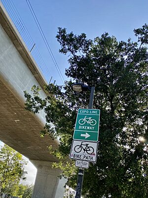
- Expo Bike Path
- This path runs right next to the E Line train for about 12 miles! It goes from University Park and USC all the way to Santa Monica.
- Hansen Dam Bike Path
- This path runs along Hansen Dam in the San Fernando Valley and is about 2.27 miles long.
- Heartwell Park Bike Path
- This 2.5-mile path goes through Heartwell Park in Long Beach and also connects to the San Gabriel River Bike Trail.
- Imperial Highway Bike Path
- This short path (about 0.25 miles) runs along the Imperial Highway, right next to the Los Angeles International Airport.
- Los Angeles River Bike Path
- This path follows parts of the famous Los Angeles River. It's currently in separate sections. One section in the Glendale Narrows is about 4.5 miles long and has recently been extended to 7.4 miles. More sections are being planned to make it even longer!
- Los Angeles River Bikeway
- Also known as LARIO, this path runs along the lower Los Angeles River for 29.1 miles. It goes from Vernon all the way to the Long Beach Harbor and the ocean.
- Legg Lake Bike Path
- You can find this path in the Whittier Narrows Recreation Area in South El Monte.
- Marvin Braude Bike Trail
- This amazing trail is 22 miles long and runs along the Pacific Ocean shoreline of western Los Angeles County! It stretches from Pacific Palisades down to Torrance. Different parts of this trail have different names:
- Will Rogers State Beach Bike Path
- This is the northernmost part, about 1.37 miles long, in Pacific Palisades.
- Santa Monica Bike Path
- This section runs along the beach in Santa Monica.
- Venice Beach Bike Path
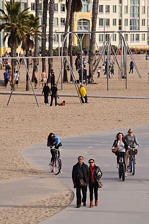
- This part is along Venice Beach and is about 1.5 miles long.
- Dockweiler State Beach Bike Path
- This path runs from Marina del Rey through Playa del Rey and Dockweiler State Beach. It's about 3.79 miles long and connects to the Ballona Creek bicycle path.
- The Strand Bike Path
- This is the South Bay section, going through Manhattan Beach, Hermosa Beach, and Redondo Beach, all the way to Torrance.
- G Line Bikeway
- This path runs next to the Los Angeles Metro G Line (formerly Orange Line) in the San Fernando Valley. It has two sections: a west path (about 4.66 miles) and an east path (about 3.84 miles).
- Orange Line Extension Bike Path
- This part runs next to the G Line extension in the West San Fernando Valley, from the Canoga Metro station to Lassen Street in Chatsworth, about 4 miles long.
- Oxnard Street Bike Path
- This path is about 1.08 miles long and runs along Oxnard Street in Encino.
- Pacific Electric Inland Empire Trail
- This long trail starts in Claremont in eastern Los Angeles County and goes for 18 miles into San Bernardino County. It's planned to be 21 miles long when finished!
- Puddingstone Reservoir Bike Path
- Located in Frank G. Bonelli Regional Park in San Dimas, this path is about 8 miles long and goes around the reservoir.
- Rail to Rail
- This path is 5.5 miles long in South Los Angeles. It's expected to be finished in 2024.
- Rio Hondo Bike Path
- This path follows the Rio Hondo river. It goes through the Whittier Narrows Recreation Area and connects to the Los Angeles River bicycle path and the San Gabriel River bicycle path.
- San Gabriel River Bike Path
- This awesome path runs alongside the San Gabriel River for 28 miles! It starts in Azusa and goes all the way to Long Beach, passing through El Dorado Park.
- San Francisquito Trail
- This trail in Santa Clarita is about 4.36 miles long and connects to the Santa Clara River Trail.
- San Fernando Road Bike Path
- This path runs along the Metrolink train route and San Fernando Road. It's being built in phases and will eventually connect to the Burbank Airport.
- Santa Clara River Trail
- Also known as the Chuck Pontius Commuter Rail Trail, this path is along the upper Santa Clara River in Santa Clarita. It's about 7.29 miles long and connects to the San Francisquito Trail.
- Shoreline Pedestrian Bikepath
- This path is in Long Beach and is about 3.1 miles long. It runs along the shoreline.
- Sierra Highway Bike Path
- This path is 7.1 miles long in the Antelope Valley, going from Lancaster south to Palmdale.
- South Fork Trail
- In Santa Clarita, this trail is 8.32 miles long and connects to both the Santa Clara River Trail and the San Francisquito Trail.
- Thompson Creek Trail
- This path runs along Thompson Creek in Claremont for 2.8 miles. You can access it from several points, including Higginbotham Park.
- Tujunga Wash Bike Path
- This path is in North Hollywood and is about 0.52 miles long.
- Victory Boulevard Bike Path
- This path is next to Victory Boulevard in Encino, running for about 2.64 miles.
- Whittier Greenway Trail
- This trail in Whittier is currently 4.7 miles long and runs parallel to Whittier Boulevard. There are plans to make it even longer!
- Woodley Avenue Bike Path
- This path is on Woodley Avenue in Sepulveda Basin park, about 1.28 miles long.
Bike Paths by River Areas
Many bike paths in Los Angeles County follow rivers or creeks. Here's how some of them are grouped:
- LOS ANGELES RIVER Paths
- The Los Angeles River flows east-west through the San Fernando Valley, then turns south through downtown LA and into the Pacific Ocean in Long Beach. Bike paths run along about half of the river's length.
- Upper Rio Hondo Bike Trail
- Lario Trail (Lower Los Angeles River)
- Los Angeles River Bike Trail (Upper Los Angeles River)
- Smaller paths connected to the Los Angeles River:
- Arroyo Seco (like the Arroyo Seco Bike Path)
- Compton Creek Bike Path
- Browns Creek Bike Path
- Tujunga Wash Bike Path
- The Los Angeles River flows east-west through the San Fernando Valley, then turns south through downtown LA and into the Pacific Ocean in Long Beach. Bike paths run along about half of the river's length.
- SAN GABRIEL RIVER Paths
- The San Gabriel River also has many bike trails.
- West Fork Bike Path
- San Gabriel River Trail (This long trail goes from the San Gabriel Mountains all the way to the Pacific Ocean!)
- San Jose Creek bike path
- Coyote Creek Bike Path
- The San Gabriel River also has many bike trails.
- Other River-Adjacent Bike Paths
- Some paths are near the LA or San Gabriel rivers but are separate loops or trails.
- Sepulveda Basin Bikeway
- Long Beach Bike Path
- Paths in Griffith Park (like the Mineral Wells Loop and Crystal Springs Loop)
- Some paths are near the LA or San Gabriel rivers but are separate loops or trails.
- Paths in Separate Water Areas
- These are bike trails in Los Angeles County that follow watercourses not connected to the San Gabriel or Los Angeles Rivers.
- Santa Clara River Trail (with connections like the San Francisquito Trail and South Fork Trail)
- Ballona Creek Bike Path
- Dominguez Channel Bike Path
- Paths around Ken Malloy Harbor Regional Park
- These are bike trails in Los Angeles County that follow watercourses not connected to the San Gabriel or Los Angeles Rivers.
Helpful Resources
If you want to learn more about bike tours in Los Angeles County, you can look for books by authors like Patrick Brady, Don and Sharron Brundige, and Wayne D. Cottrell.
Rules for Riding Safely
Bike paths in Los Angeles County are taken care of by different government groups. In California, there are special rules for bike paths. They are designed for cycling, but it's always important to be careful and aware of your surroundings. In the City of Los Angeles, it's usually okay to ride on sidewalks, but you must be very careful and not put other people walking on the sidewalk in danger. This rule might be different in other cities in Los Angeles County, so always check local signs. When you're riding your bike on the road, you need to follow the same traffic rules as cars, like obeying stop signs and traffic lights.
More to See
- CicLAvia (a fun event where streets are closed to cars for bikes!)
- West Los Angeles Veloway
- California Cycleway
- Bicycle infrastructure
- California bikeway classifications


