Los Angeles River Bikeway facts for kids

The Los Angeles River Bikeway, also known as LARIO, is a fun path for bikes and walks. It stretches for about 29.1 mi (46.8 km) along the lower part of the Los Angeles River in southern Los Angeles County, California. This bikeway is a big part of a larger plan to have a bike path run along the entire 51 miles (82 km) length of the LA River. It's also part of the Juan Bautista de Anza National Historic Trail, which is a special trail managed by the National Park Service.
Contents
Riding the Los Angeles River Bikeway
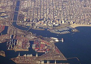
This paved bikeway starts near the ocean in Long Beach. It begins at the Shoreline Pedestrian Bikepath, right where the river meets the sea. From there, it goes upstream towards the industrial area southeast of Downtown Los Angeles. The path ends near Atlantic Boulevard in Vernon.
Cities Along the Path
As you ride or walk up the river, the bikeway passes through many different cities and areas. These include:
- West Long Beach
- North Long Beach
- East Compton
- East Rancho Dominguez
- Paramount
- Lynwood
- Downey
- Cudahy
- Bell Gardens
- Bell
- Maywood
How the Path Changes Sides
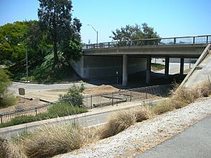
In Long Beach, the bike path stays on the east side of the river. When you reach Imperial Highway, the path crosses the LA River using the road bridge. After crossing, it continues north along the west side of the LA River all the way to Vernon.
The path on the east side of the river doesn't just stop. It continues under the bridge to where the Rio Hondo river joins the LA River. From there, it becomes the Rio Hondo Bicycle Path. This path then heads northeast towards the Whittier Narrows Recreation Area.
Finding Your Way and Parking
You'll find mileage markers painted right on the pavement of the bikeway. There are also signs posted regularly that tell you about upcoming city streets. This helps you know where you are and what's ahead!
If you want to drive to the bikeway, you can find parking at a few parks:
- Hollydale Park in South Gate
- Ralph C. Dills Park in Paramount
- DeForest Park in Long Beach
In Long Beach, you can also get onto the path from several street crossings over the river. These include Pacific Coast Highway, Willow Street, Wardlow Road, and Del Amo Boulevard.
 | Anna J. Cooper |
 | Mary McLeod Bethune |
 | Lillie Mae Bradford |


