West Long Beach facts for kids
West Long Beach, often called the Westside, is a neighborhood in Long Beach, California. It is a community where many people live and work, located on the western side of the city.
Contents
Where is West Long Beach?
West Long Beach is the westernmost part of Long Beach. It is separated from the rest of the city by the Long Beach Freeway (Interstate 710) and the Los Angeles River.
Neighborhood Borders
- To the east: The Los Angeles River
- To the north: Interstate 405
- To the south: Anaheim Street
- To the west: The cities of Los Angeles, Carson, and the Terminal Island Freeway
What are the Main Industries?
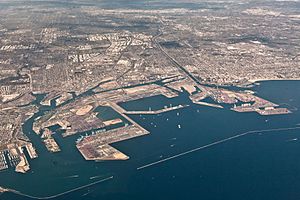
The biggest industry in West Long Beach is the combined Ports of Long Beach and Los Angeles. These ports are very important for trade, bringing in and sending out goods from all over the world.
Other Important Businesses
- A large Shell Oil refinery is nearby in Wilmington. A refinery processes crude oil into useful products like gasoline.
- The Intermodal Container Transfer Facility (ICTF) is also on the western edge of the neighborhood. This facility helps move large shipping containers between trains and trucks.
Living in West Long Beach
The neighborhood has a mix of different types of homes. You can find older houses, apartments, and townhouses. There are also industrial buildings mixed in.
Main Street and Parks
- The main road is Santa Fe Avenue, which runs north to south through the middle of the neighborhood.
- West Long Beach has three official parks. One of them is Silverado Park.
- In 2010, a renewed park named after Rear Admiral Isaac C. Kidd was finished. It is 12.39 acres and is located next to Cabrillo High School.
A Look at History and Community
Historically, West Long Beach was a working-class neighborhood. This means many people who lived there worked in jobs related to the nearby Port of Long Beach or the Shell Oil refinery.
Changes Over Time
- A large U.S. Navy housing complex used to be in the neighborhood. Today, Cabrillo High School stands on that site.
- Like many areas with working-class populations, the neighborhood faced challenges in the 1970s.
- To help improve living conditions, a local group called the West Long Beach Association was started in 1997.
- Conditions have improved in the early 2000s, but it remains one of the poorer neighborhoods in Long Beach.
Who Lives Here?
According to the 2000 US Census, there were 35,637 residents in the 90810 ZIP code, which is almost the same area as West Long Beach.
Population Mix
The population includes people from many different backgrounds:
- About 23.8% Caucasian
- About 16.4% African American
- About 23.2% Asian
- About 3.1% Pacific Islander
- Hispanics and Latinos made up 45.6% of the population.
Schools and Services
The Long Beach Unified School District serves the area.
Local Schools
- Cabrillo High School (grades 9–12)
- Stephens Middle School (grades 6–8)
- Muir Academy (grades K–8)
- Garfield Elementary (grades K-6)
- Hudson School (grades K-8)
Police Services
Police services are provided by the Long Beach Police Department Western Division. They have a station at Pacific Coast Highway and Santa Fe Avenue.
 | Ernest Everett Just |
 | Mary Jackson |
 | Emmett Chappelle |
 | Marie Maynard Daly |


