
Los Angeles River bicycle path facts for kids

The Los Angeles River bicycle path is a special path for bikes and people walking. It runs along the Los Angeles River in the Greater Los Angeles area. This path goes through Griffith Park in a spot called the Glendale Narrows.
A 7.4-mile part of the path in the Glendale Narrows is known as the Elysian Valley Bicycle & Pedestrian Path. Another part of the bike path goes from the city of Vernon all the way to Long Beach. This section is called the Los Angeles River Bikeway.
After a big flood in 1938, the river banks were covered in concrete to control flooding. This made it possible to ride bikes along almost the entire river, right to where it meets the San Pedro Bay in Long Beach. In recent years, a group called Friends of the Los Angeles River has worked to bring parts of the river back to nature. They want to make it a nice place for people to walk and bike.
Contents
About the Path

The Los Angeles River Bicycle Path has two main parts. There are also other shorter sections that do not connect to each other yet.
The Los Angeles River Revitalization Corporation (LARRC) wants to complete the entire 51-mile path by the year 2020. This project is called Greenway 2020. It aims to create bike and walking paths along the whole river.
Long Beach to Vernon Section
The Los Angeles River Bikeway, also known as LARIO, is the longest completed part of the path. It starts at the Shoreline Pedestrian Bikepath in Long Beach, where the river meets the ocean. It goes upstream to an industrial area near Downtown Los Angeles, ending at Atlantic Boulevard in Vernon.
In Long Beach, the bike path is on the east side of the river. When it reaches Imperial Highway, it crosses the river on the road bridge. Then it continues north on the west side of the river towards Vernon. The path on the east side continues under the bridge to where it meets the Rio Hondo. From there, it becomes the Rio Hondo Bicycle Path, heading northeast.
You will see mileage markers painted on the path. Signs also tell you about upcoming streets. You can find parking at Hollydale Park in South Gate, Ralph C. Dills Park in Paramount, and DeForest Park in Long Beach. Other ways to get onto the path in Long Beach are at street crossings like Pacific Coast Highway, Willow Street, Wardlow Road, and Del Amo Boulevard.

Glendale Narrows Elysian Valley Section
The second main section is the Glendale Narrows Elysian Valley Bicycle Path. This path is 7.4 miles (11.9 km) long. It runs next to the L.A. River from the border of Burbank, California and Glendale, California at Victory Boulevard and Riverside Drive. It goes downstream through the Glendale Narrows to Egret Park in Elysian Valley.
This path goes through Glendale, Griffith Park, Los Feliz, Atwater Village, and Elysian Valley. There are many places to enter the path and several parks along the way. These include Rio de Los Angeles State Park, Griffith Park, Egret Park, and Marsh Park.
The Glendale Narrows Riverwalk is a separate path for walking and biking. It is across the river on the northern bank in the city of Glendale. A new bridge project, the Garden Bridge, will connect the Glendale Narrows Elysian Valley Bicycle Path with the Glendale Narrows Riverwalk. This will link Griffith Park and Los Angeles with the city of Glendale.
Other Sections
- San Fernando Valley
In the San Fernando Valley, there are a few other parts of the path that are not connected yet. A new section is being built in Reseda. This will extend the path eastward from Canoga Park into Winnetka. Further east, the North Valleyheart Riverwalk is located in Studio City.
Paths Along Tributaries
- Arroyo Seco
The Arroyo Seco Bicycle Path follows the Arroyo Seco river channel. This path is upstream from where the Arroyo Seco meets the Los Angeles River. It goes from Montecito Heights northeast to South Pasadena.
- Compton Creek
The Compton Creek Bike Path is in Compton. It runs along the east bank of parts of Compton Creek, which flows into the Los Angeles River. The northern part of this path is paved. It goes from El Segundo Boulevard south through neighborhoods. There is also a path for horses along the west bank.
A shorter paved section exists further south along the creek. However, it is separated by train tracks and a freeway. You can only get to this southern part from a few main streets. It ends at Del Amo Boulevard, north of where Compton Creek meets the Los Angeles River.
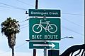
- Dominguez Channel
The Dominguez Channel Bicycle Path is 2.8 miles (4.5 km) long. It runs along the upper part of the Dominguez Channel. This channel is west of the lower Los Angeles River. The path goes between Alondra Park near El Camino College and Hawthorne near the Hawthorne Airport. This path is part of a project by the city of Hawthorne. It has many crosswalks and is easy for walkers to use. Signs on the path show how far you are from where the channel meets the Port of Los Angeles.
Future Plans
On July 23, 2013, a group called River LA (formerly Los Angeles River Revitalization Corp) announced a big goal. They want to finish a continuous 51-mile greenway and bike path along the river by the end of the decade. This path is meant to be the main part of a long park. It will also offer another way to travel through Los Angeles without a car.
This announcement came before a study by the U.S. Army Corps of Engineers was released. The Corps has the final say on what happens with the river and its future improvements.
Images for kids
-
Dominguez Creek Bike Route sign

