
South Pasadena, California facts for kids
Quick facts for kids
South Pasadena, California
|
|||
|---|---|---|---|
_(cropped).jpg)   Clockwise: South Pasadena Middle School; South Pasadena Public Library; Adobe Flores
|
|||
|
|||
| Nickname(s):
City of Trees
|
|||

Location of South Pasadena in Los Angeles County, California
|
|||

South Pasadena, California
Location in the United States
|
|||
| Country | United States | ||
| State | California | ||
| County | Los Angeles | ||
| Incorporated (city) | March 2, 1888 | ||
| Government | |||
| • Type | City Council/City Manager | ||
| Area | |||
| • Total | 3.42 sq mi (8.85 km2) | ||
| • Land | 3.41 sq mi (8.83 km2) | ||
| • Water | 0.01 sq mi (0.03 km2) 0.35% | ||
| Elevation | 659 ft (201 m) | ||
| Population
(2020)
|
|||
| • Total | 26,943 | ||
| • Density | 7,431.0/sq mi (2,869.11/km2) | ||
| Time zone | UTC-8 (Pacific) | ||
| • Summer (DST) | UTC-7 (PDT) | ||
| ZIP code |
91030/91031 (PO box)
|
||
| Area code(s) | 323/626 | ||
| FIPS code | 06-73220 | ||
| GNIS feature IDs | 1661479, 2411940 | ||


South Pasadena is a city in Los Angeles County, California, United States. In 2020, about 26,943 people lived there. It is located in the western part of the San Gabriel Valley. The city is about 3.42 square miles (8.85 square kilometers) in size.
South Pasadena is located between the city of Pasadena (which it was once a part of) and the large city of Los Angeles. It is known for being the oldest city to build its own floats for the famous Tournament of Roses Parade.
Contents
A Look Back in Time
.jpg)
Early Inhabitants: The Tongva People
The first people to live in this area were Native Americans from the Hahamog-na tribe. This tribe was part of the Tongva Nation. They lived in the Los Angeles Basin. The Tongva name for the area, including South Pasadena, was Akuvranga.
Tongva homes were along the Arroyo Seco (Los Angeles County) in South Pasadena. They also lived near other natural waterways. Their homes were dome-shaped lodges made of thatch. They ate corn, acorns, seeds, herbs, fish, and small animals. They traded with coastal Tongva for ocean fish. They used soapstone from Catalina Island to make cooking pots.
The location of South Pasadena was important for travel and trade. It was a natural crossing point along the Arroyo Seco. This is where the Hahamogna people met the first Spanish explorers. These explorers later built the San Gabriel Mission nearby.
From Rancho to City
The first buildings in the area were on the Rancho San Pascual. This land later became Pasadena, South Pasadena, and Altadena. One of these adobe buildings was used by General Flores in 1847. It was there that he agreed to surrender to American forces. This event ended Mexican rule in California. In 1875, the landowners voted to call their area Pasadena.
In February 1888, people in the southern part of Pasadena wanted more control over their land. They voted to become their own city. On March 2, 1888, South Pasadena officially became a city. It had just over 500 residents. It was the sixth city to be formed in Los Angeles County.
The city's first mayor was Donald McIntyre Graham. Very few Tongva people received any land. South Pasadena was about 3.42 square miles (8.85 square kilometers) when it was founded. When the Pacific Electric Short Line was completed, it made South Pasadena one of the first suburbs of Los Angeles. People could easily walk to the "red car" train stations.
Modern South Pasadena Life
South Pasadena is often called the "City of Trees."
Local Businesses and Landmarks
The city has many small, local shops and businesses. The Mission West area is part of the original U.S. Route 66. Two important historical places are The Fair Oaks Pharmacy and Soda Fountain, and the Rialto Theater.
The Rialto Theater was built in 1925. It has a unique mix of Spanish and Egyptian styles. It is one of the last single-screen movie theaters left. The Rialto was added to the National Register of Historic Places in 1978. It closed in 2007 but has been used in many movies and commercials. Some famous movies filmed there include The Player and La La Land.
Community Events
The Farmer's Market is a popular event in the historic Mission-West District. It happens regularly and brings the community together.
Every December, the South Pasadena Booster Club holds the "Tiger Run." This event is a 5K/10K run around the city. It is named after the South Pasadena High School mascot. People of all ages, from kids to seniors, can join. There is also a special 300-meter run for children under 10.
South Pasadena in Movies and TV
South Pasadena is often seen in movies and TV shows. Its tree-lined streets and "anywhere in America" look make it a popular filming location. Many famous films have been shot here. These include The Terminator, Halloween, Back to the Future, American Pie, and La La Land.
TV shows like Modern Family, Desperate Housewives, and CSI: Crime Scene Investigation have also filmed scenes in South Pasadena.
Transportation and Infrastructure

Getting Around South Pasadena
The main roads in South Pasadena are Fair Oaks Avenue, Huntington Drive, Fremont Avenue, and Mission Street. The Arroyo Seco Parkway (also known as the Pasadena Freeway) has two exits in South Pasadena.
LA Metro operates two bus lines through the city. The South Pasadena station for the Metro A Line (formerly the Gold Line) is in the center of South Pasadena. It is located at Mission and Meridian.
South Pasadena also has its own public transportation system. Since 2003, the City of South Pasadena Community Transit has connected with the A Line Station. This system helps people get around the city easily.
City Services
The South Pasadena Fire Department provides fire protection services for the city. The South Pasadena Police Department helps keep the city safe.
Education in South Pasadena
.jpg)
The South Pasadena Unified School District (SPUSD) has five schools. There are three elementary schools: Monterey Hills, Marengo, and Arroyo Vista. The district also includes South Pasadena Middle School and South Pasadena High School.
South Pasadena High School has a long-standing sports rivalry with San Marino High School. Until 1955, both cities shared the same high school. Every year, their football teams play for a special plaque. As of 2021, South Pasadena had won 29 games, and San Marino had won 35. There have also been three ties.
The South Pasadena Educational Foundation (SPEF) is a charity that helps raise money for the school district's programs.
Parks and Recreation
The Arroyo Seco (Los Angeles County) is a natural area with a canyon and stream. It offers many experiences for walkers and hikers.
The Arroyo Seco stream starts in the San Gabriel Mountains. It flows through steep mountain canyons for about 11 miles (18 kilometers). Then it enters the flatter urban area near the Jet Propulsion Laboratory. The stream continues through Pasadena, South Pasadena, and Northeast Los Angeles. It eventually joins the Los Angeles River.
South Pasadena has five parks for families and community activities. These parks are Garfield Park, Eddie Park, Library Park, Orange Grove Park, and War Memorial Park.
Notable People
Many well-known people have lived in South Pasadena. These include:
- Meredith Baxter, actress
- Alison Brie, actress and writer
- Andy Dick, actor and comedian
- Edward Furlong, actor
- Lucretia Garfield, wife of President James A. Garfield
- William Holden, Academy Award-winning actor
- David Lee Roth, singer from Van Halen
- Hilary Swank, Academy Award-winning actress
- Jaleel White, actor
Gallery
-
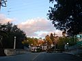
Columbia Avenue
-

The Gold Line crossing Fremont Avenue
-
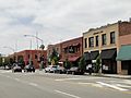
North side of Mission Street


See also
 In Spanish: South Pasadena (California) para niños
