San Pedro Bay (California) facts for kids
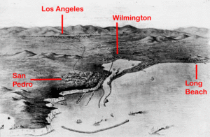
San Pedro Bay is a large inlet on the Pacific Ocean coast in southern California, United States. It's a very important place because it's home to the Port of Los Angeles and the Port of Long Beach. Together, these two ports are among the busiest in the entire world! They handle a huge amount of goods coming in and out of the country. The community of San Pedro is on the western side of the bay. The city of Long Beach is on the eastern side. The northern part of the bay, which is the biggest part of the port, is next to the Los Angeles area called Wilmington.
Contents
The Bay's Changing Bottom
Most of San Pedro Bay is about 32 to 75 feet (10 to 23 meters) deep. The seabed, or bottom of the bay, near Long Beach has sunk quite a bit. This happened because oil was pumped out of the ground from the Wilmington Field starting in the 1950s.
For a while in the 1980s and 1990s, this deeper seafloor helped the Port of Long Beach become busier than the Port of Los Angeles. It meant Long Beach could handle ships that needed deeper water. Later, the Port of Los Angeles dug out, or "dredged," its areas to make them deeper too. Now, both sides of the bay can welcome even the largest container ships. People were worried about the land sinking, but a project called "Big Squirt" started in 1960. It involved injecting water back into the ground, which stopped the sinking.
Islands in the Bay
San Pedro Bay has a few natural islands. Terminal Island is one of them, though it's been made much bigger over time. It's where many of the port facilities for Los Angeles and Long Beach are located. Mormon Island was once a place where Mormon pioneers tried to settle in the 1850s. There was also Smith's Island. The city of Los Angeles has added a lot of land to Terminal Island, and Mormon Island is now connected to the mainland.
Deadman's Island used to be a well-known landmark at the entrance of the bay. However, it was removed in 1928. This was part of an effort by Phineas Banning to make the harbor bigger. In 1927, an airport was built on Terminal Island. It was first called Allen Field and later became Naval Air Station Terminal Island.
You can also see four small islands in the bay near Long Beach that are not natural. These are artificial islands built to hold oil wells. They are called the THUMS Islands. To make them look nicer from the shore, the oil drilling equipment is hidden by tropical plants, special buildings, and even fake high-rise "buildings." These islands are named Freeman, Grissom, White, and Chaffee. They are named after NASA astronauts: Theodore Freeman, Gus Grissom, Ed White, and Roger B. Chaffee.
The Fight for a Free Harbor
As Los Angeles grew into an important center for business and trade, it became clear that the city needed a deep harbor. In the late 1890s, a big railroad company called the Southern Pacific Railroad started buying land in Santa Monica. The Huntington family, who owned the railroad, wanted a harbor built in Santa Monica. This would have given their railroad control over all the goods shipped there.
But the Los Angeles Chamber of Commerce and a new group called the Harbor League disagreed. They wanted the harbor built in San Pedro. In San Pedro, the Southern Pacific Railroad would have to compete with another railroad, Phineas Banning's Los Angeles and Harbor Railroad. This disagreement became known as the Free Harbor Fight. In 1906, the area around Wilmington and San Pedro was added to Los Angeles. This made sure that Wilmington and San Pedro would become the main port for Los Angeles. It also explains why the harbor is quite far from the city's main train yards. This distance wasn't fully fixed until the Alameda Corridor was built almost a century later.
Protecting the Bay with Breakwaters
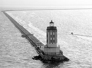
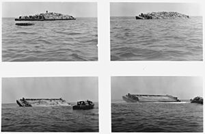
Three large walls, called breakwaters, stretch about 8.5 miles (13.7 kilometers) across most of San Pedro Bay. They have two openings to let ships enter the Port of Los Angeles and the Port of Long Beach. The first part of the San Pedro Breakwater was built between 1899 and 1911. More construction was approved in 1930. The middle breakwater began to be built in 1932. The eastern breakwater, also known as the Long Beach Breakwater, is 2.5 miles (4 kilometers) long and was built between 1941 and 1949.
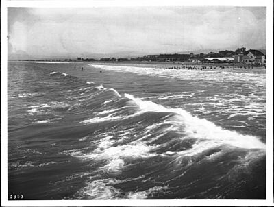
The western and middle breakwaters greatly protected the ports during a big tropical storm in California in 1939. Because the eastern breakwater wasn't built yet, coastal areas of Long Beach, like Belmont Shore, were hit very hard by the storm.
Breakwater Restoration Ideas
The Long Beach breakwater is a topic of discussion among people who live near the harbor and environmental groups. Groups like the Long Beach chapter of the Surfrider Foundation want to change or even remove the breakwater. They believe this would help water flow better and make the coast near the mouth of the Los Angeles River more natural. This idea of restoring the environment is opposed by people who own property along the waterfront and by shipping companies. They believe the breakwater is needed to protect them from storm damage.
There is a short movie that talks about these different ideas for changing the Long Beach breakwater.
 | Mary Eliza Mahoney |
 | Susie King Taylor |
 | Ida Gray |
 | Eliza Ann Grier |


