List of National Natural Landmarks in Florida facts for kids
The National Natural Landmarks (NNLs) in Florida are 18 special places out of nearly 600 across the United States. These landmarks protect important areas of nature, including unique geology, plants, and animals. You can find them in springs, swamps, marshes, and along the seashore. Many of these spots are homes for rare or endangered plants and animals.
These landmarks are spread across 14 of Florida's 67 counties. Some counties even have parts of two or more NNLs! The first one, Corkscrew Swamp Sanctuary, was named in 1964. The newest, Archbold Biological Station, was added in 1987. Florida's Natural Landmarks vary in size, from about 593 acres to a huge 14,000 acres. They can be owned by private people or by state and federal government groups.
Contents
- What are National Natural Landmarks?
- Florida's Special Natural Places
- Archbold Biological Station
- Big Cypress Bend
- Corkscrew Swamp Sanctuary
- Devil's Millhopper
- Emeralda Marsh
- Florida Caverns Natural Area
- Ichetucknee Springs
- Lignumvitae Key
- Manatee Springs
- Osceola Research Natural Area
- Paynes Prairie
- Rainbow Springs
- Reed Wilderness Seashore Sanctuary
- San Felasco Hammock
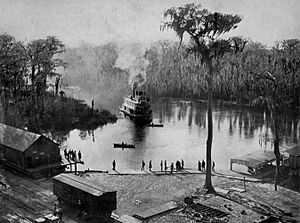
- Silver Springs
- Torreya State Park
- Waccasassa Bay Preserve State Park
- Wakulla Springs
- See also
What are National Natural Landmarks?
The National Park Service, which is part of the Department of the Interior, manages the National Natural Landmarks Program. They decide which places are special enough to become NNLs. After telling the owners, they suggest these places for the honor. The Secretary of the Interior then reviews the suggestions and makes the final decision.
Both public and privately owned lands can become NNLs. Owners can say no if they don't want their property to be a landmark. Being an NNL helps protect these places in a few ways, like offering tax benefits or grants, and keeping an eye out for anything that might harm them.
Florida's Special Natural Places
Archbold Biological Station
This landmark protects the largest untouched area of the Lake Wales Ridge. It's a very important place for studying nature and its unique plants and animals.
Big Cypress Bend
Found within Fakahatchee Strand Preserve State Park, Big Cypress Bend is famous for having the largest group of royal palm trees in the entire country. It's a truly majestic sight!
Corkscrew Swamp Sanctuary
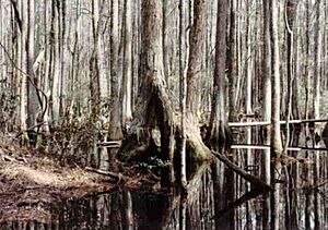
Designated in 1964, this sanctuary is home to the nation's largest remaining area of old-growth bald cypress trees. These ancient trees are a wonder to behold.
Devil's Millhopper
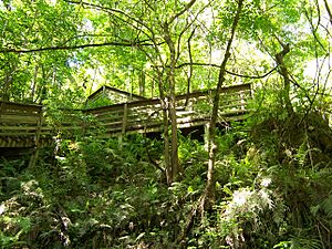
Located in its own state park, Devil's Millhopper is a unique dry sinkhole. It's like a giant bowl in the ground, and you can walk down into it to see different plants growing at various levels.
Emeralda Marsh
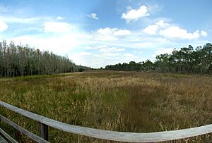
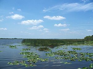
This inland freshwater marsh is filled with sawgrass and is a very popular spot for birdwatching. Many different kinds of birds love to visit this wetland.
Florida Caverns Natural Area
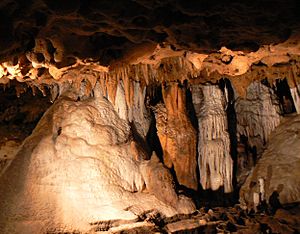
This state park protects Florida's only publicly accessible cave. It's also a winter home for the endangered Indiana bat, a special type of bat that needs protection.
Ichetucknee Springs
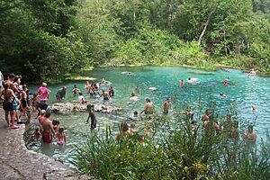
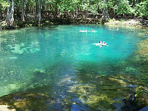
Ichetucknee Springs is Florida's third-largest artesian spring, meaning water flows up from deep underground. It's part of a beautiful state park where people love to tube and swim.
Lignumvitae Key
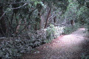
This key, or small island, is part of a state botanical park. It has the best-preserved tropical hammock forest in the country, full of unique trees and plants.
Manatee Springs
An eponymous state park surrounds Florida's sixth-largest artesian spring. It's a popular place for manatees to gather in the cooler months.
Osceola Research Natural Area
This area, part of Osceola National Forest, features an isolated forest with a mix of hardwood trees and untouched bald cypress strands. It's a great example of Florida's natural woodlands.
Paynes Prairie
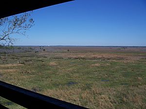
Paynes Prairie is a large freshwater marsh located in one of Florida's biggest sinkholes. Most of this special place is protected within Paynes Prairie Preserve State Park.
Rainbow Springs
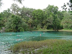
Florida's second-largest artesian spring, Rainbow Springs, is part of a state park. Its clear, beautiful waters are a popular spot for swimming and snorkeling.
Reed Wilderness Seashore Sanctuary
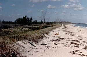
This sanctuary is part of Hobe Sound National Wildlife Refuge. It protects the longest undisturbed stretch of Florida's Atlantic coast and is an important nesting site for the loggerhead turtle.
San Felasco Hammock
Mainly located in San Felasco Hammock Preserve State Park, this area has a very diverse forest environment. It's a great place to explore different types of trees and plants.
Silver Springs
The state's largest artesian spring is surrounded by its own state park. Silver Springs is famous for its clear waters and glass-bottom boat tours.
Torreya State Park
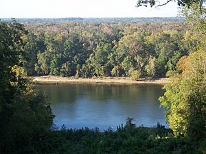
This state park is known for its steep ravines and bluffs. It's also home to endangered plants like the Florida yew, which is a rare type of tree.
Waccasassa Bay Preserve State Park
This state park protects a brackish mangrove forest. Mangroves are special trees that grow in salty water and provide important habitats for many marine animals.
Wakulla Springs
Located in Edward Ball Wakulla Springs State Park, this landmark includes Florida's deepest artesian spring. Its clear waters are home to many fish and other wildlife.
See also
 | John T. Biggers |
 | Thomas Blackshear |
 | Mark Bradford |
 | Beverly Buchanan |


