
List of Recorded Texas Historic Landmarks (Trinity-Zavala) facts for kids
Texas is full of amazing historical places, and some of the most special ones are called Recorded Texas Historic Landmarks (RTHLs). These are important buildings, sites, or objects that the Texas Historical Commission and local groups have officially recognized because they tell a big part of Texas's story. Think of them as special markers that help us remember the past!
This page lists RTHLs in several counties, from Trinity to Zavala. It's like a treasure map to some of Texas's coolest historical spots!
| Anderson-Callahan • Cameron-Duval • Eastland-Gray • Grayson-Hudspeth • Hunt-Martin • Mason-Rusk • Sabine-Travis • Trinity-Zavala |
Contents
- Understanding the Landmark Symbols
- Trinity County
- Tyler County
- Upshur County
- Upton County
- Uvalde County
- Val Verde County
- Van Zandt County
- Victoria County
- Walker County
- Waller County
- Ward County
- Washington County
- Webb County
- Wharton County
- Wheeler County
- Wichita County
- Wilbarger County
- Willacy County
- Williamson County
- Wilson County
- Winkler County
- Wise County
- Wood County
- Yoakum County
- Young County
- Zapata County
- Zavala County
- Images for kids
- See also
Understanding the Landmark Symbols
Some of these landmarks are extra special and have other important historical titles. Here's what the different colors and symbols mean:
| ⁕ National Historic Landmark: These are places recognized by the U.S. government as being important to the history of the entire country! |
| ⁂ National Historic Landmark District Contributor: These places are part of a larger area that is a National Historic Landmark. |
| § State Historic Site: These are important historical places owned and protected by the State of Texas. |
Trinity County
Trinity County has some interesting historic buildings.
| Historic Landmark Name | Image | Year Designated | What Makes it Special |
|---|---|---|---|
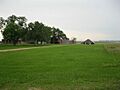
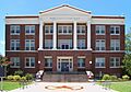
| Old Red Schoolhouse |
2004 | This old schoolhouse is a reminder of how kids used to learn in Trinity. It's also listed on the National Register of Historic Places! | |
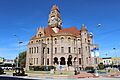
| Trinity County Courthouse |
2004 | The courthouse in Groveton is where important county decisions are made. It's a key part of the community's history and government. |


Tyler County
Tyler County is home to several historic spots, including some old homes and churches.
| Historic Landmark Name | Image | Year Designated | What Makes it Special |
|---|---|---|---|
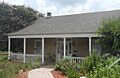
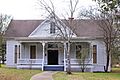
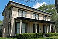
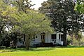
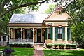
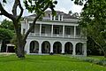
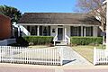
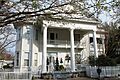
| Cooper-Reid Home | 1968 | This historic home in Woodville tells a story about the families who lived there long ago. | |
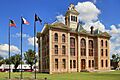
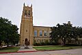
| Tyler County Courthouse |
2000 | Located in Woodville, this courthouse is a significant building for Tyler County's history and government. |
.jpg)

Upshur County
Upshur County has several landmarks, including old post offices and homes.
| Historic Landmark Name | Image | Year Designated | What Makes it Special |
|---|---|---|---|
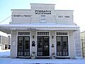
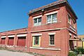
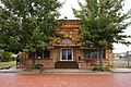
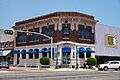
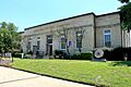
| 1925 Gilmer Post Office | 1998 | This building served as the post office in Gilmer, helping people send and receive mail almost 100 years ago! | |
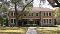
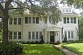
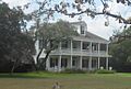
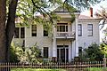
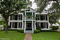
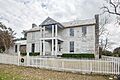
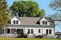
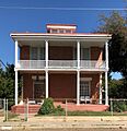
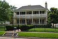
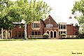
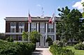
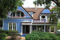
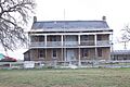
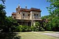
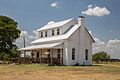
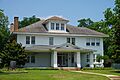
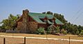
| John O'Byrne Home |
1964 | This historic home in Union Grove is recognized for its importance. | |
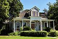
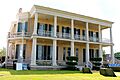
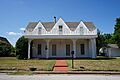
| Warren-Futrell House | 2001 | Another historic home in Gilmer, the Warren-Futrell House has been recognized as a landmark. |
.jpg)

.jpg)
Upton County
Upton County's landmarks include sites that tell stories of early settlements and trails.
| Historic Landmark Name | Image | Year Designated | What Makes it Special |
|---|---|---|---|
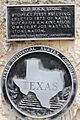
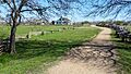
| Mendoza Trail | 1967 | This marker in McCamey remembers the historic Mendoza Trail, an old route used by early explorers. |

Uvalde County
Uvalde County is home to many significant landmarks, including churches, homes, and a famous opera house.
| Historic Landmark Name | Image | Year Designated | What Makes it Special |
|---|---|---|---|
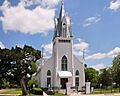
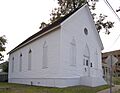
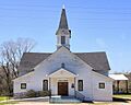
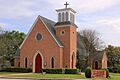
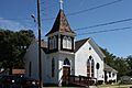
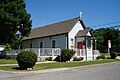
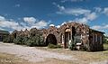
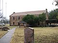
| Church of the Ascension | 1965 | This church in Montell is a historic place of worship. | |
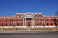
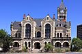
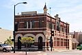
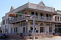
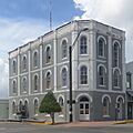
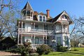
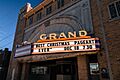
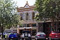
| Grand Opera House |
1967 | The Grand Opera House in Uvalde is a beautiful historic theater where many performances took place. | |
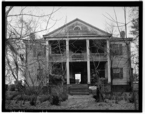
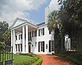
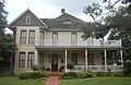
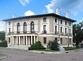
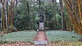
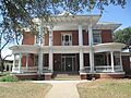
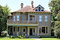
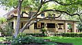
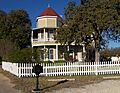
| John Nance Garner Home⁕ |
1962 | This was the home of John Nance Garner, who was Vice President of the United States! It's a very important national landmark. | |
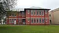
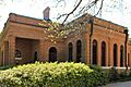
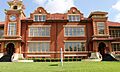
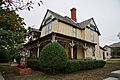
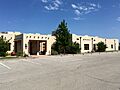
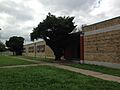
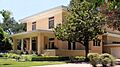
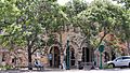
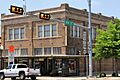
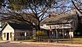
| Nicolas Street School |
2011 | This old school building in Uvalde is recognized for its historical significance. | |
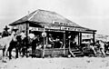
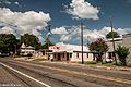
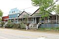
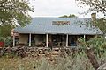
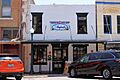
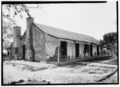
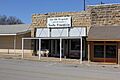
| Old Rock Store | 1967 | The Old Rock Store in Utopia is a historic building that once served as a general store for the community. | |
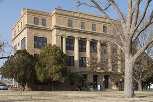
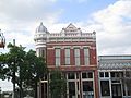
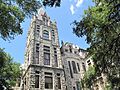
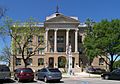
| Uvalde County Courthouse | 1983 | The Uvalde County Courthouse is a central historic building in the county seat. |


2015.jpg)

Val Verde County
Val Verde County has landmarks that reflect its unique history, including a famous saloon.
| Historic Landmark Name | Image | Year Designated | What Makes it Special |
|---|---|---|---|
| Jersey Lily Saloon | 1965 | This famous saloon in Langtry was once owned by Judge Roy Bean, a legendary figure in Texas history. |

Van Zandt County
Van Zandt County's landmarks include historic homes and its county courthouse.
| Historic Landmark Name | Image | Year Designated | What Makes it Special |
|---|---|---|---|
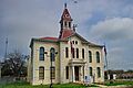
| Van Zandt County Courthouse |
1999 | The courthouse in Canton is an important historical building for the county. | |
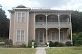
| William H. Humphries Home |
1976 | This historic home in Edgewood is recognized as a landmark. |


Victoria County
Victoria County is rich in history, with many historic homes, churches, and public buildings.
| Historic Landmark Name | Image | Year Designated | What Makes it Special |
|---|---|---|---|
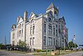
| 1892 Victoria County Courthouse |
1961 | This beautiful old courthouse in Victoria is a very important historical building for the county. | |
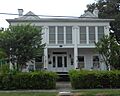
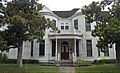
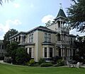
| Abraham Levi House |
1965 | The Abraham Levi House in Victoria is a recognized historic home. | |
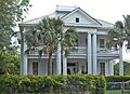
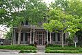
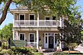
| B. F. Williams House |
1987 | This house in Victoria is another important historic home. | |
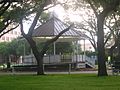
| Band Stand |
1965 | The bandstand in DeLeon Plaza in Victoria is a historic spot where people gathered for music and events. | |
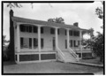
| Callender Home |
1962 | The Callender Home in Victoria is a historic residence. | |
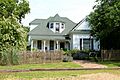
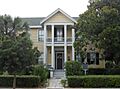
| Early Victoria Home |
1971 | This home is recognized as an early and important house in Victoria. | |
| Fleming-Welder House |
1996 | The Fleming-Welder House is another historic home in Victoria. | |
| Fossati's Delicatessen |
1987 | This deli in Victoria is a very old and famous business, known for its long history. | |
| Friedrech and Margaretha Hiller House |
2009 | The Hiller House in Victoria is a recognized historic landmark. | |
| George H. Hauschild Building |
1990 | This building in Victoria is a historic commercial structure. | |
| Hill-O'Connor-Howard House |
1981 | This house in Victoria is recognized for its historical significance. | |
| Jacob Fox House |
1985 | The Jacob Fox House in Victoria is a historic landmark. | |
| James A. McFaddin Home |
1967 | This home in Victoria is a historic landmark. | |
| Joe F. and Amelia Jecker House |
2005 | The Jecker House in Victoria is a recognized historic home. | |
| Judge Alexander Phillips Home |
1967 | This home in Victoria belonged to Judge Alexander Phillips and is a historic landmark. | |
| McNamara House |
1965 | The McNamara House in Victoria is a historic home. | |
| O'Connor-Proctor Building |
1980 | This building in Victoria is a historic commercial landmark. | |
| Old Federal Building |
1981 | This building in Victoria once served as a federal building. | |
| Old Grist Mill |
1962 | This old grist mill in Victoria is a historic reminder of how grain was processed long ago. | |
| Pela House |
1998 | The Pela House in Victoria is a historic landmark. | |
| Phillips-Sale House | 1967 | This house in Victoria is a historic landmark. | |
| Proctor House |
1985 | The Proctor House in Victoria is a historic home. | |
| Regan House |
1996 | The Regan House in Victoria is a historic landmark. | |
| Robert H. and Pauline Clark House |
2004 | This house in Victoria is a historic landmark. | |
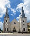
| St. Mary's Catholic Church |
1964 | St. Mary's Catholic Church in Victoria is a beautiful and historic place of worship. | |
| The Woodhouse Home |
1983 | The Woodhouse Home in Victoria is a historic landmark. | |
| Victoria Pumping Station |
2011 | This pumping station in Victoria is a historic site related to the city's water supply. |


Walker County
Walker County has many historic sites, especially around Huntsville, including parts of Sam Houston's legacy.
| Historic Landmark Name | Image | Year Designated | What Makes it Special |
|---|---|---|---|
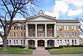
| Austin College Building |
1964 | This building on the Sam Houston State University campus is a very old and important part of Texas's educational history. | |
| Boettcher House | 1991 | The Boettcher House in Huntsville is a recognized historic home. | |
| Gibbs-Powell House |
1989 | This house in Huntsville is a historic landmark. | |
| Josey Boy Scouts Lodge | 2010 | This lodge in Huntsville is a historic place for the Boy Scouts. | |
| Old Gibbs Store | 1964 | This old store in Huntsville is a historic commercial building. | |
| Peabody Library Building |
1990 | This historic library building is located on the Sam Houston State University campus. | |
| Powell Sanctuary | 2015 | This sanctuary in Oakwood Cemetery in Huntsville is a historic site. | |
| Pritchett House | 2001 | The Pritchett House in Huntsville is a historic landmark. | |
| St. Joseph's Catholic Church | 1975 | This church in New Waverly is a historic place of worship. | |
| Steamboat House⁕ |
1964 | This unique house is part of the Sam Houston Memorial Museum and is a National Historic Landmark! | |
| Woodland, Home of Sam Houston⁕ |
1962 | This was the actual home of Sam Houston, a very famous figure in Texas history! It's a National Historic Landmark. |

.jpg)


_in_Huntsville,_Texas.JPG)
Waller County
Waller County features historic homes and churches, including a famous plantation.
| Historic Landmark Name | Image | Year Designated | What Makes it Special |
|---|---|---|---|
| Ahrenbeck-Urban Home | 1980 | This historic home in Hempstead is a recognized landmark. | |
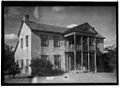
| Liendo Plantation |
1964 | Liendo Plantation near Hempstead is a very old and important plantation with a rich history. |

Ward County
Ward County's landmarks include old churches and buildings that tell the story of early settlements.
| Historic Landmark Name | Image | Year Designated | What Makes it Special |
|---|---|---|---|
| Mendoza Trail | 1967 | This marker in McCamey remembers the historic Mendoza Trail, an old route used by early explorers. |
Washington County
Washington County is full of historical sites, especially around Brenham and Chappell Hill, including homes, churches, and the county courthouse.
| Historic Landmark Name | Image | Year Designated | What Makes it Special |
|---|---|---|---|
| Anson Jones Home§ | 1962 | This was the home of Anson Jones, the last President of the Republic of Texas! It's a State Historic Site. | |
| Applewhite House |
1968 | The Applewhite House in Chappell Hill is a historic home. | |
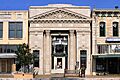
| Bassett and Bassett Banking House |
1985 | This building in Brenham was once a banking house. | |
| Blinn College Main Building |
1962 | This is the main building of Blinn College, a very old college in Brenham. | |
| B'nai Abraham Synagogue |
1965 | This synagogue in Brenham is a historic place of worship. | |
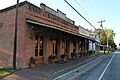
| Burton Cafe |
1992 | The Burton Cafe is part of the historic district in Burton. | |
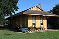
| Burton Depot |
1991 | The old train depot in Burton is a historic building. | |
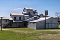
| Burton Farmers Gin |
1988 | This gin in Burton is a historic site related to cotton farming. | |
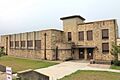
| Burton High School |
2013 | The old high school building in Burton is a historic landmark. | |
| Farmers State Bank and Reinstein Store |
2009 | This building in Chappell Hill is a historic commercial site. | |
| First Christian Church of Brenham |
1984 | This church in Brenham is a historic place of worship. | |
| First Public High School in Brenham |
1969 | This building was the first public high school in Brenham. | |
| Former Bank Building of Giddings & Giddings |
1971 | This old bank building in Brenham is a historic landmark. | |
| Fritz Paul and Emma Schroeder House |
2014 | This house near Independence is a historic landmark. | |
| Gantt-Jones House |
1976 | This house near Burton is a historic landmark. | |
| Giddings-Stone House |
1991 | This mansion in Brenham is a grand historic home. | |
| Giddings-Wilkin House |
1976 | The Giddings-Wilkin House in Brenham is a historic home. | |
| Liberty Baptist Church | 2003 | This church in Independence is a historic place of worship. | |
| Margaret Lea Houston Home |
1965 | This was the home of Sam Houston's wife, Margaret Lea Houston, in Independence. | |
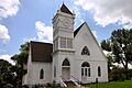
| Methodist Church |
1967 | This historic church in Chappell Hill is a landmark. | |
| Old Rock Store |
1971 | This old rock store in Chappell Hill is a historic commercial building. | |
| Pampell-Day Homestead |
1966 | This homestead in Brenham is a historic landmark. | |
| Providence Baptist Church |
1967 | This church in Chappell Hill is a historic place of worship. | |
| Reue-Eickenhorst House |
2002 | This house near Brenham is a historic landmark. | |
| Ross-Carroll House |
1992 | The Ross-Carroll House in Brenham is a historic home. | |
| Schmid Bros. Building |
1993 | This building in Brenham is a historic commercial landmark. | |
| Schuerenberg House |
1996 | The Schuerenberg House in Brenham is a historic home. | |
| Seelhorst-Lehrmann House |
1973 | This house in Brenham is a historic landmark. | |
| Southern Pacific Freight Depot |
2003 | This old train depot in Brenham is a historic transportation landmark. | |
| St. Peter's Episcopal Church | 1965 | This church in Brenham is a historic place of worship. | |
| Steiner & Dallmeyer Building |
1989 | This building in Burton is a historic commercial landmark. | |
| The Wood-Hughes House |
1974 | The Wood-Hughes House in Brenham is a historic home. | |
| W. W. Browning House |
1983 | This house near Chappell Hill is a historic landmark. | |
| Washington County Courthouse |
1985 | The Washington County Courthouse in Brenham is a very important historic building. | |
| Waverly |
1967 | Waverly near Chappell Hill is a historic site. | |
| Wittbecker-Weiss House |
1995 | The Wittbecker-Weiss House in Brenham is a historic home. |


_2008.jpg)
.jpg)


.jpg)


Webb County
Webb County, especially Laredo, has many historic buildings that reflect its rich border history.
| Historic Landmark Name | Image | Year Designated | What Makes it Special |
|---|---|---|---|
| Biggio-Kowalski-De La Garza House | 1996 | This house in Laredo is a historic landmark. | |
| Capitol, Republic of the Rio Grande |
1965 | This building in Laredo was once the capitol of the short-lived Republic of the Rio Grande! | |
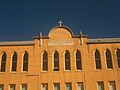
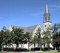
| San Augustine Cathedral |
1963 | This beautiful cathedral in Laredo is a very old and important church. | |
| St. Augustine Parochial School |
2000 | This old school building in Laredo is a historic landmark. |


Wharton County
Wharton County's landmarks include historic homes and its county courthouse.
| Historic Landmark Name | Image | Year Designated | What Makes it Special |
|---|---|---|---|
| Captain W. E. Heard Home | 1962 | This historic home in Egypt is a recognized landmark. | |
| Joseph A. Hamilton House |
1984 | This house in Wharton is a historic landmark. | |
| Judge Edwin Hawes House |
1982 | This house in Wharton belonged to Judge Edwin Hawes and is a historic landmark. | |
| Wharton County Courthouse |
2007 | The courthouse in Wharton is an important historic building for the county. |


Wheeler County
Wheeler County has several historic rock buildings and its county courthouse.
| Historic Landmark Name | Image | Year Designated | What Makes it Special |
|---|---|---|---|
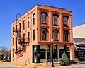
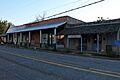
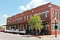
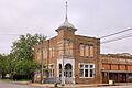
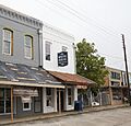
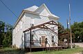
| Tower Building |
1994 | This unique building in Shamrock is a famous stop along the historic Route 66! | |
| Wheeler County Courthouse | 2000 | The courthouse in Wheeler is an important historic building for the county. |


Wichita County
Wichita County, especially Wichita Falls, has many historic churches and homes.
| Historic Landmark Name | Image | Year Designated | What Makes it Special |
|---|---|---|---|
| Electra State Bank | 1966 | This old bank building in Electra is a historic landmark. | |
| First Baptist Church of Wichita Falls | 1982 | This church in Wichita Falls is a historic place of worship. | |
| First United Methodist Church of Wichita Falls | 1983 | This church in Wichita Falls is a historic place of worship. | |
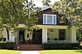
| Frank Kell Home |
1980 | The Frank Kell Home in Wichita Falls is a historic landmark. | |
| Grand Theatre | 2006 | This old theater in Electra is a historic entertainment venue. | |
| Hodges-Hardy House |
1984 | The Hodges-Hardy House in Wichita Falls is a historic home. | |
| J. A. Kemp Wholesale Grocery Building |
1997 | This building in Wichita Falls is a historic commercial landmark. | |
| Joe and Lois Perkins Estate |
2015 | This estate in Wichita Falls is a historic landmark. | |
| Kell Field Air Terminal | 1981 | This air terminal at Sheppard Air Force Base is a historic aviation landmark. | |
| Weeks Mansion |
1978 | The Weeks Mansion in Wichita Falls is a historic home. |
ws.jpg)

.jpg)

.jpg)
.jpg)
.jpg)


Wilbarger County
Wilbarger County has a few historic sites, including an old adobe building.
| Historic Landmark Name | Image | Year Designated | What Makes it Special |
|---|---|---|---|
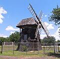
| Doans' Adobe Building |
1962 | This adobe building in Doan's Community is a very old and unique historic landmark. |
Willacy County
Willacy County features its old high school and the county courthouse as landmarks.
| Historic Landmark Name | Image | Year Designated | What Makes it Special |
|---|---|---|---|
| Old Lyford High School Building |
1985 | This old high school building in Lyford is a historic landmark. | |
| Willacy County Courthouse |
2016 | The courthouse in Raymondville is an important historic building for the county. |


Williamson County
Williamson County has many historic homes, churches, and public buildings, especially in Georgetown and Round Rock.
| Historic Landmark Name | Image | Year Designated | What Makes it Special |
|---|---|---|---|
| A. A. & Mary Spacek House | 1999 | This house in Granger is a historic landmark. | |
| A. W. Sillure House |
1990 | The A. W. Sillure House in Georgetown is a historic home. | |
| Amos-Godbey House |
1988 | This house in Georgetown is a historic landmark. | |
| Andrew J. Palm House |
1978 | The Andrew J. Palm House in Round Rock is a historic home. | |
| Bryson Stagecoach Stop |
1981 | This old stagecoach stop near Liberty Hill is a historic transportation landmark. | |
| Burcham House |
1988 | The Burcham House in Georgetown is a historic home. | |
| C.B. and Lilburn Atkinson House |
2006 | This house in Georgetown is a historic landmark. | |
| C.C. and Mattie Hughes Cody House |
2005 | This house in Georgetown is a historic home. | |
| Cabin from Gabriel Mills Area | 1976 | This log cabin in Round Rock was moved from the Gabriel Mills area and is a historic landmark. | |
| Cooper Sansom House |
1988 | This house in Georgetown is a historic home. | |
| David H. and Jerusha Dyches McFadin House |
1965 | This house near Circleville is a historic landmark. | |
| Early Church | 1970 | This old church in Florence is a historic place of worship. | |
| Early Commercial Building |
1970 | This building in Round Rock is a historic commercial landmark. | |
| Easley Home |
1984 | The Easley Home in Georgetown is a historic home. | |
| Farmers State Bank Building |
2006 | This old bank building in Georgetown is now The Williamson Museum. | |
| First Presbyterian Church of Bartlett | 1970 | This church in Bartlett is a historic place of worship. | |
| First United Methodist Church of Georgetown |
1974 | This church in Georgetown is a historic place of worship. | |
| George Irvine House |
1988 | The George Irvine House in Georgetown is a historic home. | |
| Georgetown Fire House and Old City Hall |
1984 | This building in Georgetown served as both a fire house and city hall. | |
| Georgetown High School Building |
1988 | This old high school building in Georgetown is a historic landmark. | |
| Granger City Hall (Farmers State Bank) | 1994 | This building in Granger once served as the city hall. | |
| Granger High School | 1991 | The old high school building in Granger is a historic landmark. | |
| H.C. Craig Building |
1990 | This building in Georgetown is a historic commercial landmark. | |
| J. A. McDougle Home |
1975 | This house in Georgetown is a historic home. | |
| Jesse Cooper House |
1988 | The Jesse Cooper House in Georgetown is a historic home. | |
| Lesesne-Stone Building |
1983 | This building in Georgetown is a historic commercial landmark. | |
| Liberty Hill Masonic Hall | 1976 | This Masonic Hall in Liberty Hill is a historic meeting place. | |
| M.B. Lockett Building |
1991 | This building in Georgetown is a historic commercial landmark. | |
| Marsh F. Smith House |
1988 | This house in Georgetown is a historic home. | |
| Old Dimmitt Building |
1965 | This building in Georgetown is a historic commercial landmark. | |
| Old Dimmitt Home |
1967 | The Old Dimmitt Home in Georgetown is a historic home. | |
| Page-Decrow-Weir House |
1988 | This house in Georgetown is a historic home. | |
| Preslar-Hewitt Building |
2004 | This building in Taylor is a historic commercial landmark. | |
| Shafer Saddlery |
1971 | This saddlery in Georgetown is a historic commercial landmark. | |
| Southwestern University Administration Building |
1962 | This is the main administration building of Southwestern University, a very old university in Georgetown. | |
| St. Peters United Church of Christ | 1989 | This church in Coupland is a historic place of worship. | |
| Steele Store-Makemson Hotel Building |
1988 | This building in Georgetown once housed a store and a hotel. | |
| Stubblefield Building | 1976 | This building in Liberty Hill is a historic commercial landmark. | |
| Taylor National Bank |
1980 | This old bank building in Taylor is a historic landmark. | |
| Taylor Post Office |
1992 | This old post office building in Taylor is a historic landmark. | |
| The David Love Store |
1988 | This old store in Georgetown is a historic commercial landmark. | |
| The G. W. Riley House |
1972 | This house in Georgetown is a historic home. | |
| The Harrell-Stone House |
1976 | This house in Georgetown is a historic home. | |
| W.C. Vaden House |
1992 | This house in Georgetown is a historic home. | |
| W. Y. Penn Home |
1975 | This house in Georgetown is a historic home. | |
| Wesley Chapel A.M.E. Church |
1984 | This church in Georgetown is a historic place of worship. | |
| William M. Owen House Complex |
1982 | This house complex in Round Rock is a historic landmark. | |
| Williamson County Courthouse |
1988 | The Williamson County Courthouse in Georgetown is a very important historic building. | |
| Williamson County Jail |
1965 | This old jail building in Georgetown is a historic landmark. |


.jpg)


.jpg)


.jpg)


.jpg)


2016-2.jpg)

.jpg)


Wilson County
Wilson County has historic homes, churches, and its county courthouse.
| Historic Landmark Name | Image | Year Designated | What Makes it Special |
|---|---|---|---|
| Brahan Lodge #226, A.F. & A.M. | 1962 | This Masonic lodge in LaVernia is a historic meeting place. | |
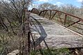
| Bridge at McAlister Crossing (Mueller Bridge) (2/10 mi. SW) |
2004 | This historic bridge near LaVernia is a recognized landmark. | |
| White House Café and Saloon | 2002 | This historic building in Floresville once housed a cafe and saloon. | |
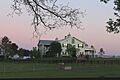
| Whitehall |
1962 | Whitehall near Sutherland Springs is a historic home. | |
| Wilson County Courthouse |
1984 | The Wilson County Courthouse in Floresville is a very important historic building. | |
| Yndo Ranch | 1964 | The Yndo Ranch near Floresville is a historic landmark. |
.jpg)
(mueller-bridge)2016-3.jpg)
.jpg)
.jpg)


Winkler County
Winkler County has landmarks that tell about its early homes and the Texas state line.
| Historic Landmark Name | Image | Year Designated | What Makes it Special |
|---|---|---|---|
| Winkler County Courthouse | 1988 | The courthouse in Kermit is an important historic building for the county. |
Wise County
Wise County has several historic college buildings, churches, and its county courthouse.
| Historic Landmark Name | Image | Year Designated | What Makes it Special |
|---|---|---|---|
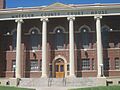
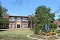
| Decatur Baptist College |
1964 | This building in Decatur is a historic part of Decatur Baptist College. | |
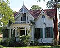
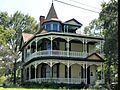
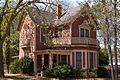
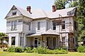
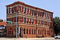
| El Castile (Old Waggoner Home) |
1962 | This grand mansion in Decatur is a historic landmark. | |
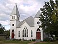
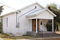
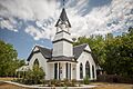
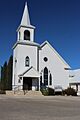
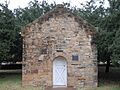
| Episcopal Mission of the Ascension | 1968 | This church in Decatur is a historic place of worship. | |
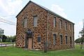
| Greenwood Masonic Lodge #779 | 2016 | This Masonic lodge near Decatur is a historic meeting place. | |
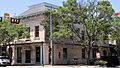
| Hanna-Robinson-Richey Drugstore | 1976 | This old drugstore in Chico is a historic commercial building. | |
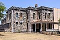
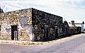
| Old Stone Prison | 1968 | This old stone prison in Decatur is a historic landmark. | |
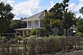
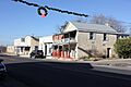
| R. C. Mount House | 1975 | This house near Chico is a historic landmark. | |
| S. W. Tilghman House | 1974 | This house in Decatur is a historic home. | |
| Sam Woody's Cabin | 1970 | This cabin near Decatur is a historic landmark. | |
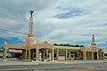
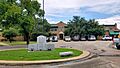
| Texas Tourist Camp Complex |
1994 | This old tourist camp in Decatur is a historic landmark. | |
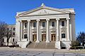
| Wise County Courthouse |
1964 | The Wise County Courthouse in Decatur is a very important historic building. |
.jpg)
.jpg)
.jpg)
.jpg)
.jpg)
.jpg)
.jpg)
.jpg)
.jpg)
.jpg)

Wood County
Wood County has historic homes, churches, and its county courthouse.
| Historic Landmark Name | Image | Year Designated | What Makes it Special |
|---|---|---|---|
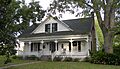
| Carlock Home |
1966 | The Carlock Home in Winnsboro is a historic landmark. | |
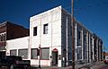
| First National Bank Building |
2001 | This building in Mineola once housed the First National Bank. | |
| Lott House |
1996 | The Lott House in Mineola is a historic home. | |
| Mineola Post Office |
1999 | This old post office building in Mineola is now the Mineola Historical Museum. | |
| Wood County Courthouse | 2003 | The courthouse in Quitman is an important historic building for the county. |

.jpg)
.jpg)
.jpg)

Yoakum County
Yoakum County has one recorded historic landmark.
| Historic Landmark Name | Image | Year Designated | What Makes it Special |
|---|---|---|---|
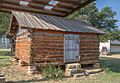
| Bonus Shack | 1962 | The Bonus Shack in Plains is a historic landmark. |
Young County
Young County has historic homes, churches, and the famous Fort Belknap.
| Historic Landmark Name | Image | Year Designated | What Makes it Special |
|---|---|---|---|
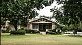
| A. B. Medlan Home | 1964 | This historic home near Graham is a recognized landmark. | |
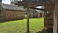
| Fort Belknap⁕ | 1962 | Fort Belknap near Newcastle was an important military post in early Texas history. It's a National Historic Landmark! | |
| Graham Post Office |
1999 | This old post office building in Graham is a historic landmark. | |
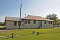
| Medlan Chapel Primitive Baptist Church | 1965 | This church near Graham is a historic place of worship. | |
| Old Fort Belknap Powder Magazine⁕ | 1962 | This building at Fort Belknap was used to store gunpowder and is a National Historic Landmark. | |
| Ryus Store Building | 1974 | This old store building in Graham is a historic commercial landmark. |
.jpg)


.jpg)

.jpg)
Zapata County
Zapata County has a very important historic ranch.
| Historic Landmark Name | Image | Year Designated | What Makes it Special |
|---|---|---|---|
| Jesus Trevino Home⁕ |
1964 | This historic home in San Ygnacio is part of the Trevino-Uribe Rancho, a very important national historic landmark! |

Zavala County
Currently, no Recorded Texas Historic Landmarks are listed within Zavala County.
Images for kids
-
Old Red Schoolhouse
-
Trinity County Courthouse
-
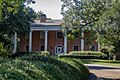
Cooper-Reid Home
-
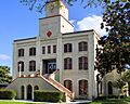
Tyler County Courthouse
-
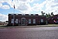
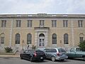
1925 Gilmer Post Office
-
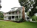
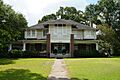
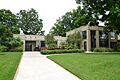
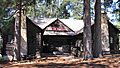
John O'Byrne Home
-
Warren-Futrell House
-
Mendoza Trail marker
-
Church of the Ascension
-
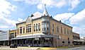
Grand Opera House
-
John Nance Garner Home
-
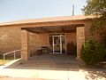
Nicolas Street School
-
Old Rock Store
-
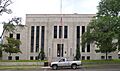
Uvalde County Courthouse
-
Jersey Lily Saloon
-
Van Zandt County Courthouse
-
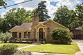
William H. Humphries Home
-
Old Victoria County Courthouse
-
Abraham Levi House
-
B. F. Williams House
-
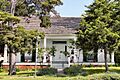
DeLeon Plaza and Bandstand
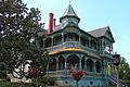
-
Callender Home
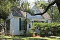
-
Early Victoria Home
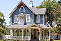
-
Fleming-Welder House
-
Fossati's Delicatessen
-
Friedrech and Margaretha Hiller House
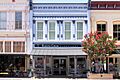
-

George H. Hauschild Building
-
Hill-O'Connor-Howard House
-
Jacob Fox House
-
James A. McFaddin Home
-
Joe F. and Amelia Jecker House
-
Judge Alexander Phillips Home
-
McNamara House
-
O'Connor-Proctor Building
-
Old Federal Building
-
Old Grist Mill
-
Pela House
-
Phillips-Sale House
-
Proctor House
-
Regan House
-
Robert H. and Pauline Clark House
-
St. Mary's Catholic Church
-
The Woodhouse Home
-
Victoria Pumping Station
-
Austin College Building
-
Boettcher House
-
Gibbs-Powell House
-
Josey Boy Scouts Lodge
-
Old Gibbs Store
-
Peabody Library Building
-
Powell Sanctuary
-
Pritchett House
-
St. Joseph's Catholic Church
-
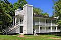
Steamboat House
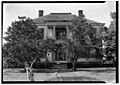
-
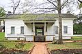
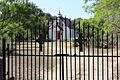
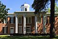
Woodland, Home of Sam Houston
-
Ahrenbeck-Urban Home
-
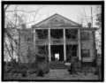
Liendo Plantation
-
Mendoza Trail marker
-
100px]]
 More images
 -
Anson Jones Home
-
Applewhite House
-
Bassett and Bassett Banking House
-
Blinn College Main Building
-
B'nai Abraham Synagogue
-
Burton Cafe
-
Burton Depot
-
Burton Farmers Gin
-
Burton High School
-
Farmers State Bank and Reinstein Store
-
First Christian Church of Brenham
-
First Public High School in Brenham
-
Former Bank Building of Giddings & Giddings
-
Fritz Paul and Emma Schroeder House
-
Gantt-Jones House
-
Giddings-Stone House
-
Giddings-Wilkin House
-
Liberty Baptist Church
-
Margaret Lea Houston Home
-
Methodist Church
-
Old Rock Store
-
Pampell-Day Homestead
-

Providence Baptist Church
-
Reue-Eickenhorst House
-
Ross-Carroll House
-
Schmid Bros. Building
-
Schuerenberg House
-
Seelhorst-Lehrmann House
-
Southern Pacific Freight Depot
-
St. Peter's Episcopal Church
-
Steiner & Dallmeyer Building
-
The Wood-Hughes House
-
W. W. Browning House
-
Washington County Courthouse
-
Waverly
-
Wittbecker-Weiss House
-
Biggio-Kowalski-De La Garza House
-

Capitol, Republic of the Rio Grande
-
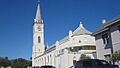
San Augustine Cathedral
-
St. Augustine Parochial School
-
Captain W. E. Heard Home
-
Joseph A. Hamilton House
-
Judge Edwin Hawes House
-
Wharton County Courthouse
-
Tower Building
-
Wheeler County Courthouse
-
Electra State Bank
-
First Baptist Church of Wichita Falls
-
First United Methodist Church of Wichita Falls
-
Frank Kell Home
-
Grand Theatre
-
Hodges-Hardy House
-
J. A. Kemp Wholesale Grocery Building
-
Joe and Lois Perkins Estate
-
Kell Field Air Terminal
-
Old Lyford High School Building
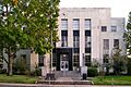
-
Willacy County Courthouse
-
A. A. & Mary Spacek House
-
A. W. Sillure House
-
Amos-Godbey House
-
Andrew J. Palm House
-
Bryson Stagecoach Stop
-
Burcham House
-
C.B. and Lilburn Atkinson House
-
C.C. and Mattie Hughes Cody House
-
Cabin from Gabriel Mills Area
-
Cooper Sansom House
-
David H. and Jerusha Dyches McFadin House
-
Early Church
-
Early Commercial Building
-
Easley Home
-
Farmers State Bank Building
-
First Presbyterian Church of Bartlett
-
First United Methodist Church of Georgetown
-
George Irvine House
-
Georgetown High School Building
-
Granger City Hall
-
Granger High School
-

H.C. Craig Building
-
J. A. McDougle Home
-
Jesse Cooper House
-
Lesesne-Stone Building
-

Liberty Hill Masonic Hall
-
M.B. Lockett Building
-
Marsh F. Smith House
-
Old Dimmitt Building
-

Old Dimmitt Home
-
Page-Decrow-Weir House
-
Preslar-Hewitt Building
-
Shafer Saddlery
-
Southwestern University Administration Building
-
St. Peters United Church of Christ
-
Steele Store-Makemson Hotel Building
-
Stubblefield Building
-
Taylor National Bank
-
Taylor Post Office
-
The David Love Store
-
The G. W. Riley House
-
The Harrell-Stone House
-
W.C. Vaden House
-

W. Y. Penn Home
-
Wesley Chapel A.M.E. Church
-
William M. Owen House Complex
-
Williamson County Courthouse
-
Williamson County Jail
-
Brahan Lodge #226, A.F. & A.M.
-
Bridge at McAlister Crossing
-
White House Café and Saloon
-
Whitehall
-
Wilson County Courthouse
-
Yndo Ranch
-

Winkler County Courthouse
-
Decatur Baptist College
-
El Castile (Old Waggoner Home)
-
Episcopal Mission of the Ascension
-
Greenwood Masonic Lodge #779
-
Hanna-Robinson-Richey Drugstore
-
R. C. Mount House
-
S. W. Tilghman House
-
Sam Woody's Cabin
-
Texas Tourist Camp Complex
-
Wise County Courthouse
-
Carlock Home
-
First National Bank Building
-
Lott House
-

Mineola Post Office
-
Wood County Courthouse
-
A. B. Medlan Home
-
Fort Belknap
-
Graham Post Office
-
Old Fort Belknap Powder Magazine
-

Ryus Store Building
-
Jesus Trevino Home
See also
| Anderson-Callahan • Cameron-Duval • Eastland-Gray • Grayson-Hudspeth • Hunt-Martin • Mason-Rusk • Sabine-Travis • Trinity-Zavala |
