
List of Recorded Texas Historic Landmarks (Eastland-Gray) facts for kids
Texas is full of amazing historical places, and many of them are called Recorded Texas Historic Landmarks (RTHLs). These special places are recognized by the Texas Historical Commission because they are important parts of Texas history. This list shows some of these landmarks in several counties, from Eastland to Gray County.
| Anderson-Callahan • Cameron-Duval • Eastland-Gray • Grayson-Hudspeth • Hunt-Martin • Mason-Rusk • Sabine-Travis • Trinity-Zavala |
Contents
- Eastland County: Historic Spots to See
- Ector County: Discovering History
- Edwards County: Landmarks in the Hill Country
- El Paso County: Borderland History
- Ellis County: Historic Buildings and Homes
- Erath County: Exploring the Past
- Falls County: Historical Gems
- Fannin County: Historic Places to Explore
- Fayette County: Old Buildings and Churches
- Fisher County: No Landmarks Yet
- Floyd County: Historic Places to Discover
- Foard County: A Landmark in Crowell
- Fort Bend County: Historic Sites to Visit
- Franklin County: Landmarks to See
- Freestone County: Historical Sites
- Frio County: Historic Buildings
- Gaines County: Landmarks in West Texas
- Galveston County: Island History
- Garza County: Historic Places in Post
- Gillespie County: German Heritage and More
- Glasscock County: One Special Landmark
- Goliad County: Historic Places to Explore
- Gonzales County: Birthplace of Texas Liberty
- Gray County: Historic Places in the Panhandle
- See also
What the Colors Mean
Some landmarks have extra special historical importance. The colors below show their highest level of recognition:
| ⁕ This means the landmark is a National Historic Landmark. It's super important to the whole country! |
| ⁂ This landmark is part of a National Historic Landmark District. It helps make a whole area special. |
| § This landmark is a State Historic Site. It's important to Texas history. |
Eastland County: Historic Spots to See
| Registered Texas Historic Landmark | Image | Marker number | Location | Nearest city | Year designated | More about this landmark |
|---|---|---|---|---|---|---|
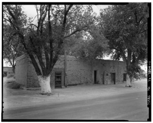
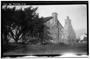
| Burkett House | 11852 | 1301 S. Mulberry St. | Eastland | 1998 | A historic home in Eastland. | |
| Carbon City Jail | 17695 | Dirt road from N. Main St. | Carbon | 2013 | This old jail tells a story about early law in Carbon. | |
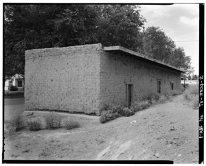
| Carbon Methodist Church Building | 12542 | 201 W. Anthracite St. | Carbon | 1996 | A historic church building at Avenue D and Anthracite Street. | |
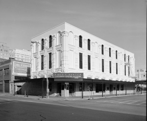
| Connellee-Majestic Theatre | 1040 | 108 N. Lamar St. | Eastland | 1988 | An old theater, once a popular entertainment spot. | |
| Eastland County Courthouse | 16983 | 100 W. Main St. | Eastland | 2007 | The main building for county government. | |
| First National Bank |
1782 | 708 Conrad Hilton Blvd. | Cisco | 1967 | An important historic bank building. | |
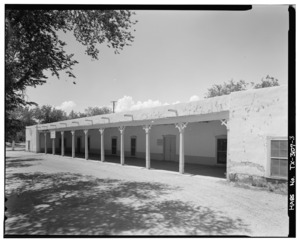
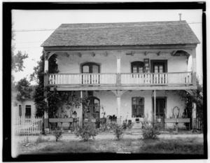
| Old Mobley Hotel |
|
3430 | 104 E. Fourth St. | Cisco | 1970 | A very old hotel with a rich history. |
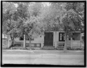
| Penn House | 3981 | Near FM 2945, west of Cisco | Cisco vicinity | 1988 | This house is on private land. | |
| Ranger Post Office | 3792 | 205 Main St. | Ranger | 1962 | The historic post office building. The marker is inside Greer's Western Store. | |
| Stubblefield Building | 5143 | 101 S. Lamar St. | Eastland | 1962 | Located at Lamar and Main, near the courthouse square. | |
| The Connellee House | 1038 | 515 S. Lamar St. | Eastland | 1972 | Another historic home in Eastland. | |
| The Kean Home |
2908 | 309 W. Sixth St. | Cisco | 1985 | A historic house in Cisco. |
.jpg)
.jpg)
_2.jpg)

.jpg)


.jpg)

.jpg)
Ector County: Discovering History
| Registered Texas Historic Landmark | Image | Marker number | Location | Nearest city | Year designated | More about this landmark |
|---|---|---|---|---|---|---|
| Barrow Ranch House | 311 | 8900 N. County Rd. West (FM 1882) | Odessa | 1962 | This ranch house is on private property. | |
| Ector County Discovery Well | 1381 | I-20 south service road 2.5 mi. W of Penwell | Penwell | 1967 | This well marked the discovery of oil in Ector County. | |
| Site of Old Livery Stable and Wagon Yard | 4853 | 205 N. Grant St. | Odessa | 1967 | The spot where an old stable and wagon yard used to be. | |
| White-Pool House |
|
5786 | 112 E. Murphy St. | Odessa | 1980 | A significant historic house in Odessa. |

Edwards County: Landmarks in the Hill Country
| Registered Texas Historic Landmark | Image | Marker number | Location | Nearest city | Year designated | More about this landmark |
|---|---|---|---|---|---|---|
| Edwards County Courthouse |
|
1402 | 100 W. Main St. | Rocksprings | 1973 | The county courthouse, a central part of Rocksprings. |
| First Baptist Church of Barksdale |
|
14896 | 200 Church St. | Barksdale | 2008 | A historic church building. |
| Headquarters, American Angora Goat Breeders' Assn. | 2418 | 200 blk W. Austin St. | Rocksprings | 1965 | The former headquarters for a goat breeding association. | |
| Hough-Haven | 2578 | 300 blk N. Sweeten St. | Rocksprings | 1966 | A historic building at the corner of Austin and Sweeten Street. | |
| Old Carson Store | 3702 | N. Austin St. at SW corner of E. Well St. | Rocksprings | 1968 | An old store building at Austin and Well Street. |

.jpg)
El Paso County: Borderland History
| Registered Texas Historic Landmark | Image | Marker number | Location | Nearest city | Year designated | More about this landmark |
|---|---|---|---|---|---|---|
| Burges House |
569 | 603 W. Yandell Dr. | El Paso | 1993 | A historic house in El Paso. | |
| Casa Ortiz | 745 | 10180 Socorro Rd. | Socorro | 1973 | An old house with historical significance. | |
| El Paso First Ward Chapel | 1428 | 3625 Douglas Ave. | El Paso | 1984 | A historic chapel building. | |
| El Paso High School |
|
18420 | 1600 N. Virginia St. | El Paso | 2016 | A historic high school building. |
| El Paso Union Depot |
|
1437 | 700 San Francisco St. | El Paso | 1982 | A historic train station. |
| Guardian Angel Church | 2302 | 3021 Frutas Ave. | El Paso | 1983 | A historic church building. | |
| Hotel Cortez |
|
12881 | 310 N. Mesa St. | El Paso | 2002 | A historic hotel. |
| La Hacienda | 2995 | 1720 W. Paisano Dr. | El Paso | 1962 | An old hacienda with historical importance. | |
| Los Portales |
|
3129 | 1587 Church St. | San Elizario | 1962 | Located on the south corner of the central town plaza. |
| Magoffin Homestead |
|
3183 | 1110 Magoffin Ave. | El Paso | 1962 | A state historical site. |
| Martin Building |
3226 | 215 N. Stanton St. | El Paso | 1981 | A historic building in El Paso. | |
| Mesa Water Boosting Station |
15822 | 5001 Fred Wilson Ave. | El Paso | 2009 | An important part of El Paso's water system history. | |
| Mission Nuestra Senora de la Purisima Concepcion Del Socorro |
|
3407 | 328 S. Nevarez Rd. | Socorro | 1963 | A historic mission, one block north of Nevarez and FM 258. |
| Old B'Nai Zion Synagogue |
|
3688 | 906 N. El Paso St. | El Paso | 1985 | A historic synagogue. |
| Old County Jail |
|
3715 | 1551 Main St. | San Elizario | 1962 | One block southeast of the Central Plaza. |
| Old County Jail |
|
14760 | 1551 Main St. | San Elizario | 1970 | Another entry for the same historic jail. |
| Old Fort Bliss |
3730 | 1836 W. Paisano Dr. | El Paso | 1965 | The site of an old military fort. | |
| Old Main | 3761 | 551 Circle Dr. | El Paso | 1982 | Located on the University of Texas at El Paso Campus. | |
| San Elizario Chapel |
|
4533 | 1556 San Elizario Rd. | San Elizario | 1962 | A historic chapel. |
| Simeon Hart Residence, Site of Hart's Mill (El Molino) | 4699 | 1720 W. Paisano Dr. | El Paso | 1981 | The site of an old mill and residence. | |
| Singer Building |
4711 | 211 Texas Ave. | El Paso | 1983 | A historic building. | |
| Site of Tienda de Carbajal | 4904 | 10245 Socorro Rd. | Socorro | 1972 | The location of an old store. | |
| The Woman's Club of El Paso |
|
5453 | 1400 N. Mesa St. | El Paso | 1980 | A historic club building. |
| Turner Home |
5572 | 1301 Montana Ave. | El Paso | 1982 | A historic home. | |
| Wallace Apartments |
5707 | 1205 Randolph Dr. | El Paso | 1985 | Historic apartments at Yandell and Randolph Streets. | |
| Ysleta Mission |
|
15485 | 131 S. Zaragoza Rd. | El Paso | 1962 | A very old and important mission. |


Ellis County: Historic Buildings and Homes
| Registered Texas Historic Landmark | Image | Marker number | Location | Nearest city | Year designated | More about this landmark |
|---|---|---|---|---|---|---|
| 1889 Masonic Lodge Hall |
|
7120 | 201 S. College St. | Waxahachie | 1976 | A historic meeting hall. |
| Dunlap - Simpson House |
7073 | 1203 W. Main St. | Waxahachie | 1974 | A historic house. | |
| Eddy O. Hawkins Home |
7112 | 200 S. Hawkins St. | Waxahachie | 1984 | A historic home. | |
| Ellis County Courthouse |
|
7091 | 101 W. Main St. | Waxahachie | 1969 | The main building for county government. |
| Ellis County Woman's Building (Davis Hall) |
13611 | 407 W. Jefferson St. | Waxahachie | 2006 | A historic building for women's activities. | |
| Ennis City Hall |
7097 | 119 W. Brown St. | Ennis | 1985 | The city government building. | |
| Ennis National Bank |
7098 | 110 W. Ennis Ave. | Ennis | 1983 | A historic bank building. | |
| First Presbyterian Church Building |
11858 | 501 W. Main St. | Waxahachie | 1997 | A historic church building. | |
| First Presbyterian Church of Ferris | 7104 | 201 N. Church St. | Ferris | 1994 | A historic church. | |
| Fry - Butcher House | 7064 | 501 FM 2377 | Red Oak | 1992 | A historic house. | |
| George Rossan Home | 7066 | South of Mike Rd. near Mill Creek | Milford | 1962 | A historic home located east of Milford. | |
| H.P. and Mollie McCartney House | 18825 | 504 Sycamore St. | Waxahachie | 2017 | A historic house. | |
| Hancock Building |
7108 | 203 S. College St. | Waxahachie | 1984 | A historic building. | |
| Harkey - Payne House | 7110 | 216 W. Jefferson St. | Palmer | 1983 | A historic house. | |
| Hawkins House |
|
7111 | 210 S. Hawkins St. | Waxahachie | 1990 | A historic house. |
| Jefferson Dunaway Home | 7065 | 115 Dunaway Rd. | Waxahachie | 1970 | A historic home. | |
| Joshua Chapel A.M.E. Church |
|
7070 | 110 Aiken St. | Waxahachie | 1984 | A historic church. |
| McKinney-Aday Farm House | 17480 | 130 Cunningham Meadows Rd. | Waxahachie | 2013 | A historic farmhouse. | |
| Moore House |
12717 | 400 W. Denton St. | Ennis | 2002 | A historic house. | |
| Old Ellis County Jail |
7094 | 200 N. Rogers St. | Waxahachie | 1978 | The old county jail building. | |
| Presiding Elder's House |
7140 | 201 Oldham Ave. | Waxahachie | 1988 | A historic house. | |
| Rockett Christian Church | 7143 | 135 Maple Leaf Dr. | Rockett | 1983 | A historic church. | |
| Rogers Street Bridge |
|
7069 | Rogers St. over Waxahachie Creek | Waxahachie | 1981 | A historic bridge. |
| Rosemont |
7068 | 701 S. Rogers St. | Waxahachie | 1981 | A historic home. | |
| Rutherford's Crossing Bridge | 7144 | Over Red Oak Creek W of new Rutherford Rd. bridge | Waxahachie | 1990 | A historic bridge. | |
| Saint James A.M.E. Church | 7145 | 312 Bois D Arc St. | Milford | 1992 | A historic church. | |
| Shiloh Cumberland Presbyterian Church | 7148 | 7810 Shiloh Rd. | Ovilla | 1962 | A historic church. | |
| St. Paul's Episcopal |
|
7062 | 308 N. Monroe St. | Waxahachie | 1965 | A historic church. |
| Strickland-Sawyer House |
7152 | 500 Oldham Ave. | Waxahachie | 1980 | A historic house. | |
| The H.P. Barkley Home |
7082 | 709 N. Dallas St. | Ennis | 1981 | A historic home. | |
| The Mahoney-Thompson House |
7118 | 604 W. Main St. | Waxahachie | 1969 | A historic house. | |
| The Telico Church | 7156 | S end of Telico Cemetery Rd. | Ennis | 1988 | A historic church. | |
| Trippet-Shive House |
7078 | 209 N. Grand Ave. | Waxahachie | 1983 | A historic house. | |
| Trotter House | 18604 | 508 S. Ninth St. | Midlothian | 2017 | A historic house. | |
| Waxahachie Chautauqua Building |
|
7077 | 400 S. Grand Ave. | Waxahachie | 1972 | A historic building in Getzendaner Park. |
| William L. and Emma Hawkins House | 7113 | 803 W. Ave. G | Midlothian | 1994 | A historic house. | |
| Williams-Erwin House |
|
7063 | 412 W. Marvin Ave. | Waxahachie | 1978 | A historic house. |

.jpg)
.jpg)
.jpg)
.jpg)
.jpg)
.jpg)
.jpg)

.jpg)

.jpg)
.jpg)
.jpg)
.jpg)

.jpg)
.jpg)
.jpg)
.jpg)
.jpg)
.jpg)
.jpg)
.jpg)
.jpg)


.jpg)

.jpg)

.jpg)
.jpg)
Erath County: Exploring the Past
| Registered Texas Historic Landmark | Image | Marker number | Location | Nearest city | Year designated | More about this landmark |
|---|---|---|---|---|---|---|
| Bluff Dale Tabernacle | 442 | 425 Glenn St. | Bluff Dale | 1982 | A historic tabernacle at the corner of Glenn and Dennis streets. | |
| Cage Home | 620 | 194 E. Long St. | Stephenville | 1983 | A historic home. | |
| Clairette Schoolhouse |
|
901 | 3 mi. N of US 281 on SH 6 | Clairette | 1985 | A historic school building. |
| Crow Home | 16446 | 396 E. Long St. | Stephenville | 2010 | A historic home at the intersection of Long and Vine Street. | |
| Crow Opera House |
|
1122 | 187 W. Washington St. | Stephenville | 1977 | A historic opera house. |
| D. L. Harris House | 1144 | 718 N. Patrick St. | Dublin | 1982 | A historic house. | |
| Dawson Saloon | 18519 | 190 W. College St. | Stephenville | 2016 | A historic saloon building. | |
| Doublin Inn | 1260 | 701 Cottonwood St. | Dublin | 1971 | A historic inn. The marker is not at the structure. | |
| Duffau School | 11868 | 0.5 mi. S of FM 1824 on FM 2481 | Stephenville | 1998 | A historic school building. | |
| Erath Arches |
|
15792 | 500 W. Washington St. | Stephenville | 2009 | Historic arches in Stephenville. |
| Erath County Courthouse |
|
1494 | 100 W. Washington St. | Stephenville | 1963 | The county courthouse. |
| First Methodist Church of Stephenville | 1771 | 328 W. Washington St. | Stephenville | 1988 | A historic church. | |
| First National Bank Building |
|
1785 | 198 S. Belknap Ave. | Stephenville | 1994 | A historic bank building. |
| Gentry and Shelton Building | 1851 | 104 E. College St. | Stephenville | 2016 | A historic building. | |
| Holt House | 16419 | 459 Church St. | Bluff Dale | 2010 | A historic house. | |
| J. F. Warnock Hardware | 2675 | 147 N. Greenwood St. | Bluff Dale | 1984 | A historic hardware store. | |
| Lingleville Tabernacle | 6255 | FM 219, about 0.2 mi. S of FM 8 | Lingleville | 1983 | A historic tabernacle. | |
| Oldest Home in Stephenville |
|
3841 | 525 E. Washington St. | Stephenville | 1967 | The oldest house in Stephenville. |
| Oxford House |
|
3894 | 619 E. Washington St. | Stephenville | 1994 | A historic house. |
| Pecan Cemetery Tabernacle | 3969 | Pecan Cemetery Rd. off CR 291 | Dublin vicinity | 1996 | A historic tabernacle near Dublin. | |
| President's House |
4115 | 1500 Military Dr. | Stephenville | 1988 | Located on the Tarleton State University campus. | |
| Stephenville Church of 1900 |
|
5112 | 525 E. Washington St. | Stephenville | 1977 | A historic church at the Stephenville Historical Museum. |
| The Gallagher House | 2099 | 261 N. Grafton St. | Dublin | 1980 | A historic house. | |
| William T. Miller Grist Mill |
|
5847 | 120 S. Park St. | Dublin | 1975 | An old grist mill at Wm. Wright Historical Park. |
| Wyatt-Boyd Ranch Complex |
6399 | Off US 281 northwest of FM 913 | Stephenville vicinity | 1987 | A historic ranch complex. |
.jpg)
.jpg)

.jpg)
.jpg)
.jpg)
.jpg)
.jpg)

.jpg)
.jpg)
.jpg)
.jpg)
.jpg)
.jpg)
.jpg)
.jpg)
.jpg)
.jpg)
.jpg)
.jpg)
_W_T_Miller_Grist_mill.jpg)
Falls County: Historical Gems
| Registered Texas Historic Landmark | Image | Marker number | Location | Nearest city | Year designated | More about this landmark |
|---|---|---|---|---|---|---|
| Allen House | 126 | 305 Ward St. | Marlin | 1991 | A historic house. | |
| Blue Ridge Baptist Church | 440 | S 3.5 mi. on FM 1771 from SH 7 | Reagan | 1970 | A historic church. | |
| Boyhood Home of Tom Connally | 1037 | 1.5 mi NW on CR 437 from SH 7 | Bruceville-Eddy | 1962 | The childhood home of Tom Connally. | |
| Dodson Place | 1240 | 7 mi. NW on FM 935 | Lott | 1962 | A historic place on private property. | |
| Falconer Home | 1560 | 433 Agnes Ave. | Marlin | 1983 | A historic home. | |
| Falls County Courthouse |
|
11717 | 125 Bridge St. | Marlin | 2000 | The county courthouse. |
| Frank and Julia Bockholt Home |
13048 | W side CR 379 between SH 320 and CR 380 | Westphalia | 2003 | A historic home. | |
| Henslee House | 2454 | 507 N. Second St. | Rosebud | 1985 | A historic house. | |
| Highlands Mansion | 2478 | N side FM 147 E of SH 6 | Marlin | 1967 | A historic mansion. | |
| James Bayliss Buck Farmstead | 18234 | 1641 US 77 | Rosebud | 2015 | A historic farm. | |
| Mooreville Methodist Church | 3464 | 206 FM 2643 | Mooreville | 1991 | A historic church that was destroyed by fire in 2019. | |
| Perry United Methodist Church | 3991 | 193 CR 127 | Perry | 1972 | A historic church. |
.jpg)

.jpg)

.jpg)
.jpg)
Fannin County: Historic Places to Explore
| Registered Texas Historic Landmark | Image | Marker number | Location | Nearest city | Year designated | More about this landmark |
|---|---|---|---|---|---|---|
| Biard Home | 8842 | 905 N. Main St. | Bonham | 1964 | A historic home. | |
| Blanton Chapel Methodist Church | 8845 | 1025 FM 981 | Trenton | 1964 | A historic church. | |
| Bonham High School Auditorium and Gymnasium | 12459 | 1201 N. Main St. | Bonham | 2001 | A historic school building. | |
| Church of St. Mark, The Evangelist, Episcopal | 8857 | 401 S. Eighth St. | Honey Grove | 1984 | A historic church. | |
| Dial United Presbyterian Church | 8865 | 8491 FM 824 | Dial | 1969 | A historic church across from Dial Cemetery. | |
| First National Bank | 8880 | 120 W. Sam Rayburn Dr. | Bonham | 1966 | A historic bank building. | |
| First Presbyterian Church |
|
8883 | 818 N. Main St. | Bonham | 1965 | A historic church. |
| First United Methodist Church of Leonard | 8885 | 206 N. Main St. | Leonard | 1981 | A historic church. | |
| Fry Homestead | 8889 | 395 FM 2456 | Ladonia | 1964 | A historic farm. | |
| Galbraith House | 8890 | 506 CR 3425 | Honey Grove | 1973 | A historic house. | |
| Haden House |
8896 | 603 W. Bonham St. | Ladonia | 1966 | A historic house. | |
| Home of T. H. Sears | 8932 | 6694 FM 151 | Whitewright | 1967 | A historic home. | |
| Ladonia Presbyterian Church Building |
|
11876 | 201 Paris St. | Ladonia | 1997 | A historic church building. |
| McClellan-Cunningham House | 16897 | 304 W. Seventh St. | Bonham | 2011 | A historic house. | |
| McKenzie Methodist Church | 8912 | 701 N. Seventh St. | Honey Grove | 1994 | A historic church. | |
| Morrell Boarding House | 8915 | 205 N. Jackson St. | Ladonia | 1965 | A historic boarding house. | |
| Old Baldwin Home | 8837 | 708 Main St. | Windom | 1967 | A historic home. | |
| Old Home of Pioneer Banker A. B. Scarborough | 8931 | 219 W. Sam Rayburn Dr. | Bonham | 1966 | A historic home. | |
| Old Kirkpatrick Home | 8905 | 1008 FM 151 | Whitewright | 1967 | A historic home. | |
| Old W. W. Brownlee Home | 8850 | 220 W. Sixth St. | Bonham | 1967 | A historic home. | |
| Rehobeth Cemetery Chapel | 8925 | 1666 CR 3900 | Ladonia | 1964 | A historic chapel. | |
| Sam Rayburn House⁕ |
|
8923 | 890 W. SH 56 | Bonham | 1965 | The home of famous politician Sam Rayburn. |
| Sam Rayburn Library and Museum |
|
15226 | 800 W. Sam Rayburn Dr. | Bonham | 2008 | A library and museum dedicated to Sam Rayburn. |
| Texas and Pacific Depot |
|
8939 | 1 N. Main St. | Bonham | 1990 | A historic train station. |
| Virginia Point Methodist Church | 8944 | 1386 CR 1200 | Savoy | 1965 | A historic church. | |
| Wheeler House | 8946 | 3 mi. W on SH 56 | Honey Grove | 1965 | A historic house. |
.jpg)

.jpg)
.jpg)
.jpg)
.jpg)

.jpg)
.jpg)
.jpg)
.jpg)
.jpg)
.jpg)
.jpg)
.jpg)

Fayette County: Old Buildings and Churches
| Registered Texas Historic Landmark | Image | Marker number | Location | Nearest city | Year designated | More about this landmark |
|---|---|---|---|---|---|---|
| Beer Office and Bottling Company |
353 | 114 S. Main St. | La Grange | 1983 | A historic office and bottling company. | |
| Bethlehem Lutheran Church |
|
396 | 412 S. White St. | Round Top | 1965 | A historic church. |
| Bradshaw-Killough House | 486 | 345 E. Travis St. | La Grange | 1991 | A historic house. | |
| Brethren Church | 500 | 1022 Kramr Rd. | Fayetteville | 1964 | A historic church. | |
| Casino Hall |
18722 | 254 N. Jefferson St. | La Grange | 2017 | A historic hall. | |
| City Library Building | 876 | 159 E. Fannin St. | La Grange | 1970 | The historic city library. | |
| Compton-Zapp House |
1016 | 111 W. Market St. | Fayetteville | 1985 | A historic house. | |
| Earthman Farm | 1365 | 10 mi. N near FM 2145 | La Grange | 1972 | A historic farm. The marker is missing. | |
| Fayette County Courthouse |
|
12627 | 151 N. Washington St. | La Grange | 2001 | The county courthouse. |
| Fayette County Precinct No. 2 Courthouse |
1580 | 112 N. Washington St. | Fayetteville | 1977 | A historic courthouse building. | |
| Flatonia City Hospital and Opera House |
1908 | 109 W. South Main St. | Flatonia | 1983 | A historic hospital and opera house. The marker is missing. | |
| Flatonia Methodist Church |
|
1909 | 403 E. North Main St. | Flatonia | 1971 | A historic church. |
| Freyburg Methodist Church | 14197 | 4520 FM 2238 | Flatonia | 1994 | A historic church. | |
| Gus Cranz Mansion | 1106 | 701 West Ave. | Schulenburg | 1964 | A historic mansion. | |
| Hamilton Ledbetter House | 3061 | 229 Hackemack Rd. | Round Top | 1978 | A historic house. | |
| Hermes House | 13237 | 541 N. Main St. | La Grange | 2004 | A historic house. | |
| John Vogt Homestead | 5659 | 5 mi. E on FM 609 | La Grange | 1983 | A historic farm. | |
| Kallus House | 15434 | 451 N. Franklin St. | La Grange | 2004 | A historic house. | |
| Kaulbach Home | 2907 | 351 E. Colorado St. | La Grange | 1968 | A historic home. | |
| Konrad Joh Log Cabin | 2763 | 2260 Hartfield Rd. | Round Top | 1978 | A historic log cabin. | |
| Lenert House | 3070 | 350 N. Madison St. | La Grange | 1987 | A historic house. | |
| Ludwig and Caroline Giese House | 12823 | 1103 S. Nassau Rd. | Round Top | 2002 | A historic house. | |
| Lyons Lodge No. 195, A. F.& A. M. | 3155 | 114 College St. | Schulenburg | 1965 | A historic lodge building. | |
| Meerscheidt House | 3319 | 458 N. Monroe St. | La Grange | 1994 | A historic house. | |
| Mulberry Creek Bridge |
|
3526 | Near West Ave. and Kallus St., Wolters Park | Schulenburg | 1990 | A historic bridge. |
| Olle Hotel |
15738 | 218 S. Market St. | Flatonia | 2009 | A historic hotel. | |
| Rocky Creek Farm | 4330 | 1475 Kneip Rd. | Round Top | 1970 | A historic farm. | |
| S.P.J.S.T. Lodge No. 1 |
17681 | 507 E. Main St. | Fayetteville | 2013 | A historic lodge building. | |
| Schueddemagen Home | 4605 | SE corner S. Washington St. at E. Wantke St. | Round Top | 1964 | A historic home. | |
| Schulenburg Baptist Church | 4608 | 110 N. Upton Ave. | Schulenburg | 1972 | A historic church. | |
| Spacek House |
4995 | 103 N. Washington St. | Fayetteville | 1983 | A historic house. | |
| St. James Episcopal Church |
4443 | 156 N. Monroe St. | La Grange | 1964 | A historic church. | |
| The Faison House |
1558 | 822 S. Jefferson St. | La Grange | 1962 | A historic house. | |
| The Menn House | 3337 | FM 1457 at north edge of town | Round Top | 1973 | A historic house. | |
| The Old Masonic Building |
3248 | 138 W. Travis St. | La Grange | 1962 | A historic Masonic building. | |
| The Sladek-Hillman House |
4946 | 209 N. Rusk St. | Fayetteville | 1979 | A historic house. | |
| Townsend-Bremer House | 5541 | 1 mi. S on FM 237 | Warrenton | 1990 | A historic house. | |
| Wheeler Building |
|
5778 | 101 W. South Main St. | Flatonia | 1989 | A historic building. |
| Winedale Stagecoach Inn |
5863 | 3738 FM 2714 | Round Top | 1967 | A historic inn. | |
| Zapp Building |
|
5940 | 201 W. Fayette St. | Fayetteville | 1983 | A historic building. |


.jpg)


.jpg)


.jpg)


Fisher County: No Landmarks Yet
There are currently no Recorded Texas Historic Landmarks listed in Fisher County.
Floyd County: Historic Places to Discover
| Registered Texas Historic Landmark | Image | Marker number | Location | Nearest city | Year designated | More about this landmark |
|---|---|---|---|---|---|---|
| Carr's Chapel | 735 | FM 378 N of CR 288 | Floydada | 1962 | A historic chapel. | |
| Zimmerman House | 5953 | 516 S. First St. | Floydada | 1990 | A historic house. |
Foard County: A Landmark in Crowell
| Registered Texas Historic Landmark | Image | Marker number | Location | Nearest city | Year designated | More about this landmark |
|---|---|---|---|---|---|---|
| Foard County Courthouse |
|
12719 | 100 S. Main St. | Crowell | 2001 | The county courthouse. |

Fort Bend County: Historic Sites to Visit
| Registered Texas Historic Landmark | Image | Marker number | Location | Nearest city | Year designated | More about this landmark |
|---|---|---|---|---|---|---|
| Cartwright-McCrary House | 8984 | 6 mi. W of Clodine off FM 1093 near Fulshear | Clodine | 1979 | A historic house. | |
| Fort Bend County Courthouse |
|
8994 | 401 Jackson St. | Richmond | 1980 | The county courthouse. |
| Fort Bend County Jail | 8995 | 602 Preston St. | Richmond | 1985 | The old county jail building. | |
| Home of Thomas Barnett | 8968 | 5 mi. NW off SH 36 near Dyer Switch | Rosenberg | 1962 | A historic home. | |
| McNabb House | 9009 | SE corner N. Sixth St. at Preston St. | Richmond | 1979 | A historic house in Decker Park. | |
| Moore Home |
|
9011 | 406 S. Fifth St. | Richmond | 1962 | A historic home. |
| Morton-McCloy House | 9051 | 402 N. Second St. | Richmond | 1994 | A historic house. | |
| Simonton School | 16950 | 34935 FM 1093 | Simonton | 2011 | A historic school building. | |
| St. John's United Methodist Church |
9064 | 400 Jackson St. | Richmond | 1983 | A historic church. | |
| Sugar Land Auditorium | 9070 | 226 Lakeview Dr. | Sugar Land | 1992 | A historic auditorium. | |
| Teague-Waddell House | 9073 | 1810 Ave. M | Rosenberg | 1979 | A historic house. | |
| Texas Prison System Central State Farm Main Building | 12990 | 1 Circle Dr. | Sugar Land | 2002 | A historic prison building. | |
| The Darst-Yoder House | 8986 | 300 S. Ninth St. | Richmond | 1976 | A historic house. | |
| The John H. Pickens Davis House | 8987 | 10215 FM 762 | Richmond | 1962 | A historic house in George Ranch Historical Park. | |
| The McFarlane House |
|
9007 | 410 Jackson St. | Richmond | 1985 | A historic house. |
| The Peareson-Winston House | 9055 | 404 S. Ninth St. | Richmond | 1976 | A historic house. | |
| Vogelsang Building | 9076 | 1911 Ave. G | Rosenberg | 1986 | A historic building. |


.jpg)


Franklin County: Landmarks to See
| Registered Texas Historic Landmark | Image | Marker number | Location | Nearest city | Year designated | More about this landmark |
|---|---|---|---|---|---|---|
| J. A. Drummond Farm Home |
9838 | 45 CR SE 4135 | Mount Vernon | 1963 | A historic farm home. The marker is missing. | |
| Killingsworth Home | 9847 | 4932 SE Access Rd. | Mount Vernon | 1965 | A historic home. | |
| The Wright-Vaughan House | 9852 | 311 E. Main St. | Mount Vernon | 1974 | A historic house. |
.jpg)
Freestone County: Historical Sites
| Registered Texas Historic Landmark | Image | Marker number | Location | Nearest city | Year designated | More about this landmark |
|---|---|---|---|---|---|---|
| Bradley House | 9861 | 318 Moody St. | Fairfield | 1967 | A historic house. | |
| Carter Log House | 9867 | 302 E. Main St. | Fairfield | 1968 | A historic log house at the Freestone Co. Historical Museum. | |
| Harmony Church | 9882 | FM 2547 S of FM 833 | Fairfield | 1965 | A historic church. | |
| John F. Wallace House | 9910 | 101 S. Ninth Ave. | Teague | 1987 | A historic house. | |
| Old Freestone Jail |
|
9879 | 302 E. Main St. | Fairfield | 1967 | The old county jail building. |
| Old Judge Allegre House | 9853 | 109 N. First St. | Wortham | 1969 | A historic house. | |
| Potter-Watson Log Cabin | 9899 | 302 E. Main St. | Fairfield | 1969 | A historic log cabin. | |
| Stewards Mill Store, 1869 | 9905 | FM 2547 at FM 833 | Fairfield | 1964 | A historic store. The marker is missing. | |
| The Dr. Emmet Headlee House | 9884 | 420 S. Tenth Ave. | Teague | 1965 | A historic house. | |
| The Fridolin (Fred) Fischer Home | 9877 | 222 S. Hall St. | Fairfield | 1982 | A historic home. | |
| The Manahan House | 9892 | 127 E. Reunion St. | Fairfield | 1972 | A historic house. |
.jpg)

.jpg)
.jpg)
_Fischer_Home_--_Fairfield,_Texas.jpg)

Frio County: Historic Buildings
| Registered Texas Historic Landmark | Image | Marker number | Location | Nearest city | Year designated | More about this landmark |
|---|---|---|---|---|---|---|
| Old Frio County Jail |
|
3733 | 500 S. Pecan St. | Pearsall | 1970 | The old county jail. |
| Pearsall Presbyterian Church | 3965 | 308 S. Pecan St. | Pearsall | 1971 | A historic church. |
(pearsall-tx)2016-3.jpg)
Gaines County: Landmarks in West Texas
| Registered Texas Historic Landmark | Image | Marker number | Location | Nearest city | Year designated | More about this landmark |
|---|---|---|---|---|---|---|
| Dan Cobb Home | 1162 | 501 NW Third St. | Seminole | 1963 | A historic home. | |
| Simpson Hotel | 4706 | 302 Main Ave. | Seagraves | 1991 | A historic hotel. |
Galveston County: Island History
| Registered Texas Historic Landmark | Image | Marker number | Location | Nearest city | Year designated | More about this landmark |
|---|---|---|---|---|---|---|
| 1871 Thomas Jefferson League Building⁂ |
7513 | 2301-2307 Strand (Ave. B) | Galveston | 1979 | A historic building. | |
| A. Wilkins Miller Cottage | 7531 | 1707 Winnie St. (Ave. G) | Galveston | 1983 | A historic cottage. | |
| Adriance-Springer House⁂ |
9917 | 1703 Broadway St. (Ave. J) | Galveston | 1989 | A historic house. | |
| Albertson Home | 17947 | 2017 Ave. N1⁄2 | Galveston | 2014 | A historic home. | |
| Ashton Villa, 1859 |
|
9924 | 2328 Broadway St. (Ave. J) | Galveston | 1967 | A grand historic villa. |
| Baden-Sproule House | 58 | 1919 37th St. | Galveston | 1989 | A historic house. | |
| Best-Lucas House⁂ |
13815 | 1122 Sealy St. (Ave. I) | Galveston | 2005 | A historic house. | |
| Boddeker House⁂ |
12810 | 1114 Broadway St. (Ave. J) | Galveston | 2001 | A historic house. | |
| C. F. Marschner Building |
7527 | 1916 Mechanic St. (Ave. C) | Galveston | 1997 | A historic building. | |
| Campbell Home⁂ |
14221 | 1515 Broadway St. (Ave. J) | Galveston | 1962 | A historic home. | |
| Carl and Hilda Biehl House⁂ |
|
17278 | 1416 Broadway St. (Ave. J) | Galveston | 2012 | A historic house. |
| Cecil and Frances Brown House | 259 | 312 S. Friendswood Dr. | Friendswood | 1997 | A historic house. | |
| Clarke-Jockusch Home⁂ |
8234 | 1728 Sealy St. (Ave. I) | Galveston | 1965 | A historic home. | |
| Congregation B'nai Israel Synagogue |
|
8237 | 822 Kempner Ave. (22nd St.) | Galveston | 1967 | A historic synagogue. |
| Davidson-Penland House⁂ |
16848 | 1207 Postoffice St. (Ave. E) | Galveston | 2011 | A historic house. | |
| Davison Home |
15582 | 109 Third Ave. N | Texas City | 1967 | A historic home. | |
| Dr. Frederick K. and Lucy Adelaide Fisher House | 7450 | 3503 Bernardo de Gálvez St. (Ave. P) | Galveston | 1993 | A historic house. | |
| E. S. Levy and Company | 7516 | 2227 Postoffice St. (Ave. E) | Galveston | 1966 | A historic building. | |
| Eaton Memorial Chapel |
|
7435 | 710 Kempner Ave. (22nd St.) | Galveston | 1970 | A historic chapel. |
| First Hutchings-Sealy National Bank⁂ |
|
7441 | 2326-2328 Strand (Ave. B) | Galveston | 1962 | A historic bank building. |
| First Lutheran Church |
|
7442 | 2415 Winnie St. (Ave. G) | Galveston | 1969 | A historic church. The marker is missing. |
| First Presbyterian Church |
|
7444 | 1903 Church St. (Ave. F) | Galveston | 1968 | A historic church. |
| Franklin-Wandless House |
11889 | 1920 Ave. M | Galveston | 1999 | A historic house. | |
| Frederich-Erhard House⁂ |
7454 | 1320 Ball St. (Ave. H) | Galveston | 1990 | A historic house. | |
| Frederick William Beissner House⁂ |
|
64 | 1702 Ball St. (Ave. H) | Galveston | 1990 | A historic house. |
| Galveston Children's Home |
|
7458 | 1315 Moody Ave. (21st St.) | Galveston | 1978 | A historic children's home. |
| Galveston Garten Verein |
7468 | 2702 Ave. O | Galveston | 1971 | A historic social club building in Kempee Park. | |
| Galveston Orphans Home |
|
18286 | 1315 Moody Ave. (21st St.) | Galveston | 2015 | Another entry for the historic children's home. |
| George Fox House⁂ |
7453 | 1402 Ball St. (Ave. H) | Galveston | 1981 | A historic house. | |
| George Seeligson Home⁂ |
7181 | 1208 Ball St. (Ave. H) | Galveston | 1976 | A historic home. | |
| Grace Episcopal Church |
|
7477 | 1115 36th St. | Galveston | 1967 | A historic church. |
| Grand Opera House 1894 |
|
7478 | 2020 Postoffice St. (Ave. E) | Galveston | 1990 | A historic opera house. |
| Grover-Chambers House⁂ |
|
7479 | 1520 Market St. (Ave. D) | Galveston | 1976 | A historic house. |
| Hagemann-Cobb House |
7482 | 3301 Ave. L | Galveston | 1982 | A historic house. | |
| Hawes Summer Home | 16835 | 2512 Ave. P1⁄2 | Galveston | 2011 | A historic summer home. | |
| Heidenheimer-Hunter Building⁂ |
7485 | 2127 Mechanic St. (Ave. C) | Galveston | 1987 | A historic building. | |
| Hendley's Row⁂ |
|
7487 | 2000-2016 Strand (Ave. B) | Galveston | 1981 | A row of historic buildings. |
| Henry C. Henck Jr. House | 7488 | 2008 Ave. N1⁄2 | Galveston | 1991 | A historic house. | |
| Henry Rosenberg Home |
|
7165 | 1306 Market St. (Ave. D) | Galveston | 1962 | A historic home. |
| Hotel Galvez |
|
7494 | 2024 Seawall Blvd. | Galveston | 1980 | A historic hotel. |
| Hutchings House | 7495 | 2816 Ave. O | Galveston | 1962 | A historic house with two markers. | |
| Hutchings House | 14875 | 2816 Ave. O | Galveston | 1962 | Another marker for the same historic house. | |
| Hutchings, Sealy & Co. Building⁂ |
|
7496 | 2326-2328 Strand (Ave. B) | Galveston | 1993 | A historic building. |
| Isaac H. and Henrietta Kempner House⁂ |
7505 | 1502 Broadway St. (Ave. J) | Galveston | 1994 | A historic house. | |
| Isaac Heffron House⁂ |
|
18528 | 1509 Postoffice St. (Ave. E) | Galveston | 2016 | A historic house. |
| Isabella Offenbach Maas Residence⁂ |
7520 | 1727 Sealy St. (Ave. I) | Galveston | 1986 | A historic residence. | |
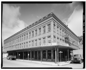
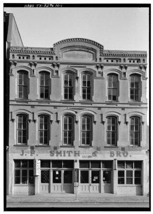
| J. F. Smith & Brothers (STOLEN)⁂ |
15085 | 2321-2323 Strand (Ave. B) | Galveston | 1962 | A historic building. The marker was stolen. | |
| J. F. Smith House | 7186 | 2217 Broadway St. (Ave. J) | Galveston | 1990 | A historic house. | |
| Jackie Andrews Private School | 9922 | 1807 Church St. (Ave. F) | Galveston | 1962 | A historic private school. | |
| James N. Davis House |
7426 | 1315 Mitchell Ave. (24th St.) | Galveston | 1979 | A historic house. | |
| James S. Waters House⁂ |
18526 | 1116 Church St. (Ave. F) | Galveston | 2016 | A historic house. | |
| John M. Jones House |
7498 | 1725 Ave. M | Galveston | 1979 | A historic house. | |
| John Smith House | 7187 | 1116 36th St. | Galveston | 1987 | A historic house. | |
| John and Eliza Hertford House⁂ |
7489 | 1509 Broadway St. (Ave. J) | Galveston | 1993 | A historic house. | |
| Julius H. Ruhl Residence⁂ |
|
7168 | 1428 Sealy St. (Ave. I) | Galveston | 1984 | A historic residence. |
| Landes-McDonough House⁂ |
|
7511 | 1602 Postoffice St. (Ave. E) | Galveston | 1973 | A historic house. |
| Lasker Home for Children |
7512 | 1019 16th St. | Galveston | 1980 | A historic children's home. | |
| Lockhart House⁂ |
7518 | 1502 Ball St. (Ave. H) | Galveston | 1981 | A historic house. | |
| Magale Building⁂ |
7522 | 2313-15 Strand (Ave. B) | Galveston | 1978 | A historic building. | |
| Mallory-Produce Building⁂ |
|
7526 | 2110-2114 Strand (Ave. B) | Galveston | 1987 | A historic building. |
| Masonic Temple, Old (BURNED) | 15112 | 2027 Postoffice St. (Ave. E) | Galveston | 1962 | The site of a historic Masonic Temple that burned down. | |
| Mathilda Wehmeyer German-American Kindergarten School |
|
18647 | 1616 Winnie St. (Ave. G) | Galveston | 2017 | A historic school. |
| Maud Moller House⁂ |
7533 | 812 19th St. (Ave. H) | Galveston | 1983 | A historic house. | |
| Menard-Ganter House⁂ |
7528 | 1209 Winnie St. (Ave. G) | Galveston | 1992 | A historic house. | |
| Miller-Brautigam Home | 15345 | 5518 Main St. | Santa Fe | 2002 | A historic home. | |
| Jacobs Home⁂ |
7532 | 1323 Church St. (Ave. F) | Galveston | 1977 | A historic home. The marker is missing. | |
| Moody Hall | 18817 | 4015 Ave. Q | Galveston | 2017 | A historic hall. | |
| Old Austin Home⁂ |
|
9926 | 1502 Market St. (Ave. D) | Galveston | 1962 | A historic home. |
| Old Ball Home |
|
60 | 1405 Mitchell Ave. (24th St.) | Galveston | 1962 | A historic home. |
| Old H. B. Moore Home |
7536 | 8 Ninth Ave. N | Texas City | 1968 | A historic home. The marker is missing. | |
| Old Red, Ashbel Smith Building |
|
7539 | 916 Strand (Ave. B) | Galveston | 1969 | A historic building. |
| Open Gates |
|
7541 | 2424 Broadway St. (Ave. J) | Galveston | 1962 | A historic mansion. |
| Poole-Parker House | 7545 | 3419 Ave. L | Galveston | 1980 | A historic house. | |
| Powhatan House |
|
7546 | 3427 Ave. O | Galveston | 1967 | A historic house. |
| Powhatan and Mattie Wren House⁂ |
14023 | 1403 Broadway St. (Ave. J) | Galveston | 2007 | A historic house. | |
| Produce Building⁂ |
|
15645 | 2110-2114 Strand (Ave. B) | Galveston | 1962 | A historic building. |
| Quigg-Baulard Cottage |
18525 | 2628 Broadway St. (Ave. J) | Galveston | 2016 | A historic cottage. | |
| Reedy Chapel A. M. E. Church |
7548 | 2013 Broadway St. (Ave. J) | Galveston | 1975 | A historic church. | |
| Sacred Heart Church⁂ |
|
7170 | 1302 Broadway St. (Ave. J) | Galveston | 1981 | A historic church. |
| Santa Fe Consolidated High School | 17644 | 13304 SH 6 | Santa Fe | 2013 | A historic high school. | |
| Santa Fe Union Station⁂ |
|
7178 | 123 Rosenberg Ave. (25th St.) | Galveston | 1983 | A historic train station. |
| Schreiber-Miller Warehouse⁂ |
7179 | 2317-2319 Strand (Ave. B) | Galveston | 1962 | A historic warehouse. | |
| Site of Old Saint Mary's Infirmary | 7174 | 715 Market St. (Ave. D) | Galveston | 1962 | The site of an old infirmary. | |
| Sonnentheil Home⁂ |
11566 | 1826 Sealy St. (Ave. I) | Galveston | 1962 | A historic home. | |
| St. Joseph's Church |
14117 | 2201 Ave. K | Galveston | 1978 | A historic church. | |
| St. Mary's Cathedral |
|
7172 | 2011 Church St. (Ave. F) | Galveston | 1967 | A historic cathedral. |
| Sweeney-Royston House |
11571 | 2402 Ave. L | Galveston | 1978 | A historic house. | |
| T. J. and Mary Lelia Dick House | 7429 | 720 Second St. | League City | 1993 | A historic house. | |
| The Bishop's Palace⁂ |
|
139 | 1402 Broadway St. (Ave. J) | Galveston | 1967 | A famous historic palace. |
| The Cottage⁂ |
8239 | 1517 Ball St. (Ave. H) | Galveston | 1966 | A historic cottage. | |
| The Cradle | 8240 | 2902 Avenue O1⁄2 | Galveston | 1962 | A historic building. | |
| The Heidenheimer Bros. Marine Building⁂ |
7486 | 305 Moody Ave. (21st St.) | Galveston | 1986 | A historic building. | |
| The Italian Vault | 7497 | 2506 65th St. | Galveston | 1992 | A historic vault in Calvary Catholic Cemetery. | |
| The Maas House⁂ |
7521 | 1802 Sealy St. (Ave. I) | Galveston | 1976 | A historic house. | |
| The Moody Home |
|
7534 | 2618 Broadway St. (Ave. J) | Galveston | 1967 | A famous historic mansion. |
| The Wilbur Cherry House⁂ |
|
270 | 1602 Church St. (Ave. F) | Galveston | 1981 | A historic house. |
| Thomas Chubb House⁂ |
326 | 1417 Sealy St. (Ave. I) | Galveston | 1981 | A historic house. | |
| Trinity Protestant Episcopal Church |
|
11580 | 708 Kempner Ave. (22nd St.) | Galveston | 1965 | A historic church. |
| Trube House⁂ |
|
11581 | 1627 Sealy St. (Ave. I) | Galveston | 1965 | A historic house. |
| Trueheart-Adriance Building⁂ |
|
11582 | 212 Kempner Ave. (22nd St.) | Galveston | 1973 | A historic building. |
| W. P. Ballinger Law Firm | 63 | 2228 Mechanic St. (Ave. C), Suite 400 | Galveston | 1967 | A historic law firm building. | |
| Wegner House | 17946 | 1328 Ave. K | Galveston | 2014 | A historic house. | |
| Wesley Tabernacle United Methodist Church | 13986 | 902 28th St. | Galveston | 2007 | A historic church. | |
| William J. Killeen House |
7506 | 1808 Ave. K | Galveston | 1980 | A historic house. | |
| William and Adele Skinner House⁂ |
18752 | 1318 Sealy St. (Ave. I) | Galveston | 2017 | A historic house. | |
| Williams-Tucker House, 1837–40 |
|
11596 | 3601 Bernardo de Gálvez St. (Ave. P) | Galveston | 1964 | A very old and important historic house. |


.jpg)


.jpg)


Garza County: Historic Places in Post
| Registered Texas Historic Landmark | Image | Marker number | Location | Nearest city | Year designated | More about this landmark |
|---|---|---|---|---|---|---|
| C. W. Post Home | 601 | 615 W. Main St. | Post | 1964 | The historic home of C. W. Post, founder of Post, Texas. | |
| Faith Lutheran Church | 1559 | 124 N. Ave. K | Post | 1965 | A historic church. | |
| Garza County Courthouse |
|
12456 | 300 W. Main St. | Post | 2000 | The county courthouse. |
| Garza County's First Oil Well | 12661 | 3.5 mi. E of historical marker along US 84 in Justiceburg | Justiceburg | 1967 | The site of the first oil well in Garza County. | |
| J. M. Boren Home | 2681 | 504 W. 12th St. | Post | 1967 | A historic home. | |
| Mason Memorial Building |
|
3239 | 117 N. Ave. N | Post | 1967 | A historic building that is now a museum. |
| OS Ranch | 3643 | US 84 SE 8 mi. from Post | Post | 1966 | A historic ranch. | |
| Old Close City School | 3710 | NE corner FM 399 and CR 230 | Post | 1968 | A historic school building. The marker is missing. | |
| Old Post Sanitarium |
|
3783 | 117 N. Ave. N | Post | 1964 | A historic sanitarium, now a museum. |
| Post-Hundley House | 5403 | 111 E. 11th St. | Post | 1976 | A historic house. | |
| Postex Cotton Mill | 4089 | 300 S. Ave F | Post | 1962 | A historic cotton mill. | |
| Verbena Community Church | 5642 | Near jct. FM 2008 and CR 186 | Post | 1965 | A historic church. |


Gillespie County: German Heritage and More
| Registered Texas Historic Landmark | Image | Marker number | Location | Nearest city | Year designated | More about this landmark |
|---|---|---|---|---|---|---|
| Adolph Gold House | 10046 | 212 E. Travis St. | Fredericksburg | 1991 | A historic house. | |
| Albert Lee Patton Building |
10093 | 232 W. Main St. | Fredericksburg | 1981 | A historic building. | |
| Albert Nebgen House | 10088 | 613 Lee Roy Behrends Rd. | Stonewall | 1988 | A historic house on private property. | |
| Cherry Mountain School Complex | 10015 | 5973 RM 2323 | Fredericksburg | 1992 | A historic school complex. | |
| Cherry Spring Schoolhouse |
10017 | 5973 RM 2323 | Fredericksburg | 1988 | A historic schoolhouse. | |
| Christian Crenwelge Place | 10023 | 312 W. Schubert St. | Fredericksburg | 1979 | A historic place. | |
| County Jail of 1885 |
10021 | 117 San Antonio St. | Fredericksburg | 1980 | The old county jail building. | |
| D. C. Riley House | 10101 | Itz-Kast Rd. 0.2 mi. N of Lower Crabapple Rd. | Fredericksburg | 1972 | A historic house. | |
| Dangers Stone House |
10027 | 213 W. Creek St. | Fredericksburg | 1974 | A historic stone house. | |
| Diedrich Rode Complex |
|
10104 | Cherry Spring Rd. near V-K Rd. | Fredericksburg | 1982 | A historic complex. |
| Domino Parlor |
10029 | 222 E. Main St. | Fredericksburg | 1980 | A historic parlor. | |
| Duecker Family Homestead | 10031 | N. Grape Creek Rd. | Fredericksburg | 1993 | A historic family farm. | |
| Durst House | 10032 | 2175 Wendell-Ahrens Rd. | Fredericksburg | 1991 | A historic house. | |
| Edward and Minnie Stein House | 10118 | 101 E. Hackberry St. | Fredericksburg | 1994 | A historic house. | |
| Ellebracht-Moritz Homestead | 10034 | 3574 RM 965 | Fredericksburg | 1987 | A historic farm on private property. | |
| Emil Weber House | 10128 | 110 N. Cherry St. | Fredericksburg | 1982 | A historic house. | |
| F. W. Arhelger Shop |
10008 | 109 N. Adams St. | Fredericksburg | 1980 | A historic shop. | |
| Felix Van Der Stucken Home |
10120 | 114 W. Austin St. | Fredericksburg | 1981 | A historic home. | |
| Frank Van Der Stucken Birthplace |
14946 | 123 E. Main St. | Fredericksburg | 1962 | The birthplace of Frank Van Der Stucken. | |
| Fredericksburg College Building | 10040 | 108 W. Travis St. | Fredericksburg | 1971 | A historic college building. | |
| Gold-Grobe House | 10047 | 413 N. Llano St. | Fredericksburg | 1989 | A historic house. | |
| Gruen-Doebbler Homestead | 16454 | 1251 Doebbler Rd. | Fredericksburg | 2010 | A historic farm. | |
| H. C. Keese Home | 10058 | Welgehausen Rd. | Fredericksburg | 1981 | A historic home. | |
| Harper Presbyterian Church | 10051 | 147 Oak Ave. | Harper | 1976 | A historic church. | |
| Heinrich Bierschwale House |
10012 | 209 W. Austin St. | Fredericksburg | 1987 | A historic house. | |
| Henry Basse House | 10010 | 1004 S. Bowie St. | Fredericksburg | 1991 | A historic house. | |
| Henry Cordes House | 10020 | 204 W. Schubert St. | Fredericksburg | 1981 | A historic house. | |
| Hoerster Building |
10055 | 242-244 W. Main St. | Fredericksburg | 1988 | A historic building. | |
| Holy Ghost (Heilige Geist) Evangelical Protestant Church |
10056 | 113 E. San Antonio St. | Fredericksburg | 1981 | A historic church. | |
| Hugo and Anna Gold Crenwelge House | 10024 | Gold-Shafer Rd. 1.3 mi. S of Old Willow Rd. | Fredericksburg | 1990 | A historic house. | |
| J. W. and Ruth Baines House | 12975 | 112 W. College St. | Fredericksburg | 2002 | A historic house. | |
| Johann Joseph Knopp House |
10066 | 309 W. Schubert St. | Fredericksburg | 1971 | A historic house. | |
| John Peter Tatsch Home, 1856 |
|
10121 | 210 N. Bowie St. | Fredericksburg | 1965 | A historic home. |
| Kiehne-Hermann Home |
|
10065 | 405 E. Main St. | Fredericksburg | 1976 | A historic home. |
| Klingelhoeffer House |
17349 | 701 W. Main St. | Fredericksburg | 2012 | A historic house. | |
| Kloth-Ludwig Home |
10067 | 414 E. Main St. | Fredericksburg | 1980 | A historic home. | |
| Kuenemann House |
11893 | 413 W. Creek St. | Fredericksburg | 1997 | A historic house. | |
| Lehne-Itz House | 10069 | 402 Whitney St. | Fredericksburg | 1993 | A historic house. | |
| Little Rock House |
10103 | 215B W. Main St. | Fredericksburg | 1965 | A historic house. | |
| Liveoak Creek Log Cabin | 10061 | Loudon Rd. 2.5 mi. N of US 290 | Fredericksburg | 1976 | A historic log cabin on private property. | |
| Loeffler-Weber House |
10072 | 508 W. Main St. | Fredericksburg | 1971 | A historic house. | |
| Lower South Grape Creek School |
10073 | 10273 E. US 290 | Stonewall | 1994 | A historic school. | |
| Luckenbach School |
10075 | 3566 Luckenbach Rd. | Luckenbach | 1982 | A historic school. | |
| Ludwig Doebbler House | 16447 | 542 Doebbler Rd. | Fredericksburg | 2010 | A historic house. | |
| Lyndon Baines Johnson⁕ |
|
10062 | Park Road 49 | Stonewall | 1967 | The birthplace of President Lyndon B. Johnson. |
| Maier-Alberthal Building |
10078 | 324 E. Main St. | Fredericksburg | 1983 | A historic building. | |
| Meckel-Hanus Building |
10081 | 307 W. Main St. | Fredericksburg | 1986 | A historic building. | |
| Moritz-Hitzfeld-Jacoby House | 10085 | 608 N. Milam St. | Fredericksburg | 1994 | A historic house. | |
| Morris Ranch Schoolhouse |
10086 | Morris Ranch Rd. | Fredericksburg | 1981 | A historic schoolhouse. | |
| Mosel-Jordan-Duecker Haus |
10087 | 121 E. San Antonio St. | Fredericksburg | 1986 | A historic house. | |
| Moseley Log Cabin |
14225 | 307 W. Schubert St. | Fredericksburg | 1964 | A historic log cabin. | |
| Mueller-Petmecky House | 10083 | 201 S. Washington St. | Fredericksburg | 1983 | A historic house. | |
| Old Gillespie County Courthouse |
|
10045 | 101 & 115 W. Main St. | Fredericksburg | 1967 | The old county courthouse. |
| Old Kammlah House |
|
10064 | 309 - 315 W. Main St. | Fredericksburg | 1966 | A historic house. |
| Old St. Mary's Church (Die Alte Kirche) |
|
15401 | 300 W. San Antonio St. | Fredericksburg | 1994 | An old historic church. |
| Our Lady of Guadalupe Catholic Church | 14535 | 302 E. College St. | Fredericksburg | 1994 | A historic church. | |
| Pape Log Cabin |
10092 | 213 W. Creek St. | Fredericksburg | 1974 | A historic log cabin. | |
| Pioneer Schandua House |
10110 | 111 E. Austin St. | Fredericksburg | 1980 | A historic pioneer house. | |
| Pioneer Store & Home |
14969 | 309 W. Main St. | Fredericksburg | 1966 | A historic store and home. | |
| Rausch Ranch Home | 10098 | Meusebach Creek Rd. at WM Hahn Rd. | Fredericksburg | 1983 | A historic ranch home. | |
| Ressmann-Boos House | 10100 | 511 E. Main St. | Fredericksburg | 1983 | A historic house. | |
| Riley-Enderlin House | 10102 | 606 N. Adams St. | Fredericksburg | 1987 | A historic house. | |
| Schmidt-Dietz Building |
10111 | 218 W. Main St. | Fredericksburg | 1981 | A historic building. | |
| Schmidt-Gold House |
10112 | 106 S. Lincoln St. | Fredericksburg | 1981 | A historic house. | |
| Schneider-Klingelhoefer House | 10114 | 714 W. Main St. | Fredericksburg | 1988 | A historic house. | |
| Schwarz Building |
10115 | 216 W. Main St. | Fredericksburg | 1981 | A historic building. | |
| Site of The Andreas Lindig Lime Kiln | 10071 | Rest area between RR 1 and US 290 | Stonewall | 1970 | The site of a historic lime kiln. | |
| St. Barnabas Episcopal Church |
10105 | 601 W. Creek St. | Fredericksburg | 1962 | A historic church. | |
| St. John's Lutheran Church | 10106 | 14689 Lower Crabapple Rd. | Fredericksburg | 1994 | A historic church. | |
| St. Mary's Catholic Church |
|
14697 | 304 W. San Antonio St. | Fredericksburg | 1995 | A historic church. |
| St. Paul Lutheran Church | 10107 | 9732 RM 1631 | Fredericksburg | 1969 | A historic church. | |
| St. Peter Lutheran Church | 10108 | 806 N. Lindsey Rd. | Doss | 1993 | A historic church. | |
| The August Hennersdorf House |
10053 | 205 W. Austin St. | Fredericksburg | 1982 | A historic house. | |
| The Burrer Home | 10013 | Baj Ln. 0.3 mi. E of Lower Crabapple Rd. | Fredericksburg | 1981 | A historic home. | |
| The Carl Henke Home | 10052 | 116 E. Travis St. | Fredericksburg | 1978 | A historic home. | |
| The Christian Kraus Homestead | 10060 | 0.75 mi. W of US 87 2 mi. W of town | Fredericksburg | 1984 | A historic farm. | |
| The Grapetown School | 10048 | 7325 Old San Antonio Rd. | Fredericksburg | 1984 | A historic school. | |
| The Meinhardt-Pfeil Home |
|
10082 | 125 W. San Antonio St. | Fredericksburg | 1981 | A historic home. |
| The Patton Home | 10094 | 107 N. Orange St. | Fredericksburg | 1981 | A historic home. | |
| The Schandua Building |
10109 | 205 E. Main St. | Fredericksburg | 1979 | A historic building. | |
| The William Rausch House |
10099 | 107 S. Lincoln St. | Fredericksburg | 1985 | A historic house. | |
| Trinity Lutheran Church |
|
10122 | 4270 Ranch Road 1 | Stonewall | 1989 | A historic church. |
| Vereins Kirche |
|
10123 | 115 Pioneer Plaza | Fredericksburg | 1967 | A historic church in Market Square. |
| Vogel Sunday House |
10124 | 418 W. Austin St. | Fredericksburg | 1982 | A historic Sunday house. | |
| Wahrmund Millinery, Moellendorf-Dietz Bakery |
10126 | 312 E. Main St. | Fredericksburg | 1978 | A historic millinery and bakery. | |
| Wahrmund-Priess House | 12488 | 575 Buckeye Rd. | Fredericksburg | 2001 | A historic house. | |
| Walch Home | 10127 | 412 E. Austin St. | Fredericksburg | 1978 | A historic home. | |
| Walter-Jenschke Sunday House |
|
15200 | 406 W. Travis St. | Fredericksburg | 1991 | A historic Sunday house. |
| Weber "Das Keller Haus" | 10129 | 110 N. Cherry St. | Fredericksburg | 1982 | A historic house with a cellar. | |
| Welgenhausen Ranch | 10130 | 12800 RM 965 | Fredericksburg | 1983 | A historic ranch. | |
| William Wahrmund House |
10125 | 206 W. Main St. | Fredericksburg | 1977 | A historic house. | |
| Williams Creek School |
15250 | 5501 S. RM 1623 | Stonewall vicinity | 2002 | A historic school in the Albert community. | |
| Zion Evangelical Lutheran Church |
|
10132 | 424 W. Main St. | Fredericksburg | 1964 | A historic church. |


.jpg)


(jenschke).jpg)


Glasscock County: One Special Landmark
| Registered Texas Historic Landmark | Image | Marker number | Location | Nearest city | Year designated | More about this landmark |
|---|---|---|---|---|---|---|
| Glasscock County Courthouse and Jail |
2188 | 117 E. Currie Ave. | Garden City | 1993 | The county courthouse and jail. |

Goliad County: Historic Places to Explore
| Registered Texas Historic Landmark | Image | Marker number | Location | Nearest city | Year designated | More about this landmark |
|---|---|---|---|---|---|---|
| Brooking-Lipscomb-White House | 520 | 142 W. End St. | Goliad | 1986 | A historic house. | |
| Elijah Ray House | 1450 | 8 mi. SW on FM 2442 | Charco | 1984 | A historic house. | |
| Geraldos B. Smart House | 2173 | 3 mi. E on US 59 | Goliad | 1962 | A historic house. The marker is not located. | |
| Goliad County Courthouse |
|
2204 | 300 S. Market St. | Goliad | 1964 | The county courthouse. |
| Goliad Lodge No. 94 A.F. & A.M. |
2205 | 202 Commercial St. | Goliad | 1967 | A historic lodge building. | |
| Judge Pryor Lea, Home | 2883 | W. Franklin St. at S. Chilton Ave. | Goliad | 1962 | A historic home. | |
| Market House Museum |
3217 | 205 S. Market St. | Goliad | 1968 | A historic market house, now a museum. | |
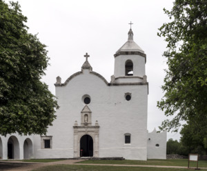
| Mission Nuestra Senora del Espiritu Santo de Zuniga |
|
3408 | 108 PR 6 | Goliad | 1969 | A historic mission in Goliad State Park. |
| Old Peck House |
|
3686 | 248 Hill Ave. | Goliad | 1962 | A historic house on private property. |
| Presidio de Nuestra Senora de Loreto de la Bahia⁕ |
|
4119 | 217 US 183 / US 77 Alt. | Goliad | 1969 | A very important historic fort. |
| Ramsey Home | 4176 | 205 E. Garden St. | Goliad | 1962 | A historic home. | |
| Reed-McCampbell-Wiess Ranch Complex | 4223 | 4 mi. NW on FM 883 | Berclair | 1991 | A historic ranch complex. | |
| Site of September 1824 Indian Treaty | 4885 | 4 mi. E on US 59 | Goliad | 1967 | The site of a historic treaty. The marker is missing. | |
| Stoddard-Collins House |
5128 | 400 E. Fannin St. | Goliad | 1993 | A historic house. | |
| W. J. "Ed" and Mary Elizabeth Lott House | 5673 | 2 mi. W of US 59 on FM 1351 | Goliad | 1996 | A historic house. |

.jpg)


Gonzales County: Birthplace of Texas Liberty
| Registered Texas Historic Landmark | Image | Marker number | Location | Nearest city | Year designated | More about this landmark |
|---|---|---|---|---|---|---|
| Braches House |
|
482 | 12 mi. SE of Gonzales off U.S. 90A | Gonzales | 1962 | A historic house. |
| Brown House | 532 | 834 Mitchell St. | Gonzales | 1963 | A historic house. | |
| Charles T. Rather House | 821 | 828 St. Louis St. | Gonzales | 1975 | A historic house. | |
| Chenault House (DEMOLISHED) | 15304 | 324 St. Paul St. | Gonzales | 1962 | A historic house that has been demolished. | |
| Episcopal Church of the Messiah | 1491 | 711 St. Louis St. | Gonzales | 1981 | A historic church. | |
| Gonzales College | 2217 | 820 St. Louis St. | Gonzales | 1962 | A historic college building. | |
| Gonzales County Jail |
|
2218 | 414 St. Lawrence St. | Gonzales | 1966 | The county jail building. |
| Gonzales Courthouse |
|
2219 | 414 St. Joseph St. | Gonzales | 1966 | The county courthouse. |
| Gonzales Memorial Museum and Amphitheatre |
|
2220 | 414 Smith St. | Gonzales | 2003 | A museum and amphitheater. |
| Harwood Methodist Church and Masonic Lodge |
|
2402 | N. Second St. by Harwood Cemetery | Harwood | 1979 | A historic church and lodge. |
| Holmes Hospital |
|
2513 | 1118 St. Louis St. | Gonzales | 1984 | A historic hospital. |
| J. W. and Nannie C. Bailey House | 277 | 623 St. Michael St. | Gonzales | 1996 | A historic house. | |
| John Fauth House | 1578 | 521 St. Peter St. | Gonzales | 1965 | A historic house. | |
| Kennard House |
2924 | 621 St. Louis St. | Gonzales | 1967 | A historic house. | |
| Leesville Baptist Church | 3066 | 6055 FM 1682 | Leesville | 1976 | A historic church. | |
| Market Square |
3219 | Block bounded by St. Lawrence St., St. John St., St. Louis St., and Water St. | Gonzales | 1966 | A historic town square. | |
| Miller's Store | 3381 | N. Railroad St. at N. Main St. | Waelder | 1968 | A historic store. | |
| Remschel House | 11900 | 524 St. Peter St. | Gonzales | 1997 | A historic house. | |
| Riverside School | 18947 | 110 St. Lawrence St. | Gonzales | 2018 | A historic school. | |
| The Eggleston House |
|
1405 | 1303 St. Louis St. | Gonzales | 1962 | A historic house in a park. |
| The Pilgrim Home | 5400 | 707 St. George St. | Gonzales | 1965 | A historic home. | |
| Wells Home | 5751 | 833 Mitchell St. | Gonzales | 1964 | A historic home. | |
| William B. and Sue J. Houston House |
13016 | 621 St. George St. | Gonzales | 2003 | A historic house. |
.jpg)


.jpg)


Gray County: Historic Places in the Panhandle
| Registered Texas Historic Landmark | Image | Marker number | Physical address | Nearest city | Year designated | Description |
|---|---|---|---|---|---|---|
| 1934 Pampa Post Office Building |
36 | 120 E. Foster Ave. | Pampa | 1992 | A historic post office building. | |
| 1931 Combs-Worley Building |
11901 | 120 W. Kingsmill Ave. | Pampa | 1998 | A historic building. | |
| Gray County Courthouse |
11902 | 205 N. Russell St. | Pampa | 1997 | The county courthouse. | |
| Pampa City Hall |
3923 | 200 W. Foster Ave. | Pampa | 1987 | The city hall building. | |
| Pioneer Cottage | 4027 | 100 E. Atchison Ave. | Pampa | 1970 | A historic cottage in City Park. |


.JPG)

|
See also
| Anderson-Callahan • Cameron-Duval • Eastland-Gray • Grayson-Hudspeth • Hunt-Martin • Mason-Rusk • Sabine-Travis • Trinity-Zavala |

All content from Kiddle encyclopedia articles (including the article images and facts) can be freely used under Attribution-ShareAlike license, unless stated otherwise. Cite this article:
List of Recorded Texas Historic Landmarks (Eastland-Gray) Facts for Kids. Kiddle Encyclopedia.