
List of Recorded Texas Historic Landmarks (Sabine-Travis) facts for kids
The following is a partial list of Recorded Texas Historic Landmarks (RTHLs) arranged by county as designated by the Texas Historical Commission and local county historical commissions in Texas. This page includes RTHLs in the following counties: Sabine, San Augustine, San Jacinto, San Patricio, San Saba, Schleicher, Scurry, Shackelford, Shelby, Sherman, Smith, Somervell, Starr, Stephens, Sterling, Stonewall, Sutton, Swisher, Tarrant, Taylor, Terrell, Terry, Throckmorton, Titus, Tom Green, and Travis.
| Anderson-Callahan • Cameron-Duval • Eastland-Gray • Grayson-Hudspeth • Hunt-Martin • Mason-Rusk • Sabine-Travis • Trinity-Zavala |
Contents
- Sabine County
- San Augustine County
- San Jacinto County
- San Patricio County
- San Saba County
- Schleicher County
- Scurry County
- Shackelford County
- Shelby County
- Sherman County
- Smith County
- Somervell County
- Starr County
- Stephens County
- Sterling County
- Stonewall County
- Sutton County
- Swisher County
- Tarrant County
- Taylor County
KEY
Landmarks with multiple historic designations are colored according to their highest designation within the following hierarchy.
| ⁕ Listed individually on the National Register of Historic Places (NRHP) as a National Historic Landmark |
| ⁂ Listed on the NRHP as a contributing property of a National Historic Landmark District |
| § Listed individually as or as part of a State Historic Site |
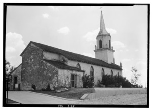
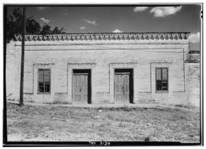
Sabine County
| Registered Texas Historic Landmark | Image | Marker number | Physical address | Nearest city | Year designated | Location description |
|---|---|---|---|---|---|---|
| C. A. Nethery & Sons General Merchandise | 15813 | SH 21 W of SH 87
31°25′56″N 93°50′58″W / 31.43222°N 93.84944°W |
Milam | 2009 | ||
| Cedar Grove Baptist Church | 17881 | 3675 Cedar Grove Rd.
31°29′10″N 93°48′3″W / 31.48611°N 93.80083°W |
Milam | 2014 | ||
| Clark-James House | 17568 | 377 Bowie Trl.
31°12′47″N 93°45′43″W / 31.21306°N 93.76194°W |
Hemphill | 2013 | ||
| Goodrich, William F. and Bertha Sutor, House | 14533 | Hemphill | 2003 | |||
| Harper Chapel Church | 13791 | Harpers Chapel Dr. at FM 83
31°22′44″N 93°43′0″W / 31.37889°N 93.71667°W |
Hemphill | 2005 | 8 mi. E on FM 83 to Harper Chapel Drive on left | |
| Sabine County Jail | 7578 | SW corner courthouse square at 201 Main St.
31°20′31″N 93°50′59″W / 31.34194°N 93.84972°W |
Hemphill | 1981 | SH 87 |

San Augustine County
| Registered Texas Historic Landmark | Image | Marker number | Physical address | Nearest city | Year designated | Location description |
|---|---|---|---|---|---|---|
| Anderson House |
7585 | End of N. Congress St.
31°31′57″N 94°6′29″W / 31.53250°N 94.10806°W |
San Augustine | 1962 | ||
| Augus Theatre |
12176 | 110 E. Columbia St.
31°31′51″N 94°6′36″W / 31.53083°N 94.11000°W |
San Augustine | 1998 | ||
| Bland-Fisher Home | 7588 | FM 3230 S of CR 110
31°35′26″N 94°6′45″W / 31.59056°N 94.11250°W |
San Augustine | 1981 | 5 mi. north of San Augustine off 1279 next to BNSF rail line | |
| Bodine Place | 7591 | San Augustine | 1962 | private property | ||
| Captain T. W. Blount House |
7589 | SH 21 W of Spur 85
31°31′56″N 94°10′3″W / 31.53222°N 94.16750°W |
San Augustine | 1962 | private property | |
| China Grove - Dr. B. F. Sharp House | 7595 | San Augustine | 1962 | not located | ||
| Christ Church |
7596 | 201 S. Ayish St.
31°31′42″N 94°6′21″W / 31.52833°N 94.10583°W |
San Augustine | 1965 | Ayish St. between Main and Market St. | |
| Col. Sexton House | 7641 | San Augustine | 1962 | 8 mi NW; private property | ||
| Columbus-Cartwright House | 7593 | End of S. Clark St.
31°31′25″N 94°5′57″W / 31.52361°N 94.09917°W |
San Augustine | 1962 | off SH 21 on Craft St. | |
| Crocket House | 7597 | San Augustine | 1962 | burned | ||
| Cullen House |
7598 | 205 S. Congress St.
31°31′35″N 94°6′28″W / 31.52639°N 94.10778°W |
San Augustine | 1962 | ||
| Harring House - Straddle Fork | 7615 | FM 705 S of SH 103
31°23′21″N 94°9′32″W / 31.38917°N 94.15889°W |
San Augustine | 1965 | ||
| Hillcrest | 7616 | 1002 E. Main St.
31°31′37″N 94°5′53″W / 31.52694°N 94.09806°W |
San Augustine | 1965 | ||
| Horatio Hanks House | 7612 | San Augustine | 1962 | West Walter Street, San Augustine | ||
| Inlow Lee Mathews House | 7622 | San Augustine | 1962 | |||
| Ketchum Place | 7620 | San Augustine | 1962 | |||
| Lewis Hotel | 17066 | 500 W. Columbia St.
31°31′53″N 94°6′55″W / 31.53139°N 94.11528°W |
San Augustine | 2011 | ||
| Mathews, Inlow and Jeanette, House | 14786 | San Augustine | 2004 | |||
| Mathew Cartright Home |
7594 | 503 E. Main St.
31°31′44″N 94°6′19″W / 31.52889°N 94.10528°W |
San Augustine | 1962 | ||
| McCauley House | 7623 | San Augustine | 1962 | private property, no access | ||
| McRae Church | 7625 | CR 220 W of CR 277
31°31′56″N 94°11′10″W / 31.53222°N 94.18611°W |
San Augustine | 1962 | 4 mi. west of San Augustine via SH 21, then .25 mi. north on McRae Cemetery Rd. | |
| Memorial Presbyterian Church |
17388 | 205 E. Livingston St.
31°31′54″N 94°6′29″W / 31.53167°N 94.10806°W |
San Augustine | 1962 | Spur 85 btwn FM 1277 and SH 21 | |
| Newt Whitton House (DEMOLISHED) | 7649 | 1962 | structure gone - no access | |||
| Norwood House | 7630 | SH 103 and SH 147 | San Augustine | 1962 | private property - no access | |
| Old Brookeland Depot | 7592 | San Augustine | 1966 | private property - no access | ||
| Old Garrett House | 7606 | SH 21 W of CR 271
31°30′19″N 94°17′4″W / 31.50528°N 94.28444°W |
San Augustine | 1962 | SH 21 about 11 mi. west of San Augustine | |
| Old Greer House | 7609 | FM 1277 near US 96 | San Augustine | 1962 | southwestern edge of San Augustine off FM 1277 | |
| Old Mott House | 7628 | San Augustine | 1962 | |||
| Old Polk-Sharp House | 7632 | 2 mi. E of FM 1277 W of town 9 mi. | San Augustine | 1962 | private property - no access | |
| Old Union School | 15560 | 1462 CR 278
31°30′40″N 94°11′5″W / 31.51111°N 94.18472°W |
San Augustine | 1962 | ||
| Old Wade Place | 7648 | CR 313 E of FM 705
31°21′12″N 94°8′47″W / 31.35333°N 94.14639°W |
San Augustine | 1962 | FM 705 about 9.5 mi. south of San Augustine | |
| "Pet" Sharp House |
7642 | 105 N. Congress St.
31°31′51″N 94°6′30″W / 31.53083°N 94.10833°W |
San Augustine | 1962 | ||
| Polk House |
7631 | 717 W. Columbia St.
31°31′54″N 94°7′13″W / 31.53167°N 94.12028°W |
San Augustine | 1962 | SH 21 about 2 blocks west of junction Loop 547 and SH 21, south side of road | |
| San Augustine County Courthouse |
12729 | 100 W. Columbia St.
31°31′49″N 94°6′41″W / 31.53028°N 94.11139°W |
San Augustine | 2001 | Courthouse square, Columbia at Broadway (SH 147) streets | |
| San Augustine County Jail |
18848 | 110 S. Harrison St.
31°31′48″N 94°6′40″W / 31.53000°N 94.11111°W |
San Augustine | 2017 | San Augustine County Courthouse grounds, east side facing Harrison Street | |
| Simp Miller House | 7626 | San Augustine | 1962 | private property - no access | ||
| Stephen W. Blount Home |
7590 | 503 E. Columbia St.
31°31′49″N 94°6′19″W / 31.53028°N 94.10528°W |
San Augustine | 1962 | ||
| Straddle Fork | 7643 | FM 705 S of SH 103
31°23′21″N 94°9′32″W / 31.38917°N 94.15889°W |
San Augustine | 1965 | FM 705 about 8 mi. south of San Augustine | |
| Sublett House | 7645 | 2419 SH 21 E
31°31′9″N 94°3′30″W / 31.51917°N 94.05833°W |
San Augustine | 1962 | SH 21, 4 mi. east of San Augustine | |
| The Gatling House |
7608 | 850 S. Liberty St.
31°31′9″N 94°6′43″W / 31.51917°N 94.11194°W |
San Augustine | 1967 | 1 mi. south of San Augustine off FM 2213 (Liberty St.) in Gatling Manor | |
| William Garrett House |
7607 | SH 21 W of CR 280
31°32′7″N 94°8′23″W / 31.53528°N 94.13972°W |
San Augustine | 1962 | 1 mi. west of San Augustine via SH 21, north side of private road |
.jpg)


.jpg)
.jpg)
.jpg)


San Jacinto County
| Registered Texas Historic Landmark | Image | Marker number | Physical address | Nearest city | Year designated | Location description |
|---|---|---|---|---|---|---|
| Coldspring Methodist Church | 13848 | 1 Cemetery Rd.
30°35′33″N 95°7′49″W / 30.59250°N 95.13028°W |
Coldspring | 1964 | Coldspring United Methodist Church | |
| J. M. Hansbro's Law Office | 7656 | 11 Byrd Ave.
30°35′34″N 95°7′45″W / 30.59278°N 95.12917°W |
Coldspring | 1967 | across from Courthouse at SH 150 and FM 1514 | |
| San Jacinto County Courthouse |
12481 | 1 Byrd Ave.
30°35′32″N 95°7′42″W / 30.59222°N 95.12833°W |
Coldspring | 2000 | Byrd Ave. at SH 150 | |
| San Jacinto County Jail |
7669 | 200 Slade St.
30°35′46″N 95°7′42″W / 30.59611°N 95.12833°W |
Coldspring | 1982 | just north of FM 1514 on Slade St. behind high school | |
| Shepherd Methodist Church | 7671 | 71 Spring Ave.
30°30′5″N 95°0′3″W / 30.50139°N 95.00083°W |
Shepherd | 1970 | just north of SH 150 on FM 222 | |
| The Robert Tod Robinson House | 7667 | 500 SH 156
30°44′15″N 95°12′54″W / 30.73750°N 95.21500°W |
Point Blank | 1975 | SH 156, .75 mi. south of Point Blank |


San Patricio County
| Registered Texas Historic Landmark | Image | Marker number | Physical address | Nearest city | Year designated | Location description |
|---|---|---|---|---|---|---|
| James McGloin Home |
14899 | N end CR 899 at Round Lake
27°58′12″N 97°47′34″W / 27.97000°N 97.79278°W |
San Patricio | 1963 | private property off FM 666 | |
| Odem Building | 3665 | 201 E. Sinton St.
28°2′13″N 97°30′33″W / 28.03694°N 97.50917°W |
Sinton | 1994 | Vineyard at Sinton Streets, Sinton |
San Saba County
| Registered Texas Historic Landmark | Image | Marker number | Physical address | Nearest city | Year designated | Location description |
|---|---|---|---|---|---|---|
| Campbell House | 686 | 505 W. Dry St.
31°11′38″N 98°43′31″W / 31.19389°N 98.72528°W |
San Saba | 1994 | 505 Dry Street, San Saba. | |
| Cedar Log Cabin Museum | 772 | 271 S. Thomas Stewart Dr.
31°11′39″N 98°42′43″W / 31.19417°N 98.71194°W |
San Saba | 1966 | Mill Pend Park, E. city limits, Highway 190, San Saba. | |
| Estep-Burleson Building | 17736 | 120 S. Cherokee St.
31°11′43″N 98°43′4″W / 31.19528°N 98.71778°W |
San Saba | 2013 | interior of block west of courthouse, S. Cherokee Street | |
| First Methodist Church | 1743 | 204 W. Brown St.
31°11′49″N 98°43′22″W / 31.19694°N 98.72278°W |
San Saba | 1965 | 204 West Brown Street, San Saba. | |
| First State Bank Building | 12496 | SW corner Main Ave. at Center St.
31°16′26″N 98°56′42″W / 31.27389°N 98.94500°W |
Richland Springs | 2001 | corner of Main and Carter (FM 45) | |
| Indian Signaling Grounds | 2638 | Rest area at US 190 about 4.5 mi. E of San Saba
31°12′18″N 98°38′22″W / 31.20500°N 98.63944°W |
San Saba | 1967 | From San Saba, take 190 east about 4.5 miles. | |
| Mill Pond House | 3379 | E. Commerce St. at S. Mill St.
31°11′42″N 98°42′47″W / 31.19500°N 98.71306°W |
San Saba | 1962 | Mill Pond Park, 190, E. City Limits, San Saba (where E. Commerce meets S. Mill and Doug Sullivan). | |
| San Saba County Courthouse |
15199 | 500 E. Wallace St.
31°11′43″N 98°43′0″W / 31.19528°N 98.71667°W |
San Saba | 2004 | ||
| San Saba County Jail | 4555 | 104 S. Water St.
31°11′43″N 98°42′54″W / 31.19528°N 98.71500°W |
San Saba | 1969 | Corner of East Commerce and South Water, San Saba. | |
| T. A. and Emma Sloan House | 18220 | 8810 FM 2732 | San Saba | 2015 | ||
| Whitis-Moore House | 14808 | 406 W. Commerce St.
31°11′43″N 98°43′28″W / 31.19528°N 98.72444°W |
San Saba | 2005 | 406 W. Commerce |


Schleicher County
| Registered Texas Historic Landmark | Image | Marker number | Physical address | Nearest city | Year designated | Location description |
|---|---|---|---|---|---|---|
| Colonel Black Ranch House | 613 | Ft. McKavett Cemetery Rd.
30°49′35″N 100°7′59″W / 30.82639°N 100.13306°W |
Fort McKavett | 1962 | From Ft. McKavett take FM 864 to Ft. McKavett Cemetery Road for 1.3 miles. | |
| First National Bank Building | 1532 | 109 S.W. Main St.
30°51′33″N 100°36′4″W / 30.85917°N 100.60111°W |
Eldorado | 1993 | 109 S.W. Main Street | |
| Old Courthouse and Jail | 3639 | 1 W. Warner Ave.
30°51′38″N 100°35′54″W / 30.86056°N 100.59833°W |
Eldorado | 1964 | On Courthouse grounds at US 190 & 277 intersection, El Dorado | |
| Schleicher County Courthouse | 4406 | 164 E. Murchison Ave.
30°51′36″N 100°35′54″W / 30.86000°N 100.59833°W |
Eldorado | 1991 | ||
| West Texas Woolen Mills | 5683 | 409 S.W. Main St.
30°51′25″N 100°36′14″W / 30.85694°N 100.60389°W |
Eldorado | 1994 | 409 SW Main St., Eldorado |

Scurry County
| Registered Texas Historic Landmark | Image | Marker number | Physical address | Nearest city | Year designated | Location description |
|---|---|---|---|---|---|---|
| Dodson House | 1239 | 900 E. Coliseum Dr.
32°42′22″N 100°53′24″W / 32.70611°N 100.89000°W |
Snyder | 1965 | Scurry County Heritage Village | |
| E. W. Clark House, 1908 | 1315 | 2306 32nd St.
32°42′36″N 100°55′28″W / 32.71000°N 100.92444°W |
Snyder | 1964 | 2306 32nd Street, Snyder. | |
| F. J. Grayum Home | 1524 | 2300 32nd St.
32°42′36″N 100°55′26″W / 32.71000°N 100.92389°W |
Snyder | 1964 | 2300 32nd Street, Snyder. | |
| First Presbyterian Church | 1820 | 2706 Ave R.
32°42′52″N 100°55′1″W / 32.71444°N 100.91694°W |
Snyder | 1969 | 2706 Avenue R, Snyder. | |
| First State Bank Building | 1870 | 2519 College Ave.
32°43′1″N 100°55′7″W / 32.71694°N 100.91861°W |
Snyder | 1967 | Corner College and 25th St., Snyder (northwest courthouse square) | |
| Harrell Ranch House | 14419 | Ranch road near bend in FM 176
32°47′23″N 100°50′40″W / 32.78972°N 100.84444°W |
Snyder | 1964 | ||
| Johnson House, 1910 | 2833 | CR 1117 1.5 mi. N of CR 1116
32°50′48″N 100°50′31″W / 32.84667°N 100.84194°W |
Snyder | 1964 | From Snyder take Ennis Creek Road north about 10 miles. Turn east on county road 1116. Drive for about 1.6 miles, turn north on County Road 1117, 1.5 miles to house. | |
| R. L. McMullan Home | 4153 | 2311 Ave N.
32°43′6″N 100°54′45″W / 32.71833°N 100.91250°W |
Snyder | 1966 | 2311 Avenue N, Snyder. | |
| Stanfield House, 1910 | 5096 | 2400 32nd St.
32°42′36″N 100°55′32″W / 32.71000°N 100.92556°W |
Snyder | 1964 | 2400 32nd Street, Snyder. | |
| Towle House | 16902 | 2911 Ave. U
32°42′46″N 100°55′18″W / 32.71278°N 100.92167°W |
Snyder | 2011 | NW corner of 30th & Ave. U |
Shackelford County
| Registered Texas Historic Landmark | Image | Marker number | Physical address | Nearest city | Year designated | Location description |
|---|---|---|---|---|---|---|
| H. C. Jacobs House | 2313 | 24 S. Jacobs St.
32°43′32″N 99°17′57″W / 32.72556°N 99.29917°W |
Albany | 1974 | Jacobs Street, Albany | |
| Ledbetter Picket House | 3059 | 112 S. Main St.
32°43′32″N 99°17′52″W / 32.72556°N 99.29778°W |
Albany | 1962 | Webb Park -112 Main Street -Albany | |
| Matthews Memorial Presbyterian Church |
3257 | 211 S. Jacobs St.
32°43′26″N 99°17′55″W / 32.72389°N 99.29861°W |
Albany | 1962 | Corner of Jacobs & S. 2nd Streets, Albany | |
| Rye-Caperton House |
4397 | 225 S. Walnut St.
32°43′22″N 99°17′44″W / 32.72278°N 99.29556°W |
Albany | 1996 | 225 South Walnut, Albany | |
| Shackelford County Courthouse |
4649 | 225 S. Main St.
32°43′22″N 99°17′48″W / 32.72278°N 99.29667°W |
Albany | 1962 | Courthouse Square, intersection of SH 6 & Highway 180, Albany | |
| Shackelford County's First Permanent Jail |
4650 | 201 S. Second St.
32°43′24″N 99°17′41″W / 32.72333°N 99.29472°W |
Albany | 1962 | South 2nd Street, Albany | |
| The Lynch Building |
5373 | 340 S. Second St.
32°43′25″N 99°17′50″W / 32.72361°N 99.29722°W |
Albany | 1975 | Faces courthouse grounds, intersection of SH 6 & Highway 180, Albany | |
| Trinity Episcopal Church | 5559 | 325 N. Ave. B
32°43′48″N 99°17′58″W / 32.73000°N 99.29944°W |
Albany | 1962 | N. 2nd Street & Avenue B, Albany | |
| Hartfield Building |
12365 | 224 W. Main St.
32°43′22″N 99°17′51″W / 32.72278°N 99.29750°W |
Albany | 2000 | Courthouse Square | |
| White Elephant Saloon |
14887 | 232 S. Main St.
32°43′22″N 99°17′51″W / 32.72278°N 99.29750°W |
Albany | 1998 | S. Main St |


Shelby County
| Registered Texas Historic Landmark | Image | Marker number | Physical address | Nearest city | Year designated | Location description |
|---|---|---|---|---|---|---|
| Eva Taylor Lane Home | 7685 | 212 Houston St.
31°47′37″N 94°10′50″W / 31.79361°N 94.18056°W |
Center | 1963 | ||
| First Methodist Church of Shelbyville | 7683 | 252 FM 417
31°45′29″N 94°4′46″W / 31.75806°N 94.07944°W |
Shelbyville | 1963 | off SH 87 on Church St. | |
| McClelland Community Church | 7687 | 519 CR 2571
31°39′44″N 94°4′19″W / 31.66222°N 94.07194°W |
Shelbyville | 1963 | 7 mi. south of Shelbyville, via SH 87 to SH 147 S to McClelland, then east on county road | |
| Myrick's Ferry Log House | 7689 | Forest Service Road 100 | Shelbyville | 1963 | 14 mi. east of Shelbyville | |
| Shelby County Courthouse |
7695 | 124 Austin St.
31°47′41″N 94°10′53″W / 31.79472°N 94.18139°W |
Center | 1969 | ||
| The Bickham House | 7676 | FM 2694 E of CR 2100
31°45′52″N 94°3′1″W / 31.76444°N 94.05028°W |
Shelbyville | 1973 | 2 mi. east of Shelbyville via SH 147 to FM 2694 |

Sherman County
| Registered Texas Historic Landmark | Image | Marker number | Physical address | Nearest city | Year designated | Location description |
|---|---|---|---|---|---|---|
| Sherman County Courthouse | 16130 | 701 N. 3rd St.
36°20′17″N 102°4′13″W / 36.33806°N 102.07028°W |
Stratford | 2008 |

Smith County
| Registered Texas Historic Landmark | Image | Marker number | Physical address | Nearest city | Year designated | Location description |
|---|---|---|---|---|---|---|
| Chilton-Lipstate-Taylor House |
17993 | 727 S. Chilton Ave.
32°20′29″N 95°18′19″W / 32.34139°N 95.30528°W |
Tyler | 2014 | house sits at the south west corner of South Chilton Avenue and West PhillipsStreet | |
| Dewberry Plantation House |
7719 | 14007 FM 346 W
32°9′32″N 95°24′17″W / 32.15889°N 95.40472°W |
Teaselville | 1962 | 4 miles west of Bullard on FM 344, then 0.5 mi. N of Teasleville on FM 346 | |
| Erasmus M. Hanna House | 7731 | 118 N. Georgia St.
32°8′43″N 95°7′13″W / 32.14528°N 95.12028°W |
Troup | 1968 | ||
| First Baptist Church of Tyler | 7724 | 301 W. Ferguson St.
32°21′7″N 95°18′11″W / 32.35194°N 95.30306°W |
Tyler | 1987 | ||
| Frank Bell House | 7704 | 17566 Beddingfield Rd.
32°13′27″N 95°19′56″W / 32.22417°N 95.33222°W |
Tyler | 1978 | ||
| Goodman Home, 1857 |
7730 | 624 N. Broadway Ave.
32°21′24″N 95°18′5″W / 32.35667°N 95.30139°W |
Tyler | 1962 | ||
| Henry Gary House | 14546 | 0.3 mi. S on US 69 from CR 461
32°27′34″N 95°23′0″W / 32.45944°N 95.38333°W |
Starrville | 1962 | ||
| John B. and Ketura Douglas House |
12193 | 318 S. Fannin Ave.
32°20′51″N 95°17′54″W / 32.34750°N 95.29833°W |
Tyler | 1998 | ||
| Major John Dean House | 7718 | 11810 CR 1141
32°18′36″N 95°24′26″W / 32.31000°N 95.40722°W |
Tyler | 1972 | take SH 31 west about 5 mi. to Spur 364, go south about .5 mi. to CR 1134, go west 1 mi. to CR 1141, go south on CR 1141 .6 mi. to house on west side of road | |
| Marvin Methodist Church |
7741 | 300 W. Erwin St.
32°21′1″N 95°18′11″W / 32.35028°N 95.30306°W |
Tyler | 1968 | ||
| Ramey House |
12196 | 605 S. Broadway Ave.
32°20′37″N 95°18′4″W / 32.34361°N 95.30111°W |
Tyler | 1997 | ||
| Smith County Jail, 1881 |
7723 | 309 E. Erwin St.
32°21′2″N 95°17′53″W / 32.35056°N 95.29806°W |
Tyler | 1993 | ||
| Starrville Community Center | 17352 | 17936 FM 16 E
32°28′13″N 95°6′18″W / 32.47028°N 95.10500°W |
Winona | 2012 | 17936 FM 16 E, South side of FM 16 E, 1 mile East of Starrville Well Historical Marker | |
| The Connally Home |
7715 | 700 S. Broadway Ave.
32°20′32″N 95°18′0″W / 32.34222°N 95.30000°W |
Tyler | 1983 | ||
| The George R. Philips House | 7750 | Tyler | 1978 | |||
| The Patterson Home | 7749 | 1311 W. Oakwood St.
32°21′23″N 95°18′55″W / 32.35639°N 95.31528°W |
Tyler | 1975 | ||
| Tyler Carnegie Library |
16531 | 125 S. College Ave.
32°21′0″N 95°18′7″W / 32.35000°N 95.30194°W |
Tyler | 2010 | northwest corner of East Elm St. and South College Ave. | |
| Whisenhunt-Kinzie House | 15545 | 205 S. Main St.
32°30′51″N 95°24′35″W / 32.51417°N 95.40972°W |
Lindale | 2008 | ||
| Whitaker-McClendon House |
7767 | 806 W. Houston St.
32°20′36″N 95°18′34″W / 32.34333°N 95.30944°W |
Tyler | 1988 | ||
| Woman's Building |
7768 | 911 S. Broadway Ave.
32°20′19″N 95°18′4″W / 32.33861°N 95.30111°W |
Tyler | 1990 |

.jpg)


.jpg)


Somervell County
| Registered Texas Historic Landmark | Image | Marker number | Physical address | Nearest city | Year designated | Location description |
|---|---|---|---|---|---|---|
| A. J. Hart Home - 1884 | 13767 | CR 404 at FM 199
32°13′51″N 97°40′2″W / 32.23083°N 97.66722°W |
Glen Rose | 1965 | From Somervell, US 67 E 8 mi., then SW on FM 199 | |
| Barnard's Mill |
304 | 307 SW Barnard St.
32°13′54″N 97°45′24″W / 32.23167°N 97.75667°W |
Glen Rose | 1962 | 315 SW Barnard St. | |
| Booker Home | 13768 | 1396 W. US 67
32°14′7″N 97°45′21″W / 32.23528°N 97.75583°W |
Glen Rose | 1963 | US 67, 2 mi. W of Glen Rose | |
| Campbell Building |
684 | 200-202 NE Barnard St.
32°14′7″N 97°45′17″W / 32.23528°N 97.75472°W |
Glen Rose | 1971 | ||
| First National Bank |
1781 | 100 NE Bernard St.
32°14′5″N 97°45′19″W / 32.23472°N 97.75528°W |
Glen Rose | 1964 | ||
| Marks-English Hospital |
15571 | 307 SW Barnard St.
32°13′55″N 97°45′25″W / 32.23194°N 97.75694°W |
Glen Rose | 1962 | ||
| Old Somervell County Jail |
3814 | 101 W. Cedar St.
32°14′4″N 97°45′23″W / 32.23444°N 97.75639°W |
Glen Rose | 1962 | Corner of Cedar and Vernon, Glen Rose | |
| Parker-Davis House, 1890 | 13765 | NE of CR 1008 near Hood County line
32°17′3″N 97°50′54″W / 32.28417°N 97.84833°W |
Glen Rose | 1964 | From Glen Rose, 9 mi. N on FM 201, 2 mi. W on CR. | |
| Snyder Sanitarium |
13766 | 205 SW Barnard St.
32°14′1″N 97°45′21″W / 32.23361°N 97.75583°W |
Glen Rose | 1985 | 209 SW Barnard St. | |
| Somervell County Courthouse |
4978 | 101 NE Barnard St.
32°14′7″N 97°45′21″W / 32.23528°N 97.75583°W |
Glen Rose | 1963 | Courthouse Square, Glen Rose |
.jpg)
.jpg)
.jpg)
.jpg)
.jpg)
.jpg)
.jpg)
.jpg)
Starr County
| Registered Texas Historic Landmark | Image | Marker number | Physical address | Nearest city | Year designated | Location description |
|---|---|---|---|---|---|---|
| Decker House | 6061 | S. Britton Ave. and Water St.
26°22′42″N 98°49′15″W / 26.37833°N 98.82083°W |
Rio Grande City | 1964 | Corner of Britton and Water Streets, Rio Grande City. Not Located | |
| Early Commercial Center⁕ | 6062 | Marker on W side Portsheller St. at Main Plaza
26°24′21″N 99°1′6″W / 26.40583°N 99.01833°W |
Roma | 1973 | Main Plaza and Hidalgo Street, Roma. | |
| Early Commercial Center⁕ | 14283 | Marker on W side Portsheller St. at Main Plaza
26°24′21″N 99°1′6″W / 26.40583°N 99.01833°W |
Roma | 1973 | ||
| First Chapel in Roma⁂ | 1697 | 708 Estrella St.
26°24′25″N 99°1′4″W / 26.40694°N 99.01778°W |
Roma | 1973 | (Estrella and Lincoln Street, Roma), 708 Estrella, Roma. | |
| Fort Ringgold, C.S.A. | 2013 | Ringgold Ave. at Lee Cir.
26°22′39″N 98°48′35″W / 26.37750°N 98.80972°W |
Rio Grande City | 1965 | At Fort main entrance on school grounds, Rio Grande City. | |
| Howard L. Bass Home |
2584 | 100 Washington St.
26°22′41″N 98°49′4″W / 26.37806°N 98.81778°W |
Rio Grande City | 1966 | Corner of Main Street and Washington Street, Rio Grande City. | |
| John Peter Kelsey Home | 2798 | E. Mirasoles St. near S. Britton Ave.
26°22′43″N 98°49′15″W / 26.37861°N 98.82083°W |
Rio Grande City | 1966 | Corner of Water Street and Mierisoles Street, Rio Grande City. | |
| Knights of Columbus Hall⁂ | 6058 | 901 Estrella St.
26°24′28″N 99°1′7″W / 26.40778°N 99.01861°W |
Roma | 1963 | 901 Estrella Street, Roma. | |
| Lee House |
6059 | Lee Cir. across from Officers' Quarters
26°22′27″N 98°48′32″W / 26.37417°N 98.80889°W |
Rio Grande City | 1965 | Fort Ringgold, US 83, Rio Grande City. | |
| Manuel Guerra Home and Store⁂ |
3200 | 702 Portsheller St.
26°24′22″N 99°1′6″W / 26.40611°N 99.01833°W |
Roma | 1973 | Main Plaza and Portsheller Street, Roma. | |
| Memorial Hospital⁂ | 3324 | SW corner Estrella St. at Convent Ave.
26°24′22″N 99°1′4″W / 26.40611°N 99.01778°W |
Roma | 1965 | Estrella Street at Main Plaza, Roma. | |
| Noah Cox House⁂ | 6055 | 101 Convent Ave.
26°24′21″N 99°1′8″W / 26.40583°N 99.01889°W |
Roma | 1963 | 101 Main Plaza - overlooking Rio Grande, Roma. | |
| Old Garcia Home⁂ | 3734 | 102 Convent Ave.
26°24′19″N 99°1′8″W / 26.40528°N 99.01889°W |
Roma | 1964 | On Main Plaza overlooking Rio Grande River, Roma. | |
| Old Ringgold Barracks Hospital |
3794 | Lee Cir. at Ringgold Ave.
26°22′36″N 98°48′37″W / 26.37667°N 98.81028°W |
Rio Grande City | 1965 | Highway 83, Fort Ringgold, Rio Grande City. | |
| Old Roma Convent Building⁂ | 4342 | NE corner Estrella St. at Convent Ave.
26°24′24″N 99°1′3″W / 26.40667°N 99.01750°W |
Roma | 1964 | Estrella Street at Main Plaza, Roma. | |
| Our Lady of Refuge Catholic Church⁂ | 3885 | 4 W. St. Eugene de Mazedon Ave.
26°24′23″N 99°1′2″W / 26.40639°N 99.01722°W |
Roma | 1962 | On Old Main Plaza, Roma. | |
| Ramirez Hall⁂ | 4174 | NE corner Portsheller St. and Convent Ave.
26°24′21″N 99°1′5″W / 26.40583°N 99.01806°W |
Roma | 1973 | Corner of Portscheller Street and Main Plaza, Roma. | |
| Ramirez Memorial Hospital⁂ | 15532 | SW corner Estrella St. at Convent Ave.
26°24′22″N 99°1′4″W / 26.40611°N 99.01778°W |
Roma | 1965 | ||
| Roma City Hall⁂ | 4341 | 101 Water St.
26°24′22″N 99°1′11″W / 26.40611°N 99.01972°W |
Roma | 1963 | Corner of Hidalgo and Gonzalez Avenues, Roma. |
Stephens County
| Registered Texas Historic Landmark | Image | Marker number | Physical address | Nearest city | Year designated | Location description |
|---|---|---|---|---|---|---|
| B. T. Brown House | 257 | US 183 at Brown Branch Creek bridge
32°44′24″N 98°54′4″W / 32.74000°N 98.90111°W |
Breckenridge | 1976 | Just east of US 183 at the south edge of Breckenridge. Driveway is just south of Brown Branch Creek Bridge. | |
| Breckenridge Stephens Walker Home | 498 | 1000 E. Connell St.
32°45′35″N 98°53′25″W / 32.75972°N 98.89028°W |
Breckenridge | 1984 | 1000 E. Connell, Breckenridge. | |
| Old First National Bank Building | 1784 | 116 W. Walker St.
32°45′21″N 98°54′12″W / 32.75583°N 98.90333°W |
Breckenridge | 1984 | 116 W. Walker, Breckenridge. | |
| Stephens County Courthouse |
5111 | 200 W. Walker St.
32°45′21″N 98°54′15″W / 32.75583°N 98.90417°W |
Breckenridge | 1997 | SE corner of courthouse square, US 180, Breckenridge. |


Sterling County
| Registered Texas Historic Landmark | Image | Marker number | Physical address | Nearest city | Year designated | Location description |
|---|---|---|---|---|---|---|
| Brown House | 533 | Labadie St. and 7th St.
31°50′23″N 100°58′21″W / 31.83972°N 100.97250°W |
Sterling City | 1962 | Corner of Labapie and 7th Street, Sterling City | |
| Concho, San Saba & Llano Valley Railroad Station | 1019 | 410 Stadium St.
31°50′32″N 100°59′4″W / 31.84222°N 100.98444°W |
Sterling City | 1981 | Corner of Stadium Drive and north end of Washington Street, Sterling City | |
| R. P. Brown Home | 4154 | 705 5th St.
31°50′15″N 100°59′21″W / 31.83750°N 100.98917°W |
Sterling City | 1962 | 705 5th Avenue, Sterling City | |
| Sterling County Jail | 5114 | 4th St. and Elm St., on Courthouse lawn
31°50′9″N 100°59′17″W / 31.83583°N 100.98806°W |
Sterling City | 1981 | Courthouse Square corner of 4th and Elm Streets, Sterling City |


Stonewall County
There are currently no Recorded Texas Historic Landmarks listed within the county.
Sutton County
| Registered Texas Historic Landmark | Image | Marker number | Physical address | Nearest city | Year designated | Location description |
|---|---|---|---|---|---|---|
| Fort Terrett Headquarters | 2024 | CR 307 off IH-10 via exit 429
30°27′47″N 100°11′9″W / 30.46306°N 100.18583°W |
Sonora | 1962 | From Sonora, take I-10 East about 30 miles to Exit 429 go under I-10 to FM 3130, go East on 3130 about 1 mile to CR 307, go down CR 307 about 1 mile to Ranch Headquarters *Private property* | |
| Old Mercantile Building |
3765 | 232 E. Main St.
30°34′18″N 100°38′40″W / 30.57167°N 100.64444°W |
Sonora | 1982 | Corner of Water and Main Streets, Sonora | |
| Old Rock Schoolhouse | 3798 | 300 block of College St.
30°33′54″N 100°38′23″W / 30.56500°N 100.63972°W |
Sonora | 1990 | 300 block of College Street, Sonora | |
| Site of Fort Terrett | 4799 | CR 307 off IH-10 via exit 429
30°27′47″N 100°11′9″W / 30.46306°N 100.18583°W |
Sonora | 1962 | From Sonora, take I-10 East about 30 miles to Exit 429 go under I-10 to FM 3130, go east on 3130 about 1 mile to CR 307, go down CR 307 about 1 mile to marker | |
| Sutton County Courthouse |
5157 | 300 E. Oak St.
30°34′20″N 100°38′37″W / 30.57222°N 100.64361°W |
Sonora | 1962 | Corner of Water and Main Streets, Sonora | |
| Sutton County Jail | 5158 | 300 E. Oak St.
30°34′24″N 100°38′39″W / 30.57333°N 100.64417°W |
Sonora | 1975 | Courthouse Square; Corner of Water and Main Streets, Sonora | |
| The Ike Miers House | 5357 | 307 E. Oak St.
30°34′15″N 100°38′55″W / 30.57083°N 100.64861°W |
Sonora | 1970 | 309 Oak Street, Sonora |


Swisher County
| Registered Texas Historic Landmark | Image | Marker number | Physical address | Nearest city | Year designated | Location description |
|---|---|---|---|---|---|---|
| Elm Tree Inn | 1466 | 200 W. Broadway Ave.
34°32′15″N 101°45′58″W / 34.53750°N 101.76611°W |
Tulia | 1962 | 200 West Broadway-Tulia, not located | |
| Flynt Building | 1932 | 136 S. Maxwell Ave.
34°32′11″N 101°45′53″W / 34.53639°N 101.76472°W |
Tulia | 1969 | 136 South Maxwell-Tulia | |
| JA Ranch Cabin | 2689 | E side 200 block Armstrong Ave. S of Tulia City Hall
34°32′6″N 101°45′56″W / 34.53500°N 101.76556°W |
Tulia | 1969 | 127 S.W. Main Street at Swisher County Museum | |
| Swisher County Courthouse | 5170 | 119 S. Maxwell Ave.
34°32′12″N 101°45′50″W / 34.53667°N 101.76389°W |
Tulia | 1962 | Courthouse Square, Broadway & Briscoe, Tulia | |
| Tulia Depot | 16606 | End of W. Broadway Ave.
34°32′14″N 101°46′40″W / 34.53722°N 101.77778°W |
Tulia | 2010 | Broadway at BNSF railroad tracks | |
| Tulia First National Bank | 5567 | 101 N. Maxwell Ave.
34°32′15″N 101°45′54″W / 34.53750°N 101.76500°W |
Tulia | 1962 | at intersection of West Broadway & Briscoe, Tulia |

.jpg)
Tarrant County
| Registered Texas Historic Landmark | Image | Marker number | Physical address | Nearest city | Year designated | Location description |
|---|---|---|---|---|---|---|
| Administration Building | 5986 | 1201 Wesleyan St.
32°43′57″N 97°16′49″W / 32.73250°N 97.28028°W |
Fort Worth | 1962 | Texas Wesleyan College | |
| Alice E. Carlson Elementary School |
12202 | 3320 W. Cantey St.
32°42′44″N 97°21′52″W / 32.71222°N 97.36444°W |
Fort Worth | 2000 | ||
| Allen Chapel A.M.E. Church |
124 | 116 Elm St.
32°45′32″N 97°19′39″W / 32.75889°N 97.32750°W |
Fort Worth | 1983 | ||
| Ann Waggoner Hall | 169 | 1301 Wesleyan St.
32°43′53″N 97°16′50″W / 32.73139°N 97.28056°W |
Fort Worth | 1967 | Texas Wesleyan University, Ann Waggoner Fine Arts Building, northeast corner Wesleyan and E. Rosedale streets | |
| Arlington Heights Lodge No. 1184, A.F. and A.M | 200 | 4600 Camp Bowie Blvd.
32°44′25″N 97°23′18″W / 32.74028°N 97.38833°W |
Fort Worth | 1987 | ||
| Atelier Building | 229 | 209 W. Eighth St.
32°45′5″N 97°19′50″W / 32.75139°N 97.33056°W |
Fort Worth | 1980 | ||
| Baldridge House | 286 | 5100 Crestline Rd.
32°44′25″N 97°23′51″W / 32.74028°N 97.39750°W |
Fort Worth | 1978 | ||
| Benton House |
375 | 1730 Sixth Ave.
32°43′31″N 97°20′24″W / 32.72528°N 97.34000°W |
Fort Worth | 1971 | ||
| Bidault House | 401 | 1416 Glade Rd.
32°52′55″N 97°8′43″W / 32.88194°N 97.14528°W |
Colleyville | 1980 | ||
| Blackstone Hotel |
12201 | 601-615 Main St.
32°45′13″N 97°19′48″W / 32.75361°N 97.33000°W |
Fort Worth | 1998 | ||
| Bryce Building |
550 | 909 Throckmorton St.
32°45′4″N 97°19′50″W / 32.75111°N 97.33056°W |
Fort Worth | 1983 | 909 Throckmorton, Fort Worth | |
| Cobb-Burney House | 925 | 1598 Sunset Ter.
32°44′37″N 97°20′38″W / 32.74361°N 97.34389°W |
Fort Worth | 1985 | 1598 Sunset Terrace, Ft. Worth. | |
| Curzon Place | 17337 | 3108 Winthrop Ave.
32°43′47″N 97°24′58″W / 32.72972°N 97.41611°W |
Fort Worth | 2012 | South side of Curzon Ave between Winthrop Ave and Westridge Ave | |
| Dorris-Brock House | 16322 | 805 N. Main St.
32°56′49″N 97°4′42″W / 32.94694°N 97.07833°W |
Grapevine | 2010 | Grapevine, 805 N. Main St. | |
| Douglass-Potts House |
12204 | 206 W. North St.
32°44′25″N 97°6′32″W / 32.74028°N 97.10889°W |
Arlington | 1999 | ||
| Dr. Clay Johnson House |
1266 | 3 Chase Ct.
32°43′31″N 97°19′54″W / 32.72528°N 97.33167°W |
Fort Worth | 1983 | #3 Chase Ct., Fort Worth | |
| Dr. George M. Munchus House |
1269 | 1130 E. Terrell Ave.
32°44′7″N 97°18′43″W / 32.73528°N 97.31194°W |
Fort Worth | 1985 | 1130 E. Terrell Ave. | |
| Eddleman-McFarland House |
1385 | 1110 Penn St.
32°44′50″N 97°20′33″W / 32.74722°N 97.34250°W |
Fort Worth | 1980 | 1110 Penn St., Fort Worth | |
| Fairfield Gates Apartments | 17336 | 3200 Fairfield Ave.
32°43′42″N 97°25′8″W / 32.72833°N 97.41889°W |
Fort Worth | 2012 | Southwest corner of Fairfield Ave and Greenway Ave | |
| Fairview, William J. Bryce House |
1556 | 4900 Bryce Ave.
32°44′23″N 97°23′35″W / 32.73972°N 97.39306°W |
Fort Worth | 1983 | 4900 Bryce St., Fort Worth | |
| Fielder House | 1594 | 1616 W. Abram St.
32°44′7″N 97°7′52″W / 32.73528°N 97.13111°W |
Arlington | 1979 | 1616 W. Abram, Arlington | |
| First TV in Texas | 14651 | 3900 Barnett St.
32°45′1″N 97°15′54″W / 32.75028°N 97.26500°W |
Fort Worth | 1967 | ||
| Flatiron Building |
1910 | 1000 Houston St.
32°45′1″N 97°19′46″W / 32.75028°N 97.32944°W |
Fort Worth | 1970 | 1000 Houston St., Fort Worth | |
| Florence Shuman Hall |
1921 | 1300 Pennsylvania Ave.
32°44′20″N 97°20′22″W / 32.73889°N 97.33944°W |
Fort Worth | 1967 | 1300 Pennsylvania Ave., Fort Worth | |
| Former TSTA Building | 1956 | 410 E. Weatherford St.
32°45′30″N 97°19′48″W / 32.75833°N 97.33000°W |
Fort Worth | 1981 | 410 E. Weatherford, Fort Worth | |
| Fort Worth Elks Lodge 124 |
2027 | 512 W. Fourth St.
32°45′10″N 97°20′5″W / 32.75278°N 97.33472°W |
Fort Worth | 1986 | 512 W. 4th St., Fort Worth | |
| Fort Worth Livestock Exchange |
2029 | 201 E. Exchange Ave.
32°47′20″N 97°20′48″W / 32.78889°N 97.34667°W |
Fort Worth | 1967 | 201 E. Exchange St., Fort Worth | |
| Fort Worth Main Post Office Building |
2030 | 251 W. Lancaster Ave.
32°44′47″N 97°19′46″W / 32.74639°N 97.32944°W |
Fort Worth | 1980 | 251 W. Lancaster, Ft. Worth | |
| Fort Worth Public Market Building |
2031 | 1400 Henderson St.
32°44′39″N 97°20′16″W / 32.74417°N 97.33778°W |
Fort Worth | 1980 | 1400 Henderson, Fort Worth | |
| Fort Worth Stock Yards Entrance |
2033 | 100 blk. E. Exchange Ave.
32°47′20″N 97°20′55″W / 32.78889°N 97.34861°W |
Fort Worth | 1985 | 100 block of E. Exchange St., Fort Worth (2 markers on portal columns on either side of street) | |
| Friday House | 12206 | 1906 Ambers Cir.
32°43′50″N 97°4′46″W / 32.73056°N 97.07944°W |
Arlington | 1999 | ||
| Garvey-Veihl House | 2105 | 769 Samuels Ave.
32°46′7″N 97°19′52″W / 32.76861°N 97.33111°W |
Fort Worth | 1993 | 769 Samuels Ave, Fort Worth | |
| General Thomas N. Waul, C.S.A. |
2142 | Oakwood Cemetery Section 31, 700 Grand Ave.
32°46′13″N 97°20′55″W / 32.77028°N 97.34861°W |
Fort Worth | 1983 | 701 Grand Ave., Fort Worth; Oakwood Cemetery, Section 31 | |
| George B. Monnig House | 2150 | 115 W. Broadway Ave.
32°44′27″N 97°19′36″W / 32.74083°N 97.32667°W |
Fort Worth | 1985 | 115 W. Broadway, Fort Worth | |
| Grammer-Pierce House |
18100 | 2232 College Ave.
32°43′10″N 97°20′7″W / 32.71944°N 97.33528°W |
Fort Worth | 2015 | ||
| Greater Saint James Baptist Church |
2266 | 210 Harding St.
32°45′34″N 97°19′28″W / 32.75944°N 97.32444°W |
Fort Worth | 1986 | 210 Harding St., Fort Worth | |
| Gunhild Weber House |
2305 | 1404 S. Adams St.
32°43′45″N 97°20′13″W / 32.72917°N 97.33694°W |
Fort Worth | 1978 | 1404 S. Adams, Fort Worth | |
| Hamilton House | 15314 | 600 S. Collins St.
32°43′49″N 97°5′53″W / 32.73028°N 97.09806°W |
Arlington | 2000 | ||
| Hemphill Presbyterian Church | 2435 | 1701 Hemphill St.
32°43′33″N 97°19′52″W / 32.72583°N 97.33111°W |
Fort Worth | 1984 | 1701 Hemphill St. | |
| Henry M. Williams Home | 2450 | 4926 Crestline Rd.
32°44′30″N 97°23′45″W / 32.74167°N 97.39583°W |
Fort Worth | 1982 | 4926 Crestline Rd., Fort Worth | |
| Hotel Texas |
2574 | 815 Main St.
32°45′9″N 97°19′45″W / 32.75250°N 97.32917°W |
Fort Worth | 1982 | 815 Main St., Fort Worth at main entrance, inside. | |
| Hutcheson-Smith Home |
2601 | 312 N. Oak St.
32°44′24″N 97°6′33″W / 32.74000°N 97.10917°W |
Arlington | 1982 | 312 N. Oak St., Arlington | |
| Ida Saunders Hall |
2614 | 1320 Pennsylvania Ave.
32°44′20″N 97°20′25″W / 32.73889°N 97.34028°W |
Fort Worth | 1966 | 1300 block of Pennsylvania Ave., Fort Worth | |
| J. D. Cooper House | 2671 | 211 Willis Ave.
32°44′5″N 97°5′33″W / 32.73472°N 97.09250°W |
Arlington | 1965 | 211 Willis St., entrance to Meadowbrook Park. House damaged by fire 1999, possibly moved. RTHL marker may be in Fielder Museum. | |
| James-Fujita House | 2741 | 2530 College Ave.
32°42′52″N 97°20′8″W / 32.71444°N 97.33556°W |
Fort Worth | 1986 | 2530 College Ave, Fort Worth | |
| Kennedale Independent School District | 18476 | 120 W. Kennedale Pkwy.
32°38′53″N 97°13′19″W / 32.64806°N 97.22194°W |
Kennedale | 2016 | ||
| Knights of Pythias |
2967 | 315 Main St.
32°45′19″N 97°19′52″W / 32.75528°N 97.33111°W |
Fort Worth | 1962 | 110 East Third St., Fort Worth. | |
| Land Title Building | 3030 | 155 E. Fourth St.
32°45′18″N 97°19′51″W / 32.75500°N 97.33083°W |
Fort Worth | 1979 | 111 W. 4th, Fort Worth | |
| Laneri House | 3033 | 902 S. Jennings Ave.
32°44′7″N 97°19′49″W / 32.73528°N 97.33028°W |
Fort Worth | 1982 | 902 S. Jennings Ave., Fort Worth | |
| Lanius House | 3035 | 2420 S. Adams St.
32°42′57″N 97°20′13″W / 32.71583°N 97.33694°W |
Fort Worth | 1985 | 2420 W. Adams, Fort Worth | |
| Margaret Meacham Hall |
3210 | 1326 Pennsylvania Ave.
32°44′20″N 97°20′26″W / 32.73889°N 97.34056°W |
Fort Worth | 1967 | 1326 Pennsylvania Avenue, Fort Worth | |
| Marshall R. Sanguinet House |
3224 | 4729 Collinwood Ave.
32°44′14″N 97°23′26″W / 32.73722°N 97.39056°W |
Fort Worth | 1981 | 4729 Collinwood, Fort Worth | |
| Masonic Temple Association of Fort Worth |
3246 | 1100 Henderson St.
32°44′50″N 97°20′18″W / 32.74722°N 97.33833°W |
Fort Worth | 1984 | 1100 Henderson, Fort Worth | |
| Maxwell-Liston House | 3265 | 712 May St.
32°44′12″N 97°19′46″W / 32.73667°N 97.32944°W |
Fort Worth | 1985 | 712 May. St, Fort Worth | |
| Mitchell-Schoonover Home |
3425 | 600 Eighth Ave.
32°44′18″N 97°20′39″W / 32.73833°N 97.34417°W |
Fort Worth | 1979 | 600 S. 8th Ave, Ft.Worth | |
| Nash Farm |
17960 | 626 Ball St.
32°56′3″N 97°5′9″W / 32.93417°N 97.08583°W |
Grapevine | 2014 | The nominated property includes all land bounded by West College Street, Ball Street, and Homestead Lane in Grapevine, Tarrant County, Texas. | |
| Neil P. Anderson Building |
3569 | 411 W. Seventh St.
32°45′3″N 97°19′56″W / 32.75083°N 97.33222°W |
Fort Worth | 1978 | ||
| Nugent-Hart House | 3628 | 312 S. Waxahachie St.
32°33′37″N 97°8′13″W / 32.56028°N 97.13694°W |
Mansfield | 1983 | ||
| Oakwood Cemetery |
3659 | 701 Grand Ave.
32°46′10″N 97°20′52″W / 32.76944°N 97.34778°W |
Fort Worth | 1966 | Grand at Gould Avenue, Oakwood Cemetery, at gate, Fort Worth | |
| Pioneer Cabin (STOLEN) | 14084 | Fort Worth | 1962 | |||
| Pollock-Capps House |
4066 | 1120 Penn St.
32°44′49″N 97°20′33″W / 32.74694°N 97.34250°W |
Fort Worth | 1977 | 1120 Penn St., Fort Worth | |
| Ponton, Dr. Arvel and Faye, House |
15259 | 1208 Mistletoe Dr.
32°43′50″N 97°21′22″W / 32.73056°N 97.35611°W |
Fort Worth | 2008 | 1208 Mistletoe Dr. | |
| Ralph Man Homestead | 54390 | Mansfield | 1977 | 604 W. Broad St. | ||
| Rogers-O'Daniel House |
4339 | 2230 Warner Rd.
32°42′35″N 97°20′50″W / 32.70972°N 97.34722°W |
Fort Worth | 1984 | 2230 Warner Rd., Fort Worth | |
| Saint Ignatius Academy Building |
4441 | 1206-12 Throckmorton St.
32°44′55″N 97°19′47″W / 32.74861°N 97.32972°W |
Fort Worth | 1962 | 1206-12 Throckmorton, Fort Worth | |
| Saint Mary of the Assumption Roman Catholic Church |
4464 | 509 W. Magnolia Ave.
32°43′49″N 97°19′48″W / 32.73028°N 97.33000°W |
Fort Worth | 1979 | 509 W. Magnolia Ave., Fort Worth | |
| Saint Patrick's Cathedral |
4475 | 1206 Throckmorton St.
32°44′57″N 97°19′48″W / 32.74917°N 97.33000°W |
Fort Worth | 1962 | 1206 Throckmorton, Fort Worth | |
| Sandidge-Walker House | 4565 | 2420 College Ave.
32°42′57″N 97°20′8″W / 32.71583°N 97.33556°W |
Fort Worth | 1986 | 2420 College Ave, Fort Worth | |
| Santa Fe Depot |
4577 | 1501 Jones St.
32°44′57″N 97°19′26″W / 32.74917°N 97.32389°W |
Fort Worth | 1970 | 1501 Jones, Fort Worth | |
| Sinclair Building |
4709 | 512 Main St.
32°45′14″N 97°19′51″W / 32.75389°N 97.33083°W |
Fort Worth | 1992 | 512 Main St., Fort Worth | |
| Tarrant County Courthouse |
5195 | 100 W. Weatherford St.
32°45′26″N 97°19′58″W / 32.75722°N 97.33278°W |
Fort Worth | 1969 | Main at Weatherford Streets, Fort Worth | |
| Tarrant County Criminal Courts Building | 5196 | 200 W. Belknap St.
32°45′27″N 97°20′5″W / 32.75750°N 97.33472°W |
Fort Worth | 1984 | 200 W. Belknap, Fort Worth | |
| Tarrant County State Bank Building |
5197 | 332 S. Main St.
32°56′17″N 97°4′43″W / 32.93806°N 97.07861°W |
Grapevine | 1986 | 332 S. Main Street, Grapevine | |
| Texas Garden Clubs, Inc., Headquarters |
16969 | 3111 Old Garden Rd.
32°44′9″N 97°21′52″W / 32.73583°N 97.36444°W |
Fort Worth | 2011 | 3111 Old Garden Road, Fort Worth | |
| Texas & Pacific Railroad Passenger Terminal |
5243 | 211 W. Lancaster Ave.
32°44′45″N 97°19′43″W / 32.74583°N 97.32861°W |
Fort Worth | 1980 | Lancaster & Throckmorton St., Fort Worth | |
| Thannisch Block Building |
5278 | 101-109 E. Exchange Ave.
32°47′21″N 97°20′56″W / 32.78917°N 97.34889°W |
Fort Worth | 1983 | 109 E. Exchange Avenue, Fort Worth | |
| The Sanctuary - Gustavaus Adolphus Church | 5423 | 400 Hemphill St.
32°44′27″N 97°19′55″W / 32.74083°N 97.33194°W |
Fort Worth | 1984 | 400 Hemphill, Ft. Worth | |
| Thistle Hill, The Cattle Baron's Mansion |
5463 | 1509 Pennsylvania Ave.
32°44′16″N 97°20′32″W / 32.73778°N 97.34222°W |
Fort Worth | 1977 | 1509 Pennsylvania Ave., Fort Worth | |
| Thomas G. & Marjorie Shaw House |
5469 | 2404 Medford Ct. E.
32°43′3″N 97°21′24″W / 32.71750°N 97.35667°W |
Fort Worth | 1993 | 2404 Medford Ct., East, Fort Worth | |
| Torian Log Cabin | 5508 | 205 S. Main St.
32°56′22″N 97°4′41″W / 32.93944°N 97.07806°W |
Grapevine | 1978 | 205 Main St. Grapevine | |
| Van Zandt Cottage |
5635 | 2900 Crestline Rd.
32°44′39″N 97°21′32″W / 32.74417°N 97.35889°W |
Fort Worth | 1962 | 2900 Crestline Rd., Trinity Park. Marker reported missing Jul. 2006. | |
| Newby, W.G., Memorial Building |
14114 | 1316 Pennsylvania Ave.
32°44′20″N 97°20′24″W / 32.73889°N 97.34000°W |
Fort Worth | 1967 | ||
| Watauga Presbyterian Church | 5723 | 6209 Rusk St.
32°51′37″N 97°16′3″W / 32.86028°N 97.26750°W |
Haltom City | 1972 | 6209 Rusk St., Haltom City | |
| Westbrook Estate |
15766 | 2232 Winton Terrace W.
32°43′15″N 97°21′35″W / 32.72083°N 97.35972°W |
Fort Worth | 2009 | ||
| Westover Manor |
5771 | 8 Westover Rd.
32°44′31″N 97°24′14″W / 32.74194°N 97.40389°W |
Westover Hills | 1988 | 8 Westover Rd., Westover Hills | |
| William Reeves House |
5845 | 2200 Hemphill St.
32°43′13″N 97°19′55″W / 32.72028°N 97.33194°W |
Fort Worth | 1984 | 2200 Hemphill, Fort Worth |
.jpg)
.jpg)

.jpg)
.jpg)
.jpg)
.jpg)
.jpg)
.jpg)


.jpg)
.jpg)
.jpg)
.jpg)

.jpg)

.jpg)
.jpg)
.jpg)

.jpg)
.jpg)
.jpg)


.jpg)
.jpg)
.jpg)
.jpg)
.jpg)
.jpg)
.jpg)
.jpg)
.jpg)
.jpg)
.jpg)
.jpg)
.jpg)
.jpg)
.jpg)
_002.jpg)
.jpg)
.jpg)
.jpg)

.jpg)
.jpg)
.jpg)


.jpg)

.jpg)
.jpg)
.jpg)


.jpg)

.jpg)

.jpg)
.jpg)

.jpg)
.jpg)

.jpg)
.jpg)


.jpg)

.jpg)
.jpg)
.jpg)
Taylor County
| Registered Texas Historic Landmark | Image | Marker number | Physical address | Nearest city | Year designated | Location description |
|---|---|---|---|---|---|---|
| Abilene Woman's Club Building | 13446 | 3425 S. 14th St. |
