Smith County, Texas facts for kids
Quick facts for kids
Smith County
|
||
|---|---|---|
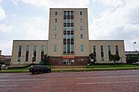
Smith County Courthouse in Tyler
|
||
|
||
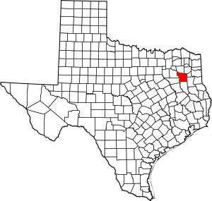
Location within the U.S. state of Texas
|
||
 Texas's location within the U.S. |
||
| Country | ||
| State | ||
| Founded | July 1846 | |
| Seat | Tyler | |
| Largest city | Tyler | |
| Area | ||
| • Total | 950 sq mi (2,500 km2) | |
| • Land | 921 sq mi (2,390 km2) | |
| • Water | 28 sq mi (70 km2) 3.0% | |
| Population
(2020)
|
||
| • Total | 233,479 | |
| • Estimate
(2022)
|
241,757 |
|
| • Density | 245.8/sq mi (94.9/km2) | |
| Time zone | UTC−6 (Central) | |
| • Summer (DST) | UTC−5 (CDT) | |
| Congressional district | 1st | |
Smith County is a place in Texas, a state in the United States. In 2020, about 233,479 people lived there. The main city, called the county seat, is Tyler. Smith County is named after James Smith, a brave general from the Texas Revolution. Smith County is also part of the larger Tyler city area.
Contents
Exploring Smith County's Past
The very first people known to live in the area of Smith County were the Caddo Indians. They lived here long before others arrived.
In July 1846, Smith County was officially formed. It separated from the Nacogdoches District. The county was named to honor James Smith, a general who fought in the Texas Revolution. At this time, Tyler was chosen as the main city for the county.
Camp Ford: A Historic Site
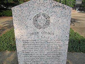
During the American Civil War, Camp Ford was the biggest prisoner-of-war camp west of the Mississippi River. Today, the original site of Camp Ford is a public park. It is owned by Smith County and looked after by the Smith County Historical Society.
The park has a kiosk, a paved walking trail, and signs that explain its history. There is also a rebuilt cabin and a picnic area. You can find Camp Ford on Highway 271, just north of Loop 323.
Learning About Local History
The Smith County Historical Society is a group that works to find, collect, and keep important items and information about Smith County's history. This group started in 1959. They help people learn about the past of this area. You can find more information on their website.
Smith County's Location and Roads
Smith County covers a total area of about 950 square miles. Most of this area, about 921 square miles, is land. The remaining 28 square miles, which is about 3%, is water. The county has many roads, including about 1,180 miles of two-lane county roads.
Main Roads in Smith County
 Interstate 20
 U.S. Highway 69
 U.S. Highway 80
 U.S. Highway 271
 State Highway 31
 State Highway 57
 State Highway 64
 State Highway 110
 State Highway 135
 State Highway 155
 Loop 49
 Loop 323
Neighboring Counties
Smith County shares its borders with several other counties:
- Wood County (to the north)
- Upshur County (to the northeast)
- Gregg County (to the east)
- Rusk County (to the southeast)
- Cherokee County (to the south)
- Henderson County (to the southwest)
- Van Zandt County (to the northwest)
People and Population in Smith County
| Historical population | |||
|---|---|---|---|
| Census | Pop. | %± | |
| 1850 | 4,292 | — | |
| 1860 | 13,392 | 212.0% | |
| 1870 | 16,532 | 23.4% | |
| 1880 | 21,863 | 32.2% | |
| 1890 | 28,324 | 29.6% | |
| 1900 | 37,370 | 31.9% | |
| 1910 | 41,746 | 11.7% | |
| 1920 | 46,769 | 12.0% | |
| 1930 | 53,123 | 13.6% | |
| 1940 | 69,090 | 30.1% | |
| 1950 | 74,701 | 8.1% | |
| 1960 | 86,350 | 15.6% | |
| 1970 | 97,096 | 12.4% | |
| 1980 | 128,366 | 32.2% | |
| 1990 | 151,309 | 17.9% | |
| 2000 | 174,706 | 15.5% | |
| 2010 | 209,714 | 20.0% | |
| 2020 | 233,479 | 11.3% | |
| 2022 (est.) | 241,757 | 15.3% | |
| U.S. Decennial Census 1850–2010 2010 2020 |
|||
In 2010, the population of Smith County was 209,714 people. This was a big increase from its population of 4,292 in 1850. By 2020, the population grew even more to 233,479.
The people living in Smith County come from many different backgrounds. In 2020, about 57.59% of the people were non-Hispanic white. About 16.28% were Black or African American. Other groups included American Indian or Alaska Native, Asian, Pacific Islander, and people of mixed races. About 20.25% of the population was Hispanic or Latino. These numbers show that Smith County, like many other places in the U.S., is becoming more diverse.
In 2021, the average income for a household in Smith County was about $63,115. The average value of a home owned by its residents was around $169,600. About 12.51% of the people in the county lived at or below the poverty line.
Education in Smith County
Many different school districts serve children in Smith County. These districts help students from kindergarten through high school.
Local School Districts
- Arp Independent School District
- Bullard Independent School District (also partly in Cherokee County)
- Chapel Hill Independent School District
- Gladewater Independent School District (also partly in Gregg County and Upshur County)
- Lindale Independent School District (also partly in Van Zandt County)
- Troup Independent School District (also partly in Cherokee County)
- Tyler Independent School District
- Van Independent School District (also partly in Van Zandt County)
- Whitehouse Independent School District
- Winona Independent School District
Colleges and Universities
For students who want to continue their education after high school, there are several colleges and universities in the area:
- Tyler Junior College
- Texas College
- University of Texas at Tyler
Media and News in Smith County
Smith County is part of a larger media area that includes Tyler, Longview, and Jacksonville. This means people in the county can watch local TV news and listen to radio stations.
Television and Radio
Some of the local TV channels include KLTV, KTRE-TV, KYTX-TV, KFXK-TV, KCEB-TV, and KETK-TV. For radio listeners, KTBB is an AM station based in Tyler that offers news and talk shows.
Newspapers
The main newspaper for Smith County is the Tyler Morning Telegraph. It is published daily in Tyler. You can also find news about the area in the Longview News-Journal, which is printed in Longview.
See also
 In Spanish: Condado de Smith (Texas) para niños
 | Frances Mary Albrier |
 | Whitney Young |
 | Muhammad Ali |


