
List of Recorded Texas Historic Landmarks (Grayson-Hudspeth) facts for kids
Texas is full of amazing old buildings and places that tell stories about the past! These special spots are called Recorded Texas Historic Landmarks (RTHLs). They are chosen by the Texas Historical Commission and local history groups because they are important parts of Texas history.
This page will show you some of these cool landmarks in these counties: Grayson, Gregg, Grimes, Guadalupe, Hale, Hall, Hamilton, Hansford, Hardeman, Hardin, Harris, Harrison, Hartley, Haskell, Hays, Hemphill, Henderson, Hidalgo, Hill, Hockley, Hood, Hopkins, Houston, Howard, and Hudspeth.
Contents
- Grayson County: Historic Places to Explore
- Gregg County: Landmarks of the East Texas Oil Boom
- Grimes County: Preserving Early Texas History
- Guadalupe County: Historical Gems of Seguin
- Hale County: Plainview's Historic Places
- Hall County: Landmarks of the Texas Panhandle
- Hamilton County: Historic Structures in Central Texas
- Hansford County: Landmarks of the Northern Panhandle
- Hardeman County: Quanah's Historic Sites
- Hardin County: Kountze and Silsbee Landmarks
- Harris County: Houston's Many Landmarks
- Harrison County: Marshall's Rich History
- Hartley County: Channing's Historic Sites
- Haskell County: Landmarks in the Rolling Plains
- Hays County: San Marcos and Beyond
- Hemphill County: Canadian's Historic Sites
- Henderson County: Athens and Surrounding Areas
- Hidalgo County: Rio Grande Valley History
- Hill County: Hillsboro's Historic Buildings
- Hockley County
- Hood County: Granbury's Historic Square
- Hopkins County: Sulphur Springs Landmarks
- Houston County: Crockett's Historic Treasures
- Howard County: Big Spring's Historic Sites
- Hudspeth County: Landmarks of West Texas
- Images for kids
What the Colors Mean
Some landmarks have extra special historical titles. The colors below show you the highest title they have:
| ⁕ This means the place is a National Historic Landmark. It's super important to the whole country! |
| ⁂ This place is part of a National Historic Landmark District. It helps make a big historical area special. |
| § This place is a State Historic Site. It's owned or managed by the state to protect its history. |
Grayson County: Historic Places to Explore
Grayson County has many interesting landmarks. These places tell us about the people and events that shaped the area.
Famous Birthplace and Old Buildings
- style="background:#A8EDEF"|Birthplace of Dwight D. Eisenhower
 §
§

This is the house where Dwight D. Eisenhower, who later became a U.S. President, was born in 1890. It's now a state historic site.
- style="background:#A8EDEF"|Captain N. A. Birge House
.jpg)
This historic house belonged to Captain N. A. Birge.
- Cold Springs Log Cabin School
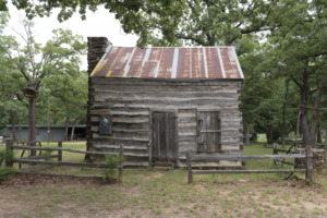
This old log cabin was once a school. It shows how schools looked long ago.
- style="background:#A8EDEF"|E. M. Kohl Building

.jpg)
This building is a historic landmark in Denison.
- style="background:#A8EDEF"|Federal Building (United States Courthouse)
.jpg)
This building serves as a United States Courthouse.
- First Presbyterian Church and Manse
.jpg)
This church and its manse (the minister's house) are historic.
- Grayson College
.jpg)
This college building has been a landmark since 1965.
- style="background:#A8EDEF"|Hall Furniture Building

This building is recognized for its historical importance.
- Martindale–Lackey–Hudgins House
.jpg)
This house is a Recorded Texas Historic Landmark.
- style="background:#A8EDEF"|Old Sherman Public Library

This building once served as the public library for Sherman.
- Samuel E. and Mary C. Marshall House
.jpg)
This house is a historic landmark in Whitewright.
- style="background:#A8EDEF"|Umphress–Taylor Home

This home is a recognized historic landmark.
Gregg County: Landmarks of the East Texas Oil Boom
Gregg County is known for its oil history. Many of its landmarks are connected to this important time.
Historic Homes and Community Buildings
- Bumpus House

This house was a landmark, but it sadly burned down in 2014. Its marker is now at the Gladewater Museum.
- style="background:#A8EDEF"|Everett Building
.jpg)
This building is a historic landmark in Longview.
- style="background:#A8EDEF"|F. L. Whaley House

This house is a recognized historic landmark.
- Harmon General Hospital Chapel

This chapel was part of a large hospital during World War II.
- Kilgore College Administration Building
.jpg)
This building is a key part of Kilgore College.
- Kilgore Public Library
.jpg)
This library building is a historic landmark.
- Longview Municipal Building and Central Fire Station
.jpg)
This building served as the city hall and fire station.
- Longview Train Depot
.jpg)
This train station is an important part of the city's transportation history.
- style="background:#A8EDEF"|Northcutt House

This house is a historic landmark.
- style="background:#A8EDEF"|Rembert-Harrison House

This house is a recognized historic landmark.
- St. Luke's United Methodist Church
.jpg)
This church is a historic landmark in Kilgore.
Grimes County: Preserving Early Texas History
Grimes County has many landmarks that show what life was like in early Texas.
Old Homes and Public Buildings
- style="background: #CCFFCC;"|Allen Home

This historic home is part of a larger historic district.
- style="background: #CCFFCC;"|Anderson Baptist Church

This church is a historic landmark.
- style="background: #CCFFCC;"|B. B. Goodrich House

This house is a historic landmark in Anderson.
- Foster Home

This home is a recognized historic landmark.
- style="background: #CCFFCC;"|Grimes County Courthouse


This courthouse is a very important historical building in Anderson.
- Jesse Youens Home

This home is a historic landmark in Navasota.
- Joseph Brooks Home

This home is a recognized historic landmark.
- style="background: #CCFFCC;"|Leake Building

This building is a historic landmark.
- style="background: #CCFFCC;"|Miss Sally Thompson School Building
This old school building is a historic landmark.
- Norwood House

This house is a historic landmark.
- Oakland Baptist Church

This church is a historic landmark in Roans Prairie.
- style="background: #CCFFCC;"|Old First National Bank of Navasota
.jpg)
This old bank building is a historic landmark.
- Plantersville Baptist Church

This church is a historic landmark in Plantersville.
- style="background:#A8EDEF"|R. B. S. Foster Home

This home is a very important historic landmark.
- Robert A. Horlock House

This house is a historic landmark.
- Sangster House

This house is a historic landmark.
- style="background:#A8EDEF"|Site of Piedmont Springs Resort
This was once a popular resort with natural springs.
- style="background:#A8EDEF"|Steele House

This house is a historic landmark.
- style="background: #CCFFCC;"|Steinhagen Log Cabin

This log cabin is a historic landmark in Anderson.
- The Terrell House

This house is a historic landmark.
Guadalupe County: Historical Gems of Seguin
Guadalupe County is home to many historic buildings, especially in Seguin, that show its rich past.
Notable Homes and Churches
- Andrew Herron Home

This house was a historic landmark, but the building is no longer there.
- Hard Scrabble
This house is a historic landmark in Seguin.
- style="background:#A8EDEF"|Hollamon House-Erskine House

This house is a very important historic landmark.
- style="background:#A8EDEF"|Humphrey House
This house is a historic landmark in Seguin.
- style="background:#A8EDEF"|Los Nogales

This historic site is a museum today.
- Moore House

This house is a historic landmark.
- style="background:#A8EDEF"|Sebastopol
2016-3.jpg)
This unique concrete house is a state historic site.
- style="background:#A8EDEF"|Sweet Home Vocational and Agricultural School

This school building is a historic landmark.
- style="background:#A8EDEF"|Tewes House

This house is a historic landmark near Marion.
- style="background: #CCFFCC;"|The Women's Club Rooms
.jpg)
This building served as a meeting place for the Women's Club.
Hale County: Plainview's Historic Places
Hale County has several landmarks, mostly found in Plainview.
Important Buildings in Plainview
- style="background: #CCFFCC;"|Montgomery Ward Building
This building was once a Montgomery Ward store, a big department store chain.
Hall County: Landmarks of the Texas Panhandle
Hall County, in the Texas Panhandle, has historic sites that tell about its past.
Key Buildings and a Famous Hotel
- style="background:#A8EDEF"|Hall County Courthouse

This courthouse is a very important historic building in Memphis.
- style="background:#A8EDEF"|Hotel Turkey
.jpg)
This historic hotel is a landmark in Turkey, Texas.
- Turkey High School
.jpg)
This old high school building is a historic landmark.
Hamilton County: Historic Structures in Central Texas
Hamilton County features several historic buildings, especially in the city of Hamilton.
Old Homes and Community Buildings
- Cole House
.jpg)
This house is a historic landmark.
- style="background:#A8EDEF"|Hamilton County Courthouse

This courthouse is a very important historic building in Hamilton.
- Knights of Pythias Lodge Hall

This building was a meeting place for the Knights of Pythias.
- Manning-Gordon-Henderson House

This house is a historic landmark.
- Presbyterian Church
.jpg)
This church is a historic landmark.
- Saint Mary's Episcopal Church

This church is a historic landmark.
Hansford County: Landmarks of the Northern Panhandle
Hansford County has a few historic landmarks, mainly in Spearman.
Historic Buildings in Spearman
- Brandt Building
This building is a historic landmark in Spearman.
- Spearman Hotel
This historic hotel was a landmark, but it has been demolished.
Hardeman County: Quanah's Historic Sites
Hardeman County has several historic landmarks, many of them in Quanah.
Churches and Public Buildings
- Chillicothe First Methodist Church

This church is a historic landmark.
- style="background: #CCFFCC;"|First Presbyterian Church of Quanah

This church is a historic landmark.
- style="background: #CCFFCC;"|Hardeman County Courthouse
.jpg)
This courthouse is a very important historic building.
- style="background: #CCFFCC;"|Hardeman County Jail

This old jail building is a historic landmark.
- style="background:#A8EDEF"|Railroad Depot, Old

This old train depot is a very important historic landmark.
- style="background: #CCFFCC;"|Simpson Building
This building is a historic landmark.
- Trinity Church of Quanah

This church is a historic landmark.
Hardin County: Kountze and Silsbee Landmarks
Hardin County has a few historic landmarks, including a notable house and an old industrial building.
Historic House and Industrial Site
- style="background:#A8EDEF"|Kirby-Hill House

This house is a historic landmark in Kountze.
- Silsbee Ice Plant
This old ice plant is a historic landmark in Silsbee.
Harris County: Houston's Many Landmarks
Harris County, home to Houston, has a huge number of Recorded Texas Historic Landmarks, showing its long and busy history.
Important Buildings and Homes in Houston

This building is a historic landmark in Houston.
- San Felipe Cottage

This historic cottage is located in Heritage Park.
- Pillot House

This house is a historic landmark in Sam Houston Heritage Park.

This church is a historic landmark in downtown Houston.
- Cedar Bayou Masonic Lodge No. 321, A. F. & A. M.

This lodge hall is a historic landmark in Baytown.
- Hall of Cedar Bayou Masonic Lodge No. 321, A. F. & A. M.
This is another part of the historic Masonic Lodge.

This building is a historic landmark in Houston.
- Houston Cotton Exchange and Board of Trade

This building was important for Houston's cotton trade.
- W. L. Foley Building

This building is a historic landmark.
- Hogg Building

This building is a historic landmark in Houston.

This old bakery building is a historic landmark.
- The Sheridan Apartments

These apartments are a historic landmark.
- Auditorium Hotel

This hotel is a historic landmark.
- DePelchin Faith Home

This building is a historic landmark.
- Trinity Episcopal Church

This church is a historic landmark.
- Houston Fire Station No. 7

This old fire station is a historic landmark.
- Clayton House

This house is a historic landmark.
- Baytown Post Office

This old post office building is a historic landmark.
- Fondren Mansion

This mansion is a historic landmark.
- Holcombe House

This house is a historic landmark.
- Houston Light Guard Armory

This building was once an armory and is now a museum.
- Wade and Mamie Irvin House

This house is a historic landmark in Morgan's Point.
- West Mansion

This mansion was a historic landmark, but it was torn down in 2019.
- Moore Log House

This log house is a historic landmark.
- Pioneer Memorial Log House

This log house is a historic landmark in Hermann Park.
- Blue Triangle Branch, Y. W. C. A. Building

This building is a historic landmark.
- Julia Ideson Building

This building is a historic landmark and part of the Houston Public Library.
- Magnolia Brewery Building

This old brewery building is a historic landmark.

This tall building is a historic landmark in Houston.
- Farnsworth & Chambers Building

This building is a historic landmark.
- Harris County 1910 Courthouse

This old courthouse is a historic landmark.

This house is a historic landmark.
- Hidalgo Park Quiosco

This park structure is a historic landmark.
- Sylvan Beach Pavilion

This pavilion is a historic landmark in La Porte.
Harrison County: Marshall's Rich History
Harrison County, with its county seat Marshall, has many historic homes and public buildings.
Historic Homes and Churches
- style="background:#A8EDEF"|Arnot House
.jpg)
This house is a historic landmark in Marshall.
- style="background:#A8EDEF"|Edgemont

This historic home is a landmark near Marshall.
- Elks Building

This building is a historic landmark.
- style="background:#A8EDEF"|First Methodist Church
.jpg)
This church is a historic landmark in Marshall.
- First Presbyterian Church
.jpg)
This church is a historic landmark.
- style="background:#A8EDEF"|Fry-Barry House
.jpg)
This house is a historic landmark.
- style="background: #CCFFCC;"|Ginocchio-Cook-Pedison House
.jpg)
This house is a historic landmark.
- style="background: #CCFFCC;"|Ginocchio Hotel and Restaurant
.jpg)
This historic building once served as a hotel and restaurant.
- style="background:#A8EDEF"|Hagerty-Harris House

This house is a historic landmark.
- style="background:#A8EDEF"|Harrison County Courthouse
.jpg)
This old courthouse is a very important historic building.
- John Barry Henderson Home
.jpg)
This home is a historic landmark.
- style="background:#A8EDEF"|Judge J. B. Williamson House

This house is a historic landmark.
- style="background:#A8EDEF"|Magnolia Hall

This historic home is a landmark.
- Marshall Hall
.jpg)
This building is a historic landmark at the university.
- style="background:#A8EDEF"|Pierce House
.jpg)
This house is a historic landmark.
- style="background:#A8EDEF"|Starr Family Home§
.jpg)
This historic home is a state historic site.
- style="background: #CCFFCC;"|Texas & Pacific Depot
.jpg)
This old train depot is a historic landmark.
- style="background: #CCFFCC;"|The Allen House
.jpg)
This house is a historic landmark.
- style="background:#A8EDEF"|The Belle Fry Gaines House

This house is a historic landmark.
- style="background:#A8EDEF"|The Hochwald House
.jpg)
This house is a historic landmark.
- style="background:#A8EDEF"|The Turner House
.jpg)
This house is a historic landmark.
- Todd-McKay-Wheat House
This house is a historic landmark.
- style="background:#A8EDEF"|Weisman-Hirsch House
.jpg)
This house is a historic landmark.
- Whetstone-Lancaster House
This house is a historic landmark.
- style="background: #CCFFCC;"|William Patillo House
This house is a historic landmark.
Hartley County: Channing's Historic Sites
Hartley County has several historic landmarks, many of them in Channing.
Churches and Public Buildings
- Channing United Methodist Church
This church is a historic landmark.
- style="background:#A8EDEF"|Hartley County Courthouse
_Channing,_Texas.jpg)
This courthouse is a very important historic building.
- style="background:#A8EDEF"|XIT General Office

This building was the main office for the huge XIT Ranch.
- style="background:#A8EDEF"|XIT Ranch Headquarters

This was the main place for the XIT Ranch, one of the biggest ranches in Texas history.
Haskell County: Landmarks in the Rolling Plains
Haskell County has a few historic landmarks, mostly in the city of Haskell.
Old Homes and a Railroad Depot
- J. U. Fields Home
This house is a historic landmark in Haskell.
- Old Railroad Depot
This old train depot is a historic landmark.
Hays County: San Marcos and Beyond
Hays County, known for its beautiful rivers and hills, has many historic landmarks, especially in San Marcos and Kyle.
Historic Homes and Public Buildings
- style="background: #CCFFCC;"|Alexander Gates & Lillian Johnson Thomas House

This house is a historic landmark.
- style="background:#A8EDEF"|Augusta Hofheinz House

This house is a historic landmark.
- style="background:#A8EDEF"|Beverly Hutchison House

This house is a historic landmark.
- Buda Christian Church

This church is a historic landmark in Buda.
- style="background:#A8EDEF"|Bunton Branch Bridge

This bridge is a very important historic landmark.
- style="background:#A8EDEF"|Burleson Home
This house is a historic landmark.
- style="background:#A8EDEF"|Cemetery Chapel

This chapel in the San Marcos City Cemetery is a historic landmark.
- style="background:#A8EDEF"|Charles Cock Home

This home is a very important historic landmark.
- style="background:#A8EDEF"|Claiborne Kyle Log House

This log house is a very important historic landmark.
- style="background:#A8EDEF"|Cora Jackman Donalson House
.jpg)
This house is a historic landmark.
- style="background:#A8EDEF"|Cumberland Presbyterian Church (Fort Street Presbyterian Church)

This church is a historic landmark.
- style="background: #CCFFCC;"|Dripping Springs Academy

This old school building is a historic landmark.
- Eli T. Merriman Home

This home is a historic landmark.
- style="background:#A8EDEF"|Farmers Union Gin Company

This old cotton gin is a historic landmark.
- style="background:#A8EDEF"|First United Methodist Church

This church is a historic landmark.
- style="background: #CCFFCC;"|George Thomas McGehee House

This house is a historic landmark.
- style="background:#A8EDEF"|Goforth-Harris House

This house is a historic landmark.
- style="background:#A8EDEF"|Heard-Baker House

This house is a historic landmark.
- style="background: #CCFFCC;"|Ike Wood House

This house is a historic landmark.
- J. H. and Abbie Barbee House

This house is a historic landmark.
- style="background:#A8EDEF"|James C. Lane House

This house is a historic landmark in Wimberley.
- James Lafayette and Eliza Pitts Malone House

This house is a historic landmark.
- style="background: #CCFFCC;"|John F. McGehee Home

This home is a historic landmark.
- style="background:#A8EDEF"|John Matthew Cape House

This house is a historic landmark.
- style="background:#A8EDEF"|John R. Dobie House

This house is a historic landmark in Wimberley.
- style="background: #CCFFCC;"|Joseph W. Earnest Home

This home is a historic landmark.
- style="background:#A8EDEF"|Kone-Cliett House

This house is a historic landmark.
- style="background: #CCFFCC;"|Kone-Yarbrough House

This house is a historic landmark.
- style="background:#A8EDEF"|Lloyd Gideon Johnson House

This house is a historic landmark.
- style="background: #CCFFCC;"|Marshall–Chapman Home

This home is a historic landmark in Dripping Springs.
- style="background:#A8EDEF"|McElroy-Severn House (Stagecoach House and Onion Creek Post Office)

This building served as a stagecoach stop and post office.
- style="background: #CCFFCC;"|O. T. Brown Home

This home is a historic landmark.
- Old D. A. Young Building

This old building is a historic landmark in Kyle.
- Old Fish Hatchery Office Building

This building was once an office for a fish hatchery.
- style="background:#A8EDEF"|Old Main

This is a very important historic building at Texas State University.
- Old Storey Home

This home is a historic landmark.
- style="background:#A8EDEF"|Ragsdale-Jackman-Yarbrough House

This house is a historic landmark.
- Robert Early McKie House

This house is a historic landmark.
- style="background: #CCFFCC;"|Robert Hixon Belvin Home

This home is a historic landmark.
- style="background:#A8EDEF"|Rylander-Kyle House
.jpg)
This house is a historic landmark.
- Sanders-Grosgebauer House

This house is a historic landmark.
- Southside School

This old school building is a historic landmark.
- The Calaboose

This small building was once a jail.
Hemphill County: Canadian's Historic Sites
Hemphill County, in the Texas Panhandle, has several historic landmarks, mainly in Canadian.
Banks, Jails, and Hospitals
- First National Bank of Canadian

This old bank building is a historic landmark.
- Glazier Calaboose
This small jail building is a historic landmark.
- Hemphill County Jail
This old jail building is a historic landmark.
- Jones Mansion
This mansion is a historic landmark in Canadian.
- The Former Canadian Hospital
This building once served as the Canadian Hospital.
- W. C. T. U. Building

This building is a historic landmark.
Henderson County: Athens and Surrounding Areas
Henderson County has several historic landmarks, with many in Athens.
Jails, Courthouses, and Churches
- 1925 Henderson County Jail
.jpg)
This old jail building is a historic landmark.
- style="background:#A8EDEF"|Faulk-Gauntt Building
.jpg)
This building is a historic landmark.
- Henderson County Courthouse
.jpg)
This courthouse is a historic landmark.
- Meredith Campground and Tabernacle
This campground and tabernacle are historic landmarks.
- Pioneer Oak
This historic oak tree is a landmark.
Hidalgo County: Rio Grande Valley History
Hidalgo County, in the Rio Grande Valley, has many historic landmarks that tell about its unique culture and development.
Historic Buildings and Churches
- American Legion Hall

This hall is a historic landmark in Donna.
- Buell School

This old school building is a historic landmark in Pharr.
- style="background:#A8EDEF"|Casa de Palmas

This hotel is a historic landmark in McAllen.
- style="background:#A8EDEF"|Cortez Hotel

This hotel is a historic landmark in Weslaco.
- D. Guerra & Sons Store
This old store is a historic landmark.
- Donna Central Elementary School

This old school building is a historic landmark.
- Edinburg Junior College Auditorium
This auditorium is a historic landmark.
- style="background:#A8EDEF"|Former Hidalgo Post Office
This old post office building is a historic landmark in Hidalgo.
- Kiwanis Club of Pharr

This building is a historic landmark.
- style="background: #CCFFCC;"|La Lomita Chapel

This historic chapel is a landmark near Mission.
- Lamar Junior High School
This old junior high school building is a historic landmark.
- style="background:#A8EDEF"|M. & J. Nelson Building

This building is a historic landmark in McAllen.
- McAllen Post Office
This old post office building is a historic landmark.
- Mercedes City Hall
This city hall building is a historic landmark.
- style="background:#A8EDEF"|Old Hidalgo County Courthouse

This old courthouse is a very important historic building.
- style="background:#A8EDEF"|Old Hidalgo County Jail
This old jail building is a very important historic landmark.
- Old Hidalgo County Jail

This old jail building is a historic landmark in Edinburg.
- Our Lady of Guadalupe Catholic Church

This church is a historic landmark in Mission.
- Paris Gum Factory
This old factory building is a historic landmark.
- Percy Herman House
This house is a historic landmark.
- style="background:#A8EDEF"|Rio Theater

This old theater is a historic landmark in Mission.
- San Juan Hotel

This hotel is a historic landmark.
- style="background:#A8EDEF"|Shary Building

This building is a historic landmark in Mission.
- Skaggs House

This house is a historic landmark in Weslaco.
- San Juan Plantation
This old plantation is a historic landmark.
- style="background:#A8EDEF"|St. Joseph's Church
This church is a historic landmark.
- style="background:#A8EDEF"|The Border Theater

This theater is a historic landmark in Mission.
- Weslaco City Hall
This city hall building is a historic landmark.
- Weslaco High School
This old high school building is a historic landmark.
Hill County: Hillsboro's Historic Buildings
Hill County has many historic landmarks, especially in Hillsboro and Hubbard.
Historic Homes and Public Buildings
- style="background: #CCFFCC;"|Abbott House

This house is a historic landmark in Hillsboro.
- Bond's Alley
.jpg)
This historic alley is a landmark in Hillsboro.
- style="background: #CCFFCC;"|Brin House
.jpg)
This house is a historic landmark.
- Carver Homestead

This homestead is a historic landmark in Whitney.
- Condor House
.jpg)
This house is a historic landmark in Hubbard.
- style="background: #CCFFCC;"|Davis Home

This home is a historic landmark.
- First Methodist Church of Hubbard

This church is a historic landmark.
- style="background:#A8EDEF"|Gebhardt Bakery

This old bakery building is a historic landmark.
- style="background: #CCFFCC;"|George L. and Roxie Brooks Porter Home
.jpg)
This home is a historic landmark.
- style="background:#A8EDEF"|Hill County Courthouse

This courthouse is a very important historic building.
- style="background:#A8EDEF"|Hill County Jail

This old jail building is a historic landmark.
- style="background:#A8EDEF"|Hillsboro Post Office Building

This old post office building is a historic landmark.
- Hubbard High School

This old high school building is a historic landmark.
- Itasca Railroad Depot
.jpg)
This old train depot is a historic landmark.
- style="background:#A8EDEF"|J. T. Baker House
This house is a historic landmark.
- J. W. Park Home
.jpg)
This home is a historic landmark in Itasca.
- style="background:#A8EDEF"|Katy Depot

This old train depot is a very important historic landmark.
- style="background: #CCFFCC;"|Lumpkin House
.jpg)
This house is a historic landmark.
- McDaniel Family Home
.jpg)
This home is a historic landmark.
- style="background: #CCFFCC;"|McKinnon - Anderson House
.jpg)
This house is a historic landmark.
- style="background: #CCFFCC;"|Old G. D. Tarlton House
.jpg)
This house is a historic landmark.
- Peoria Cumberland Presbyterian Church
.jpg)
This church is a historic landmark.
- style="background:#A8EDEF"|Pioneer Bank Building

This old bank building is a historic landmark.
- Rigsby Home
.jpg)
This home is a historic landmark in Hubbard.
- style="background: #CCFFCC;"|St. Mary's Episcopal Church
.jpg)
This church is a historic landmark.
- style="background:#A8EDEF"|Turner House

This house is a historic landmark near Itasca.
Hockley County
There are currently no Recorded Texas Historic Landmarks listed in Hockley County.
Hood County: Granbury's Historic Square
Hood County is famous for its historic square in Granbury, which has many important landmarks.
Historic Homes and Buildings in Granbury
- Aston House
.jpg)
This house is a historic landmark in Granbury.
- style="background: #CCFFCC;"|Aston-Landers Building
.jpg)
This building is a historic landmark on Granbury's square.
- style="background:#A8EDEF"|Baker-Carmichael House
.jpg)
This house is a historic landmark.
- style="background: #CCFFCC;"|Baker-Doyle Building
.jpg)
This building is a historic landmark.
- style="background: #CCFFCC;"|Baker-Rylee Building and Town Square Service Station
.jpg)
This building is a historic landmark on the town square.
- Bowden Kennon House
.jpg)
This house is a historic landmark.
- Cresson School
.jpg)
This old school building is a historic landmark in Cresson.
- Daniel-Harris Home
.jpg)
This home is a historic landmark.
- David L. Nutt Home

This home is a historic landmark.
- Dr. William and Eunice Walker House
.jpg)
This house is a historic landmark.
- style="background: #CCFFCC;"|E. A. Hannaford Building
.jpg)
This building is a historic landmark.
- E. A. Hannaford House
.jpg)
This house is a historic landmark.
- style="background: #CCFFCC;"|First National Bank
.jpg)
This old bank building is a historic landmark.
- First Presbyterian Church of Granbury
.jpg)
This church is a historic landmark.
- Former Acton Masonic Lodge Hall
.jpg)
This old lodge hall is a historic landmark in Acton.
- style="background: #CCFFCC;"|Glenn Brothers Building
.jpg)
This building is a historic landmark.
- Gordon Home
.jpg)
This home is a historic landmark.
- Granbury Light Plant
.jpg)
This old light plant is a historic landmark.
- style="background: #CCFFCC;"|Granbury Opera House

This historic opera house is a landmark.
- Granbury Railroad Depot
.jpg)
This old train depot is a historic landmark.
- style="background: #CCFFCC;"|Hardware and Tin Shop
.jpg)
This old shop building is a historic landmark.
- Harris Building
.jpg)
This building is a historic landmark.
- style="background: #CCFFCC;"|Haynes-Burns-Ewell Building
.jpg)
This building is a historic landmark.
- Holderness-Aiken House
.jpg)
This house is a historic landmark.
- style="background: #CCFFCC;"|Hood County Courthouse
.jpg)
This courthouse is a very important historic building.
- style="background: #CCFFCC;"|Hood County Jailhouse
.jpg)
This old jail building is a very important historic landmark.
- J.D. and Georgia Brown House

This house is a historic landmark.
- style="background: #CCFFCC;"|J.F. and J. Nutt Building
.jpg)
This building is a historic landmark.
- Lees-Bryan House
.jpg)
This house is a historic landmark.
- Smith-Savage House
.jpg)
This house is a historic landmark.
- style="background: #CCFFCC;"|The Fair
.jpg)
This building is a historic landmark.
- Thrash-Landers-Hiner House
.jpg)
This house is a historic landmark.
- Tolar Tabernacle
.jpg)
This tabernacle is a historic landmark in Tolar.
- W. D. and Essie Gafford House
.jpg)
This house is a historic landmark in Lipan.
- style="background:#A8EDEF"|Wright-Henderson-Duncan House
.jpg)
This house is a historic landmark.
Hopkins County: Sulphur Springs Landmarks
Hopkins County has several historic landmarks, mainly in Sulphur Springs.
Courthouses and Historic Homes
- Ashcroft House
.jpg)
This house is a historic landmark.
- style="background:#A8EDEF"|Hopkins County Courthouse
.jpg)
This courthouse is a very important historic building.
Houston County: Crockett's Historic Treasures
Houston County, one of the oldest counties in Texas, has many historic landmarks, especially in Crockett.
Historic Homes and Churches
- C. R. Rich Building

This building is a historic landmark in Lovelady.
- style="background:#A8EDEF"|Downes-Aldrich House

This house is a historic landmark in Crockett.
- Early Bank Building

This old bank building is a historic landmark.
- First Christian Church of Grapeland

This church is a historic landmark.
- House Built by A. T. Monroe
This house is a historic landmark.
- style="background:#A8EDEF"|Houston County Courthouse

This courthouse is a very important historic building.
- style="background:#A8EDEF"|Monroe-Crook House

This house is a historic landmark.
- Patton-Buchanan Building

This building is a historic landmark.
- W.V. McConnell Building

This building is a historic landmark.
Howard County: Big Spring's Historic Sites
Howard County has several historic landmarks, mainly in Big Spring.
First Buildings and Hotels
- First Permanent Building in Big Spring
This building was the first permanent structure in Big Spring.
- style="background:#A8EDEF"|Potton House

This house is a very important historic landmark.
- style="background:#A8EDEF"|Settles Hotel

This historic hotel is a landmark.
- St. Thomas Catholic Church

This church is a historic landmark.
Hudspeth County: Landmarks of West Texas
Hudspeth County, located in West Texas, has a few historic landmarks, including its courthouse.
Mercantile and Courthouse
- Fort Hancock Mercantile
This old store is a historic landmark in Fort Hancock.
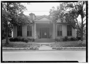
- style="background:#A8EDEF"|Hudspeth County Courthouse

This courthouse is a very important historic building in Sierra Blanca.
- Sierra Blanca Methodist Church
This church is a historic landmark.
Images for kids
-

More images for Eisenhower Birthplace State Historic Site
-
More images for Capt. Noble Allan Birge House
-
More images for Cold Springs Log Cabin School
-
More images for Ernst Martin Kohl Building
-
More images for Paul Brown United States Courthouse
-
More images for Hall Furniture Building, Sherman TX
-
More images for Everett Building (Longview, Texas)
-
More images for Whaley House (Longview, Texas)
-
More images for Kilgore College Administration Building
-
More images for Kilgore Public Library
-
More images for Longview Municipal Building and Central Fire Station
-
More images for Longview (Amtrak station)
-
More images for Northcutt House
-
More images for Frank Taylor and Kate Womack Rembert House
-
More images for St. Luke's United Methodist Church (Kilgore, Texas)
-
More images for Anderson Baptist Church
-
More images for B. B. Goodrich House
-
More images for Grimes County Courthouse (Anderson, Texas)
-
More images for R. B. S. Foster Home
-
More images for Site of Piedmont Springs Resort
-
More images for Steele House Navasota Wiki
-
More images for Andrew Herron House
-
More images for Dublin Plantation
-
More images for Erskine House No. 2
-
More images for Erskine House
-
More images for Los Nogales Museum
-
More images for Sevastopol (house)
-
More images for Sweet Home Vocational and Agricultural School
-
More images for Edward tewes house 2013
-
More images for Women's Club Rooms
-
More images for Montgomery Ward Building
-
More images for Hall County Courthouse, Memphis, TX
-
More images for HotelTurkey (1 of 1)
-
More images for Turkey High School Wiki (1 of 1)
-
More images for Hamilton County Courthouse (Texas)
-
More images for Knights of Pythias Lodge Hall Hamilton Wiki
-
More images for First Presbyterian Church Hamilton (1 of 1)
-
More images for St. Marys Episcopal Hamilton Wiki
-
More images for XIT General Office
-
More images for XIT General Office
-
More images for Chillicothe First Methodist Church
-
More images for First Presbyterian Church of Quanah
-
More images for Hardeman County Courthouse (Texas)
-
More images for Former Hardeman County Texas Jail
-
More images for Quanah, Acme and Pacific Depot
-
More images for Trinity Church of Quanah Texas
-
More images for Kirby hill house kountze texas 2014
-
More images for Silsbee Ice Plant
-
More images for Forum of Civics of River Oaks Garden Club, Houston.jpg
-
More images for San Felipe Cottage in Sam Houston Park, Houston, Texas.jpg
-
More images for Pillot House in Sam Houston Park, Houston, Texas.jpg
-
More images for Annunciation Church -- Downtown Houston.jpg
-
More images for Cedar Bayou Masonic Lodge No. 321, A. F. & A. M.jpg
-
More images for Sweeney, Coombs & Fredricks Building, Houston.jpg
-
More images for Houston Cotton Exchange And Board of Trade.jpg
-
More images for The W. L. Foley Building.jpg
-
More images for Hogg Building -- Also Called Hogg Palace.jpg
-
More images for The Kennedy Bakery.jpg
-
More images for The Sheridan Apartments, Houston, Texas.jpg
-
More images for Auditorium Hotel, Houston.jpg
-
More images for DePelchin Faith Home -- Houston, Texas.jpg
-
More images for Trinity Episcopal Church, Houston.jpg
-
More images for Houston Fire Station No. 7.jpg
-
More images for Clayton House Houston's Genealogy Library.jpg
-
More images for Old Baytown Post Office.jpg
-
More images for Fondren Mansion -- Houston.jpg
-
More images for Holcombe House, Houston.jpg
-
More images for Originally the Houston Light Guard Armory -- Today the Buffalo Soldiers National Museum.jpg
-
More images for Wade and Mamie Irvin House.jpg
-
More images for Front of James and Jessie West Mansion, Harris, County, Texas.jpg
-
More images for Moore Log House -- Houston, Texas.jpg
-
More images for Pioneer Memorial Log House -- Houston.jpg
-
More images for Blue Triangle Branch, Y.W.C.A. Building -- Houston, Texas.jpg
-
More images for Houston Public Library Julia Ideson Building.jpg
-
More images for Magnolia Brewery Building.jpg
-
More images for The Gulf Building Houston Texas.jpg
-
More images for Farnsworth & Chambers Building Houston NASA HQ.jpg
-
More images for Harris County 1910 Courthouse Restored Houston Texas.jpg
-
More images for James_L_Autry_House_on_Courtlandt_Place_in_Houston,_Texas.jpg
-
More images for Hidalgo Park Quiosco in Houston.jpg
-
More images for Sylvan Beach Pavilion 2.jpg
-
More images for ArnotHouse1 (1 of 1).jpg
-
More images for Edgemont.jpg
-
More images for Elks Building, Marshall, Texas.jpg
-
More images for Marshall October 2016 37 (First United Methodist Church).jpg
-
More images for Marshall October 2016 24 (First Presbyterian Church).jpg
-
More images for Marshall October 2016 23 (Fry-Barry House).jpg
-
More images for Marshall October 2016 40 (The Ginocchio Home).jpg
-
More images for Marshall October 2016 44 (Ginocchio Hotel and Restaurant).jpg
-
More images for Hagerty1.JPG
-
More images for Marshall October 2016 35 (Old Harrison County Courthouse).jpg
-
More images for Fannie Ratchford 1970 0914 (10929751893).jpg
-
More images for DialHouse.jpg
-
More images for PierceHome.jpg
-
More images for East Texas Baptist University October 2016 10 (Marshall Hall).jpg
-
More images for OldPierceHouse (1 of 1).jpg
-
More images for Marshall October 2016 17 (Starr Family Home).jpg
-
More images for Marshall October 2016 41 (Texas and Pacific Railway Depot & Museum).jpg
-
More images for The Allen House
-
More images for JohnStinson1.JPG
-
More images for HochwaldHouse1 (1 of 1).jpg
-
More images for Marshall October 2016 14 (Turner House).jpg
-
More images for WeismanHirschHouse (1 of 1).jpg
-
More images for Historic American Buildings Survey, Harry L. Starnes, Photographer November 18, 1936 FRONT AND EAST SIDE ELEVATION. - Whetstone House, Marshall, Harrison County, TX HABS TEX,102-MARSH,6-2.tif
-
More images for Hartley County Courthouse (Built 1906) Channing, Texas.jpg
-
More images for XIT General Office, Channing, TX IMG 4932.JPG
-
More images for Revised XIT Ranch office, Channing, TX IMG 4935.JPG
-
More images for Alexander Thomas House San Marcos Texas 2023.jpg
-
More images for Augusta hofheinz house 2013.jpg
-
More images for Hutchison house san marcos 2013.jpg
-
More images for Buda christian church 2013.jpg
-
More images for Bunton branch bridge 2009.jpg
-
More images for Cemetery chapel 2010.jpg
-
More images for Cock house 2013.jpg
-
More images for Claiborne Kyle Log House.JPG
-
More images for Kyle-tx2016-38(cora-jackman-donalson-house).jpg
-
More images for Fort street presbyterian church 2012.jpg
-
More images for Dripping springs academy 2013.jpg
-
More images for Eli Merriman Home San Marcos Texas 2023.jpg
-
More images for Farmers union cotton gin 2012.jpg
-
More images for San Marcos - First United Methodist Church.jpg
-
More images for George McGehee House San Marcos Texas 2023.jpg
-
More images for Goforth harris house 2013.jpg
-
More images for Heard house 2008.jpg
-
More images for 227 Mitchell, San Marcos, Texas.JPG
-
More images for Barbee House San Marcos Texas 2023.jpg
-
More images for Jamesclane1.jpg
-
More images for James Malone House San Marcos Texas 2023.jpg
-
More images for John McGehee Home San Marcos Texas 2023.jpg
-
More images for Cape house san marcos 2013.jpg
-
More images for JohnRDobie1.jpg
-
More images for Joseph Earnest Home San Marcos Texas 2023.jpg
-
More images for Kone cliett house 2013.jpg
-
More images for Kone Yarbrough House San Marcos Texas 2023.jpg
-
More images for Johnson house san marcos 2008.jpg
-
More images for Marshall chapman home 2013.jpg
-
More images for Onioncreekpostoffice1.jpg
-
More images for OT Brown Home San Marcos Texas 2023.jpg
-
More images for Old D.A. Young Building 1881 Kyle, Texas.JPG
-
More images for Old Fish Hatchery Office San Marcos Texas 2023.jpg
-
More images for OldMainatTSU.jpg
-
More images for Old Storey Home San Marcos Texas 2023.jpg
-
More images for Ragsdale jackman yarbough house 2013.jpg
-
More images for Robert McKie House San Marcos Texas 2023.jpg
-
More images for Robert Belvin Home San Marcos Texas 2023.jpg
-
More images for San-marcos-tx2017-126(rylander-kyle-house).jpg
-
More images for Sanders Grosgebauer House San Marcos Texas 2023.jpg
-
More images for Southside School San Marcos Texas 2023.jpg
-
More images for Hays calaboose 2013.jpg
-
More images for Happy State Bank, Canadian, TX IMG 6065.JPG
-
More images for Hemphill County Jail
-
More images for Library in Canadian, TX IMG 6075.JPG
-
More images for Athens October 2017 09 (Henderson County Jail).jpg
-
More images for FrandandGauntt1 (1 of 1).jpg
-
More images for Henderson County Courthouse, Athens, Texas (8529938442).jpg
-
More images for American Legion Hall Donna Texas 2021.jpg
-
More images for Buell School Pharr Texas 2021.jpg
-
More images for Casa de Palmas 2012-09-13 14-05-27.jpg
-
More images for Cortez Hotel 2012-09-13 14-00-10.jpg
-
More images for JP LeNoir Elementary School Donna Texas 2021.jpg
-
More images for Kiwanis Club of Pharr Texas 2021.jpg
-
More images for La Lomita Chapel.JPG
-
More images for M and J Nelson Building 2012-09-13 14-03-43.jpg
-
More images for Old Hidalgo Couny Courthouse, Hidalgo, Texas.JPG
-
More images for Old Hidalgo County Jail Edinburg Texas 2021.jpg
-
More images for Our Lady of Guadalupe Catholic Church in Mission, Texas LCCN2014630427.tif
-
More images for Teatro La Paz.JPG
-
More images for San Juan Hotel.jpg
-
More images for Front View Shary Building.jpg
-
More images for Skaggs House Frontera Audubon Weslaco TX.jpg
-
More images for Border Theatre.jpg
-
More images for Abbott House Hillsboro Texas 2019.jpg
-
More images for Bond Alley Hillsboro Wiki (1 of 1).jpg
-
More images for Brin House Hillsboro Wiki (1 of 1).jpg
-
More images for Carver Homestead.jpg
-
More images for Condor House Hubbard Wiki (1 of 1).jpg
-
More images for Davis House Hillsboro Texas 2019.jpg
-
More images for FirstUnitedMethodistChurchHubbardWiki.jpg
-
More images for Hillsborobakery2.JPG
-
More images for Porter House Wiki (1 of 1).jpg
-
More images for Hill county courthouse 2013.jpg
-
More images for HillCountyJail1color.JPG
-
More images for Hillsboro, TX, City Library IMG 7105.JPG
-
More images for Hubbard High School.JPG
-
More images for Itasca Texas Train Depot ws (1 of 1).jpg
-
More images for JWPark House (1 of 1).jpg
-
More images for Hillsborotraindepot1color.JPG
-
More images for Lumpkin House Hillsboro Wiki (1 of 1).jpg
-
More images for McDaniel Family House Hubbard Wiki (1 of 1).jpg
-
More images for McKinnon - Anderson House Hillsboro Wiki (1 of 1).jpg
-
More images for Tarlton House Hillsboro Wiki (1 of 1).jpg
-
More images for Peoria Cumberland Presbyterian Church Hillsboro Wiki (1 of 1).jpg
-
More images for Farmers National Bank.JPG
-
More images for Rigsby House Hubbard Wiki (1 of 1).jpg
-
More images for St. Mary's Episcopal Church Hillsboro Wiki (1 of 1).jpg
-
More images for Randle - Turner House, Itasca, Hill County, Texas.jpg
-
More images for Aston House Granbury (1 of 1).jpg
-
More images for Granbury June 2018 42 (Destiny - Aston-Landers Building).jpg
-
More images for Granbury June 2018 47 (Baker-Carmichael House).jpg
-
More images for BakerDoyleBuilding (1 of 1).jpg
-
More images for Granbury June 2018 44 (The Fillin' Station - Baker-Rylee Building and Town Square Service Station).jpg
-
More images for Bowden Kennon House Granbury Wiki (1 of 1).jpg
-
More images for Cresson School 2 (1 of 1).jpg
-
More images for Daniel-Harris Home (1 of 1).jpg
-
More images for David L. Nutt House.JPG
-
More images for Walker House (1 of 1).jpg
-
More images for Granbury June 2018 37 (Home Sweet Home and Cendera Funding - E. A. Hannaford Building and Boyle Building).jpg
-
More images for Hannaford House (1 of 1).jpg
-
More images for Granbury June 2018 39 (First National Bank).jpg
-
More images for Granbury June 2018 03 (First Presbyterian Church).jpg
-
More images for Acton Masonic Lodge (1 of 1).jpg
-
More images for Granbury June 2018 41 (Turquoise Tumbleweed - Glenn Brothers Building).jpg
-
More images for Granbury June 2018 48 (Dora Lee Langdon Cultural and Educational Center - Gordon Home).jpg
-
More images for Granbury June 2018 11 (Granbury Light Plant).jpg
-
More images for Granbury Opera House at Twilight.JPG
-
More images for Granbury June 2018 13 (Granbury Railroad Depot).jpg
-
More images for Granbury June 2018 40 (Caylor Creek Boutique - Hardware and Tin Shop).jpg
-
More images for Granbury June 2018 29 (Paradise Bistro & Coffee Co., The Paisley Buffalo, and Merry Jayne's - Harris Building).jpg
-
More images for Granbury June 2018 31 (Central Texas Title - Haynes-Burns-Ewell Building).jpg
-
More images for Holderness-Aikens House (1 of 1).jpg
-
More images for Granbury June 2018 30 (Hood County Courthouse).jpg
-
More images for Granbury June 2018 19 (Hood County Museum - Hood County Jailhouse).jpg
-
More images for J. D. and Georgia Brown House, Granbury, Texas.jpg
-
More images for Granbury June 2018 23 (The Nutt House Hotel - J.F. and J. Nutt Building).jpg
-
More images for LeesBryanHouse (1 of 1).jpg
-
More images for Smith-Savage House Granbury Wiki (1 of 1).jpg
-
More images for Granbury June 2018 43 (Magnolia Realty - The Fair).jpg
-
More images for ThrashLandersHinerHouse (1 of 1).jpg
-
More images for Tolar Tabernacle Wiki (1 of 1).jpg
-
More images for W. D. and Essie Gafford House Lipan (1 of 1).jpg
-
More images for Granbury June 2018 66 (Wright-Henderson-Duncan House).jpg
-
More images for Ashcroft House (1 of 1).jpg
-
More images for Sulphur Springs June 2015 02 (Hopkins County Courthouse).jpg
-
More images for Lovelady-rich-building.jpg
-
More images for DownesAldrichHouse1.JPG
-
More images for Early bank building crockett tx.jpg
-
More images for First Christian Church of Grapeland.jpg
-
More images for Historic American Buildings Survey, Harry L. Starnes, Photographer June 2, 1936 FRONT ELEVATION. - Monroe-Coleman House, 707 East Houston Street, Crockett, Houston County, TX HABS TEX,113-CROC,1-1.tif
-
More images for HoustonCountyCourtHouse1.JPG
-
More images for DownesHouse1.JPG
-
More images for Patton buchanan bldg crockett tx.jpg
-
More images for W v mcconnell building crockett tx.jpg
-
More images for Potton House Big Spring Texas.jpg
-
More images for Big Spring Texas Settles Hotel 2013.jpg
-
More images for ST THOMAS CATHOLIC CHURCH pic2.jpg
-
More images for Hudspeth county courthouse 2009.jpg
