
Pampa, Texas facts for kids
Quick facts for kids
Pampa, Texas
|
|
|---|---|
|
City
|
|

Pampa business district
|
|
 |
|
| Country | United States |
| State | Texas |
| County | Gray |
| Government | |
| • Type | Council-Manager |
| Area | |
| • Total | 9.02 sq mi (23.36 km2) |
| • Land | 9.02 sq mi (23.36 km2) |
| • Water | 0.00 sq mi (0.00 km2) |
| Elevation | 3,225 ft (983 m) |
| Population
(2020)
|
|
| • Total | 16,867 |
| • Density | 1,869.96/sq mi (722.05/km2) |
| Time zone | UTC-6 (Central (CST)) |
| • Summer (DST) | UTC-5 (CDT) |
| ZIP codes |
79065-79066
|
| Area code(s) | 806 |
| FIPS code | 48-54912 |
| GNIS feature ID = | 1364740 |
Pampa is a city located in Gray County, Texas, in the United States. The name "Pampa" comes from the Quechua word for "plain," which means a large, flat area of land. In 2020, about 16,867 people lived there. Pampa is the main city and county seat of Gray County. It is also the most important city in the Pampa micropolitan area, which includes both Gray and Roberts Counties. The city was named after the Pampas Lowlands, which are vast grasslands found in South America.
Every July, Pampa hosts the Top o' Texas Rodeo. This event brings cowboys and cowgirls from Texas and nearby states to Gray County. You can also visit the White Deer Land Company Museum in downtown Pampa. It has interesting exhibits about ranching and the history of the area.
Contents
History of Pampa
The city of Pampa has a rich history, starting with the arrival of the railroad.
How Pampa Began
In 1888, the Santa Fe Railroad built its tracks through the area where Pampa is now. A train station and a telegraph office were set up. George Tyng, who managed the White Deer Lands ranch, planned out the town.
The town was first called "Glasgow," then "Sutton." Mr. Tyng suggested changing the name to "Pampa." He chose this name because it reminded him of the pampas grasslands in South America.
Timothy Dwight Hobart helped the town grow. He sold land plots only to people who promised to live there and develop the area. Soon, Pampa became an important center for farming.
Oil Boom and Growth
In 1916, gas and oil were found in the Texas Panhandle. This discovery led to a big oil boom, and Pampa grew very quickly. Because of this growth, the government seat of Gray County was moved from Lefors to Pampa in 1928.
During World War II, the Army Air Forces Training Command ran the Pampa Army Air Field. This base was active from 1942 to 1945. It was located about 10 miles east of Pampa, near the intersection of SH 152 and FM 1474.
The 1995 Tornado
On June 8, 1995, a very strong tornado hit Pampa. It struck the industrial part of town on the west side. The tornado destroyed or damaged about 250 businesses and homes.
This tornado caused about $30 million in damage. It was the most expensive and destructive tornado ever recorded in Pampa. The tornado's path was three miles long and 200 yards wide. At its strongest, it was rated an F4 on the Fujita scale, which measures tornado intensity.
Geography and Location
Pampa is located in the northwestern part of Gray County. According to the United States Census Bureau, the city covers about 9.02 square miles (23.2 square kilometers) of land. There is no water area within the city limits.
Major Roads and Highways
U.S. Route 60 goes through Pampa. If you head northeast on US 60, you'll reach Canadian, which is about 46 miles away. Going southwest on US 60 will take you to Amarillo, about 54 miles away.
Texas State Highway 70 also crosses US 60 in the southwestern part of Pampa. Traveling north on SH 70 leads to Perryton, about 62 miles away. If you go south on SH 70, you'll reach Interstate 40, which is about 24 miles from Pampa.
Population and People
The number of people living in Pampa has changed over the years.
| Historical population | |||
|---|---|---|---|
| Census | Pop. | %± | |
| 1920 | 987 | — | |
| 1930 | 10,470 | 960.8% | |
| 1940 | 12,895 | 23.2% | |
| 1950 | 16,583 | 28.6% | |
| 1960 | 24,664 | 48.7% | |
| 1970 | 21,726 | −11.9% | |
| 1980 | 21,396 | −1.5% | |
| 1990 | 19,959 | −6.7% | |
| 2000 | 17,887 | −10.4% | |
| 2010 | 17,994 | 0.6% | |
| 2020 | 16,867 | −6.3% | |
| 1920–2000, 2010, 2020 | |||
What the 2020 Census Shows
The 2020 United States census counted 16,867 people living in Pampa. There were 6,601 households and 4,234 families in the city.
| Race | Number | Percentage |
|---|---|---|
| White (NH) | 10,073 | 59.72% |
| Black or African American (NH) | 444 | 2.63% |
| Native American or Alaska Native (NH) | 111 | 0.66% |
| Asian (NH) | 113 | 0.67% |
| Some Other Race (NH) | 37 | 0.22% |
| Mixed/Multi-Racial (NH) | 595 | 3.53% |
| Hispanic or Latino | 5,494 | 32.57% |
| Total | 16,867 |
What the 2010 Census Showed
In 2010, Pampa had 17,994 residents. This was a small increase from the year 2000. The city had about 2,008 people per square mile.
Most of the people in Pampa were White (80.9%). About 3.3% were Black, and 0.8% were Native American or Alaskan Native. About 0.4% were Asian, and 2.6% reported having two or more races. People of Hispanic or Latino background made up 26% of the population.
There were 7,123 households in Pampa between 2006 and 2010. On average, each household had 2.6 people. About 27% of the population was under 18 years old, and 8.1% were under 5 years old. People over 65 years old made up 16% of the population.
The average income for a household was $40,358. The average income per person was $22,025. About 76.2% of people owned their homes. The average value of a home was $65,300.
Media and News
Pampa has local newspapers and radio stations that keep residents informed.
Local Newspaper
The Pampa News is a local newspaper published in Pampa. It serves Pampa and the surrounding areas of Gray County. The paper is published three times a week.
Radio Stations
Pampa is served by four commercial radio stations. KGRO 1230 AM, KOMX 100.3 FM, and KRWP 103.3 FM provide local news for the Panhandle region. KGRO started broadcasting in 1966 and has been the long-time home for Pampa Harvester sports. These stations are owned by Southwest Media Group-Pampa LLC.
KHNZ 101.3 FM is another station that plays classic country music. It is owned by Route 66 Media of Shamrock.
Education in Pampa
Pampa offers various educational opportunities for students of all ages.
Public Schools
The city's public schools are part of the Pampa Independent School District. This district manages four elementary schools: Austin, Lamar, Travis, and Wilson. There is also one junior high school.
Older students attend Pampa High School. The Pampa Learning Center is also part of the school system, offering a different learning environment.
College Education
For higher education, Pampa has a branch of Clarendon College. This branch is called the Pampa Center.
Lovett Memorial Library
The Lovett Memorial Library is an important part of Pampa's community. The library building was officially opened on January 18, 1955.
In 1985, the Harrington Foundation from Amarillo helped the library. They paid for the library's records to be put on computers. This allowed the library to join a group with most other public libraries in the Panhandle region.
By the mid-1990s, the library building was getting old. It also did not meet the rules of the Americans for Disabilities Act (ADA). In October 1995, it was announced that Mrs. Ruth Ann Holland had left $500,000 to the Library Foundation in her will.
In 1996, the Lovett Library Foundation, which managed Mrs. Holland's gift and other donations, announced a plan. They would extensively renovate the old building. In January 1998, the library staff, books, and equipment moved. They went to the old B. M. Baker school on the south side of town. The library was set up in the cafeteria and a classroom area there.
This move allowed the old building on Houston Street to be renovated. The children's area was moved to the second floor. A bridge was built to connect the second floor to other children's rooms. An elevator was installed, and new shelves, lighting, and ceiling tiles were added. The building was made fully compliant with ADA rules.
In June 2003, R. L. Franklin, a well-known rancher from Pampa, announced a gift. He would donate two statues to the library to celebrate the 50th anniversary of its opening in January 1955. One statue, by Don Ray of Channing, shows a seated woman reading to a child. This statue is placed in front of the library. Another statue, called "Pioneer Woman," was created by David Frech of New York. It was placed in the library's Reading Garden. Both statues were dedicated to four local women who had a long history of involvement with the library, including Mr. Franklin's mother. The statues were dedicated on January 9, 2005. The author Elmer Kelton was a special guest speaker at one of the dedication events.
Climate in Pampa
Pampa has a humid subtropical climate. This type of climate is known for hot, humid summers and mild winters.
The hottest temperature ever recorded in Pampa was 111°F (44°C) on June 25, 1980. The coldest temperature recorded was -12°F (-24°C) on January 11, 1962.
| Climate data for Pampa, Texas, 1991–2020 normals, extremes 1908–present | |||||||||||||
|---|---|---|---|---|---|---|---|---|---|---|---|---|---|
| Month | Jan | Feb | Mar | Apr | May | Jun | Jul | Aug | Sep | Oct | Nov | Dec | Year |
| Record high °F (°C) | 85 (29) |
89 (32) |
93 (34) |
98 (37) |
104 (40) |
111 (44) |
109 (43) |
109 (43) |
105 (41) |
99 (37) |
91 (33) |
85 (29) |
111 (44) |
| Mean maximum °F (°C) | 72.4 (22.4) |
77.0 (25.0) |
84.2 (29.0) |
89.3 (31.8) |
95.1 (35.1) |
99.4 (37.4) |
101.8 (38.8) |
100.2 (37.9) |
96.8 (36.0) |
90.5 (32.5) |
80.7 (27.1) |
72.5 (22.5) |
103.3 (39.6) |
| Mean daily maximum °F (°C) | 50.2 (10.1) |
53.6 (12.0) |
62.7 (17.1) |
70.9 (21.6) |
79.5 (26.4) |
88.4 (31.3) |
92.8 (33.8) |
91.3 (32.9) |
83.7 (28.7) |
72.5 (22.5) |
60.4 (15.8) |
50.4 (10.2) |
71.4 (21.9) |
| Daily mean °F (°C) | 36.7 (2.6) |
39.6 (4.2) |
48.1 (8.9) |
56.4 (13.6) |
65.9 (18.8) |
75.5 (24.2) |
79.9 (26.6) |
78.4 (25.8) |
70.8 (21.6) |
58.7 (14.8) |
46.6 (8.1) |
37.5 (3.1) |
57.8 (14.4) |
| Mean daily minimum °F (°C) | 23.2 (−4.9) |
25.7 (−3.5) |
33.4 (0.8) |
41.9 (5.5) |
52.3 (11.3) |
62.5 (16.9) |
66.9 (19.4) |
65.6 (18.7) |
58.0 (14.4) |
44.9 (7.2) |
32.8 (0.4) |
24.7 (−4.1) |
44.3 (6.8) |
| Mean minimum °F (°C) | 8.5 (−13.1) |
10.7 (−11.8) |
17.1 (−8.3) |
26.9 (−2.8) |
37.6 (3.1) |
51.2 (10.7) |
59.0 (15.0) |
57.4 (14.1) |
44.0 (6.7) |
28.5 (−1.9) |
16.6 (−8.6) |
8.7 (−12.9) |
2.9 (−16.2) |
| Record low °F (°C) | −12 (−24) |
−11 (−24) |
−6 (−21) |
12 (−11) |
25 (−4) |
40 (4) |
51 (11) |
47 (8) |
31 (−1) |
12 (−11) |
5 (−15) |
−8 (−22) |
−12 (−24) |
| Average precipitation inches (mm) | 0.79 (20) |
0.63 (16) |
1.46 (37) |
2.21 (56) |
2.84 (72) |
3.19 (81) |
2.50 (64) |
3.09 (78) |
1.93 (49) |
2.22 (56) |
0.98 (25) |
0.95 (24) |
22.79 (578) |
| Average snowfall inches (cm) | 3.3 (8.4) |
3.3 (8.4) |
1.8 (4.6) |
0.6 (1.5) |
0.2 (0.51) |
0.0 (0.0) |
0.0 (0.0) |
0.0 (0.0) |
0.0 (0.0) |
0.7 (1.8) |
1.5 (3.8) |
4.3 (11) |
15.7 (40.01) |
| Average precipitation days (≥ 0.01 in) | 3.9 | 4.1 | 5.6 | 5.8 | 7.9 | 8.4 | 7.1 | 8.2 | 6.0 | 5.4 | 4.3 | 4.5 | 71.2 |
| Average snowy days (≥ 0.1 in) | 1.8 | 1.8 | 0.9 | 0.3 | 0.1 | 0.0 | 0.0 | 0.0 | 0.0 | 0.3 | 0.7 | 2.0 | 7.9 |
| Source: NOAA | |||||||||||||
Notable People from Pampa
Many interesting people have connections to Pampa, Texas.
- Black Bart, a retired professional wrestler.
- Cody Canada, an American southern rock and alt-country musician.
- Mary Castle (1931–1998), an actress.
- Duane Lee Chapman, also known as Dog the Bounty Hunter, grew up in Pampa.
- Warren Chisum, a politician.
- Gene Cockrell, an American football player.
- Gerald J. Ford, who was the Chairman of the Trustees at Southern Methodist University in Dallas.
- Ben H. Guill (1909–1994), a Republican U.S. representative for Texas from 1950 to 1951.
- Woody Guthrie, the famous songwriter, lived in Pampa with his father for a short time and attended high school there.
- John Jenkins, a former head football coach for the University of Houston.
- Randy Matson, a former World Champion shot putter.
- Tom Mechler, who served as the state chairman of the Republican Party of Texas from 2015 to 2017.
- T. Boone Pickens, a well-known businessman and former CEO of Mesa Petroleum.
- Trae Young, a professional basketball player who plays as a point guard.
- Zach Thomas, a retired National Football League Hall of Fame linebacker.
Images for kids
-
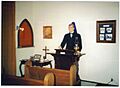
Model chapel in White Deer Museum
-
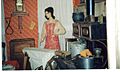
Ironing in the kitchen, circa 1900, White Deer Museum


See also
 In Spanish: Pampa (Texas) para niños
