
Floydada, Texas facts for kids
Quick facts for kids
Floydada, Texas
|
|
|---|---|

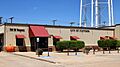
Floydada City Hall
|
|
| Nickname(s):
Pumpkin Capital of Texas, Pumpkin Capital USA
|
|

Floydada, Texas
Location in Texas

Floydada, Texas
Location in the United States
|
|
| Country | |
| State | |
| County | Floyd |
| Region | Llano Estacado |
| Platted | 1890 |
| Area | |
| • Total | 2.04 sq mi (5.27 km2) |
| • Land | 2.04 sq mi (5.27 km2) |
| • Water | 0.00 sq mi (0.00 km2) |
| Elevation | 3,182 ft (970 m) |
| Population
(2020)
|
|
| • Total | 2,675 |
| • Density | 1,311/sq mi (507.6/km2) |
| Time zone | UTC−6 (CST) |
| ZIP code |
79235
|
| Area code | 806 |
| FIPS code | 48-26268 |
Floydada (pronounced floy-DAY-duh) is a city in Texas, located in Floyd County. It is the main city, or county seat, of Floyd County. This small community is found on the high plains of the Llano Estacado in West Texas. It is often called the "Pumpkin Capital of Texas" because many pumpkins are grown there! In 2020, about 2,675 people lived in Floydada.
Contents
History of Floydada
.jpg)
The area where Floydada is now was first settled in 1890. It was originally named "Floyd City." James B. and Caroline Price gave 640 acres of land to start the town.
Floydada was chosen as the main city for Floyd County. This happened after an election against another town called Della Plain. When a post office opened, the name was changed to "Floydada."
The exact meaning of the name "Floydada" is a bit of a mystery! Some people think it was supposed to be "Floydalia." They believe the name got mixed up when it was sent to the U.S. Postal Service. Others say it combines the county's name, Floyd, with James Price's mother's name, Ada. A third idea is that it comes from Caroline Price's parents, Floyd and Ada.
In 1928, Floydada became an important place for trains. The Quanah, Acme and Pacific Railway built tracks to the town. This helped the town grow and connect with other places.
Where is Floydada?
Floydada is in the southwest part of Floyd County. It is about 51 miles southwest of Lubbock. It is also 27 miles northwest of Plainview. Major roads like U.S. Route 62 and U.S. Route 70 pass through the city. The city covers an area of about 2.04 square miles (5.3 square kilometers). All of this area is land.
Floydada sits on the high plains of the Llano Estacado. This is about 6 miles west of the Caprock Escarpment. The Caprock Escarpment is a steep cliff that marks the edge of the high plains.
Just 6 miles south of Floydada is Blanco Canyon. This is a beautiful canyon carved by the White River. The land around Floydada used to be covered in grasslands. Large herds of bison lived there. Now, most of the grasslands have been turned into farms. Farmers grow crops like cotton, grain sorghum, wheat, and, of course, pumpkins!
Weather in Floydada
Floydada experiences all four seasons: spring, summer, fall, and winter.
- Winters are usually cool and windy. There is not much rain, but it does snow sometimes.
- Summers have lighter winds and warm temperatures.
Here is a general idea of the average weather:
| Category | Summer | Winter |
|---|---|---|
| Average high temperature | 92F | 50F |
| Average low temperature | 68F | 25F |
| Average precipitation | 3.75in | 0.5in |
| Average morning humidity | 75% | 70% |
| Average afternoon humidity | 50% | 50% |
| Average wind speed | 11.5 mph | 14.5 mph |
| Average snowfall | 0.0in | 5.0in |
| Average sunshine | 78% | 65% |
| Climate data for Floydada, Texas (1991–2020 normals, extremes 1939–present) | |||||||||||||
|---|---|---|---|---|---|---|---|---|---|---|---|---|---|
| Month | Jan | Feb | Mar | Apr | May | Jun | Jul | Aug | Sep | Oct | Nov | Dec | Year |
| Record high °F (°C) | 81 (27) |
88 (31) |
94 (34) |
100 (38) |
109 (43) |
111 (44) |
109 (43) |
109 (43) |
103 (39) |
100 (38) |
89 (32) |
85 (29) |
111 (44) |
| Mean maximum °F (°C) | 73.3 (22.9) |
77.9 (25.5) |
85.6 (29.8) |
90.2 (32.3) |
96.8 (36.0) |
100.9 (38.3) |
100.7 (38.2) |
99.1 (37.3) |
95.4 (35.2) |
90.0 (32.2) |
80.2 (26.8) |
72.7 (22.6) |
103.5 (39.7) |
| Mean daily maximum °F (°C) | 52.1 (11.2) |
56.6 (13.7) |
65.2 (18.4) |
73.4 (23.0) |
81.5 (27.5) |
89.5 (31.9) |
92.4 (33.6) |
91.2 (32.9) |
83.5 (28.6) |
73.9 (23.3) |
61.8 (16.6) |
52.9 (11.6) |
72.8 (22.7) |
| Daily mean °F (°C) | 38.7 (3.7) |
42.4 (5.8) |
50.4 (10.2) |
58.5 (14.7) |
67.8 (19.9) |
76.7 (24.8) |
80.2 (26.8) |
78.9 (26.1) |
71.3 (21.8) |
60.5 (15.8) |
48.3 (9.1) |
39.9 (4.4) |
59.5 (15.3) |
| Mean daily minimum °F (°C) | 25.3 (−3.7) |
28.2 (−2.1) |
35.6 (2.0) |
43.5 (6.4) |
54.2 (12.3) |
63.8 (17.7) |
67.9 (19.9) |
66.5 (19.2) |
59.0 (15.0) |
47.1 (8.4) |
34.9 (1.6) |
26.8 (−2.9) |
46.1 (7.8) |
| Mean minimum °F (°C) | 11.7 (−11.3) |
14.6 (−9.7) |
20.1 (−6.6) |
29.2 (−1.6) |
40.5 (4.7) |
54.7 (12.6) |
60.9 (16.1) |
59.4 (15.2) |
47.0 (8.3) |
31.5 (−0.3) |
19.4 (−7.0) |
12.8 (−10.7) |
7.3 (−13.7) |
| Record low °F (°C) | −9 (−23) |
−7 (−22) |
3 (−16) |
18 (−8) |
27 (−3) |
42 (6) |
46 (8) |
48 (9) |
34 (1) |
16 (−9) |
2 (−17) |
−3 (−19) |
−9 (−23) |
| Average precipitation inches (mm) | 0.71 (18) |
0.69 (18) |
1.33 (34) |
1.47 (37) |
3.11 (79) |
3.41 (87) |
1.82 (46) |
1.98 (50) |
2.62 (67) |
1.45 (37) |
0.75 (19) |
0.85 (22) |
20.19 (513) |
| Average snowfall inches (cm) | 0.9 (2.3) |
1.2 (3.0) |
0.5 (1.3) |
0.1 (0.25) |
0.0 (0.0) |
0.0 (0.0) |
0.0 (0.0) |
0.0 (0.0) |
0.0 (0.0) |
0.1 (0.25) |
0.7 (1.8) |
0.9 (2.3) |
4.4 (11) |
| Average precipitation days (≥ 0.01 in) | 2.1 | 2.5 | 3.4 | 3.5 | 5.5 | 6.3 | 4.5 | 4.9 | 4.9 | 3.7 | 2.5 | 2.4 | 46.2 |
| Average snowy days (≥ 0.1 in) | 0.8 | 0.8 | 0.3 | 0.1 | 0.0 | 0.0 | 0.0 | 0.0 | 0.0 | 0.1 | 0.4 | 0.7 | 3.2 |
| Source: NOAA | |||||||||||||
Education in Floydada
The city of Floydada is served by the Floydada Independent School District. This district helps educate the students in the area.
Apple Inc. has worked with Floydada schools. They gave laptop computers to students and staff at the Jr. High and High School. In 2007–2008, Floydada was the only town in Texas to be an "Apple distinguished school." This means it was recognized for its great use of technology in learning.
Coronado's Camp Site
Scientists called archaeologists have dug up things in Blanco Canyon. This canyon is about 6 miles south of Floydada. They found important clues that a famous Spanish explorer, Francisco Vázquez de Coronado, set up a big camp there. He was searching for a legendary place called Quivira, one of the "Seven Cities of Gold."
The Floyd County Historical Museum in downtown Floydada shows some of these amazing items. These artifacts were found at Coronado's old campsite. There is also a special historical marker in Blanco Canyon. It tells the story of Coronado's journey through the canyon.
Wind Energy in Floydada
Floydada is in a special area often called the "wind corridor" of the United States. This corridor stretches across the Great Plains. It goes from the Texas Panhandle all the way up to Minnesota. This area has some of the best wind for making energy in the country.
The region is great for wind energy because of its strong, steady winds. It can also connect to two different electric power systems. There are also plans to build more power lines in the area.
The quality of wind is rated on a scale from one to seven. In Floyd County, the wind is rated as a class 4. This is considered good for developing wind energy. Texas has several companies that manage the electric grid. In the Floyd County area, these are the Southwest Power Pool (SPP) and the Electric Reliability Council of Texas (ERCOT). Being close to both grids is helpful. It means electricity from wind farms can be sent in either direction.
In 2009, a plan was made to build many new power lines across Texas. The goal was to bring wind energy from West Texas and the Texas Panhandle to bigger cities. Floyd County is part of this plan. This project could help grow wind energy in Floydada. Xcel Energy is also planning to build a power line through Floyd County.
Economy and Jobs

The main way people make a living in Floydada is through agriculture. This means farming! However, local companies also offer other services. They build custom metal items and develop irrigation motors. They also create efficient rock-crushing systems. One special product they make is called the "Row Stalker."
Notable People from Floydada
Many interesting people have come from Floydada:
- Price Brookfield (1920–2006) – A college and professional basketball player.
- Max F. Crawford (1938–2010) – A well-known author.
- H. Jeff Kimble – A physics professor at Caltech university.
- Joe D. Montgomery – An educator and lawmaker in Alaska.
- Don Williams (1939–2017) – A famous country music singer and songwriter.
- L. G. Wilson (1924–2001) – A noted football coach.
Images for kids
-
Floydada City Hall
See also
 In Spanish: Floydada (Texas) para niños
