
List of Roman-to-modern scheduled monuments in Pembrokeshire facts for kids
Pembrokeshire is the fifth-largest county in Wales, but it has more than 500 special old places called scheduled monuments. These are like historical treasures that are protected by law! This means Pembrokeshire has a super high number of these sites, with about 33 for every 100 square kilometers.
About two-thirds of Pembrokeshire's protected sites, which is 346 of them, are from prehistoric times. These include ancient hill forts, strongholds on cliffs, old enclosures, hut sites, and special burial places like mounds and chambered tombs. There are also stone circles and standing stones from these very early periods.
This article focuses on the 182 sites from later times: the Roman period, the Early Medieval period (also known as the Dark Ages), and the Medieval and Post-Medieval periods right up to modern times. From Roman times, there are only a few sites. But from the Early Medieval period, you'll find many stones with old carvings, stone crosses, and holy wells.
Later, in the Medieval period, many castles, mottes and baileys (early types of castles), priories (religious houses), chapels, churches, and even a Bishop's palace were built. There are also old town walls and houses. From the Post-Medieval period, you can discover old coalmines, kilns (ovens for making things like pottery or lime), dovecotes (buildings for pigeons), and even coastal defenses from the 19th and 20th centuries.
These scheduled monuments are protected by a Welsh government group called Cadw. They work with other history experts like RCAHMW and Dyfed Archaeological Trust to create and look after the list of these important places.
Contents
Ancient Wonders of Pembrokeshire
Let's explore some of the amazing scheduled monuments in Pembrokeshire, grouped by their time period.
Roman Times (around 43 AD to 410 AD)
Even though the Romans were in Britain for a long time, there are only a few Roman sites protected in Pembrokeshire.
- Castle Flemish: This was likely a Roman farm or villa from the late 1st century. It's an area about 80 meters across, surrounded by a low bank.
- Roman Road East of Bryn Farm: This is a 200-meter stretch of an old Roman road. It's special because it shows how the Romans built their roads, even over boggy ground!
- Hut Groups on Gateholm Island: This is a tidal island, meaning you can only reach it at certain times. It has over 100 rectangular huts. Historians think they were used by people during Roman times or just after, possibly even as a Christian settlement.
Early Medieval Period (around 410 AD to 1066 AD)
This period, sometimes called the Dark Ages, was a time of change after the Romans left. Many of the sites from this era are religious or marked by special stones.
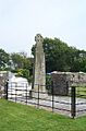
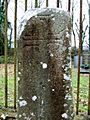
- Cross-Marked and Inscribed Stones: You'll find many stones with crosses or old writings carved into them. These include places like Maen Colman, the famous Carew Cross (a tall, impressive cross from the 11th century), and stones in churchyards at Bridell, Cilgerran, and Nevern. The Inscribed Stone in Nevern Churchyard is a great example, with writings in both Latin and Ogam (an ancient Irish alphabet).
- Holy Wells and Chapels: Places like Llanllawer Holy Well and St. Govan's Chapel and Well were important religious sites. There are also old chapels like St. Justinian's Chapel, St. Non's Chapel, and St. Patrick's Chapel near St. Davids.
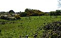
- Early Settlements: The West Angle Bay Early Medieval Settlement is an old cemetery. Drim Camp is a type of early fort called a Ringwork.
Medieval Period (around 1066 AD to 1485 AD)
This was the age of castles and grand buildings!
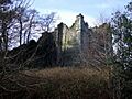
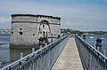
- Castles and Forts: Pembrokeshire is famous for its castles. You can visit impressive ones like Carew Castle, Cilgerran Castle, Haverfordwest Castle, Llawhaden Castle, Manorbier Castle, Narberth Castle, Pembroke Castle, Tenby Castle, and Wiston Castle. Many of these started as "motte and bailey" castles, which were mounds with wooden forts on top, like Pointz Castle Mound or Castell Eglwyswrw.
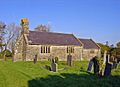
- Religious Buildings: Important religious sites include Haverfordwest Priory, Pill Priory (a monastery from the late 12th century), and St Dogmaels Abbey. There are also many churches and chapels, like St. Teilo's Church in Maenclochog.
- Palaces and Houses: The Lamphey Bishop's Palace and St Davids Bishop's Palace were grand homes for bishops. You can also find ruins of medieval houses, like Angle Castle (or Hall) and Carswell Medieval House.
- Town Defenses: The Pembroke town walls and Tenby town walls are great examples of how towns protected themselves in medieval times.
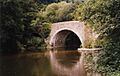
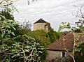
- Other Sites: Medieval bridges like Carew Bridge and Llawhaden Bridge, dovecotes (for keeping pigeons), and even deserted medieval villages like Linney show us how people lived.
Post-Medieval and Modern Times (from 1485 AD onwards)
This period brings us closer to today, with sites showing industrial growth and military defenses.
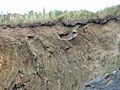
- Industrial Sites: You can see remains of early industries like the Underhill Wood Primitive Coal Workings, Grove Colliery (a coal mine), and the Stepaside/Kilgetty Ironworks. Old mills like Aberfelin Mill and lime kilns (used to make lime for building or farming) at Porthgain and Solva are also protected.
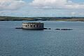
- Military Defenses: As warfare changed, new forts and batteries were built, especially along the coast. Examples include Chapel Bay Fort, Fort Popton, Dale Point Fort, and Fort Hubberstone (used in both World Wars). There are also more modern sites like the Gravel Bay anti-aircraft battery and First World War Practice Trenches at Penally Range.
- Other Modern Sites: The Hakin Observatory was part of an attempt to build a college in the early 19th century. You can also find old tramroad inclines, quays, and even radar stations from the 20th century, like the one at Strumble Head.
Images for kids
-

Gateholm Island
-
Stone lined graves at West Angle Bay
-
Carew Cross
-
Inscribed Pillar Stone in Bridell Churchyard
-

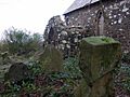
Pillar stone, Llanychllwydog Church
-

Llanllawer Holy Well and the issuing stream
-
Pillar stone, Llanychaer churchyard
-

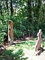
Gatepost Cross at Llanllawer Church
-
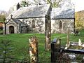
Pontfaen church with pillar stones
-

Two Pre-Norman Gravestones in Mathry Churchyard
-
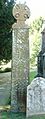
High Cross in Nevern Churchyard
-
Vitalinus stone, Nevern
-
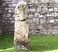
Stone in Morvil churchyard
-

St Govans' chapel
-
Inscribed Stone in St Dogwell's Churchyard
-
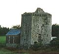
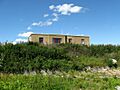
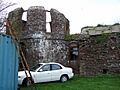
Pele Tower, Angle
-

Remains of East Blockhouse N of Rat Island
-

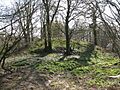
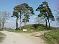
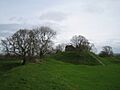
Pointz Castle Mound
-
Carew Bridge
-
Carew Castle
-
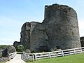
Cilgerran Castle
-

Motte and bailey castle, Eglwyswrw
-
Haverfordwest Castle
-

Monastic garden at Haverfordwest priory
-
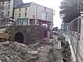
The Crypt at the bottom of Market Street
-
Motte at Cas-lai-Hayscastle
-
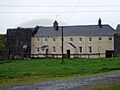
Eastington Manor House
-
Part of Lamphey Bishop's Palace
-
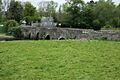
Llawhaden Bridge
-

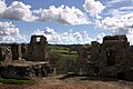
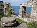
The hall range and the well, Llawhaden Castle
-
Manorbier Castle
-

The Old Palace, Lydstep
-
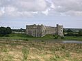
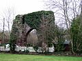
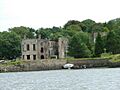
Cresswell Castle
-
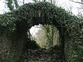
The Sisters' House at Minwear
-
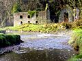
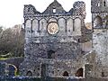
Pill priory chancel
-
Narberth Castle ruins
-

Pilgrims' cross, Nevern
-
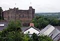
Castell Trefdraeth - Newport Castle from the churchyard
-

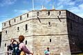
Martello Tower (disused)
-

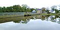
Pembroke castle from the tidal millpond
-

Sculptured Stone Cross in Penally Church
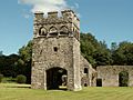
-
The watchtower, Caldey Island
-
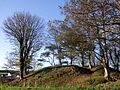
Motte at Castlebythe
-

Trackway alongside the motte
-
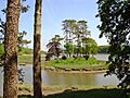
Tidal Island, Slebech
-
Picton Motte, Dungledi
-

St John's, Slebech
-
StDavids Bishop's Palace facade
-
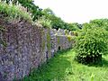
Medieval West Wall of the Cathedral Close
-
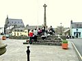
TheCity Cross in Cross Square, St Davids
-

St Dogmaels Abbey Remains
-
Motte north of St Ishmaels
-
Wiston Castle
-
Wolfscastle motte
-
Castle Hill, Tenby
-

Tenby Market Cross
-
Town Walls and The Imperial Hotel, Tenby
-

Grove Colliery, Stepaside
-

Kilgetty Ironworks
-

Old wreck at Hook Colliery Quay
-
Water mill at Aber Draw
-
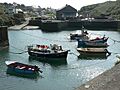
Porthgain Harbour
-
The Llechryd Bridge over the River Teifi
-
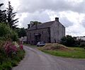
Coedcanlas Farm
-
"Big House" at Landshipping
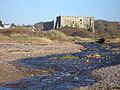
-
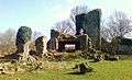
Haroldston House ruins
-

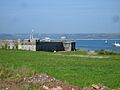
Old fort, Castle Point, Fishguard
-

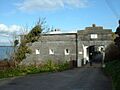
Main gate, Defensible Barracks
-
Lime kiln, Kiln Park, Penally
-
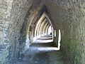
Chapel Bay Fort
-
Popton Fort
-
Dale Point Fort
-
West Blockhouse Fort
-
Stack Rock Fort
-
The sealed entrance to Scoveston Fort
-

Hubberston Fort ramparts
-
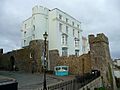
Hakin observatory
-
Martello Tower, Pembroke Dock
-

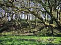
Footpath at Rhode Wood
-

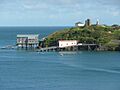
St Catherines Island and Fort from Castle Beach, Tenby
-
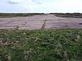
Dale airfield runway


.jpg)


_-_geograph.org.uk_-_462600.jpg)


.jpg)


.jpg)


More to Explore
