
List of beaches in Ponce, Puerto Rico facts for kids
.jpg)
Ponce, a city in Puerto Rico, is home to many beautiful beaches. There are 40 beaches in total! Twenty-eight of these are on the main island, and 12 are found on smaller islands nearby. The most famous island for beaches is Caja de Muertos, which is mostly empty and natural. This article will tell you about some of the most popular beaches in Ponce. We'll only talk about natural saltwater beaches.
All beaches in Ponce are open to everyone. However, the beach at the Club Nautico de Ponce is only for club members. Some public beaches are closed off to protect nature. For example, Playa Larga beach on Caja de Muertos is protected by law. Luckily, none of Ponce's beaches are known for being dangerous or having many drownings.
Some of the most loved beaches in Ponce include El Tuque Beach, located near highway PR-2 west of the city. There's also La Guancha Beach at the La Guancha complex, south of the city. On Caja de Muertos island, you'll find four amazing beaches: Playa Pelícano, Playa Larga, Playa Carrucho, and Playa Blanca.
Playa Pelícano beach was the first beach in Puerto Rico and the entire Caribbean to get the special Blue Flag Beach award. This award means it's super clean and well-managed. It's also the only beach in the world inside a nature reserve to get this award! Many beaches in Ponce are small and hidden. Locals often know about them, and you might need to drive on dirt roads to reach them. The coast in southwestern Puerto Rico is full of these secret sandy spots.
While some beaches like La Guancha and El Tuque are great for families, many others are perfect for sunbathing, relaxing, or just being alone. Some beaches are better for certain activities, like scuba diving. You can reach the beaches on Caja de Muertos by private boat. On weekends, there's a ferry that leaves early in the mornings from the La Guancha Boardwalk in Barrio Playa. Remember to make reservations!
The sand on Ponce's beaches comes from minerals carried by rivers flowing from the Cordillera Central mountains. This means the type of sand depends on the rocks the rivers pass through. Beaches west of Ponce, like El Tuque and Las Salinas, have mostly white sand. This sand is made of tiny pieces of coral and seashells. Beaches east of Ponce, such as La Guancha and the Hilton beach, have darker sand. This sand contains volcanic rock, quartz, and other dark minerals. So, mainland beaches often have dark sand, while the offshore islands have white sand.
Contents
Cool Beaches to Explore
This table lists some of the beaches in Ponce, showing where they are and what you can do there.
Beaches on the Main Island
| No. | Beach Name | Length (m) | Neighborhood | Location | Map Coordinates | Fun Activities & Services | Special Notes | Picture |
|---|---|---|---|---|---|---|---|---|
| 1 | El Tuque; also known as Balneario El Tuque |
1100 | Canas | El Tuque, near PR-2, at km 200.1 | 17°58′21″N 066°40′43″W / 17.97250°N 66.67861°W |
|
|
|
| 2 | Punta Salinera | unknown | Canas | Southwest of Laguna Las Salinas on PR-2, km 200.2 | 17°58′1.67″N 066°40′18.37″W / 17.9671306°N 66.6717694°W |
|
||
| 3 | Las Salinas | unknown | Canas | South of Laguna Las Salinas on PR-2, km 200.2 | 17°58′07″N 066°40′00″W / 17.96861°N 66.66667°W |
|
||
| 4 | Cañas | 1100 | Canas | Between Punta Cucharas and the jetty west of the Ponce water plant. You can get there from PR-2 & Ave. Punto Oro. | 17°58′42″N 066°39′07″W / 17.97833°N 66.65194°W |
|
||
| 5 | Matilde | unknown | Canas | South of the Ponce water treatment plant, west of Río Matilde. Follow the road to the water plant from PR-2 and PR-9. | 17°58′51″N 066°38′28″W / 17.98083°N 66.64111°W |
|
||
| 6 | Chencha; also known as "El Tubo" |
500 | Playa | Between Río Matilde and the breakwater at Ocean View Restaurant. Get there from PR-585, then Ave. Los Meros. | 17°58′55″N 066°38′11″W / 17.98194°N 66.63639°W |
|
||
| 7 | Los Meros | 500 | Playa | Between the breakwater at Ocean View Restaurant and the Villa Pesquera fishing piers. Access from PR-585, then Ave. Los Meros. | 17°58′57″N 066°37′44″W / 17.98250°N 66.62889°W |
|
||
| 8 | Playa de Ponce | unknown | Playa | Between the Villa Pesquera fishing piers and the Ave. Hostos Final pier. At the very end of PR-585. | 17°58′51″N 066°37′23″W / 17.98083°N 66.62306°W |
|
||
| 9 | El Malecón | unknown | Playa | At Parque Pasivo Enrique Gonzalez on Calle Bonaire, two blocks south of Avenida Hostos (PR-123) in barrio Playa de Ponce. | 17°58′45″N 066°37′11″W / 17.97917°N 66.61972°W |
|
This is also where the Cruce a Nado Internacional swimming race finishes. | |
| 10 | Club Náutico de Ponce | unknown | Playa | On Isla de Gatas, inside the Club Náutico de Ponce property, across from La Guancha Boardwalk. You can get there via PR-12. | 17°57′49″N 066°37′10″W / 17.96361°N 66.61944°W |
|
This beach is part of a private club. |  |
| 11 | La Guancha; also known as Playa Carenero |
850 | Playa | At the La Guancha Recreational and Cultural Complex, at the very end of PR-12. | 17°57′50″N 066°36′43″W / 17.96389°N 66.61194°W |
|
||
| 12 | Playa del Hilton | unknown | Playa | At the Hotel Ponce Hilton, west of Río Bucaná. You can get there through Hilton Ponce Golf and Casino Resort, PR-12 South to Avenida Caribe. | 17°58′10″N 066°36′08″W / 17.96944°N 66.60222°W |
|
||
| 13 | Punta Cabuyón; also known as Playa Punta Cabullones. |
325 | Vayas | Just west of Punta de Cabullones. Accessed from Barrio Bucana through the Santa Cruz community (the road turns to dirt). | 17°58′15″N 066°35′38″W / 17.97083°N 66.59389°W |
|
This area has been a nature reserve since December 31, 2016. | |
| 14 | Vayas | 2200 | Vayas | In the Quinta Esperanza area, across from Cayo Desgraciado. Accessed from PR-1 to Calle La Esperanza (the road turns to dirt). | 17°58′1″N 066°34′08″W / 17.96694°N 66.56889°W |
|
Beaches on Ponce's Islands
| No. | Beach Name | Length (m) | Neighborhood | Location | Map Coordinates | Fun Activities & Services | Special Notes | Picture |
|---|---|---|---|---|---|---|---|---|
| Beaches at Isla de Ratones | ||||||||
| 15 | Isla de Ratones | unknown | Canas | On Isla de Ratones. You can get there by kayak from Reserva Natural Punta Cucharas or by boat from the marina west of Punta Cucharas on PR-2. | 17°57′08″N 066°40′51″W / 17.95222°N 66.68083°W |
|
||
| Beaches at Isla Cardona | ||||||||
| 16 | Isla Cardona | unknown | Playa | On Isla Cardona. You can get there by kayak or boat. | 17°57′28″N 066°38′11″W / 17.95778°N 66.63639°W |
|
This is also where the Cruce a Nado Internacional swimming race starts. | |
| Beaches at Caja de Muertos | ||||||||
| 17 | Pelícano | 300 | Playa | On Caja de Muertos; located on the western side of the island, between the boat dock and Cerro Morrillo. You can get there by ferry from La Guancha Boardwalk. | 17°53′08″N 066°31′41″W / 17.88556°N 66.52806°W |
|
 |
|
| 18 | Guardia Costanera | unknown | Playa | On Caja de Muertos; located on the northwest side of the island (facing Ponce). You can get there by ferry from La Guancha Boardwalk. | 17°53′45″N 066°40′43″W / 17.89583°N 66.67861°W |
|
.jpg) |
|
| 19 | Blanca | unknown | Playa | On Caja de Muertos; located on the northwest side of the island (facing Ponce). You can get there by ferry from La Guancha Boardwalk. | 17°53′56″N 066°31′12″W / 17.89889°N 66.52000°W |
|
.jpg) |
|
| 20 | Carrucho also known as Playa Chica |
unknown | Playa | On Caja de Muertos; located at Punta Carrucho, on the northeast end of the island, facing the Puerto Rico mainland. You can get there by ferry from La Guancha Boardwalk. | 17°54′09″N 066°30′46″W / 17.90250°N 66.51278°W |
|
.jpg) |
|
| 21 | Ensenadita also known as Playa Pocitas |
unknown | Playa | On Caja de Muertos, located on the southeastern side of the island, facing the open Caribbean Sea. You can get there by ferry from La Guancha Boardwalk. | 17°53′38″N 066°30′54″W / 17.89389°N 66.51500°W |
|
||
| 22 | Larga | unknown | Playa | On Caja de Muertos, located on the south-southeast side of the island. You can get there by ferry from La Guancha Boardwalk. | 17°53′08″N 066°31′38″W / 17.88556°N 66.52722°W |
|
This beach is protected, so no walking on it. You can snorkel and scuba dive offshore. It's located between Cerro Morrillo and Caja de Muertos Light. |  |
KEY:
Activities You Can Do:
 Swimming
 Snorkeling (looking at underwater life with a mask)
 Scuba Diving (exploring underwater with special gear)
 Surfing
 Boating
 Camping
 Hiking (walking on trails)
 Picnicking (eating outdoors)
 Fishing
 Sunbathing
 Lookout tower
Services Available:
 Visitor's Center
 Lifeguards
 Restrooms
 Children's Playground
Special Awards:
 Blue Flag beach (a sign of a clean, safe, and well-managed beach)
Images for kids
-
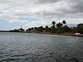
Beach at the Ponce Hilton Hotel, looking west
.jpg)
See also
- Puerto Rico Tourism Company
- Porta Caribe
