List of lighthouses in New Zealand facts for kids
Imagine a tall tower with a bright light at the top, guiding ships safely at sea. These are called lighthouses, and they are very important for sailors. This article lists the main lighthouses in New Zealand.
Maritime New Zealand looks after 23 active lighthouses and 74 smaller light beacons. All these lighthouses work automatically. They are controlled from a special room in Wellington. Other lights, like the ones at Taiaroa Head and Bean Rock, are managed by local port groups. Some old lighthouses are no longer used, such as the ones at Manukau South Head and Akaroa.
Many of New Zealand's first lighthouses were designed by clever engineers. Two important ones were James Balfour and John Blackett. You can find details about all active lighthouses and lights in the New Zealand Nautical Almanac. This book tells you where they are, how they work, and how far their light can be seen.
North Island Lighthouses
The North Island of New Zealand has many important lighthouses. They help guide ships around its long coastline. Here is a list of some of them:
| Name | Coordinates | Year completed | Tower height | Status |
|---|---|---|---|---|
| Baring Head | 41°25′S 174°52′E / 41.417°S 174.867°E | 1935 | 12m | Active |
| Cape Brett | 35°10′S 174°20′E / 35.167°S 174.333°E | 1910 | 13m | Decommissioned |
| Bean Rock | 36°50′S 174°50′E / 36.833°S 174.833°E | 1871 | 15 | Active |
| Cape Egmont | 39°17′S 173°45′E / 39.283°S 173.750°E | 1881 | 20m | Active |
| Cape Palliser | 41°37′S 175°17′E / 41.617°S 175.283°E | 1897 | 18m | Active |
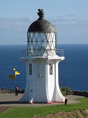
| Cape Reinga | 34°26′S 172°41′E / 34.433°S 172.683°E | 1941 | 10m | Active |
| Castle Point | 40°54′S 176°14′E / 40.900°S 176.233°E | 1913 | 23m | Active |
| Cuvier Island | 36°26′S 175°47′E / 36.433°S 175.783°E | 1889 | 15m | Active |
| East Cape | 37°41′S 178°33′E / 37.683°S 178.550°E | 1900 | 14m | Active |
| Mokohinau Island | 35°54′S 175°07′E / 35.900°S 175.117°E | 1883 | 14m | Active |
| Pencarrow Head | 41°21′S 174°51′E / 41.350°S 174.850°E | 1859 | 11.5m | Decommissioned |
| Rangitoto | 36°46′54″S 174°49′20″E / 36.78167°S 174.82222°E | 1905 | 21m | Active |
| Tiritiri Matangi | 36°36′S 174°54′E / 36.600°S 174.900°E | 1865 | 20m | Active |
South Island Lighthouses
The South Island also has many lighthouses. They guide ships through its tricky waters and along its rugged coast. Here is a list of some of them:
| Name | Coordinates | Year completed | Tower height | Status |
|---|---|---|---|---|
| Brothers Island | 41°06′S 174°26′E / 41.100°S 174.433°E | 1877 | 12m | Active |
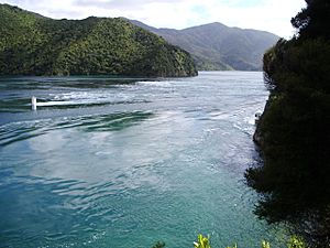
| French Pass | 40°55′S 173°50′E / 40.917°S 173.833°E | 1884 | 3m | Active |
| Stephens Island | 40°40′S 174°00′E / 40.667°S 174.000°E | 1894 | 15m | Active |
| Farewell Spit | 40°33′S 173°00′E / 40.550°S 173.000°E | 1870 | 27m | Active |
| Kahurangi Point | 40°47′S 172°13′E / 40.783°S 172.217°E | 1903 | 18m | Active |
| Cape Campbell | 41°44′S 174°17′E / 41.733°S 174.283°E | 1870 | 22m | Active |
| Cape Foulwind | 41°45′S 171°28′E / 41.750°S 171.467°E | 1876 | 9m | Active |
| Tuhawaiki Point | 44°27′S 171°16′E / 44.450°S 171.267°E | 1904 | 9m | Active |
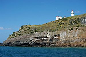
| Taiaroa Head | 45°46′25″S 170°44′42.7″E / 45.77361°S 170.745194°E | 1865 | 12m | Active |
| Katiki Point | 45°24′S 170°52′E / 45.400°S 170.867°E | 1878 | 8m | Active |
| Nugget Point | 46°27′S 169°49′E / 46.450°S 169.817°E | 1870 | 9.4m | Active |
| Waipapa Point | 46°40′S 168°51′E / 46.667°S 168.850°E | 1884 | 13m | Active |
| Dog Island | 46°39′S 168°25′E / 46.650°S 168.417°E | 1865 | 37m | Active |
| Centre Island | 46°28′S 167°51′E / 46.467°S 167.850°E | 1878 | 12m | Active |
| Puysegur Point | 46°10′S 166°36′E / 46.167°S 166.600°E | 1879 | 5m | Active |
Learn More
- Lists of lighthouses and lightvessels


