List of rivers of Ponce, Puerto Rico facts for kids
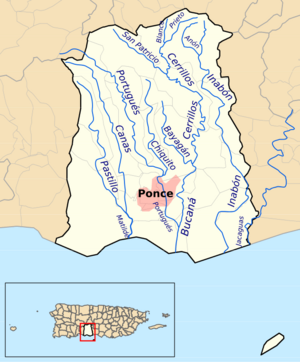
This article is about the 14 rivers found in the area of Ponce, Puerto Rico. These rivers either start in Ponce or flow mostly through it. Most of them begin and end within Ponce's borders, except for two: Río Portugués and Río Jacaguas. We are only listing rivers that are officially recognized as rivers, not smaller streams called quebradas (brooks).
All the rivers in Ponce flow into one of four main river systems, called river basins. These basins then empty their water into the Caribbean Sea. The four river basins are: Río Matilde, Río Bucaná, Río Inabón, and Río Jacaguas.
Some rivers join together. For example, Río Pastillo and Río Canas combine to form Río Matilde. Many rivers, like Río Blanco, Río Prieto, Río San Patricio, Río Bayagán, Río Cerrillos, Río Chiquito, and Río Portugués, all flow into Río Bucaná. Río Anon flows into Río Inabón. Río Jacaguas is special because it forms the border between Ponce and Juana Díaz.
People have also changed some rivers. Río Bucaná and Río Portugués have parts that are "canalized." This means their banks have been made straight with walls, especially in the city areas. Also, two rivers have been "dammed," meaning a wall was built across them to create a lake. Río Cerrillos was dammed to create the Cerrillos Lake. The damming of Río Portugués was finished in 2013, creating the Portugués Lake.
Contents
Meet the Rivers of Ponce!
| Number | River Name | Starting Height (feet) |
Ending Height (feet) |
Length (km) |
Photo |
|---|---|---|---|---|---|
| 1 | Río Anón | 3,854 | 1,060 | 4.0 | |
| 2 | Río Bayagán | 141 | 42 | 9.0 | 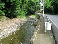 |
| 3 | Río Blanco | 2,970 | 1,381 | 2.0 | |
| 4 | Río Bucaná | 115 | 0 | 9.16 | 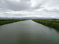 |
| 5 | Río Canas | 930 | 15 | 14.0 | 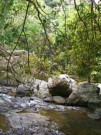 |
| 6 | Río Cerrillos | 1,200 | 69 | 29.8 | 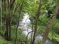 |
| 7 | Río Chiquito | 1,170 | 98 | 9.5 | 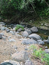 |
| 8 | Río Inabón | 4,100 | 0 | 32.01 | 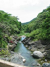 |
| 9 | Río Jacaguas | 2,099 | 0 | 39.72 | 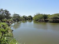 |
| 10 | Río Matilde | 15 | 0 | 1.7 | 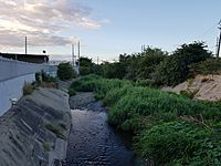 |
| 11 | Río Pastillo | 435 | 15 | 19.0 | 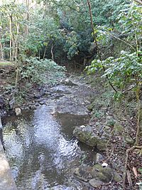 |
| 12 | Río Portugués | 2,853 | 3 | 29.66 | 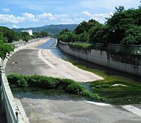 |
| 13 | Río Prieto | 3,920 | 1,381 | 4.0 | |
| 14 | Río San Patricio | 1,917 | 660 | 6.3 |
Rivers in Alphabetical Order
- Río Anón
- Río Bayagán
- Río Blanco
- Río Bucaná
- Río Canas
- Río Cerrillos
- Río Chiquito
- Río Inabón
- Río Jacaguas
- Río Matilde
- Río Pastillo
- Río Portugués
- Río Prieto
- Río San Patricio
Rivers from West to East
This list shows the rivers from the westernmost point to the easternmost point where they meet the sea:
- Río Pastillo
- Río Canas
- Río Chiquito
- Río Blanco
- Río Prieto
- Río San Patricio
- Río Bucaná
- Río Bayagán
- Río Matilde
- Río Portugués
- Río Anón
- Río Cerrillos
- Río Inabón
- Río Jacaguas
Rivers by Distance from the Shore
This list groups rivers by how far their mouth (where they meet the sea or another river) is from the Ponce shore.
Rivers Meeting the Caribbean Sea (0 km from shore)
Rivers Up to 1 km from Shore
- Río Pastillo
- Río Canas
- Río Chiquito
- Río Bayagán
Rivers Up to 2 km from Shore
- Río San Patricio
- Río Portugués
- Río Anón
- Río Cerrillos
Rivers Up to 3 km from Shore
- Río Blanco
- Río Prieto
See also
 | Janet Taylor Pickett |
 | Synthia Saint James |
 | Howardena Pindell |
 | Faith Ringgold |


