Little Menominee River facts for kids
Quick facts for kids Little Menominee River |
|
|---|---|

Little Menominee River (USGS)
|
|
| Physical characteristics | |
| Main source | Grant County, northwest of Hazel Green, Wisconsin 943 ft (287 m) 42°33′42″N 90°32′10″W / 42.5616667°N 90.5361111°W |
| River mouth | Confluence with the Mississippi west of Galena, Illinois 591 ft (180 m) 42°25′31″N 90°32′04″W / 42.4252778°N 90.5344444°W |
| Length | 14 mi (23 km) |
| Basin features | |
| Progression | Little Menominee River → Mississippi → Gulf of Mexico |
| GNIS ID | 412371 |
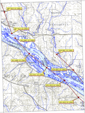
The Little Menominee River is a small river in the United States. It flows for about 13.9-mile-long (22.4 km). This river is a branch, or tributary, of the Upper Mississippi River. It joins the mighty Mississippi in Jo Daviess County, Illinois.
Contents
Where Does the Little Menominee River Flow?
The Little Menominee River starts in Grant County, Wisconsin. This is its source, or where it begins. From there, the river flows south. It moves towards the east of another river called the Menominee River.
Journey Through Illinois
The river then enters Illinois. It crosses the northwestern part of Illinois for about six miles. Finally, it meets the Mississippi River. This meeting point is near the southern end of East Dubuque. The town of Menominee, Illinois is also located right on the river's banks.
What Does "Menominee" Mean?
The name "Menominee" has a special meaning. It comes from the Menominee people. They are a Native American group.
The Meaning Behind the Name
The word "Menominee" means "good seed" or "wild rice." This name likely refers to important plants found in the area. These plants were very important to the Menominee people.
The Driftless Area: A Unique Landscape
The Little Menominee River flows through a special region. This area is known as the Driftless Area. It covers parts of Illinois and Wisconsin.
How the Driftless Area Formed
What makes the Driftless Area unique? It was not covered by glaciers during the last ice age. Most areas to the east and west were flattened by these huge ice sheets. But the Driftless Area was untouched. This means it has hills and valleys that were shaped by rivers, not ice.
 | Calvin Brent |
 | Walter T. Bailey |
 | Martha Cassell Thompson |
 | Alberta Jeannette Cassell |

