Little Salt Lake facts for kids
Quick facts for kids Little Salt Lake |
|
|---|---|
| Location | Iron, Utah, United States |
| Coordinates | 37°54′07″N 112°54′07″W / 37.902°N 112.902°W |
| Lake type | Endorheic |
| Primary outflows | Evaporation |
| Basin countries | United States |
| Surface elevation | 5,682 ft (1,732 m) |
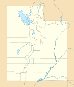
Little Salt Lake (also known as Parowan Lake) is a special place in Iron County, Utah, United States. It is a dry lake, which means it's a lakebed that usually has no water.
Contents
Where is Little Salt Lake?
This dry lake is located in the southwestern part of the Parowan Valley. It sits at the base of the Red Hills. You can find it just east of the Parowan Gap. It is also west of Interstate 15 and the town of Paragonah. The town of Parowan is to its southeast.
The lakebed is quite high up, at an elevation of about 5,682 feet (1,732 m). This is like being on top of a very tall building!
The History of Little Salt Lake
How the Lake Used to Be
Long ago, Little Salt Lake was not always dry. It was a seasonal lake, meaning it had water during certain times of the year. The water was brackish, which means it was a mix of fresh and salty water. It was fed by springs and streams from the Hurricane Cliffs.
This lake was also an endorheic basin. This means water flowed into it but did not flow out to a river or ocean. Instead, the water would just evaporate.
Native American Connections
The Native American people lived near the lake for a very long time. They called the lake "Paragoon." This name meant "vile water," probably because of its brackish taste.
A creek once flowed from the lake. It went westward through the Parowan Gap in the Red Hills.
Naming the Lake and Valley
Later, American settlers named it Little Salt Lake. They did this to compare it to the much larger Great Salt Lake to the north. The original Native American name, "Paragoon," was changed a bit. It was then used for the valley and the towns of Paragonah and Parowan.
Why the Lake is Dry Today
Over time, people started to use the water from the creeks and springs. They needed this water to irrigate their crops and grow food. Because so much water was taken for farming, Little Salt Lake stopped being a seasonal wetland. It slowly became an arid, dry lakebed, also known as a playa.
 | Shirley Ann Jackson |
 | Garett Morgan |
 | J. Ernest Wilkins Jr. |
 | Elijah McCoy |


