Paragonah, Utah facts for kids
Quick facts for kids
Paragonah, Utah
|
|
|---|---|

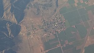
Aerial view of the town
|
|

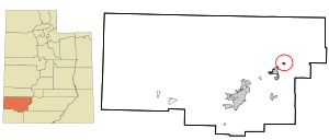
Location in Iron County and the state of Utah
|
|
| Country | United States |
| State | Utah |
| County | Iron |
| Founded | 1851 |
| Incorporated | April 3, 1916 |
| Named for | Southern Paiute for the Little Salt Lake |
| Area | |
| • Total | 0.67 sq mi (1.74 km2) |
| • Land | 0.67 sq mi (1.74 km2) |
| • Water | 0.00 sq mi (0.00 km2) |
| Elevation | 5,903 ft (1,799 m) |
| Population
(2010)
|
|
| • Total | 488 |
| • Density | 809.81/sq mi (312.53/km2) |
| Time zone | UTC-7 (Mountain (MST)) |
| • Summer (DST) | UTC-6 (MDT) |
| ZIP code |
84760
|
| Area code(s) | 435 |
| FIPS code | 49-57960 |
| GNIS feature ID | 2413115 |
Paragonah is a small town in Iron County, Utah, United States. You say its name like "PARR-ə-GOO-nə". In 2010, about 488 people lived there.
About Paragonah, Utah
Paragonah is located in the northeastern part of Iron County. It is about 4 miles (6.4 km) northeast of Parowan, which is the main town in the county. The big highway, Interstate 15, runs near Paragonah. You can get to the town from Exit 82.
Paragonah is about 23 miles (37 km) northeast of Cedar City. It is also about 228 miles (367 km) south of Salt Lake City, the capital of Utah. The town covers an area of about 0.67 square miles (1.74 square kilometers), and it's all land.
Paragonah's Population and People
The number of people living in Paragonah has changed over the years. Here's how the population has grown and shrunk:
| Historical population | |||
|---|---|---|---|
| Census | Pop. | %± | |
| 1860 | 121 | — | |
| 1870 | 211 | 74.4% | |
| 1880 | 256 | 21.3% | |
| 1890 | 268 | 4.7% | |
| 1900 | 358 | 33.6% | |
| 1910 | 399 | 11.5% | |
| 1920 | 449 | 12.5% | |
| 1930 | 384 | −14.5% | |
| 1940 | 365 | −4.9% | |
| 1950 | 404 | 10.7% | |
| 1960 | 300 | −25.7% | |
| 1970 | 275 | −8.3% | |
| 1980 | 310 | 12.7% | |
| 1990 | 307 | −1.0% | |
| 2000 | 470 | 53.1% | |
| 2010 | 488 | 3.8% | |
| 2019 (est.) | 545 | 11.7% | |
| U.S. Decennial Census | |||
In 2000, there were 470 people living in Paragonah. These people lived in 156 different homes. Most of the people living there were white. A small number of people were from other racial backgrounds. About 1.5% of the population was Hispanic or Latino.
Many homes in Paragonah had families. About 37.8% of homes had children under 18 living there. Most families were married couples living together. The average family size was about 3.5 people.
The people in Paragonah were of different ages. About 33.8% of the population was under 18 years old. About 14.9% of the people were 65 years old or older. The average age in the town was 34 years old.
The History of Paragonah
Paragonah was first settled in the early 1850s. People from the nearby town of Parowan moved here. They found good farming land next to a stream called Red Creek.
The settlement was first called Red Creek. Later, its name was changed to Paragoonah, and then finally to Paragonah. The name comes from the Southern Paiute language. It probably refers to the red color of the water in the area. Paragonah officially became a town in 1916.
See also
 In Spanish: Paragonah (Utah) para niños
 | Isaac Myers |
 | D. Hamilton Jackson |
 | A. Philip Randolph |

