Loch Brown facts for kids
Quick facts for kids Loch Brown |
|
|---|---|

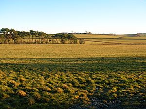
The site of Loch Brown
|
|
| Lua error in Module:Location_map at line 420: attempt to index field 'wikibase' (a nil value). | |
| Location | Crosshands, East Ayrshire, Scotland |
| Type | Drained freshwater loch |
| Primary inflows | Skeoch and Mossgiel Burns |
| Primary outflows | Garroch Burn |
| Basin countries | Scotland |
| Surface area | 50–60 acres (20–24 ha) |
| Settlements | Mauchline |
Loch Brown, also known as Loch Broun, Broon or Broom in Scots, was once a freshwater loch (a Scottish lake). It was located in a "kettle hole," which is a hollow in the ground formed by melting ice from a glacier. This area is near Crosshands in East Ayrshire, Scotland.
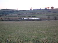
Today (in 2011), you can still see a dip in the ground where the loch used to be. Sometimes, it even has some water. It's close to farms and homes in places like Skeoch, Dalsangan, Ladebrae, Lochhill, and Crosshands. Most of the old loch site is in the Parish of Mauchline, with a small part in Craigie. An old name for the loch was Duveloch, which might come from the Gaelic word Dubh, meaning "black" or "dark" loch.
The loch was formed naturally by glaciers. Its water flowed out through the Garroch Burn, which then joined the Cessnock Water and finally the River Irvine. A road, the B744, passes near where the loch was. The small village of Crosshands is also nearby, on the main A76 road.
Contents
History of Loch Brown
Old maps show Loch Brown clearly. Robert Gordon's map (from 1580-1661) and Jan Jansen's map (from 1659) both included it. Roy's map (from 1747-55) also showed the loch, a nearby mill, and the Garroch Burn flowing into the Cessnock Water.
The first official description of Mauchline Parish, written by Rev Auld (who was a friend of Robert Burns) between 1791 and 1799, mentioned Loch Brown. He wrote:
- "The only loch in the parish, called Loch Brown is about three miles North West from Mauchline."
- "Wild ducks, geese, and sometimes swans resort to it."
- "It covers about 60 acres of ground and would have been drained many years ago, had it not been for the sake of two corn mills which it supplies with water."
Later, in 1845, Rev Tod also noted that the loch was 60 acres and still supplied water to two corn mills.
When the main railway line was built from Kilmarnock towards Dumfries, the railway company decided to build it right across Loch Brown. The railway then went through the Mossgiel or Skeoch Tunnel to Mauchline. The loch was about seven miles from Kilmarnock. The first train crossed the drained loch in 1848. The schoolmaster from Crosshands even took his students to see it pass!
Loch Brown was roughly round and covered about 50 to 60 acres. However, swampy land stretched far up the valley towards Mossgiel and Skeoch farms. Small streams from these farms flowed through this marshy area. The swamp was full of reeds, rushes, willow trees, and alder bushes. It was a home for many water birds. People who hunted illegally (poachers) often visited, but estate gamekeepers guarded the area. The loch and its swamp were popular with sportsmen from Kilmarnock. It was even said that Tam Samson, a friend of the famous poet Robert Burns, used to meet people there.
Draining Loch Brown
The water from Loch Brown flowed into the Garroch Burn. This burn was like a deep canal (called a lade) that went towards the old village of Ladeside. It powered the water wheels of the mills at Dalsangan. When the railway company drained the loch, they dug a deep channel. They paid the owner of the Dalsangan meal mill £400 because the mill would no longer have water. After this, the mill became a large farm.
The loch didn't disappear completely because its bottom was very uneven. This left deep puddles full of fish. People used to talk about how many fish they caught and how fish was a common meal in every house back then. The railway company later filled these holes, making the ground flatter. Eventually, the area became rich farmland, growing grass and other crops.
Farmers found the old loch's land to be very fertile. Landowners rented it out for a high price of £2 per acre. Even in the 1930s, the soil was still black and rich. When the ground is ploughed today, you can still see where the loch's shores were. One side has sand, and the other has gravelly stones. If you dig a deep hole, you find dark, rich soil (humus) that goes down a long way. Old nuts, leaves, and twigs were still found in the 1930s, just as they were 100 or 200 years before. However, they quickly turned into black soil when exposed to the air. The marsh, its reeds, and wild birds eventually disappeared, replaced by rich meadows.
Curling on the Loch
Loch Brown was a favorite place for curling matches in winter. The "roaring game," as curling is sometimes called, was played here until the early 1900s. There's a story that once, a horse-drawn wagon (a wagonette) full of curlers from Kilmarnock drove onto the ice. The horses had to be taken off and had their shoes sharpened so they could grip the ice. But while they were gone, the wagon's wheels sank deep into the ice! People had to use picks and crowbars to get the vehicle out.
Ladeside Village
This small village, or "clachan," was near Dalsangan Mill. It almost completely disappeared because the railway was built right through its center, and several homes were torn down. The mill was operated by Hugh Morton in 1841 but was no longer used by 1860. This was partly because the Garroch Burn never had a strong flow of water to power it.
An old name for Ladeside was Machine Cross. This name might have come from a smithy (a place where metal is worked) that used to be there, with its various "machines." However, it's more likely a changed version of "Mauchline." The village was home to about a dozen families. A flax mill also existed here at one time. The smithy later moved to Crosshands, and its building still stands. A school was also located at Crosshands.
Coal Mining at Ladeside
Ladeside might be a very old place. Workmen laying a water pipe along the road once found an old coal mine shaft. It had stone walls and was in very good condition. When the pit was opened up, it was about seventy feet deep. The old pile of waste from the mine (called a "bing") made a noticeable slope in the road. It's believed that the monks of Fail Monastery mined coal near their lands, and this could have been one of their ancient mines. The village of Ladeside appears on early maps of the area.
Old Roads
A lane once came from Carnell Castle (which used to be called Cairnhill). It circled through Ladeside village and then went directly to the main road from Kilmarnock to Mauchline, which is now the A76 Carlisle Road. The road now passes by the current Laidside, which is a small farm and the only house left from the old village. It runs alongside the cutting where the burn now flows, joining the Galston Road that goes through Crosshands. Before World War II, a large group of tall trees hid Crosshands from view, but most of these have now been cut down.
Robert Burns Connection
Tam Samson used to hunt birds over the marshy land around Loch Brown. In those days, this marsh stretched almost up to Mossgiel Farm, which was Robert Burns's home at the time. Burns would have passed near the loch when he went to the market in Kilmarnock. However, it's not known if he ever wrote directly about it. Thomas Samson was a friend of Burns from Kilmarnock. He was known as "a seedsman of good credit, a zealous sportsman, and a good fellow."
 | Dorothy Vaughan |
 | Charles Henry Turner |
 | Hildrus Poindexter |
 | Henry Cecil McBay |


