Loch Ericht facts for kids
Quick facts for kids Loch Ericht |
|
|---|---|

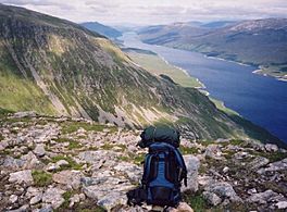
View from Beinn Bheòil
|
|
| Coordinates | 56°51′N 4°21′W / 56.850°N 4.350°W |
| Type | freshwater loch |
| Max. length | 23.33 km (14.50 mi) |
| Max. width | 0.8 km (0.50 mi) |
| Surface area | 2,238.5 ha (5,531 acres) |
| Average depth | 189 ft (58 m) |
| Max. depth | 512 ft (156 m) |
| Shore length1 | 60 km (37 mi) |
| Surface elevation | 356 m (1,168 ft) |
| 1 Shore length is not a well-defined measure. | |
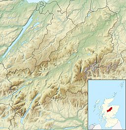
Loch Ericht is a beautiful freshwater loch (that's a Scottish word for lake!) located in the heart of Scotland. It sits right on the border between two areas: Perth and Kinross and the Highlands. This long, narrow loch stretches from the northeast to the southwest. The small village of Dalwhinnie is found at its northern end.
Loch Ericht is quite special because it's the tenth largest freshwater lake in all of Scotland. It's also famous for its great fishing. People often come here to catch trout, including a special kind called Ferox trout.
Making Electricity with Water
Loch Ericht is an important part of a big project that uses water to make electricity. This is called a hydro-electric scheme. The loch has dams at both its northern and southern ends.
Water flows into the northern end of the loch through something called the Cuaich Aqueduct. From the southern end, the water travels about 4-mile (6.4 km) through the River Ericht. This river then connects to a power station at Loch Rannoch, where electricity is made. The dam at the northern end also helps protect the village of Dalwhinnie from flooding.
Mountains and Wild Areas
Loch Ericht is surrounded by some very tall mountains. These mountains are known as Munros, which are Scottish mountains over 3,000 feet (914 metres) high. Two of these impressive peaks are Ben Alder, which is 1148 metres tall, and Geal-Chàrn, standing at 1132 metres.
Around the loch, you'll find traditional hunting areas. These areas are called "forests," even though they might not be covered in trees. The most well-known of these is the Ben Alder Forest.
Finding Loch Ericht on a Map
If you want to find Loch Ericht on a map, you can look for these specific maps:
- The Ordnance Survey Explorer map 393. This map is called "Ben Alder, Loch Ericht and Loch Laggan" (ISBN: 9780319239186).
- The Ordnance Survey Landranger map 42. This map is titled "Glen Garry and Loch Rannoch" (ISBN: 9780319231296).
 | Bessie Coleman |
 | Spann Watson |
 | Jill E. Brown |
 | Sherman W. White |


