Ben Alder facts for kids
Quick facts for kids Ben Alder |
|
|---|---|
| Beinn Eallair | |

Ben Alder
|
|
| Highest point | |
| Elevation | 1,148 m (3,766 ft) |
| Prominence | 783 m (2,569 ft) Ranked 40th in British Isles |
| Parent peak | Ben Nevis |
| Listing | Munro, Marilyn |
| Naming | |
| English translation | Hill of rock and water |
| Language of name | Scottish Gaelic |
| Geography | |
| Location | Highlands, Scotland |
| OS grid | NN496718 |
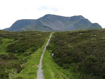
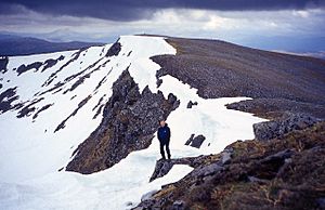
Ben Alder (in Gaelic: Beinn Eallair) is a very tall mountain in the Scottish Highlands. It is located far away from towns and roads. This makes it one of the most remote mountains in Scotland. Ben Alder is the highest peak between Loch Ericht and Glen Spean.
The top of Ben Alder is a huge flat area. Here you can find Lochan a' Garbh Coire. This is one of the highest lakes in Britain. Ben Alder is the 25th highest Munro in Scotland. A Munro is a Scottish mountain that is over 3,000 feet (914.4 meters) tall. Because it is so remote, fewer people visit Ben Alder.
The mountain is about 19 kilometers (12 miles) from Dalwhinnie. It is also 15 kilometers (9 miles) from Corrour railway station. Most people take two days to climb Ben Alder. They often also climb its nearby mountain, Beinn Bheoil. There are two small shelters, called bothies, near the mountain. These bothies can give walkers a place to rest. One bothy, Ben Alder Cottage, is said to have a ghost. It is believed to be the ghost of a local guide who died there.
If you use a mountain bike or have special permission, you can drive on a track along Loch Ericht. This can help fit climbers reach six Munros in one long day. This is usually done in late spring or early summer.
Ben Alder in Kidnapped
Ben Alder is famous for being in the novel Kidnapped. This book was written by Robert Louis Stevenson. In the story, the main characters are David Balfour and Alan Breck Stewart. They are hidden by a Scottish clan chief named Cluny Macpherson. A clan chief is the leader of a Scottish family group. Cluny Macpherson was a fugitive, meaning he was hiding from the law. He was on the run after the Second Jacobite Rising. He hid in a secret spot on Ben Alder.
The part about Cluny Macpherson is based on a true story. He really did hide on Ben Alder for nine years! His hiding place was called 'the Cage'. He later escaped to France. Prince Charles Edward Stuart also stayed with him briefly. This was in September 1746. The Prince was hiding after his defeat in the Forty-Five rebellion.
 | Shirley Ann Jackson |
 | Garett Morgan |
 | J. Ernest Wilkins Jr. |
 | Elijah McCoy |


