Loch Shin facts for kids
Quick facts for kids Loch Shin |
|
|---|---|
 |
|
| Location | North West Scottish Highlands |
| Coordinates | 58°6′N 4°32′W / 58.100°N 4.533°W |
| Type | freshwater loch, reservoir |
| Primary outflows | River Shin |
| Basin countries | Scotland |
| Max. length | 17 mi (27 km) |
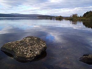
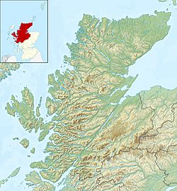
Loch Shin (which means Loch Sìn in Scottish Gaelic) is a large freshwater loch (a Scottish word for lake) located in the North West Scottish Highlands. It is the biggest loch in an area called Sutherland.
The loch stretches for about 17 miles (27 kilometers) from the north-west to the south-east. Near its southern end, you'll find the small town of Lairg.
Loch Shin and Hydro-Electric Power
In the 1950s, something big happened at Loch Shin. A company called Wimpey Construction built the Lairg Dam. This dam raised the water level of the loch by more than 30 feet (9 meters)!
This project was part of a hydro-electric scheme. This means they used the power of the water to create electricity. It was a way to bring modern power to the Highlands.
Surrounding Landscape
Loch Shin is surrounded by some impressive mountains. To the west, you can see Ben More Assynt, which stands tall at 3,273 feet (998 meters). To the east, there's Ben Klibreck, reaching 3,154 feet (961 meters).
The water from Loch Shin flows into the River Shin. This short river then empties into the Dornoch Firth near Bonar Bridge, eventually reaching the North Sea.
Farming and History
About three miles north of Lairg, there's a monument. It reminds people of an early attempt to change the Highlands. In the 1870s, a powerful landowner called the Duke of Sutherland tried to start a new industry.
He ploughed up about 2,000 acres (800 hectares) of land. However, his efforts to create a new industry there didn't work out as planned. Today, the area around Loch Shin is a very important center for sheep farming in Scotland.
 | Aurelia Browder |
 | Nannie Helen Burroughs |
 | Michelle Alexander |


