
Lohrville, Wisconsin facts for kids
Quick facts for kids
Lohrville, Wisconsin
|
|
|---|---|
|
Village
|
|

Location of Lohrville in Waushara County, Wisconsin.
|
|
| Country | |
| State | |
| County | Waushara |
| Area | |
| • Total | 1.22 sq mi (3.17 km2) |
| • Land | 1.21 sq mi (3.14 km2) |
| • Water | 0.01 sq mi (0.03 km2) |
| Elevation | 804 ft (245 m) |
| Population
(2010)
|
|
| • Total | 402 |
| • Estimate
(2019)
|
389 |
| • Density | 320.43/sq mi (123.69/km2) |
| Time zone | UTC-6 (Central (CST)) |
| • Summer (DST) | UTC-5 (CDT) |
| FIPS code | 55-45425 |
| GNIS feature ID | 1568499 |
Lohrville is a small village located in Waushara County, Wisconsin, in the United States. In 2010, about 402 people lived there.
Contents
History of Lohrville
Lohrville began in 1906 when the American Granite Company started digging for granite. This process is called quarrying. The village was named after Charles Lohr, who was the company's first president.
Many people moved to Lohrville to work in the granite quarries. The Chicago and North Western Railway Company even built a special train track to the quarries. Lohrville officially became a village in 1910.
By 1920, the village had 245 residents. However, by 1940, the number of people living there went down to 191. The old train tracks are no longer used for trains. Instead, they have been turned into a walking and biking path called the Bannerman Trail.
Geography of Lohrville
Lohrville is located at 44°2′19″N 89°7′17″W / 44.03861°N 89.12139°W.
The village covers a total area of about 1.24 square miles (3.17 square kilometers). Most of this area is land, about 1.23 square miles (3.14 square kilometers). A very small part, about 0.01 square miles (0.03 square kilometers), is water.
Population Information
| Historical population | |||
|---|---|---|---|
| Census | Pop. | %± | |
| 1920 | 245 | — | |
| 1930 | 262 | 6.9% | |
| 1940 | 191 | −27.1% | |
| 1950 | 206 | 7.9% | |
| 1960 | 225 | 9.2% | |
| 1970 | 213 | −5.3% | |
| 1980 | 336 | 57.7% | |
| 1990 | 368 | 9.5% | |
| 2000 | 408 | 10.9% | |
| 2010 | 402 | −1.5% | |
| 2019 (est.) | 389 | −3.2% | |
| U.S. Decennial Census | |||
What the 2010 Census Showed
The census in 2010 counted 402 people living in Lohrville. There were 171 households, which are groups of people living together in one home. Out of these, 114 were families.
The village had about 326.8 people per square mile. Most of the people living in Lohrville were White (95.5%). A small number were African American (0.5%), Native American (1.7%), or Asian (0.5%). Some people were from other backgrounds (1.0%) or a mix of two or more races (0.7%). About 4.0% of the population identified as Hispanic or Latino.
About 22.8% of households had children under 18 living there. Many households (50.3%) were married couples living together. The average household had 2.35 people, and the average family had 2.72 people.
The average age of people in the village was 45.4 years old. About 19.2% of residents were under 18. About 17.9% were 65 years old or older. Slightly more than half of the residents (52.5%) were female, and 47.5% were male.
Images for kids
-
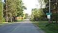
Entering Lohrville
-
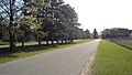
Lohrville looking West
-
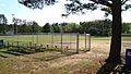
Lohrville baseball field


See also
 In Spanish: Lohrville (Wisconsin) para niños
