Long Creek (Back Creek tributary) facts for kids
Quick facts for kids Long Creek |
|
|---|---|
| Other name(s) | Tributary to Back Creek |
| Country | United States |
| State | Maryland Delaware |
| County | Cecil (MD) New Castle (DE) |
| Physical characteristics | |
| Main source | Belltown Run divide Marabou Meadows, Delaware 82 ft (25 m) 39°31′56″N 075°49′28″W / 39.53222°N 75.82444°W |
| River mouth | Back Creek Dans, Maryland 0 ft (0 m) 39°35′03″N 075°45′15″W / 39.58417°N 75.75417°W |
| Length | 6.28 mi (10.11 km) |
| Basin features | |
| Progression | southwest |
| River system | Elk River |
| Basin size | 7.99 square miles (20.7 km2) |
| Tributaries |
|
| Bridges | Frazer Road, Woods Road, Augustine Hermann Highway, Boatyard Road |
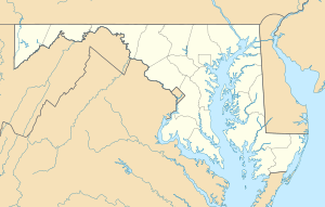
Long Creek is a small stream, about 6.28 mi (10.11 km) long. It flows into Back Creek in Cecil County, Maryland. Think of it as a smaller stream (a "2nd order tributary") that feeds into a larger one.
What's in a Name?
Sometimes, places have more than one name! According to the Geographic Names Information System (which is like a big dictionary of names for places in the U.S.), Long Creek has also been called:
- Long Branch
- Margarets Creek
Where Does Long Creek Start and End?
Long Creek begins in a place called Marabou Meadows in New Castle County, Delaware. It starts near a spot that divides the water flow, like a tiny mountain ridge for water.
From there, the creek flows southwest. It crosses the state line and enters Maryland. Finally, it joins up with Back Creek in a town called Dans, Maryland.
Understanding the Watershed
A watershed is like a big bowl that collects all the rain and snowmelt. All the water in that bowl eventually flows into one main river or stream.
Long Creek's watershed covers an area of about 7.99 square miles (20.7 km2). This means all the rain that falls on this area will eventually make its way into Long Creek. The area gets about 45.4 inches of rain each year. About 18.3% of this land is covered by forests.
 | Mary Eliza Mahoney |
 | Susie King Taylor |
 | Ida Gray |
 | Eliza Ann Grier |


