Longfellow, Oakland, California facts for kids
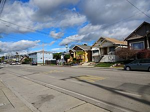
Longfellow is a neighborhood located in North Oakland, California. It is bordered by Temescal Creek to the north and major roads like State Route 24 to the east, Interstate 580 to the south, and Adeline Street to the west.
Contents
Discovering Longfellow's History
The area known as Longfellow today was once part of a larger district called Temescal. In the late 1800s, Temescal covered a much bigger area. It stretched from 36th Street north to the Berkeley border. It also went from the Emeryville border west to Broadway in the east.
How Freeways Shaped the Neighborhood
In the 1960s, the Grove-Shafter Freeway was built. This new freeway physically split the old Temescal district. It created smaller, distinct neighborhoods. Longfellow became one of these new areas. Other neighborhoods formed were Santa Fe, Temescal, and lower Rockridge.
Temescal Creek and Community Gardens
The name Temescal still has ties to the Longfellow neighborhood. For example, the Temescal Community Garden is located here. It was the first community garden in Oakland, started in 1984. Temescal Creek flows underground near this garden. This creek helps define the northern edge of Longfellow.
Schools in Longfellow
The neighborhood got its name from the Longfellow Elementary School. This school opened on Lusk Street. It is believed to be named after the famous American poet, Henry Wadsworth Longfellow. Longfellow Elementary School closed in 2004. Today, the Oakland Military Institute uses the building. This is a college preparatory school that moved there in 2007.
Other schools in the area include North Oakland Community Charter School (NOCCS). St Martin De Porres Catholic School is also in Longfellow. The Oakland Public School that used to serve Longfellow was Santa Fe Elementary. It closed in 2012. Now, elementary students from Longfellow attend Emerson Elementary School. This school is located in the nearby Temescal neighborhood.
Longfellow's Rich Culture
In the early 1900s, North Oakland was a lively Italian neighborhood. This included the area now known as Longfellow. Grove Street, which is now Martin Luther King Jr. Way, was a busy street. Many Italian businesses were located there. Sacred Heart Parish, a church founded in 1876, was a central part of this Italian community.
Public Transport and Revitalization
Grove Street was also important for public transportation. The Grove Street #5 streetcar connected the community to the larger Key System. This system helped people travel across the Bay Area.
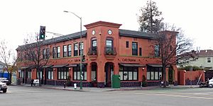
When the freeway was built in the 1960s, it divided the neighborhood. The businesses on Grove Street and Sacred Heart Parish faced challenges. However, this commercial area has been revitalized. Many new food businesses have opened. These include Grace Street Catering, Café Dejéna, MLK Café, and Arthur Mac's Tap and Snack.
African American History in Longfellow
In the 1940s and 1950s, the Longfellow and Santa Fe neighborhoods changed. More African American families moved into the area. Two important African American organizations started here. These are the African American Museum and Library (AAMLO) and the Black Panther Party.
The African American Museum and Library
The AAMLO began as the East Bay Negro Historical Society in 1965. Residents of Longfellow and North Oakland founded it. They first met at the Church of the Good Shepard. This church is still located at 52nd and West streets. The society collected documents about the history of black Americans. It was open to everyone, including school groups. The society wanted to share the contributions of African Americans. The organization moved out of the neighborhood in the 1980s. It is now located on 14th Street.
The Black Panther Party's Roots
The Black Panther Party was an African American political organization. Its founders, Huey P. Newton and David Hilliard, grew up in North Oakland. Huey P. Newton lived on 47th Street. David Hilliard lived on West Street. The Second Black Panther Party Office was located on Martin Luther King Jr. Way.
Longfellow Today
Longfellow has an active community group. It is called the Longfellow Community Association (LCA). This group formed in 2010. The LCA has over 100 members. They work on various community interests. They also partner with local schools and businesses. Many artists live in the neighborhood. One famous artist is Jon Sarriugarte. He is a metalsmith and creates art cars for Burning Man.
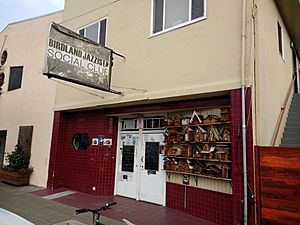
Many new restaurants have opened in Longfellow recently. These include Salsipuedes, Birdland Jazzista Social Club, and Propaganda.
 | Shirley Ann Jackson |
 | Garett Morgan |
 | J. Ernest Wilkins Jr. |
 | Elijah McCoy |


