Lough Talt facts for kids
Quick facts for kids Lough TaltLoch Tailt |
|
|---|---|
 |
|
| Location | County Sligo |
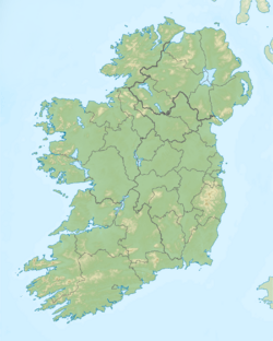
| Coordinates | 54°5′0″N 8°55′30″W / 54.08333°N 8.92500°W |
| Lake type | Glacial lake |
| Primary outflows | Lough Talt River |
| Catchment area | 5.7 km2 (2.2 sq mi) |
| Basin countries | Ireland |
| Surface area | 0.97 km2 (0.37 sq mi) |
| Max. depth | 40 m (130 ft) |
| Surface elevation | 130 m (430 ft) |
| Islands | 2 |
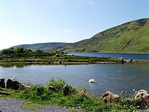
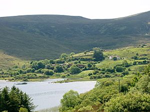
Lough Talt (which means Loch Tailt in Irish) is a beautiful lake in the Ox Mountains of south County Sligo, Ireland. You can find it between the villages of Tubbercurry and Bonniconlon on the R294 road.
Lough Talt is a special place. It's part of the Lough Hoe Bog Special Area of Conservation. This means the area is protected because it has unique bogland and very clear lakes. Lough Talt is the biggest lake in this protected area.
This lake is a glacial lake, formed by glaciers long ago. It sits about 130 meters (426 feet) above sea level. At its deepest point, the lake is about 40 meters (131 feet) deep. The lake covers an area of almost 1 square kilometer (0.4 square miles). Water flows out of Lough Talt into the Lough Talt River, which then joins the River Moy. The lake also has two crannogs, which are old artificial islands built in the lake.
Contents
Discover the Animals and Plants of Lough Talt
Lough Talt is home to many different kinds of fish. You can find brown trout, three-spined stickleback, and perch here. Some rare fish also live in the lake, like the threatened Arctic char and the critically endangered European eel. Brown trout are the most common fish you'll see.
Besides fish, the endangered white-clawed crayfish has also been found in Lough Talt. This is a special type of freshwater crayfish.
Wetland Snails and Birds
The marshes along the lake's edge are home to a tiny snail called Vertigo geyeri. This wetland snail is considered threatened in Europe.
Many birds also visit or live at the lake. You might spot swans, ducks, and dippers. One of the islands used to have a very large group of common and black-headed gulls. However, by 1992, this group had become much smaller.
Explore Lough Talt: Walking Trails
If you love walking, Lough Talt is a great place to visit. There is a walking trail that goes all the way around the lake. This trail is about 5.5 kilometers (3.4 miles) long. Part of this path shares the R294 road.
Lough Talt is also the starting point for a much longer trail called the Sligo Way. This trail is about 80 kilometers (50 miles) long and ends in Dromahair, County Leitrim. It's a great way to explore the beautiful Irish countryside.
Lough Talt: A Source of Drinking Water
Lough Talt is very important for the people living in south County Sligo. It provides treated drinking water for many towns, including Tubbercurry and Ballymote.
In May 2019, a big project started to improve the Lough Talt Water Treatment plant. The goal was to make sure the water is safe to drink. This project aimed to stop the "boil water notices" that communities sometimes had to follow.
 | Charles R. Drew |
 | Benjamin Banneker |
 | Jane C. Wright |
 | Roger Arliner Young |


