Lower Campbell Lake facts for kids
Quick facts for kids Lower Campbell Lake |
|
|---|---|
| Coordinates | 50°01′18.3″N 125°27′53.3″W / 50.021750°N 125.464806°W |
| Primary inflows | Campbell River |
| Primary outflows | Campbell River |
| First flooded | 1958 |
| Surface area | 2,694 ha (6,660 acres) |
| Average depth | 17.1 m (56 ft) |
| Max. depth | 75.6 m (248 ft) |
| Water volume | 458,784,000 m3 (1.62018×10¹⁰ cu ft) |
| Residence time | 32 days |
| Shore length1 | 89.2 km (55.4 mi) |
| Surface elevation | 178 m (584 ft) |
| 1 Shore length is not a well-defined measure. | |
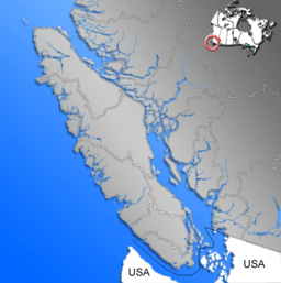
Lower Campbell Lake is a large body of water on Vancouver Island in British Columbia, Canada. It is actually a reservoir, which means it's a lake created by people. This lake is also known simply as Campbell Lake.
The lake was formed when the Ladore Dam was built. This dam was finished in 1958. Many types of fish live in the lake. These include Cutthroat trout, Rainbow trout, Dolly varden, and Kokanee salmon. You can also find smaller fish like prickly sculpin and threespine stickleback here.
Contents
Where is Lower Campbell Lake?
Lower Campbell Lake is about 10 kilometers (6 miles) west of the city of Campbell River. It is an important part of the Sayward Forest Canoe Route. This route is a popular place for canoeing and kayaking.
Lake Size and Depth
The lake covers a large area of about 2,694 hectares (6,657 acres). Its average depth is 17.1 meters (56 feet). However, in some spots, the lake can be much deeper. The deepest part of Lower Campbell Lake is 75.6 meters (248 feet) deep.
Water Flow and Sources
The main river flowing into Lower Campbell Lake is the Campbell River. This river comes from Upper Campbell Lake through the Strathcona Dam. Water then flows out of Lower Campbell Lake through the Ladore Dam. From there, it goes into John Hart Lake.
Other smaller streams also feed into the lake. These include Beavertail, Fry, Greenstone, and Miller creeks. Water from the Salmon and Quinsam rivers is also directed into the lake. Before the Ladore Dam was built, Lower Campbell Lake was much smaller. It had a surface area of only 1,075 square meters (11,570 square feet).
Natural Surroundings
Lower Campbell Lake is located in a special natural area. This area is called the Coastal Western Hemlock Biogeoclimatic Zone. This means the climate and types of plants here are typical for coastal areas with lots of hemlock trees.
 | Selma Burke |
 | Pauline Powell Burns |
 | Frederick J. Brown |
 | Robert Blackburn |


