Lowville, Wisconsin facts for kids
Quick facts for kids
Lowville, Wisconsin
|
|
|---|---|

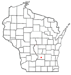
Location of Lowville, Wisconsin
|
|
| Country | |
| State | |
| County | Columbia |
| Area | |
| • Total | 35.7 sq mi (92.5 km2) |
| • Land | 34.3 sq mi (88.7 km2) |
| • Water | 1.5 sq mi (3.8 km2) |
| Elevation | 932 ft (284 m) |
| Population
(2000)
|
|
| • Total | 987 |
| • Density | 28.8/sq mi (11.1/km2) |
| Time zone | UTC-6 (Central (CST)) |
| • Summer (DST) | UTC-5 (CDT) |
| FIPS code | 55-46050 |
| GNIS feature ID | 1583602 |
Lowville is a small town located in Columbia County, Wisconsin, in the United States. According to the 2000 census, about 987 people lived there. It is a quiet community in the state of Wisconsin.
Contents
History of Lowville
When Columbia County was first set up in 1846, a specific area of land was chosen to be a voting area. This area was named Lowville. It was named after Jacob Low, an important early settler and farmer in the region.
In January 1849, the local government, called the county board, decided to make Lowville an official "civil town." This means it became a recognized local government area. Jacob Low's home was chosen as the place for the town's very first election.
Later, in January 1850, the size of the town of Lowville was changed. It was made smaller to include only a specific section of land known as Township 11, Range 10.
Geography of Lowville
Lowville covers a total area of about 35.7 square miles (which is about 92.5 square kilometers). Most of this area is land. About 34.3 square miles (88.7 square kilometers) is land.
A smaller part of the town is covered by water. This water area is about 1.5 square miles (3.8 square kilometers). This means that about 4.11% of Lowville's total area is water. These numbers come from the United States Census Bureau.
Population and People
In the year 2000, a census was taken in Lowville. A census is like a big count of all the people and homes. It showed that 987 people lived in the town.
There were 368 households, which are like homes where people live. Out of these, 294 were families. The town had about 28.8 people living in each square mile.
Most of the people in Lowville were White, making up about 97.97% of the population. There were also small numbers of Native American and Asian residents. About 0.61% of the people were of Hispanic or Latino background.
Households and Families
Many homes in Lowville had children under 18 living there, about 29.3% of them. Most households, about 71.7%, were married couples living together. Some homes, 4.9%, had a female head of the house without a husband.
The average number of people in a household was 2.68. For families, the average size was 2.99 people.
Age Groups
The population in Lowville was spread out across different age groups.
- About 23.5% of the people were under 18 years old.
- About 6.4% were between 18 and 24 years old.
- About 28.4% were between 25 and 44 years old.
- About 29.1% were between 45 and 64 years old.
- About 12.7% were 65 years old or older.
The average age of people in Lowville was 41 years. For every 100 females, there were about 105.2 males.
Income Information
In 2000, the average income for a household in Lowville was $54,519 per year. For families, the average income was $57,500 per year. The average income for each person in the town was $20,039.
A small number of people and families lived below the poverty line. This means their income was below a certain level needed for basic living. About 3.8% of all people and 3% of families were in this situation. Among those under 18, 4.4% were below the poverty line, and among those 65 and older, 6.5% were.
See also
 In Spanish: Lowville (Wisconsin) para niños
 | James Van Der Zee |
 | Alma Thomas |
 | Ellis Wilson |
 | Margaret Taylor-Burroughs |

