Ludlow Falls, Ohio facts for kids
Quick facts for kids
Ludlow Falls, Ohio
|
|
|---|---|
|
Village
|
|

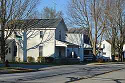
Greenville Avenue
|
|

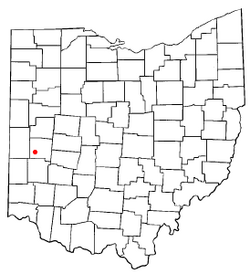
Location of Ludlow Falls, Ohio
|
|

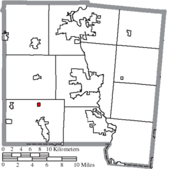
Location of Ludlow Falls in Miami County
|
|
| Country | United States |
| State | Ohio |
| County | Miami |
| Township | Union |
| Area | |
| • Total | 0.18 sq mi (0.46 km2) |
| • Land | 0.18 sq mi (0.46 km2) |
| • Water | 0.00 sq mi (0.00 km2) |
| Elevation | 906 ft (276 m) |
| Population
(2020)
|
|
| • Total | 175 |
| • Density | 977.65/sq mi (378.51/km2) |
| Time zone | UTC-5 (Eastern (EST)) |
| • Summer (DST) | UTC-4 (EDT) |
| ZIP code |
45339
|
| Area code(s) | 937, 326 |
| FIPS code | 39-45374 |
| GNIS feature ID | 2399201 |
Ludlow Falls is a small village located in Miami County, Ohio, in the United States. In 2020, about 175 people lived there. It is part of the larger Dayton area. The village gets its name from a surveyor named Israel Ludlow.
Contents
Geography and Nature
Ludlow Falls is a very small village. It covers an area of about 0.18 square miles (0.46 square kilometers). All of this area is land, with no large bodies of water.
A stream called Ludlow Creek flows through the village. This creek is a branch of the Stillwater River. The village is named after a beautiful waterfall on this very stream.
For school, kids in Ludlow Falls go to the Milton-Union School district. This district is located in the nearby town of West Milton.
Village History and Railroads
A long time ago, in 1881, a railroad line was built through Ludlow Falls. This line connected Springfield, Ohio to Indianapolis, Indiana. Later, a company called the New York Central Railroad owned it.
By the 1970s, not many trains used this line. The very last train ran on March 31, 1976. Soon after, the tracks were taken up.
People Living in Ludlow Falls
| Historical population | |||
|---|---|---|---|
| Census | Pop. | %± | |
| 1920 | 171 | — | |
| 1930 | 202 | 18.1% | |
| 1940 | 212 | 5.0% | |
| 1950 | 277 | 30.7% | |
| 1960 | 273 | −1.4% | |
| 1970 | 292 | 7.0% | |
| 1980 | 248 | −15.1% | |
| 1990 | 300 | 21.0% | |
| 2000 | 210 | −30.0% | |
| 2010 | 208 | −1.0% | |
| 2020 | 175 | −15.9% | |
| U.S. Decennial Census | |||
How Many People Live Here?
In 2010, there were 208 people living in Ludlow Falls. These people lived in 81 different homes, and 55 of these were families. Everyone living in the village at that time was White. A very small number, about 0.5%, were of Hispanic or Latino background.
About 35% of the homes had children under 18 living there. Many homes, about 41%, were married couples living together. Some homes had a female head of household without a husband, and a few had a male head of household without a wife. About a quarter of all homes were single individuals.
The average age of people in the village was 34 years old. About 29% of residents were under 18 years old. About 7% were between 18 and 24, and about 23% were between 25 and 44. A larger group, about 34%, were between 45 and 64. Finally, about 7% of the people were 65 years old or older. Slightly more than half of the people were male (52.4%), and the rest were female (47.6%).
Education
Students in Ludlow Falls attend schools within the Milton-Union Exempted Village School District. The main high school for this district is Milton-Union High School.
See also
 In Spanish: Ludlow Falls para niños
 | William L. Dawson |
 | W. E. B. Du Bois |
 | Harry Belafonte |

