Luera Mountains facts for kids
Quick facts for kids Luera Mountains |
|
|---|---|
| Highest point | |
| Peak | Luera Peak (Luera Mountains) |
| Elevation | 9,420 ft (2,870 m) |
| Dimensions | |
| Length | 15 mi (24 km) (NNW-SSE) |
| Width | 15 mi (24 km) (circular) |
| Geography | |
| Country | United States |
| Settlements | Datil, NM and Old Horse Springs, NM |
| Range coordinates | 33°49′35″N 107°52′39″W / 33.826449°N 107.877548°W |
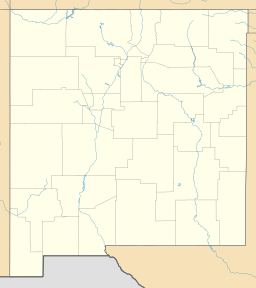
The Luera Mountains are a mountain range in New Mexico, USA. They are about 15 miles (24 km) long. You can find them in the southeast part of Catron County. These mountains are near the center of the Plains of San Agustin. They also touch the northern end of the Black Range. The Continental Divide of the Americas runs along the top of the Black Range nearby.
The Continental Divide also crosses the southern part of the Luera Mountains. It goes from west to east there. Then, it turns south into the Black Range. The Continental Divide National Scenic Trail is a hiking trail. It runs south of the water divide in the Luera Mountains. Later, it meets the Continental Divide in the Black Range.
Contents
Exploring the Luera Mountains
The Luera Mountains form a roughly circular area. They are about 15 miles (24 km) wide. Luera Peak is the highest point. It is located in the center-north of the range. A small ridge goes southeast from the peak. There is also a creek and a canyon nearby.
The Plains of San Agustin mostly surround the Luera Mountains. These plains stretch to the west, northwest, and northeast. New Mexico State Road 12 runs along the north side of the plains.
To the southeast of the Luera Mountains, you'll find New Mexico State Road 163. This road crosses the Continental Divide. It also crosses the National Scenic Trail. Road 163 connects to New Mexico State Road 52 in the east. This area is part of the Cibola National Forest. The road also connects to Forest Road 30 in the southwest. This leads to the Gila Wilderness and Apache Creek. This road runs alongside the Continental Divide.
West and southwest of the Luera Mountains is another mountain range. It is about the same size but does not have a name. Both ranges are in the middle-west of the Plains of San Agustin. The plains stretch northeast from these two ranges. The higher parts of the Plains of San Agustin are to the south and southwest. This is where the Continental Divide goes from the west to meet the Black Range. From there, the Continental Divide turns directly south.
Luera Peak: The Highest Point
The Luera Mountains do not have one clear ridgeline. The water divide, which is also the Continental Divide, is in the southern foothills. Luera Peak is the highest point. It is in the center-north of the range. Luera Peak is 9,420 feet (2,871 meters) tall. Its exact location is 33°49′35″N 107°52′39″W / 33.826449°N 107.877548°W.
The Continental Divide's Path
The Continental Divide of the Americas is a very important line. It separates the water that flows to the Pacific Ocean from the water that flows to the Atlantic Ocean. This divide goes around the northwest and west edges of the Luera Mountains. It also crosses the central-southern part of the Plains of San Agustin. The scenic trail often runs right next to the Divide, or even follows it.
See also
 In Spanish: Sierra de Luera para niños
 | Janet Taylor Pickett |
 | Synthia Saint James |
 | Howardena Pindell |
 | Faith Ringgold |


