Plains of San Agustin facts for kids
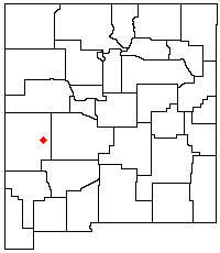
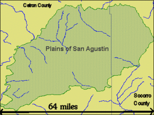
The Plains of San Agustin is a large, flat area in the southwestern part of New Mexico, a state in the United States. This region is found in the San Agustin Basin. It lies south of U.S. Highway 60. The plains stretch across parts of Catron and Socorro Counties. They are about 50 miles (80 km) west of the town of Socorro. The town of Reserve is about 25 miles north of the plains.
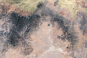
The plains run from northeast to southwest. They are about 55 miles (88 km) long. Their width changes, usually between 5 and 15 miles (8–24 km). Mountains surround this basin. To the south are the Luera Mountains and Pelona Mountain. The Tularosa Mountains are to the west. The Mangas, Crosby, Datil, and Gallinas Mountains are to the north. The San Mateo Mountains are to the east. The Continental Divide is also very close to the southern and western edges of the plains.
Some people believe the Plains of San Agustin were the location of the famous Roswell UFO incident. This event involved a supposed crash of an unknown object in 1947.
Contents
Geology of the Plains
The Plains of San Agustin are part of a special geological area. This area is called the Mogollon-Datil volcanic field. It is just south of the Colorado Plateau. It is also west of the Rio Grande Rift Valley. The basin itself is a graben. A graben is a block of land that has dropped down. This happens between two parallel cracks in the Earth's crust called faults.
How the Plains Formed
The graben formed after many volcanic eruptions. The flat surface of the plains was created by a huge ancient lake. This lake existed during the Pleistocene Ice Age. It is known as Lake San Agustin. The land in the graben dropped about 4,000 feet. However, the surface looks flatter now. This is because a lot of dirt and rock filled it in. This filling reduced the surface drop to about 2,000 feet. Most of these sediments entered the basin before Lake San Agustin formed. Scientists have not found signs of new ground movement since the lake dried up.
Ecology of the Area
The plains are near the northern edge of the Chihuahuan Desert. This desert is mostly covered by shrublands. Shrublands are areas with many bushes and small trees.
Interesting Places to Visit
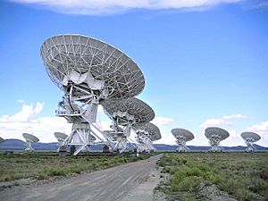
The Plains of San Agustin are famous for one main reason. They are home to the Very Large Array. This is a huge radio astronomy observatory. An observatory is a place where scientists study space. The plains were chosen for this observatory because they are far from big cities. This means there is less radio interference. The mountains around the plains also help block signals.
Archaeological Sites
The edges of the plains have many interesting archaeological sites. These are places where people lived long ago. One well-known site is a prehistoric rock shelter. It is called Bat Cave.
Other cool places in the area include a ghost town named Old Horse Springs. There is also the Ake Site. This is another place where ancient people lived.
See also
 In Spanish: Llanuras de San Agustín para niños
 | Mary Eliza Mahoney |
 | Susie King Taylor |
 | Ida Gray |
 | Eliza Ann Grier |


