Lutter, Haut-Rhin facts for kids
Quick facts for kids
Lutter
|
||
|---|---|---|
|
||
| Country | France | |
| Region | Grand Est | |
| Department | Haut-Rhin | |
| Arrondissement | Altkirch | |
| Canton | Altkirch | |
| Intercommunality | Jura alsacien | |
| Area
1
|
8.46 km2 (3.27 sq mi) | |
| Population
(2006)
|
305 | |
| • Density | 36.05/km2 (93.37/sq mi) | |
| Time zone | UTC+01:00 (CET) | |
| • Summer (DST) | UTC+02:00 (CEST) | |
| INSEE/Postal code |
68194 /68480
|
|
| Elevation | 418–780 m (1,371–2,559 ft) (avg. 440 m or 1,440 ft) |
|
| 1 French Land Register data, which excludes lakes, ponds, glaciers > 1 km2 (0.386 sq mi or 247 acres) and river estuaries. | ||
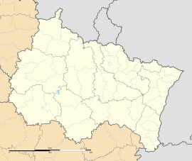
Lutter is a small commune (which is like a small town or village) located in eastern France. It is found in the Haut-Rhin department. This area is part of the Alsace region, known for its unique culture and beautiful landscapes.
Contents
Understanding a French Commune
What is a Commune?
In France, a commune is the smallest unit of local government. Think of it like a town or a village. Each commune has its own mayor and local council. These groups help manage the daily life of the people living there.
Lutter's Location in France
Lutter is in the Haut-Rhin department. This department is in the eastern part of France. It is close to the borders with Germany and Switzerland. The area is known for its rolling hills and forests.
Facts About Lutter
How Many People Live There?
As of 2006, about 305 people lived in Lutter. This makes it a very small and quiet place. Small communes like Lutter often have a strong community feel.
Who is the Mayor?
The mayor of Lutter is Rémy Halm. He served from 2001 to 2008. The mayor is the head of the local government. They help make decisions for the commune.
How Big is Lutter?
Lutter covers an area of about 8.46 square kilometers. This is roughly 3.27 square miles. Its elevation ranges from 418 meters to 780 meters above sea level. This means it has some hills and higher ground.
See also
 In Spanish: Lutter para niños
 | Anna J. Cooper |
 | Mary McLeod Bethune |
 | Lillie Mae Bradford |


