Lyerly, Georgia facts for kids
Quick facts for kids
Lyerly, Georgia
|
||
|---|---|---|

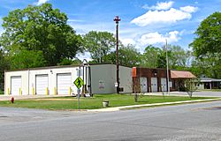
Lyerly Town Hall
|
||
|
||

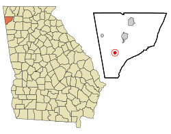
Location in Chattooga County and the state of Georgia
|
||
| Country | United States | |
| State | Georgia | |
| County | Chattooga | |
| Area | ||
| • Total | 0.75 sq mi (1.95 km2) | |
| • Land | 0.75 sq mi (1.95 km2) | |
| • Water | 0.00 sq mi (0.00 km2) | |
| Elevation | 630 ft (192 m) | |
| Population
(2020)
|
||
| • Total | 454 | |
| • Density | 604.53/sq mi (233.30/km2) | |
| Time zone | UTC-5 (Eastern (EST)) | |
| • Summer (DST) | UTC-4 (EDT) | |
| ZIP code |
30730
|
|
| Area code(s) | 706/762 | |
| FIPS code | 13-48092 | |
| GNIS feature ID | 0332285 | |
Lyerly is a small town located in Chattooga County, in the state of Georgia, United States. It is a quiet community with a population of 454 people, according to the 2020 census.
History of Lyerly
Lyerly started as a small community in 1889. It grew around a train station built by the Chattanooga, Rome and Columbus Railroad. Before Lyerly, there was a town nearby called Melville, but it went out of business that same year.
The new town of Lyerly officially became a town in 1891. It might have been named after Charles A. Lyerly. He was a banker from Tennessee who bought a lot of land in the area.
Geography and Location
Lyerly is found in the southern part of Chattooga County. You can find its exact spot using these coordinates: 34°24′13″N 85°24′23″W / 34.40361°N 85.40639°W.
The Chattooga River flows along the southeastern edge of the town. This river is a branch of the Coosa River.
Georgia State Route 114 is a main road that connects Lyerly to other places. It goes northeast for about 6 miles (10 km) to Summerville, which is the county seat. The road also goes southwest for about 6 miles (10 km) to the Alabama state line, near Gaylesville.
The town of Lyerly covers a total area of about 0.75 square miles (1.9 square kilometers). All of this area is land.
Population Over Time
The population of Lyerly has changed over the years. Here's a look at how many people have lived there during different census counts:
| Historical population | |||
|---|---|---|---|
| Census | Pop. | %± | |
| 1900 | 234 | — | |
| 1910 | 322 | 37.6% | |
| 1920 | 323 | 0.3% | |
| 1930 | 296 | −8.4% | |
| 1940 | 368 | 24.3% | |
| 1950 | 524 | 42.4% | |
| 1960 | 409 | −21.9% | |
| 1970 | 426 | 4.2% | |
| 1980 | 482 | 13.1% | |
| 1990 | 493 | 2.3% | |
| 2000 | 488 | −1.0% | |
| 2010 | 540 | 10.7% | |
| 2020 | 454 | −15.9% | |
| U.S. Decennial Census | |||
As of the 2000 census, there were 488 people living in Lyerly. The town had 198 households and 131 families. The average household had about 2.46 people, and the average family had about 3.08 people.
The age of the people in Lyerly in 2000 was spread out:
- About 24.2% were under 18 years old.
- About 10.9% were 65 years or older.
The average age in the town was 37 years.
See also
 In Spanish: Lyerly para niños
 | Kyle Baker |
 | Joseph Yoakum |
 | Laura Wheeler Waring |
 | Henry Ossawa Tanner |

