Métascouac Lake facts for kids
Quick facts for kids Métascouac Lake |
|
|---|---|
| Location | Lac-Jacques-Cartier, La Côte-de-Beaupré Regional County Municipality |
| Coordinates | 47°50′15″N 71°50′18″W / 47.8375°N 71.83833°W |
| Lake type | Natural |
| Primary inflows | (Clokwise from the mouth) Décharge d’un ensemble de lacs dont Durocher, des Mûres, Taillefer et Themers, décharge des lacs Isabelle et Flynn, décharge du lac Tomochiche et du lac Sérigny, décharge du lac Lescarbeau. |
| Primary outflows | Métascouac River |
| Basin countries | Canada |
| Max. length | 8.5 km (5.3 mi) |
| Max. width | 3.2 km (2.0 mi) |
| Surface elevation | 471 m (1,545 ft) |
Lac Métascouac is a beautiful freshwater lake in Quebec, Canada. It's located in the Laurentides Wildlife Reserve, a large protected area. The Métascouac River flows through this lake.
The area around the lake is mostly forests. People come here for forestry work and also for fun outdoor activities like fishing or hiking.
The lake usually freezes over in early December. It stays frozen until the end of March. It's generally safe to walk or play on the ice from mid-December to mid-March.
Contents
Where is Lac Métascouac?
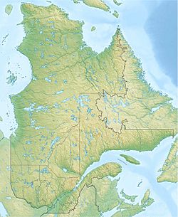
Lac Métascouac is in a part of Quebec called Lac-Jacques-Cartier. This area is managed by the La Côte-de-Beaupré Regional County Municipality. It's part of the Capitale-Nationale region.
The lake is quite large. It is about 8.5 km (5.3 mi) long and 3.2 km (2.0 mi) wide. It sits at an elevation of 471 m (1,545 ft) above sea level.
Nearby Waters
Many smaller lakes and rivers feed into Lac Métascouac. These include:
- Lakes like Durocher, des Mûres, Taillefer, Themers, Isabelle, Flynn, Tomochiche, Sérigny, and Lescarbeau.
The main river that flows out of Lac Métascouac is the Métascouac River. This river then joins other important waterways:
- The Petit lac Métascouac
- The Métabetchouane River
- Eventually, the mighty Lac Saint-Jean
- Finally, the Saguenay River, which flows into the Saint Lawrence estuary near Tadoussac.
A dam was built at the start of the Métascouac River, where it leaves Lac Métascouac.
How to Get There
The area around Lac Métascouac is not directly on major roads. However, you can reach it using Quebec Route 169 or Quebec Route 155. These main roads connect larger cities like Quebec (city) and Alma. From there, smaller forest roads lead to the lake.
What's in a Name?
The name "Métascouac" has an interesting history. It was first used for the river that flows out of the lake.
In 1847, a surveyor named Frederic William Blaiklock explored this region. He wrote about the "Rivière Metasquiac." Later, in 1870, a map showed the lake as "Grand L. Metasquéag."
Another explorer, Henry O'Sullivan, visited in 1892. He thought Lac Métascouac was one of the most beautiful lakes in the whole Métabetchouane river area. He described it as having green islands and gentle hills around it.
Meaning of "Métascouac"
The meaning of "Métascouac" comes from the Innu language. There are a few ideas about what it means:
- Some thought it meant "lake of beautiful women."
- Others suggested "where there is only green wood."
However, the most likely meaning comes from a dictionary written in 1901 by Father Georges Lemoine. He said "Métascouac" means "place where three streams meet."
This meaning makes a lot of sense! The Métascouac River, which flows from the lake, joins the Métabetchouane River about 20 kilometers away. They meet at a right angle, like the letter "T." So, it looks like three rivers are coming together at that spot.
The name "Lac Métascouac" was officially recognized on December 5, 1968, by the Commission de toponymie du Québec, which is Quebec's place-name board.
 | Anna J. Cooper |
 | Mary McLeod Bethune |
 | Lillie Mae Bradford |


