
Mabú facts for kids
Quick facts for kids
Mabú
|
|
|---|---|
|
Barrio
|
|

Park in Urbanización Los Rosales in Mabú
|
|

Location of Mabú within the municipality of Humacao shown in red
|
|

Mabú
Location in Caribbean
|
|
| Commonwealth | |
| Municipality | |
| Area | |
| • Total | 2.93 sq mi (7.6 km2) |
| • Land | 2.93 sq mi (7.6 km2) |
| • Water | 0 sq mi (0 km2) |
| Elevation | 410 ft (120 m) |
| Population
(2010)
|
|
| • Total | 8,045 |
| • Density | 2,745.7/sq mi (1,060.1/km2) |
| Source: 2010 Census | |
| Time zone | UTC−4 (AST) |
| ZIP Code |
00791
|
Mabú is a special place located in the town of Humacao, Puerto Rico. It's known as a barrio, which is like a neighborhood or a district in Puerto Rico. In 2010, about 8,045 people called Mabú home.
A Look at Mabú's History
Mabú has an interesting history, connected to the bigger story of Puerto Rico. After the Spanish–American War ended in 1898, Spain gave Puerto Rico to the United States. This happened because of a special agreement called the Treaty of Paris of 1898.
After this, Puerto Rico became an unincorporated territory of the United States. This means it's part of the U.S. but doesn't have all the same rights as a state.
In 1899, the United States government did a count of all the people in Puerto Rico. This count is called a census. They found that the combined population of Mabú and a nearby barrio called Cataño was 1,179 people.
Mabú Today
Today, Mabú is a lively community within Humacao. It covers an area of about 2.93 square miles. People in Mabú enjoy local parks and basketball courts, like the one in the Los Rosales neighborhood.
Gallery
-
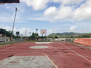
A court for Streetball in Puerto Rico in Los Rosales, a neighborhood of Mabú

See also
 In Spanish: Mabú (Humacao) para niños
- List of communities in Puerto Rico
